
Derryvree’s Double Till30279 BCE
Thirty thousand two hundred and seventy-nine BCE is a modern label, not a securely datable Irish event. Derryvree, County Fermanagh, preserves organic freshwater sediments between two glacial tills, demonstrating an ice-free interval during late Marine Isotope Stage 3. Plants and insects indicate a cold, treeless wetland. Other deposits confirm episodic, mobile glaciation, preceding the Last Glacial Maximum. Castlepook Cave, County Cork, records cold-stage fauna, including mammoth, reindeer and hyaena; a possibly cut-marked reindeer bone may indicate a brief human visit. However, no settlement, society or precise landscape can be reconstructed. Glacial erosion and fragmentary archives chiefly reveal fluctuating environmental conditions.
Dateline
The label 30,279 BCE gives an appearance of precision that the evidence cannot sustain. No community in Ireland recorded years, names or events at this depth of time, and there is no archaeological deposit that can be assigned to this one calendar year. In radiocarbon practice, the date is about 32,228 years before AD 1950; it belongs to the later part of the Pleistocene, within Marine Isotope Stage 3. What can responsibly be described is a broad interval of centuries and millennia around it, using dated sediments, fossil plants, cave fauna and the changing record of ice.
A Date Range, Not an Anniversary
The most relevant Irish chronological anchor is the Derryvree freshwater series near Maguiresbridge, County Fermanagh. Roadworks exposed a sequence in a drumlin in which organic-rich silts and fine sands lay between two tills: unsorted sediments deposited directly by glacier ice. The order of layers is firm evidence. Ice occupied the place first; an interval followed in which fresh water, vegetation and sediments accumulated; and a later ice advance buried the deposit beneath a second till.
Organic material from the intervening bed produced radiocarbon determination BIRM-166, conventionally reported as 30,500 radiocarbon years before present, with an uncertainty of roughly a millennium. “Before present” means before AD 1950, and radiocarbon years are not calendar years. Changes in atmospheric carbon mean that results must be calibrated against independent records. Published calibration treatments place the result in a very broad late-MIS 3 span, approximately 36,900–31,700 calibrated years before present. That range includes 30,279 BCE, but it cannot identify a particular season, generation or occurrence at Derryvree.
The older Irish Quaternary term Derryvree Cold Phase is useful shorthand for this part of the record, provided it is not mistaken for a single island-wide weather event. The evidence describes changing local conditions over a long cold-stage interval. Greenland ice-core records show that the North Atlantic climate could alter abruptly during MIS 3, while Ireland’s surviving deposits are too fragmentary to match securely to one short climatic pulse. A numbered BCE year must therefore remain a modern filing device, rather than a date witnessed by the landscape.
Fresh Water Between Ice Advances
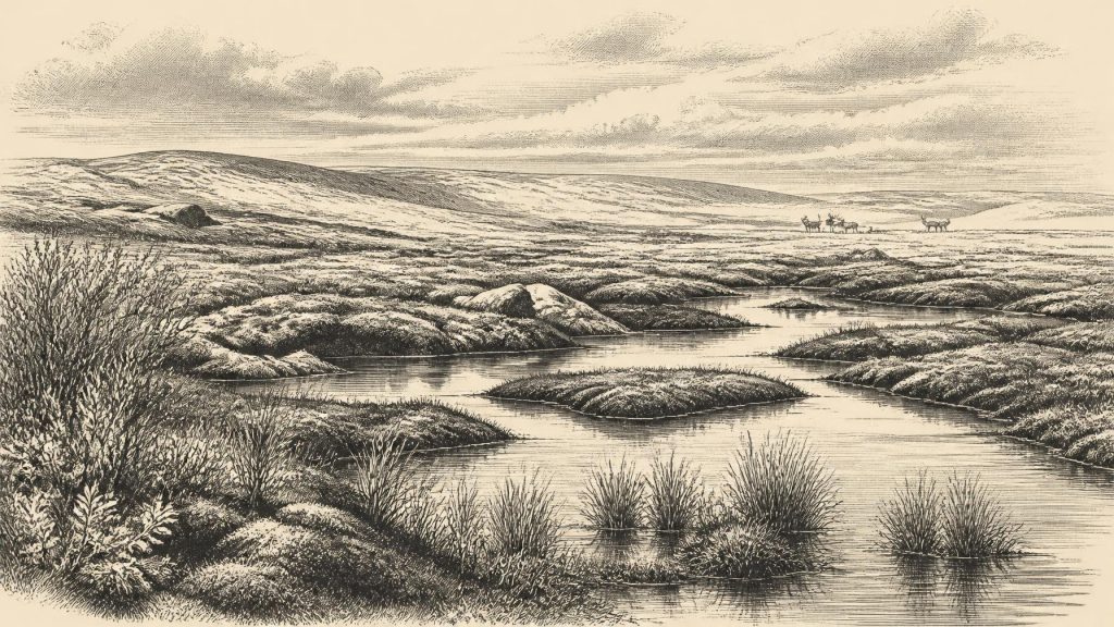
Derryvree is important because it contradicts any simple image of an Ireland continuously buried beneath ice throughout the Ice Age. The organic layer indicates that this part of Fermanagh was ice-free long enough for a wetland or shallow freshwater basin to exist. Fossil mosses, sedges, aquatic plants and insects point to cold, open conditions with standing or slow-moving water and wet margins. The landscape was treeless rather than forested: a mosaic of shallow pools, mineral-rich silt, mossy ground, low herbs and dwarf woody vegetation, exposed to severe winter conditions and short growing seasons.
This was not a temperate bog in the modern Irish sense. Terms such as tundra, muskeg and periglacial wetland are comparisons, used to convey a cold, waterlogged environment shaped by frost and thaw. They are interpretations built upon direct evidence: plant remains demonstrate species growing in or near the basin; insect remains help indicate cold conditions; the sands and silts show water moving and settling; and the tills establish glacial episodes before and after the freshwater interval. Together they illuminate a small but unusually well-preserved habitat, not the whole island at one moment.
Other north-Irish deposits, notably at Hollymount, Greenagho and Aghnadarragh, also preserve evidence for non-glacial intervals between phases of Midlandian glaciation. They support the larger conclusion that ice cover was episodic, regional and mobile. Nevertheless, they do not justify a detailed map of Ireland in 30,279 BCE. An ice margin may have stood far away from Derryvree, while snowfields, frozen ground, river systems and exposed coastal plains altered across the wider region. The later Last Glacial Maximum lay ahead: the best current reconstructions place major British–Irish Ice Sheet growth from about 31,000 to 26,000 years ago, with maximum volume reached much later, around 23,000 years ago.
Animals of an Open Country
Southern cave deposits add a second, broader line of evidence. Castlepook Cave, near Doneraile in north County Cork, is Ireland’s richest known archive of pre-Last Glacial Maximum vertebrate remains. Its faunal collection includes woolly mammoth, reindeer, giant deer, brown bear, wolf, spotted hyaena, Arctic fox, hare and lemmings. Individual bones from the cave span a long period rather than one occupation horizon. The assemblage therefore does not show that every species lived together in the same valley or year. It does show that Ireland repeatedly supported, or received, a striking cold-stage fauna during the millennia before the ice sheet’s fullest expansion.
Reindeer, lemmings and Arctic fox are consistent with open, cold habitats; mammoths and giant deer indicate that enough grazing existed, at least in some places and seasons, to sustain very large herbivores. Wolves and hyaenas reveal predation and scavenging within a substantial food web. The cave itself was not necessarily a human camp. Bones can have reached it through carnivore activity, natural deaths, water movement and the disturbance of deposits over thousands of years. Its early twentieth-century excavations also preceded modern standards of stratigraphic recording, making careful re-examination essential.
Recent reassessment has made Castlepook central to the question of early people in Ireland. A reindeer femur from the old collection, dated to around 33,000 years ago, bears a mark interpreted by some researchers as having been made by a sharp stone tool during carcass processing. If the modification proves anthropogenic, it would be evidence of a brief Upper Palaeolithic human visit far earlier than Ireland’s formerly accepted record. It is not evidence for a permanent settlement, a village, or continuous occupation. The bone has no associated hearth, house, stone-tool assemblage or secure living floor, and its interpretation must remain cautious.
No Polities, No Proven Settlement
Political affairs, diplomacy and organised conflict cannot be reconstructed for Ireland at this date. There are no rulers, territories, forts, graves, monuments, writing systems or named peoples. Nor is there direct evidence for trade, farming, craft production, ritual places, language or formal learning. It would be misleading to fill these absences with an imagined Ice-Age society merely because mobile Upper Palaeolithic peoples elsewhere in Europe made sophisticated tools, art and social networks.
If people did reach Ireland during this broad interval, the most that can reasonably be inferred is mobility. They may have followed animal movements or taken advantage of temporary environmental corridors in a north-west European landscape reshaped by lower sea levels and growing ice. Yet animal movement demonstrates biogeographical connectivity, not a known human route; it does not prove that Ireland was continuously joined to Britain or the continent by dry land at this particular time. Coasts, channels and ice barriers changed repeatedly, and the evidence does not resolve their exact configuration in 30,279 BCE.
For everyday life, the archaeological silence is equally important. A putative butchered bone could imply the processing of a carcass, but cannot reveal how many people were present, whether they travelled by season, how long they stayed, what tools they carried, or how they understood the world. There is no reliable Irish evidence for religious observance, visual culture or a local tradition passed uninterrupted from this period to later Irish history. The island’s well-attested Mesolithic communities, Neolithic tomb builders and later societies belong to worlds separated from Derryvree by many thousands of years and by the destructive passage of the last ice sheet.
A Landscape That Erased Its Own Past
The absence of secure sites is not proof that no human ever entered Ireland before the Last Glacial Maximum. Glaciers are powerful agents of erosion, transport and burial; they could remove exposed campsites and rearrange the sediments in which traces survived. But absence cannot be converted into proof of settlement either. The responsible conclusion is more restrained: Ireland around this nominal date is known primarily through environmental archives. Derryvree records open freshwater and wet ground between ice advances; Castlepook records a varied cold-stage fauna; both preserve fragments of a changing landscape, not an annal.
Its historical importance lies precisely in that fragility. Beneath a Fermanagh drumlin, a thin layer of organic silt preserves evidence that water, plants and insects persisted during an interval of intense cold. In Cork caves, bones retain the memory of mammals moving through habitats later altered beyond recognition. These remains show an Ireland neither timelessly frozen nor securely hospitable: a severe, fluctuating environment in which opportunities for life opened locally before ice, changing climate and rising geological uncertainty closed them again.
Primary Sources
- A Middle Midlandian Freshwater Series at Derryvree, Maguiresbridge, County Fermanagh, Northern Ireland
- Early Midlandian–Middle Midlandian, Pleistocene, Northern Ireland
- The subdivision of the Quaternary Period in Ireland
- References and Recommended Reading
- The IntCal20 Northern Hemisphere radiocarbon age calibration curve (0–55 cal kBP)
- A Reconsideration of the Radiocarbon Dating of the Marine Isotope Stage 3 Fauna from Southern Ireland
- The Irish Quaternary Fauna Project
- Castlepook Cave, County Geological Site Report
- Castlepook Cave, Co. Cork: Excavations 2022
- The Archaeological Heritage of County Cork
- Growth and Retreat of the Last British–Irish Ice Sheet, 31,000 to 15,000 Years Ago: the BRITICE-CHRONO Reconstruction
- BRITICE-CHRONO Maps and GIS Data of the Last British-Irish Ice Sheet 31 to 15 ka
- Exploring Controls of the Early and Stepped Deglaciation on the Western Margin of the Last British–Irish Ice Sheet
- Trimlines, Blockfields and the Vertical Extent of the Last Ice Sheet in Southern Ireland
- Dimensions and Chronology of the Last Ice Sheet in Western Ireland
- Phylogeographic, Ancient DNA, Fossil and Morphometric Analyses Reveal Ancient and Modern Introductions of a Large Mammal: the Complex Case of Red Deer in Ireland
- Preliminary Assessment of the Archive of Faunal Remains from Excavated Irish Cave Sites
- Our Ancient Landscapes: Hunter-Gatherers in Ireland
- New Insights on the Fauna of Ireland’s Younger Dryas and Early Holocene from Alice & Gwendoline Cave
- The Problem of a Late Quaternary Landbridge Between Britain and Ireland
- Relative Sea-Level Changes and Crustal Movements in Britain and Ireland Since the Last Glacial Maximum
- Sedimentary Ancient DNA Reveals Late Pleistocene Faunal Connectivity Between Ireland and Eurasia
