
Derryvree’s Bogbean Assemblage30455 BCE
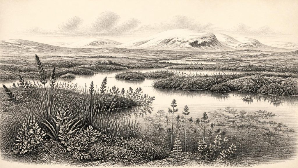
Around 30,455 BCE, Ireland lay within a cold, unstable Pleistocene landscape, although the date represents a broad calibrated range rather than a specific year. At Derryvree, County Fermanagh, freshwater silts between glacial tills preserve bogbean, water-milfoil, mosses, sedges and Arctic-alpine vegetation, indicating shallow wetlands amid open tundra during an ice-free interval. Insects support severe periglacial conditions with short productive summers. Cave finds elsewhere show Ice Age fauna, including reindeer and mammoth, but cannot be directly linked to Derryvree. A possibly cut-marked reindeer bone suggests early human activity, yet permanent occupation remains unproven. Renewed ice later completely buried this temporary ecosystem.
Dateline
30,455 BCE is a useful modern label, but it cannot identify an event that happened in a known Irish calendar year. Nobody in Ireland recorded dates, rulers or seasons in a system that can be converted into the modern calendar. Nor does the evidence permit a diary-like reconstruction of this particular year. The responsible subject is instead Ireland in the later part of the Pleistocene, within the unstable climatic world of Marine Isotope Stage 3, and the unusually revealing deposits preserved beneath a drumlin at Derryvree, near Maguiresbridge in County Fermanagh.
The closest evidence is not a settlement or a monument but a buried freshwater deposit. Its importance lies precisely in its modesty: organic silt, sand, plant remains and small animal traces accumulated during an interval when a local landscape could sustain shallow water and tundra vegetation, before a later ice advance sealed the evidence below glacial till. It records environmental possibility rather than a named human community. Around the modern date 30,455 BCE, Ireland was a cold, changing north-western edge of Europe, where ice, water, vegetation and animal movement mattered far more than the institutions familiar from later history.
A Date Inside a Wide Window
Road works in 1969 exposed the Derryvree sequence in a north-east to south-west drumlin. Beneath the landform lay a lower till, deposited by glacier ice; above it were freshwater silts and fine sands rich in organic material; above those came a second, thick till. The order is decisive. Ice had occupied the site, then an ice-free or at least locally ice-free interval allowed freshwater sediment to collect, and renewed glaciation later buried the wetland. This is direct stratigraphic evidence for change, not simply an inference from the modern landscape.
Organic matter from the deposit produced the radiocarbon determination BIRM-166: 30,500 radiocarbon years before present, with a substantial laboratory uncertainty of +1,170 and -1,030 years. “Before present” conventionally means before AD 1950, but a radiocarbon age is not a calendar age that can simply be subtracted from 1950. Atmospheric carbon-14 varied through time. Calibration is therefore essential, and at such antiquity it produces broad probability ranges rather than a pinpoint date. A commonly cited modern calibration places the relevant Derryvree interval broadly about 36,900–31,700 calibrated years BP, or roughly 34,950–29,750 BCE.
That wide range is the proper frame for 30,455 BCE. It permits the date to be discussed alongside Derryvree, but not assigned to a particular season, water level or living creature in the deposit. The sediments themselves accumulated over time. Equally, the older terminology of a “Middle Midlandian Interstadial” should not be mistaken for proof of a mild, wooded Ireland. Later research often prefers the more guarded description “Derryvree Cold Phase”, because the fossil evidence points to harsh, open conditions even during this break between ice advances.
A Wetland Beneath Ice
Derryvree offers a rare glimpse of the living surface that later ice destroyed or concealed elsewhere. The assemblage included freshwater mosses, sedges and aquatic plants, among them water-milfoil and bogbean (Menyanthes trifoliata). Plant remains such as these show that still or slowly moving freshwater existed at the site. They do not demonstrate a large permanent lake, extensive woodland or benign climate. Rather, they indicate a mosaic of shallow pools, wet margins and damp ground in which plants could grow during a short productive season.
The terrestrial flora was equally revealing. Dwarf willow, mountain avens, juniper, grasses, sedges, clubmosses and other cold-tolerant taxa point towards open tundra or tundra-steppe. There is no persuasive basis for imagining a closed forest. Trees were absent or extremely scarce in the local landscape. In such an environment, wind exposure, frost action, snow cover and a brief summer growing period would have shaped where plants survived. The contrast between wetland species and dry-ground Arctic-alpine plants is not contradictory: it is evidence for closely packed habitats—water, sedge margin, gravelly ground and sparse scrub—within a severe wider climate.
Insect remains strengthen that picture. Cold-adapted beetles and other invertebrate evidence indicate a northern, periglacial environment. Earlier estimates based on comparable fossil assemblages have suggested July temperatures perhaps around 11–13°C, alongside very cold winters. Those figures are reconstructions, not thermometer readings from Fermanagh, and should be treated accordingly. Their value is comparative: summers could permit freshwater life and plant growth, while winters remained sufficiently severe to exclude the temperate woodland environment later associated with Ireland.
The Derryvree wetland was therefore not a refuge from the Ice Age in any comfortable modern sense. It was a productive but constrained habitat. Moss, sedge and aquatic vegetation would have supported insects and small animals; open country beyond it could have offered grazing and movement routes to larger herbivores. The evidence says nothing of fields, livestock, houses, cultivated crops, stores or managed woodland. Ireland at this point had no demonstrable farming economy, and the material basis for later settlement—permanent villages, built boundaries, worked landscapes and landholding—was still tens of millennia in the future.
Animals and a Possible Human Trace
Southern Irish caves show that large mammals reached Ireland during parts of the last glacial cycle. Castlepook Cave, near Doneraile in County Cork, has yielded remains attributed to reindeer, woolly mammoth, giant deer, brown bear, hare, fox and spotted hyaena. These cave collections are invaluable, but they must be read carefully. They were accumulated by different processes, including carnivores and natural death, and many finds were excavated long ago. A list of species from a cave does not mean that all lived together, in one locality, or in the same year as the Derryvree wetland.
Reindeer are especially relevant to an open, cold landscape. Their presence in Ireland is compatible with grazing animals using broad, sparsely vegetated terrain, while hyaena remains remind us that carcasses and caves had their own ecological histories. Mammoth remains testify to the island’s connection, at certain times, with the wider north-west European faunal world. Yet none of this authorises a theatrical reconstruction in which mammoths, reindeer and predators stand together beside the Fermanagh pools in 30,455 BCE. The records come from different places, deposits and dating contexts.
The most consequential, but still debated, human clue is a reindeer femur from Castlepook. It has been reported as bearing a deep incision interpreted as a stone-tool cut mark, and its reported age is broadly around 33,000 radiocarbon years ago. If the modification is confirmed as anthropogenic and securely associated with the bone’s age, it may represent remarkably early human handling of a carcass in Ireland. But one marked bone cannot establish a permanent population, a camp, a route of migration or a repeated hunting tradition. There is no securely associated hearth, dwelling, burial, stone-tool assemblage or occupation surface of this antiquity in Ireland.
Accordingly, society and everyday life cannot responsibly be described in the usual historical sense. There are no known chiefs, kin groups, languages, beliefs, artworks or ritual places for this date. If people entered Ireland during this broad period, they may have done so as small, mobile foraging parties using the opportunities offered by animal movements and changing coastal or ice-margin geography. That is a reasonable archaeological possibility, not an established fact about Derryvree or 30,455 BCE. No political affairs, diplomacy or organised conflict can be recovered from the evidence.
Ice, Coasts and Connections
Ireland’s regional geography was changing rapidly on geological timescales. Global sea level was lower than today because vast quantities of water were held in continental ice sheets, but lower sea level did not automatically create an easy, continuous route into Ireland. Glaciers, cold seas, shifting shorelines, exposed shelves, rivers and local topography all affected movement. The British–Irish Ice Sheet was not a single static blanket. Modern reconstructions show that its growth, maximum extent and retreat varied markedly between sectors, while older local deposits preserve evidence for repeated advances and ice-free intervals.
The Derryvree sequence embodies that regional instability. The lower till records an earlier glacial occupation; the wetland records a pause in which freshwater life became possible; the upper till records renewed ice movement. The drumlin seen today was thus not simply created in one unchanging “Ice Age”. It is a layered archive of environmental reversals. At some later stage, advancing ice would have overridden the site, incorporating and protecting the wetland sediments beneath its debris.
For cultural history, the principal lesson is restraint. There is no evidence for trade in objects, formal exchange networks or maritime communities in Ireland at this date. Nor can the possible movement of animals or people be converted into claims about nations, ancestry or later Irish identities. What can be said is more fundamental: the island had not yet become the settled, wooded and farmed place of later prehistory. Its history was being written in sediments, bones and ice, with the conditions for human visits—and perhaps only fleeting ones—changing as quickly as the climate.
What Derryvree Preserves
The bogbean and water-milfoil at Derryvree are small fossils with a large historical value. They demonstrate that even during a cold phase of the last glacial cycle, parts of Ireland could contain freshwater habitats amid open tundra. The enclosing tills demonstrate that such conditions were temporary. Together they correct two misleading extremes: Ireland was neither uniformly hospitable nor continuously, uniformly entombed beneath ice.
For 30,455 BCE, then, the most accurate annual overview is an environmental one. Modern calendar-year precision is unavailable; the evidence belongs to a wide calibrated interval, not a single datable episode. A cold Fermanagh wetland, open vegetation, mobile Ice Age fauna and expanding or returning ice are securely grounded themes. Human presence remains possible but unproven at the scale of a population. Derryvree’s buried plants are not a story of kings or battles. They are the surviving record of an Irish landscape repeatedly made, erased and remade long before written history.
Primary Sources
- A Middle Midlandian Freshwater Series at Derryvree, Maguiresbridge, County Fermanagh, Northern Ireland
- Early Midlandian–Middle Midlandian, Pleistocene, Northern Ireland
- Irish Pleistocene Biostratigraphy
- The Irish Quaternary Fauna Project
- Castlepook Cave
- Heritage Artefacts of County Cork
- UCD School of Archaeology Research Day 2022
- Archaeology Research Excavation Grant 2022
- Ireland’s Palaeolithic Archaeology – Fleeting Footprints in a Frozen Land
- New Insights on the Fauna of Ireland’s Younger Dryas and Early Holocene from Alice & Gwendoline Cave
- The Mesolithic in Ireland: When Was It?
- Growth and Retreat of the Last British–Irish Ice Sheet, 31,000 to 15,000 Years Ago: the BRITICE-CHRONO Reconstruction
- Timing, Pace and Controls on Ice Sheet Retreat: an Introduction to the BRITICE-CHRONO Transect Reconstructions of the British–Irish Ice Sheet
- Dating Constraints on the Last British-Irish Ice Sheet: a Map and Database
- Radiocarbon Constraints on the History of the Western Irish Ice Sheet Prior to the Last Glacial Maximum
- AMS 14C Dating of Deglacial Events in the Irish Sea Basin and Other Sectors of the British–Irish Ice Sheet
- New Data for the Last Glacial Maximum in Great Britain and Ireland
- Trimlines, Blockfields and the Vertical Extent of the Last Ice Sheet in Southern Ireland
- The IntCal20 Northern Hemisphere Radiocarbon Age Calibration Curve (0–55 cal kBP)
- A Stratigraphic Framework for Abrupt Climatic Changes During the Last Glacial Period Based on Three Synchronized Greenland Ice-Core Records: Refining and Extending the INTIMATE Event Stratigraphy