BIRM-166 Under Twin Tills30308 BCE
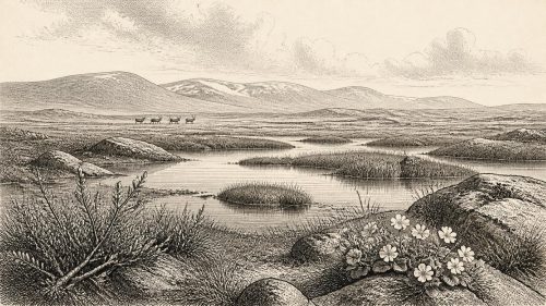
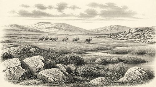
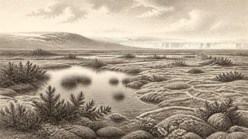
The label 30,308 BCE cannot identify a recoverable Irish year, but lies within a broad late Marine Isotope Stage 3 interval. At Derryvree, County Fermanagh, freshwater organic sediments between glacial tills, dated BIRM-166, record a cold, open tundra-like wetland during temporary local ice retreat. Subsequent ice buried this landscape, while other sites demonstrate episodic glaciation and climatic variation. Castlepook Cave, County Cork, preserves mixed remains of mammoth, giant deer, reindeer, predators and other cold-adapted fauna. A possibly tool-marked reindeer bone may indicate a brief human visit, but proves neither settlement nor economy. Ireland’s evidence remains environmental, fragmentary, and chronologically uncertain.
Dateline
30,308 BCE is a modern calendar label, not a year that can be recovered from Ireland’s archaeological record. No Irish community used this calendar; no written source, ruler, battle, settlement or individual can be assigned to this particular year. In terms used by Quaternary scientists, it falls roughly 32,257 years before the conventional radiocarbon “present” of 1950, during the later part of Marine Isotope Stage 3, a volatile phase of the last Ice Age. Calendar-year precision is not available at this depth of time. The responsible history of Ireland at this point must therefore be built from dated deposits and fossils whose age ranges extend across centuries or millennia.
A Date Range, Not a Day
The nearest major Irish environmental archive is Derryvree, near Maguiresbridge in County Fermanagh. Roadworks there in 1969 cut through a drumlin and exposed an extraordinary sequence: glacial till below, freshwater silts and organic sediment in the middle, and another thick till above. The order matters. Ice had occupied the site, then withdrew or ceased to dominate locally long enough for water, plants and sediment to accumulate, before ice returned and sealed the deposit.
The organic horizon yielded the radiocarbon measurement BIRM-166: 30,500 radiocarbon years BP, with a substantial uncertainty of roughly a thousand years either way. Radiocarbon years are not identical to calendar years, because atmospheric carbon-14 has varied through time. Modern calibration curves convert such measurements into broad probability ranges. For BIRM-166, that means a span broadly in the order of 37,000 to 32,000 calibrated years BP, rather than a single calendar date. The nominal year 30,308 BCE lies near the younger end of that wide chronological neighbourhood, but cannot be tied to one pool, plant, season or human generation at Derryvree.
This is an important discipline. Ireland around this notional year cannot be described as if an observer had made a dated diary entry. What Derryvree securely establishes is a cold, non-glacial interval in one part of Fermanagh during the Middle Midlandian sequence. It does not demonstrate that the whole island was ice-free at once, nor that every coast, upland and valley had the same weather or vegetation.
Freshwater Between Ice Advances
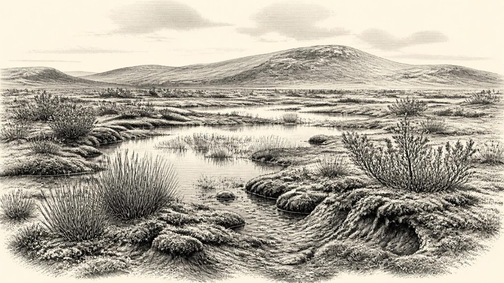
Derryvree nevertheless offers one of the clearest pictures of Irish conditions for this broad period. Its silts, fine sands, plant remains and small-animal evidence indicate freshwater and wet ground within an open, periglacial landscape. The vegetation was not woodland like that of modern Ireland. The published interpretation is of tundra-like country: mosses, sedges, low herbs and dwarf shrubs around shallow or slow-moving water, with exposed mineral ground beyond. Such terrain could be seasonally productive, yet it was shaped by severe winters, frost action and a short growing season.
Aquatic and wetland plants are especially valuable because they show that water persisted long enough to support a local ecological community. This was neither a featureless snowfield nor a benign green pasture. It was a mosaic of sedge margins, mossy ground, pools and sparse open vegetation. In such a setting, meltwater, frozen ground and wind would have been powerful agents of change. The later till above the sediments is equally eloquent: this was a landscape vulnerable to renewed glaciation, and its living surfaces were ultimately buried beneath ice-laid debris.
Comparable inter-till and organic deposits in northern Ireland, including material near Greenagho and Hollymount, reinforce the wider point that glaciation was episodic and regional. They do not yield an annual sequence, but they overturn the simplistic idea that Ireland was continuously and uniformly ice-covered throughout the last Ice Age. Local ice-free or lightly glaciated intervals existed, although their exact timing, duration and extent remain matters of geological reconstruction rather than direct observation.
An Island Entering a Colder Phase
At roughly 32,000 calibrated years BP, the British–Irish Ice Sheet was growing rapidly, though its development varied between regions. Recent reconstructions indicate major expansion of Scottish and northern ice masses around 32,000–30,000 years ago, followed by further coalescence and advance. By about 30,000 years ago, models depict a combined British–Irish ice complex, with Northern Ireland and the Irish Sea increasingly important to its configuration. This does not mean that every part of Ireland was already beneath thick, permanent ice in 30,308 BCE. It means that the island stood within a changing glacial system whose margins, meltwater routes and local climates could alter markedly over comparatively short geological intervals.
Crag Cave in County Kerry supplies complementary evidence. Uranium-thorium dates on cave calcite show repeated episodes of speleothem growth across much of the last glacial period. Because calcite deposition in such a shallow cave requires liquid water and conditions generally above freezing, the record indicates that south-west Ireland experienced intermittent climatic amelioration. Cave growth is not a thermometer for every Irish valley, but it confirms that the last Ice Age involved pronounced swings between more and less favourable conditions.
Coastlines, too, were unlike those of today. Sea level was lower globally as water was stored in expanding ice sheets, but the precise local shape of the Irish Sea and the connections between Ireland, Britain and the continental shelf depended on ice, relative sea level and crustal movement. The evidence does not support casually imagining a simple, dry land bridge available throughout this period. Any route followed by animals or people must be considered within a shifting, glacially influenced north-west European geography.
Castlepook’s Faunal Record
The strongest southern Irish evidence comes from Castlepook Cave, also called Mammoth Cave, near Doneraile in north County Cork. This limestone cave system is Ireland’s richest known repository of vertebrate remains from the period leading towards the Last Glacial Maximum. Excavations conducted mainly between 1904 and 1918 recovered a large, mixed collection accumulated over a long time. Surviving material includes woolly mammoth, giant deer, reindeer, brown bear and spotted hyaena; later deposits also produced wolf, Arctic fox and lemmings.
These animals do not prove that all lived together in one year, or even in one century. Individual bones from Castlepook have returned radiocarbon ages extending over tens of thousands of years, and water movement, carnivore activity and early excavation methods complicate the original contexts. The cave was, in part, a carnivore den and a trap or repository for bones. A hyaena might drag prey into a gallery; floods could move remains; later disturbance could mix deposits. The cave therefore documents a changing Ice Age fauna, not a neatly preserved hunting camp.
Its species nonetheless make the general landscape intelligible. Reindeer and lemmings point to cold, open habitats; mammoth and giant deer indicate the potential richness of open grass-herb environments at suitable moments; hyaena, wolf and bear reveal a predator and scavenger guild. The world outside the cave was ecologically connected to Britain and continental Europe, even if its exact physical connections changed. Ireland was not an isolated ecological void.
The Unresolved Human Question
A reindeer femur from Castlepook has been publicised as carrying a deep mark interpreted by zooarchaeologist Ruth Carden as having been made by a sharp stone tool during the processing of a fresh carcass. County Cork heritage material places the specimen broadly around 31,000 BCE, and this claim is directly relevant to the date considered here. If the mark is confirmed as anthropogenic and broadly contemporary with the animal’s death, it may represent a fleeting Upper Palaeolithic human visit to Ireland: perhaps the cutting of meat, hide, sinew or another tissue from a reindeer limb.
That interpretation must remain carefully bounded. The bone is not a house, hearth, burial, stone-tool assemblage, occupation surface or evidence for a resident population. No securely associated Irish Palaeolithic toolkit has been published from Castlepook, and the old cave collections lack the controlled stratigraphic context expected of modern excavation. Nor can one altered bone establish whether people killed the animal, found it dead, scavenged it, travelled in a small party, or remained in Ireland beyond a brief episode. Recent archaeological work at the cave has aimed to recover undisturbed deposits and improve this picture.
Society Beyond Recovery
Accordingly, political affairs, diplomacy, warfare, religion, learning, trade and permanent settlement cannot responsibly be reconstructed for Ireland in 30,308 BCE. There is no evidence for chiefs, tribes, alliances, shrines, ritual specialists, exchange networks or named cultural groups on the island at this date. Nor is there evidence for farming, domestic animals, fields, boats or built villages. European Upper Palaeolithic societies elsewhere possessed sophisticated stone technologies and expressive cultural traditions, but those wider continental facts cannot be imported into Ireland without Irish finds to support them.
The most that may be said about everyday life is conditional. If people did reach Ireland during a milder opening within this cold age, they would have encountered a landscape where animal movements, shelter, weather and access to raw materials governed survival. Reindeer, where available, could have offered food, hide, sinew, bone and antler. Yet the Castlepook femur cannot reveal which of these resources were taken. It is evidence for a possible action, not a complete economy.
For this point in deep time, the principal Irish development is environmental rather than political: an island of open wetlands, cave-dwelling carnivores and cold-adapted herbivores, standing amid the rapid growth and fluctuation of the British–Irish Ice Sheet. Derryvree’s freshwater sediments and Castlepook’s bones preserve that world in fragments. Their uncertainty is not a weakness to conceal; it is the essential historical fact. Around 30,308 BCE, Ireland can be illuminated by deposits and fossils, but not yet narrated year by year.
Primary Sources
- Middle Midlandian Freshwater Series at Derryvree, Maguiresbridge, County Fermanagh, Northern Ireland
- Middle Midlandian Freshwater Series at Derryvree, Maguiresbridge, County Fermanagh, Northern Ireland
- Irish Pleistocene Biostratigraphy
- Figure 6.—The Subdivision of the Quaternary Period in Ireland
- Episodic Speleothem Deposition Tracks the Terrestrial Impact of Millennial-Scale Last Glacial Climate Variability in SW Ireland
- Episodic Speleothem Deposition Tracks the Terrestrial Impact of Millennial-Scale Last Glacial Climate Variability in SW Ireland
- A Reconsideration of the Radiocarbon Dating of the Marine Isotope Stage 3 Fauna from Southern Ireland
- The Irish Quaternary Fauna Project
- Castlepook Cave: Cork County Geological Site Report
- Heritage Artefacts of County Cork 2021
- 2022:564 — Castlepook Cave, Castlepook South, Cork
- Archaeology Research Excavation Grant 2022: Final Report
- First Evidence of a Late Upper Palaeolithic Human Presence in Ireland
- New Insights on the Fauna of Ireland's Younger Dryas and Early Holocene from Alice & Gwendoline Cave
- The IntCal20 Northern Hemisphere Radiocarbon Age Calibration Curve (0–55 cal kBP)
- Growth and Retreat of the Last British–Irish Ice Sheet, 31,000 to 15,000 Years Ago: the BRITICE-CHRONO Reconstruction
- Extent and Timing of the Last Glacial Maximum in Britain and Ireland: A Review
- The Timing and Magnitude of the British–Irish Ice Sheet Between Marine Isotope Stages 5d and 2
- BRITICE-CHRONO Maps and GIS Data of the Last British–Irish Ice Sheet 31 to 15 ka
- The Glacial Stratigraphy of the Sperrin Mountains and Its Relation to the Glacial Stratigraphy of North-West Ireland
- Castlepook Caves, County Cork
- Mammoth Cave, Castlepook, County Cork