
BIRM-166 Wetland Sample30119 BCE
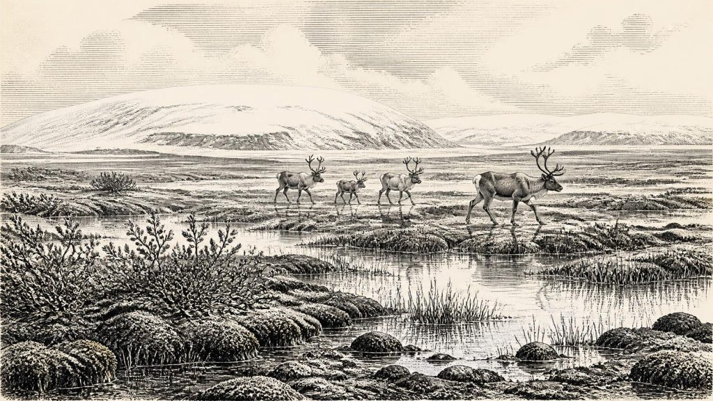
At approximately 30,119 BCE, Ireland lay within the climatically unstable later Marine Isotope Stage 3, beyond precise calendar dating or historical record. At Derryvree, County Fermanagh, organic sediments between two glacial tills document an ice-free local landscape of shallow pools, mosses, sedges, herbs and tundra-like vegetation. They demonstrate regional climatic fluctuation, not an ice-free island. Lower seas and shifting ice altered coasts, while Crag Cave records intermittent conditions. Faunal remains at Castlepook Cave indicate open-country mammals. A marked reindeer bone suggests tentative Upper Palaeolithic human activity, but no secure settlement evidence exists. Environmental change and renewed glaciation define this period.
Dateline
The label 30,119 BCE is a modern point on a deep prehistoric timescale, not a year that can be recovered from an Irish calendar, chronicle or annual archaeological record. It falls roughly 32,000 years before the conventional radiocarbon reference year of AD 1950, in the later part of Marine Isotope Stage 3 (MIS 3), a climatically volatile phase of the last Ice Age. No named people, political communities, settlements or individual events can responsibly be assigned to Ireland in this particular year. The best evidence instead comes from sediments, fossils, cave deposits and ice-sheet reconstructions accumulated over long periods.
Modern calendar-year precision is unavailable at this depth of time. Radiocarbon measurements have laboratory uncertainties and must be calibrated because atmospheric carbon-14 has varied. Calibrated results are probability ranges, not exact historical dates. The most informative Irish record close to this notional date, the Derryvree deposit in County Fermanagh, has been placed broadly at about 36,900–31,700 calibrated years BP, or approximately 34,950–29,750 BCE. Thus 30,119 BCE lies within a wide environmental window represented by the deposit, but it cannot be tied to a particular season, layer, animal or human action.
A Freshwater Interval Between Ice Advances
Derryvree, near Maguiresbridge in County Fermanagh, was exposed by roadworks in 1969 when a cutting passed through a drumlin. Investigators found a sequence of two thick tills, the unsorted debris laid down by glacier ice, with freshwater silts, fine sands and organic-rich mud trapped between them. This order of layers is the central fact. Ice had previously affected the site; later, water and vegetation persisted long enough to build up a wetland deposit; still later, another ice advance laid down the upper till and sealed the earlier landscape.
Organic material from this intervening deposit, laboratory sample BIRM-166, produced a conventional radiocarbon age of 30,500 years BP, with a large uncertainty of +1,170 and −1,030 years. Its age and sample type require caution, but the deposit securely demonstrates a local interval in which the Derryvree area was not overridden by glacier ice. It is not proof that all Ireland was ice-free, nor a day-by-day climate report. It is, however, unusually valuable evidence for a northern Irish landscape in the broad period surrounding the requested date.
The mud preserved plant remains, pollen and insect evidence that point to a cold, open and largely treeless environment. Grasses and sedges grew alongside mosses and herbs. Recorded macrofossils include mountain avens, dwarf willow, lesser clubmoss, bogbean and alternate water-milfoil. Bogbean and water-milfoil are especially revealing because they indicate shallow fresh water or saturated pool margins. The old term muskeg has sometimes been applied to this landscape: not a modern Irish bog reproduced unchanged, but wet, mossy ground interrupted by pools, sedge margins and patches of exposed mineral soil.
Interpretation must remain local. The Derryvree flora does not provide a map of every coast, valley and upland. Yet it decisively rules out an image of Ireland as uniformly buried beneath permanent ice at all times during MIS 3. Around this broad interval, the island contained changing mosaics of ice, snow, periglacial ground, freshwater basins and open vegetation. The later glacier that sealed the mud also helps explain why evidence is so scarce: advancing ice eroded, displaced or buried many surfaces on which animals, plants and any people might once have left traces.
Gathering Ice and Altered Coasts
Ireland stood on the Atlantic edge of a wider north-west European cold world. The greatest expansion of the last British–Irish Ice Sheet lay ahead rather than behind: major reconstructions place its maximum extent chiefly between about 27,000 and 21,000 calibrated years BP, although ice growth was neither uniform nor simultaneous in every sector. At the time represented by Derryvree, ice margins could advance, stagnate or retreat on regional scales as climate shifted. A local freshwater bed between tills is evidence for that instability, not an exception that cancels the reality of a severe glacial climate.
Sea levels were much lower than today because vast quantities of water were held in northern ice sheets. Ireland’s shorelines and surrounding seas therefore differed greatly from the modern map. Nevertheless, neither lower sea level nor broad regional reconstructions demonstrate a simple, continuously walkable route from continental Europe into Ireland at this precise time. Ice, marine channels, weather and changing coastlines all shaped possible movement. Any crossing by animals or people would have required conditions that cannot be reconstructed for one named year.
Crag Cave in County Kerry adds a separate but complementary climate archive. Uranium-series dating of its speleothems shows episodes of calcite growth during MIS 3, implying intervals when liquid water could circulate through the shallow cave system. Such evidence supports the larger conclusion that the Irish last-glacial climate fluctuated sharply rather than remaining steadily frozen. It cannot, however, turn 30,119 BCE into an exact warm episode or establish conditions in Fermanagh from a cave in Kerry.
Animals in Open Country
Cave collections, particularly from Castlepook Cave near Doneraile in north County Cork, show that Ireland supported substantial Late Pleistocene animal communities during broadly overlapping phases of the last Ice Age. The assemblage includes evidence for woolly mammoth, reindeer, giant deer, brown bear, wolf, foxes, mountain hare, lemmings and spotted hyaena. These remains accumulated over extended and complicated periods, often through carnivore activity as well as natural death and later disturbance. They should not be treated as a list of animals standing together beside Castlepook in 30,119 BCE.
Even so, the fauna makes the open-country setting intelligible. Reindeer and mammoth are consistent with cold, sparsely wooded habitats; hyaenas and wolves remind us that caves could be carnivore shelters and bone accumulators, not merely places visited by people. Animal populations would have responded to seasonality, forage, snow cover and the shifting position of ice. Their movements were a more important force in the island’s history than any recoverable boundary or political institution.
The Castlepook Human Question
One object from Castlepook gives this remote era exceptional, though still tentative, archaeological importance: a reindeer femur in the National Museum of Ireland’s Natural History collections carries a deep mark interpreted by zooarchaeologist Ruth Carden as having been made by a sharp stone tool during carcass processing. County Cork heritage material associates the bone with about 31,000 BCE. If the interpretation and chronological association are sustained, it may be evidence that people handled a reindeer carcass in Ireland during the Upper Palaeolithic, far earlier than the island’s securely established post-glacial settlement record.
The limitations are as important as the possibility. The femur came from an old cave collection, rather than a modern excavation of an intact occupation surface. No securely associated lithic assemblage, hearth, dwelling floor, burial, artwork or human remains of this age has been published from Ireland. The bone’s date is the age of the animal, not a precise date for the incision; nor can one marked bone establish whether people killed the animal, scavenged it, removed hide, meat or sinew, or processed it elsewhere before carnivores took remains into the cave. Renewed investigation at Castlepook is valuable precisely because it may test these questions with modern methods.
What Cannot Be Written
There is no evidence for an Irish polity, ruler, tribe, territory, diplomacy or organised warfare around this date. Nor can religion, language, teaching, art, kinship rules or customary law be inferred from the Derryvree wetland or Castlepook bones. Farming, herding, pottery, metalworking, monuments, permanent houses and exchange networks are likewise unsupported. It would be misleading to import the cave art, elaborate ornaments or named archaeological cultures of contemporary continental Europe into Ireland simply because they existed elsewhere.
If people did visit, the most cautious inference is of brief, mobile activity by individuals able to use sharp stone edges and to exploit animal resources in a difficult landscape. Reindeer could provide meat, fat, marrow, hide, sinew and bone, but the Irish evidence does not identify which of these mattered in a particular encounter. It does not demonstrate a settled population or continuity with later inhabitants. The defining history of Ireland around 30,119 BCE is therefore environmental: a cold island of open wet ground and mobile fauna, intermittently accessible and increasingly vulnerable to renewed glaciation.
Derryvree’s moss-rich mud is consequential because it preserves that otherwise fragile interval. Between two acts of ice deposition, it records shallow water, tundra-like vegetation and ecological persistence. Its lesson is not that a particular event occurred in a numbered year, but that Ireland’s Ice Age history was dynamic, regional and uncertain—and that even a thin buried wetland can carry the most reliable testimony available from a world before written memory.
Primary Sources
- A Middle Midlandian Freshwater Series at Derryvree, Maguiresbridge, County Fermanagh, Northern Ireland
- Middle Midlandian Interstadial Deposits at Greenagho, Near Belcoo, County Fermanagh, Northern Ireland
- Irish Pleistocene Biostratigraphy
- Figure 6: The Subdivision of the Quaternary Period in Ireland
- Aghnadarragh
- Freshwater Organic Deposits and Stratified Sediments Between Early and Late Midlandian (Devensian) Till Sheets, at Aghnadarragh, County Antrim, Northern Ireland
- Mammoth and Musk Ox ESR-Dated to the Early Midlandian at Aghnadarragh, County Antrim, Northern Ireland, and the Age of the Fermanagh Stadial
- Episodic Speleothem Deposition Tracks the Terrestrial Impact of Millennial-Scale Last Glacial Climate Variability in SW Ireland
- Trimlines, Blockfields and the Vertical Extent of the Last Ice Sheet in Southern Ireland
- Exploring Controls of the Early and Stepped Deglaciation on the Western Margin of the Last British-Irish Ice Sheet
- Growth and Retreat of the Last British–Irish Ice Sheet, 31,000 to 15,000 Years Ago: the BRITICE-CHRONO Reconstruction
- The Timing and Magnitude of the British–Irish Ice Sheet Between Marine Isotope Stages 5d and 2
- The Evolution of the Terrestrial-Terminating Irish Sea Glacier During the Last Glaciation
- Timing and Pace of Ice-Sheet Withdrawal Across the Marine–Terrestrial Transition West of Ireland During the Last Glaciation
- Deglaciation Chronology of the Donegal Ice Centre, North-West Ireland
- Pattern and Timing of Retreat of the Last British-Irish Ice Sheet
- The Last Eurasian Ice Sheets – a Chronological Database and Time-Slice Reconstruction, DATED-1
- The IntCal20 Northern Hemisphere Radiocarbon Age Calibration Curve (0–55 cal kBP)
- The Irish Quaternary Fauna Project
- Heritage Artefacts of County Cork 2021
- 2022:564 — Castlepook Cave, Castlepook South, Cork
- Ireland's Palaeolithic Archaeology – Fleeting Footprints in a Frozen Land
