
Derryvree’s Buried Poolscape31558 BCE
The modern label 31,558 BCE cannot identify a precise Irish event, but falls within a climatically variable late Ice Age interval. Sediments beneath Derryvree drumlin in County Fermanagh preserve freshwater silts between glacial tills, showing a locally ice-free, treeless tundra wetland later overridden by ice. Pollen, plants and insects indicate cold, open, waterlogged ground. Ireland’s ice sheet changed regionally before its later maximum, while cave fossils confirm large mammals, including reindeer and mammoth. A cut-marked Castlepook reindeer femur may indicate human carcass processing, but lacks secure context or associated occupation evidence. No evidence supports settlement, society, culture or migration routes.
Dateline
31,558 BCE is a modern calendar label, not a date that can be recovered from Ireland’s prehistoric record. No community on the island counted years in this way, and no excavated deposit can identify a particular season, journey or individual at such precision. In radiocarbon convention, the label falls roughly 33,507 years before AD 1950, within the later part of Marine Isotope Stage 3, a climatically changeable phase of the last Ice Age. The responsible scale for this article is therefore millennial rather than annual: calibrated ranges, stratigraphic sequences and carefully qualified evidence.
The most informative Irish evidence overlapping this notional date comes not from a settlement but from sediments beneath a drumlin at Derryvree, near Maguiresbridge in County Fermanagh. Together with cave-fauna records, glacial landforms and wider British–Irish Ice Sheet research, it allows a partial reconstruction of a severe but locally varied Irish environment. It does not reveal a polity, a named people or an established Irish population.
A Freshwater Interval
Road excavations in 1969 cut through the Derryvree drumlin and exposed a remarkable sequence: thick glacial till below, freshwater silts and fine sands in the middle, and another till above. Till is the mixed, unsorted sediment deposited directly by glacier ice. The order of the layers is the essential fact. Ice had covered the locality; a period then followed in which open water and organic sediment accumulated; later ice advanced across the site again, burying and preserving that brief environmental archive.
Organic material from the middle beds produced a conventional radiocarbon age of 30,500 +1,170/−1,030 radiocarbon years BP, known as Birm-166. Calibration of a result this old produces a broad range rather than an annual answer: modern discussion places it at approximately 36,900–31,700 calibrated years BP, or about 34,950–29,750 BCE. The nominal year considered here lies within that range, but it cannot be assigned to a particular Derryvree layer. The deposit demonstrates a cold, ice-free episode at this locality; it does not prove that all of Ireland was ice-free at once.
That distinction matters. The island’s Ice Age history was regional and dynamic. A wet hollow in Fermanagh could sustain freshwater life while ice occupied uplands or other sectors, and later ice could override the same locality. Derryvree is consequently a window onto conditions in north-central Ireland during part of MIS 3, rather than a complete map of the island.
Open Ground and Cold Water
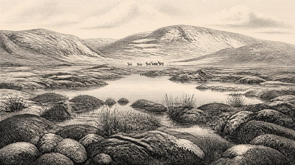
Derryvree’s pollen, plant remains and insect evidence point to a treeless, periglacial landscape. The researchers described open tundra vegetation and a muskeg-like setting: waterlogged ground, plant-rich margins, mosses and sedges, interrupted by pools. “Muskeg” is a useful modern ecological comparison, not a claim that the ancient terrain precisely duplicated any living northern wetland. Its value lies in conveying a place that was both wet and exposed, where shallow water, peat-forming vegetation and frost-prone ground existed together.
This was not the green, wooded Ireland familiar from later prehistory. There is no evidence here for oak woodland, arable clearings or settled farms. The plant and insect assemblages instead indicate sparse, low vegetation suited to cold conditions. Open terrain would have made wind, seasonal temperature contrasts and the availability of shelter decisive facts of life for animals and any passing people. Yet the freshwater beds also show that the landscape was not a uniform frozen waste: liquid water, vegetation and organic productivity persisted in particular sheltered basins.
Such evidence illuminates environment more directly than human society. It can establish that a pool, its margins and its surrounding open ground existed; it cannot tell us which plants people gathered, whether anyone camped nearby, or how long a given wetland survived. The temptation to turn a palaeoecological record into a detailed human scene must be resisted.
Before the Greatest Ice Expansion
At around 33,500 calibrated years BP, Ireland was approaching, but had not yet reached, the better-known Last Glacial Maximum. Recent reconstructions of the British–Irish Ice Sheet show that ice growth, maximum extent and retreat were asynchronous: different marine and terrestrial sectors behaved differently. The principal maximum ice volume is placed later, around 23,000 years BP, while many margins attained their greatest positions between roughly 30,000 and 22,000 years BP. Ireland was therefore part of a changing ice-sheet system, not a land fixed in one glacial state.
Derryvree and Greenagho, another County Fermanagh site with organic deposits beneath till, are important precisely because they preserve evidence for ice-free conditions before renewed glaciation. In south-west Ireland, cave calcite records also indicate that climatic ameliorations and deteriorations punctuated MIS 3. These archives do not provide a neat island-wide sequence. Rather, they show why older narratives of one simple, steadily advancing Irish ice cover have been replaced by reconstructions of expansion, retreat and local environmental variation.
Later glaciation also explains much of the silence in the archaeological record. Moving ice eroded surfaces, rearranged sediment and destroyed or deeply buried many places where a short-lived occupation might once have existed. This is an explanation for missing evidence, not evidence that people certainly lived everywhere before the ice arrived.
Animals in a Shifting Landscape
Irish cave collections preserve a wider Ice Age fauna than survives today. The Irish Quaternary Fauna Project found evidence that a range of mammals reached Ireland between at least about 45,000 and 20,000 years ago. Reindeer and woolly mammoth occur more often than red deer in pre-Last Glacial Maximum cave contexts; giant deer and carnivores are also part of the broader Pleistocene record. These animals belong to open-country ecosystems rather than later forested Ireland.
Castlepook Cave near Doneraile, County Cork, is especially significant. Its old collections contain remains accumulated through more than one episode, and caves can act as dens, traps, shelters, drainage routes and repositories for material brought in by carnivores. A bone from such a collection is therefore not automatically a record of a living animal at the cave entrance, still less of a single, intact animal community. Individual specimens require their own identification, dating and taphonomic assessment.
The faunal evidence nevertheless makes a central point: parts of Ireland supported large mammals during the long pre-maximum interval. Reindeer suggest open, cold-country habitats; mammoth remains point to connections with the wider north-west European Pleistocene world. But fossil animals cannot by themselves establish the nature of the route by which they arrived, the seasonality of their movements, or a continuous corridor for people.
The Reindeer Femur Question
A reindeer femur from Castlepook has been publicly reported as dating to about 33,000 years ago and bearing a deep incision interpreted by zooarchaeologist Ruth Carden as a mark made with a sharp stone tool during carcass processing. If that interpretation is sustained, it is potentially momentous: it would indicate that people handled reindeer in Ireland far earlier than the long-established post-glacial settlement record. It is the closest evidence relevant to human activity around the present chronological horizon.
Its limits are equally important. The femur was recovered in antiquarian cave work, not in a modern excavation of an undisturbed occupation floor. The radiocarbon date records the animal’s death, not necessarily the moment when the incision was made. Nor does one marked limb establish where an animal was killed, whether meat, hide, marrow or sinew was taken, or whether the bone was subsequently moved by water or carnivores. No securely associated hearth, stone-tool assemblage, dwelling, burial, food-preparation area or artwork of this age has been identified in Ireland.
The most cautious conclusion is thus one of possible short human incursion or carcass processing, not permanent settlement. It would be irresponsible to convert the bone into a village, a tribal territory or a continuous lineage of inhabitants. Even the cultural label of a contemporary continental European archaeological tradition should not be transferred to Ireland without a diagnostic Irish artefact assemblage.
What Cannot Yet Be Written
There is no defensible evidence for political affairs, rulers, diplomacy, warfare, law or institutions in Ireland at this date. There is likewise no Irish evidence from which to reconstruct religious rites, formal burial, language, visual art, teaching or ceremonial places. Absence of such finds does not prove that people, if present, had no beliefs, relationships or knowledge. It means only that the surviving Irish record cannot describe them.
Economy and everyday life are almost as elusive. There was no agriculture, livestock husbandry, metalworking, pottery production or trade network evidenced on the island at this horizon. If the Castlepook incision represents human butchery, it supports a very narrow inference: someone may have used a sharp stone edge in processing a reindeer carcass. It does not demonstrate a local tool-making industry or regular hunting economy. Ireland’s first incontrovertible evidence for substantial, sustained colonisation belongs much later, in the Mesolithic.
An Island at the Margin
Lower global sea levels exposed more of the continental shelf than exists today, altering coastlines and the geography of the Irish Sea region. Yet palaeogeographic possibility must not be confused with proof of a traversable land bridge or a particular migration route at 31,558 BCE. Routes may have changed with sea level, ice margins and local topography; much relevant landscape is now submerged or has been remodelled by ice and later marine processes.
The strongest historical picture is therefore modest but compelling. Around this point in the Ice Age, northern Ireland included cold, open freshwater wetlands during an interval later sealed beneath glacier deposits. Large mammals ranged through parts of the island, while the ice sheet’s configuration was changing on regional scales. A single reindeer femur raises the possibility that people briefly entered this world. Derryvree’s buried poolscape remains the firmer witness: not a calendar-year event, but a preserved fragment of Ireland before the greatest sweep of the last ice.
Primary Sources
- A Middle Midlandian Freshwater Series at Derryvree, Maguiresbridge, County Fermanagh, Northern Ireland
- The Irish Quaternary Fauna Project
- Trimlines, Blockfields and the Vertical Extent of the Last Ice Sheet in Southern Ireland
- Growth and Retreat of the Last British–Irish Ice Sheet, 31,000 to 15,000 Years Ago: The BRITICE-CHRONO Reconstruction
- The Timing and Magnitude of the British–Irish Ice Sheet Between Marine Isotope Stages 5d and 2
- Phylogeographic, Ancient DNA, Fossil and Morphometric Analyses Reveal Ancient and Modern Introductions of a Large Mammal: The Complex Case of Red Deer (Cervus elaphus) in Ireland
- New Insights on the Fauna of Ireland’s Younger Dryas and Early Holocene From Alice & Gwendoline Cave
- Ireland: Submerged Prehistoric Sites and Landscapes
- The Mesolithic in Ireland: When Was It?
- Heritage Artefacts of County Cork
- Introduction to the Late Quaternary and Holocene of Northern Ireland
- Figure 6: The Subdivision of the Quaternary Period in Ireland
- Project Findings Provide Essential Insight Into the Last British–Irish Ice Sheet
- Hydrographic Survey Data Uncovers Preserved Glacial Landscape
- Irish Quaternary Geomorphology Map Service
- Ireland Through Geological Time
- Reindeer Bone Found in Cork Cave Shows Human Activity in Ireland 33,000 Years Ago
- Archaeological Excavations at Killuragh Cave, Co. Limerick: A Persistent Place in the Landscape From the Early Mesolithic to the Late Bronze Age
- A Critical Review and Re-Investigation of the Pleistocene Deposits of Northern Ireland
- Episodic Speleothem Deposition Tracks the Terrestrial Impact of Millennial-Scale Last Glacial Climate Variability in South-West Ireland
- Radiocarbon Constraints on the History of the Western Irish Ice Sheet Prior to the Last Glacial Maximum
- The IntCal20 Northern Hemisphere Radiocarbon Age Calibration Curve (0–55 cal kBP)
