

Derryvree’s Periglacial Ponds31384 BCE
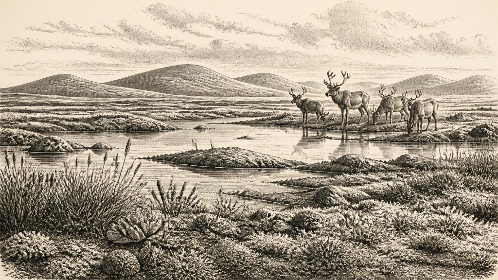
Although 31,384 BCE is a modern label rather than a recoverable Irish year, evidence from MIS 3 reveals fluctuating Ice-Age environments. At Derryvree, County Fermanagh, freshwater organic sediments between glacial tills, dated broadly to 36,900–31,700 calibrated years BP, record cold, treeless periglacial wetlands with seasonal liquid water and sparse vegetation. Cave evidence complements this local picture: Crag Cave indicates milder interstadials, while Castlepook Cave preserves fauna including mammoth, reindeer, giant deer, hyaena, Arctic fox and lemmings. A possibly human-made cutmark on reindeer bone suggests, but cannot prove, Upper Palaeolithic visits. Later glaciation buried or destroyed much evidence, requiring cautious conclusions.
Dateline
The label 31,384 BCE is a modern chronological convenience, not a year that can be recovered from an Irish record. No calendar, written account, named community or dated event survives from this depth of time. In archaeological terms it falls roughly 33,300 calendar years before AD 1950, during the Late Pleistocene and broadly within Marine Isotope Stage 3 (MIS 3), a climatically volatile part of the last Ice Age. The appropriate evidence is therefore measured in calibrated ranges of centuries and millennia. It can illuminate environments, animals and possible human movements, but cannot provide an annual narrative.
The strongest Irish evidence relevant to this notional date comes not from a settlement, but from a buried wetland at Derryvree near Maguiresbridge in County Fermanagh. Together with animal remains from caves in County Cork and records of changing ice, it shows an Ireland that was neither the familiar green island of later history nor simply a single, permanent sheet of ice. It was a region of sharp local contrasts, repeatedly altered by cold, water, vegetation and advancing glaciers.
Freshwater Between the Tills
Road construction at Derryvree in 1969 cut through a drumlin and exposed an exceptional sequence. Freshwater silts and fine sands, containing organic remains, lay between two thick deposits of glacial till. The order of these layers supplies the essential history: ice first deposited the lower till; a non-glacial interval followed, allowing waterborne sediments and organic material to accumulate; then a later ice advance buried the wetland beneath another till.
Organic material from the freshwater deposit returned a conventional radiocarbon age of about 30,500 years BP, with a substantial uncertainty. Subsequent calibration has placed the relevant interval broadly at approximately 36,900–31,700 calibrated years BP. The modern label 31,384 BCE lies within that wide span, but cannot be attached to one particular plant, pond edge or season in the deposit. Derryvree is evidence for a phase of environmental conditions in south Fermanagh, not a snapshot of all Ireland in one numbered year.
The plant, pollen and insect remains point to a cold, open, periglacial landscape. Periglacial does not mean glacier-covered: it describes terrain strongly shaped by frost, seasonal freezing and thawing, sparse vegetation and severe climate at the margins of ice. At Derryvree there were shallow freshwater habitats and waterlogged ground, perhaps akin in some respects to muskeg or tundra wetland. Mosses, sedges and hardy herbaceous plants occupied the margins. Pollen preservation was poor, yet the overall signal is clear enough: this was not a forested country of oak, hazel and pasture.
Such a landscape could nevertheless be biologically productive during a brief growing season. Pools supported aquatic and marginal plants; wet ground provided niches for insects and mosses; drier patches carried scattered tundra vegetation. The evidence does not justify imagining a pleasant lakeside climate. Long winters, frost-heaved soils, exposed ground and a short summer would have constrained life. But it does demonstrate liquid water, vegetation and functioning freshwater ecosystems in at least this part of Ireland during MIS 3.
An Unstable Ice-Age Island
Ireland’s geography at this time cannot be reduced to a simple map of modern shorelines. Global sea level was much lower than today because enormous volumes of water were held in continental ice sheets. Yet whether particular routes were dry, shallow marine, blocked by ice or divided by tidal channels depended on regional uplift and subsidence, changing ice margins and the complex Irish Sea basin. The sea barrier was not necessarily identical to the later, fully insular Ireland of the post-glacial world; equally, a low sea level does not prove a broad, easy land bridge or routine movement of people into Ireland.
At about 33,300 calendar years BP, the British–Irish Ice Sheet had not yet reached its Last Glacial Maximum, conventionally dated much later, around 27,000–20,000 years BP. Its growth was neither smooth nor uniform. Ice expanded and contracted across different sectors while cold intervals alternated with comparatively milder Greenland Interstadials. The Derryvree sequence records one local interruption in glacial dominance before later ice overran and sealed the sediments. Cave calcite from Crag Cave in County Kerry provides complementary evidence: episodes of speleothem growth during MIS 3 required liquid water circulating underground and are linked to relatively milder interstadial conditions.
This does not mean that all of Ireland was ice-free or environmentally alike. Derryvree describes northern inland conditions; Crag Cave records underground water in the south-west; neither can speak for every valley, upland or coast. Their value lies in demonstrating variation. The Ireland of this era was repeatedly remade by climate, with habitable ecological pockets appearing and disappearing across a wider northern Atlantic landscape.
Caves and Cold-Climate Fauna
Castlepook Cave, also known as Mammoth Cave, near Doneraile in north County Cork, offers the most vivid evidence for Irish animal life in the broader period. Its collections include remains attributed to woolly mammoth, giant deer, reindeer, brown bear, wolf, Arctic fox, lemmings and spotted hyaena. The cave was a repository over a long time, not a single undisturbed moment. Its fauna therefore must not be treated as a herd seen together in 31,384 BCE. Individual bones have different histories, and many were recovered during early excavations whose methods could not meet modern standards of stratigraphic recording.
Even so, renewed radiocarbon work has materially changed the chronology. Improved sample preparation showed that several Castlepook specimens were far older than earlier results had suggested, placing part of the fauna securely in MIS 3. In particular, the presence of reindeer, mammoth and hyaena indicates connections with the cold, open environments of north-west Europe. Giant deer, despite the later popular name “Irish elk”, was a widespread Eurasian species rather than an animal peculiar to Ireland.
These animals suggest an open mosaic rather than dense woodland. Reindeer could exploit tundra and steppe-tundra resources; lemmings and Arctic fox are especially strong indicators of cold conditions; hyaenas were capable scavengers and predators in open country. Mammoths and giant deer evoke large-ranging herbivores, but their cave remains cannot establish their local population sizes, migration routes or precise coexistence. The responsible conclusion is that suitable animal habitats existed in parts of Ireland during intervals of MIS 3, and that the island formed part of a changing north-west European faunal world.
The Castlepook Cutmark
One Castlepook object raises a larger question. A reindeer femur has been reported as bearing a deep linear modification interpreted by zooarchaeologist Ruth Carden as a mark made by a sharp stone implement on fresh bone. Public heritage accounts have associated the bone with an age of about 33,000 years. If the identification of the mark as anthropogenic, and its association with the animal’s death, withstand further scrutiny, it may indicate that Upper Palaeolithic people processed a reindeer in Ireland tens of millennia before the previously secure evidence for human activity.
The implications should not outrun the find. The femur dates the animal, not necessarily the instant at which the mark was made. It derives from an old cave collection rather than a recently excavated occupation surface containing associated tools, hearths, shelters, food waste and repeated activity. A linear scar also needs careful distinction from damage caused by carnivores, trampling, sediment movement, weathering, breakage or excavation. No securely associated lithic assemblage, human remains or settlement of comparable MIS 3 age has yet been demonstrated in Ireland.
Consequently, it is not responsible to describe an Irish tribe, a permanent colony or a settled hunting territory in 31,384 BCE. Nor can political affairs, diplomacy, warfare, organised religion, trade networks or formal learning be reconstructed for Ireland at this date. There are no known institutions, leaders, monuments, burials, artworks or built dwellings from which such claims could be made. If people did reach the island, they were more likely to have been small, mobile Upper Palaeolithic groups undertaking a short visit or seasonal foray in a demanding landscape. That is an interpretation based on wider European comparison, not a direct Irish observation.
What Can Be Said
Everyday life, if humans were present, would have centred on mobility, clothing, fire, stone tools and the skilled use of animal resources; yet none of these activities is securely attested in Ireland for this horizon. A possible cutmark is not proof of a camp. Likewise, the presence of large mammals does not prove hunting, trade in hides or ritual treatment of animals. Absence of surviving sites is significant but not conclusive, because later glaciation eroded landscapes and because submerged or deeply buried evidence is difficult to find.
The more secure history is environmental. Around the broad time represented by 31,384 BCE, parts of Ireland experienced cold, treeless and wet periglacial conditions; freshwater ecosystems developed at Derryvree during an interval between ice advances; and cave faunas show that cold-adapted and large mammals reached the island during MIS 3. The later growth of the British–Irish Ice Sheet would transform much of this terrain again, erasing or burying much of its fragile record. Derryvree’s ponds and Castlepook’s bones are therefore not minor curiosities: they are rare surviving witnesses to an Ireland whose history must be told in deposits, dates and carefully bounded possibilities.
Primary Sources
- A Middle Midlandian Freshwater Series at Derryvree, Maguiresbridge, County Fermanagh, Northern Ireland
- Palaeoecology
- Figure 6.— The Subdivision of the Quaternary Period in Ireland
- Episodic Speleothem Deposition Tracks the Terrestrial Impact of Millennial-Scale Last Glacial Climate Variability in SW Ireland
- A Reconsideration of the Radiocarbon Dating of the Marine Isotope Stage 3 Fauna from Southern Ireland
- The Irish Quaternary Fauna Project
- Phylogeographic, Ancient DNA, Fossil and Morphometric Analyses Reveal Ancient and Modern Introductions of a Large Mammal: The Complex Case of Red Deer (Cervus elaphus) in Ireland
- Castlepook Cave: County Geological Site Report
- First Evidence of a Late Upper Palaeolithic Human Presence in Ireland
- New Insights on the Fauna of Ireland’s Younger Dryas and Early Holocene from Alice & Gwendoline Cave
- The Mesolithic in Ireland: When Was It?
- Ireland: Submerged Prehistoric Sites and Landscapes
- Growth and Retreat of the Last British–Irish Ice Sheet, 31,000 to 15,000 Years Ago: the BRITICE-CHRONO Reconstruction
- Pattern and Timing of Retreat of the Last British-Irish Ice Sheet
- Maximum Extent and Dynamic Behaviour of the Last British–Irish Ice Sheet West of Ireland
- New Data for the Last Glacial Maximum in Great Britain and Ireland
- Trimlines, Blockfields and the Vertical Extent of the Last Ice Sheet in Southern Ireland
- Advance and Retreat of the Marine-Terminating Irish Sea Ice Stream into the Celtic Sea During the Last Glacial: Timing and Maximum Extent
- Oscillating Retreat of the Last British-Irish Ice Sheet on the Continental Shelf Offshore Galway Bay, Western Ireland
- Cork County Heritage Office
- 2022:564 – Castlepook Cave, Castlepook South, Cork
- Archaeology Research Excavation Grant 2022: Final Report