

Crag Cave’s Winter Calcite31385 BCE
Around 31,385 BCE, Ireland lay within Marine Isotope Stage 3, an unstable phase of the last Ice Age rather than a precisely datable historical moment. Derryvree, County Fermanagh, preserves freshwater sediments between glacial tills, indicating cold, open, tundra-like wetland during an ice-free interval. Calcite growth in Kerry’s Crag Cave demonstrates episodic conditions permitting liquid water, while ice sheets remained dynamic elsewhere. Southern caves yielded mammoth, reindeer and hyaena remains, showing links to wider European fauna. A cut-marked Castlepook reindeer bone may indicate early human activity in Ireland, but disturbed context and absent settlements preclude claims of permanent occupation or society.
Dateline
The label 31,385 BCE gives a useful point of reference for a very remote Irish past, but it must not be mistaken for a date at which an event can be placed. No calendar-year precision is available for Ireland at this depth of time. In simple conversion, it lies roughly 33,334 years before AD 1950, the conventional origin of “before present” dating, but radiocarbon results of this age must be calibrated into broad probability ranges rather than read as exact years. The responsible history of Ireland at this point is therefore not a chronicle of rulers, battles or named communities. It is a reconstruction from sediments, fossil bones, cave minerals, pollen and the marks left by changing ice.
A Cold, Changing Island
This was Marine Isotope Stage 3, a long interval of the last Ice Age, conventionally dated to about 59,500–24,000 years ago. It was not a single unchanging freeze. Greenland ice-core records reveal abrupt shifts between relatively milder interstadials and colder stadials, and Irish evidence suggests that these North Atlantic fluctuations affected conditions at the far western edge of Europe. The familiar Ireland of oak woods, pasture, fields and settlements was unimaginably distant. Much of the country was a severe, sparsely vegetated and environmentally unstable place, shaped by frost, meltwater, wind and the advance or retreat of glaciers.
It would nevertheless be wrong to picture the whole island as continuously buried beneath one uniform sheet of ice. The British–Irish Ice Sheet grew and altered through the last glacial cycle. Geological evidence from Ireland records both glacial occupation and intervals in which particular localities were ice-free or ice-marginal. Its margins did not advance everywhere at the same moment, nor did the island’s land and sea environments respond in a single, simple pattern. Around the present notional date, the most useful conclusion is regional: parts of Ireland could support cold terrestrial and freshwater environments between glacial episodes, while ice elsewhere may have been extensive or mobile.
Derryvree Beneath the Drumlin
The clearest Irish environmental archive for this broad period comes from Derryvree, near Maguiresbridge in County Fermanagh. Road excavations in 1969 cut through a drumlin and exposed a remarkable sequence. A deposit of freshwater silts and fine sands, rich in organic material, lay trapped between two distinct bodies of till: the unsorted debris deposited directly by glacier ice. The order of the layers matters more than any picturesque interpretation. First ice had deposited the lower till; later, water and organic sediment accumulated in a non-glacial environment; then another ice advance sealed the deposit beneath upper till.
Organic material from the Derryvree freshwater series produced a conventional radiocarbon determination of 30,500 ± 1,170 radiocarbon years BP, known as BIRM-166. Published calibration discussions have placed that wide result at approximately 36,900–31,700 calibrated years BP, or roughly 34,950–29,750 BCE. The date label considered here falls within that broad interval. It cannot, however, identify a particular season, generation or even an exact horizon in the sediments. Calibration curves improve as research advances, and a range of several millennia is the proper scale for interpretation. Derryvree illuminates the environmental world around 31,385 BCE; it does not supply a diary entry for that year.
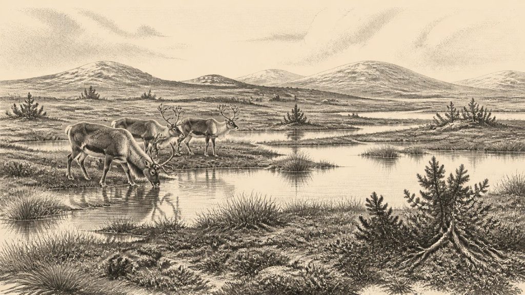
The biological evidence indicates open tundra and a periglacial climate. Pollen, plant remains, mosses and insect material point towards largely treeless wet ground, described by researchers as a muskeg-like environment: sedges, grasses, herbs and mossy surfaces around shallow pools and plant-rich water margins. Juniper occurred, but no closed woodland is implied. This was a landscape in which water could collect during a relatively non-glacial phase, while winter cold, seasonal freezing and short growing seasons strongly constrained what grew there. Such evidence is especially valuable because later glaciers commonly eroded or disturbed older deposits.
Water in Kerry, Ice on the Move
Crag Cave in County Kerry provides a different but complementary line of evidence. Uranium-thorium dating of broken and reworked calcite deposits shows episodes of speleothem growth during Marine Isotope Stage 3. Stalagmites and related calcite formations require water to pass through the cave system; in this shallow cave, their formation has been interpreted as evidence that mean annual temperatures were at least compatible with liquid water. The record does not show a mild climate in any modern sense, nor can it prescribe conditions in Fermanagh or Cork in a particular year. It does show that south-west Ireland experienced episodic climatic amelioration during the wider Ice Age.
Together, Derryvree and Crag Cave caution against a flat map of an entirely frozen Ireland. Yet they cannot prove that all Ireland was open country at once. Evidence from western coasts and offshore settings indicates that the Irish Ice Sheet was already capable of major growth and dynamic advance before the Last Glacial Maximum. Other studies place its fullest later expansion around 26,000–19,000 calibrated years BP, with the Irish Sea sector reaching a major maximum around 25,000–23,000 years BP. Thus the age represented by Derryvree belongs not to the familiar final maximum, but to the longer and more complicated build-up to it.
Animals and a Possible Human Trace
Southern Irish caves preserve an equally fragmentary record of Ice Age animals. Castlepook Cave near Doneraile, County Cork, long known as Mammoth Cave, has yielded remains attributed to woolly mammoth, reindeer and spotted hyaena, among other fauna. These finds establish that parts of Ireland formed part of a wider north-west European ecological zone during favourable episodes. Open grazing country could sustain large herbivores, while carnivores used caves or carried material into them. Cave bone collections must, however, be read with care: animals die naturally, carnivores accumulate prey, water moves bones, and early excavations often removed material without the stratigraphic records expected today.
A reindeer femur from Castlepook has particular importance. It has been publicly reported as dating to about 33,000 years ago and bears a deep linear mark interpreted by zooarchaeologist Ruth Carden as a fresh-bone cut or chop made with a stone implement. If that interpretation is confirmed by fuller publication and corroborating finds, it would indicate that people processed a reindeer in Ireland during the Upper Palaeolithic, vastly earlier than the well-established post-glacial settlement record. The cautious wording is essential. The bone derives from an old, disturbed cave assemblage; no stone tool is securely associated with it, and no excavated hearth, dwelling floor or stratified campsite of this age has yet been demonstrated.
Accordingly, Ireland around 31,385 BCE cannot responsibly be described as having a settled human population. Nor can historians identify clans, leaders, territories, diplomacy, religion, language or political institutions. There is no evidence for farming, permanent villages, trade routes, monuments, writing, formal warfare or ritual practice. If people did reach the island during an interstadial, the most defensible inference is limited: they may have been highly mobile hunter-gatherers operating within wider animal movements and exploiting a landscape then connected more closely to Britain and continental Europe by lowered sea levels. That is an inference from ecology and geography, not a recovered social history.
Everyday Life Without a Settlement Record
The absence of proven campsites means that everyday life can only be approached conditionally. Reindeer, if hunted, would have offered meat, marrow, hide, sinew and bone; their seasonal movements could have shaped where mobile groups travelled. Butchery is not the same thing as residence, and one marked bone is not evidence for a camp. Mammoths and hyaenas testify to an Ice Age fauna, but neither tells us who encountered whom, or whether a human party remained for days, months or generations. The safest statement is that the landscape had resources for animals adapted to open cold country and, perhaps intermittently, for human visitors able to cross a difficult north-west European terrain.
Environmental change was the great force in this Irish “year”. The critical political boundary was not a frontier between peoples but the shifting edge of ice, water and habitable ground. Pools at Derryvree accumulated silt and plant matter; calcite formed in Crag Cave when water moved through limestone; grazing animals and predators ranged through suitable country; later glacial advances buried, reworked or erased much of what had existed. These are not minor preliminaries to history. They are the conditions that determined whether Ireland could support life and whether any trace of it would survive.
What Can Be Known
For 31,385 BCE, certainty lies in the character of the evidence rather than in a named event. Ireland was within the last Ice Age and subject to rapid North Atlantic climatic variability. Derryvree preserves a cold, open freshwater landscape between glacial deposits during a broadly dated interval spanning the nominal year. Crag Cave records episodes when liquid water permitted calcite growth in south-west Ireland. Cave fauna confirms that Ice Age mammals reached the island during parts of Marine Isotope Stage 3. A marked reindeer bone at Castlepook raises the significant possibility of an early human presence, but does not yet establish a permanent population or a Palaeolithic society.
That restraint is not an absence of history. It is the history appropriate to deep time: a changing island of tundra pools, limestone caves, wandering animals and unstable ice margins, known through traces that are precious precisely because so much has been lost.
Primary Sources
- A Middle Midlandian Freshwater Series at Derryvree, Maguiresbridge, County Fermanagh, Northern Ireland
- A Reconsideration of the Radiocarbon Dating of the Marine Isotope Stage 3 Fauna from Southern Ireland
- Episodic Speleothem Deposition Tracks the Terrestrial Impact of Millennial-Scale Last Glacial Climate Variability in SW Ireland
- Trimlines, Blockfields and the Vertical Extent of the Last Ice Sheet in Southern Ireland
- Radiocarbon Constraints on the History of the Western Irish Ice Sheet Prior to the Last Glacial Maximum
- Late Pleistocene Chronostratigraphy and Ice Sheet Limits, Southern Ireland
- Timing and Pace of Ice-Sheet Withdrawal Across the Marine–Terrestrial Transition West of Ireland During the Last Glaciation
- Pattern and Timing of Retreat of the Last British-Irish Ice Sheet
- Stratigraphic and Palaeo-Geomorphological Evidence for the Glacial-Deglacial History of the Last British-Irish Ice Sheet in the North-Western Irish Sea
- The Timing and Magnitude of the British–Irish Ice Sheet Between Marine Isotope Stages 5d and 2: Implications for Glacio-Isostatic Adjustment, High Relative Sea Levels and ‘Giant Erratic’ Emplacement
- Spatio-Temporal Dynamics of Speleothem Growth and Glaciation in the British Isles
- Advance and Retreat of the Marine-Terminating Irish Sea Ice Stream into the Celtic Sea During the Last Glacial: Timing and Maximum Extent
- The IntCal20 Northern Hemisphere Radiocarbon Age Calibration Curve (0–55 cal kBP)
- The IntCal20 Approach to Radiocarbon Calibration Curve Construction: A New Methodology Using Bayesian Splines and Errors-in-Variables
- Fast and Slow Components of Interstadial Warming in the North Atlantic During the Last Glacial
- The Irish Quaternary Fauna Project
- Red Deer in Ireland: Phylogeography and Population History
- First Evidence of a Late Upper Palaeolithic Human Presence in Ireland
- Archaeology Research Excavation Grant 2022: Final Report
- Castlepook Cave Excavation, County Cork, 2022
- Heritage Artefacts of County Cork
- Prehistoric Details
- Ice Age Ireland: Cool Fossils!