
Crocuta at Castlepook31309 BCE
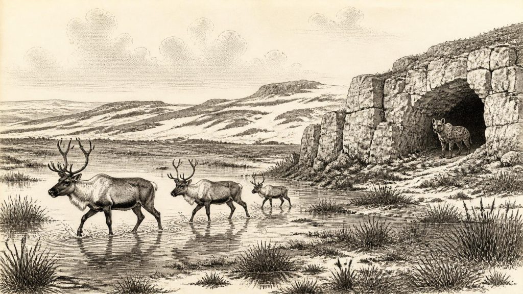
Around 31,309 BCE, Ireland experienced unstable Late Pleistocene conditions during Marine Isotope Stage 3, not a precisely recoverable historical year. Derryvree, County Fermanagh, preserves freshwater sediments between glacial tills, indicating a treeless, waterlogged tundra-like landscape during an ice-free interval. Castlepook Cave, County Cork, contains pre-Last Glacial Maximum remains of reindeer, mammoth, giant deer, bear and spotted hyaena, demonstrating connections with wider European fauna. Possible stone-tool damage on a reindeer bone suggests, but does not establish, human presence. No settlement, culture or economy can be identified. Later glaciation, erosion and sea-level rise severely fragmented Ireland’s deep-time archaeological record in many places.
Dateline
The label 31,309 BCE offers a useful point of orientation, but it cannot describe a recoverable year in Irish history. No written calendar, settlement sequence or precisely dated event permits that degree of resolution. In archaeological terms it corresponds approximately to 33,258 years before AD 1950, during the Late Pleistocene and the climatically changeable Marine Isotope Stage 3 (MIS 3). Dates from this depth of time are expressed responsibly as calibrated ranges, supported by stratigraphy, radiocarbon measurements and comparison with wider North Atlantic climate records. The evidence can illuminate an interval of cold landscapes, animal communities and advancing ice; it cannot tell us what happened in Ireland in one particular calendar year.
An Island in a Changing Ice Age
Ireland at this point lay on Europe’s north-western edge during the last glacial period. It was not yet the island of wooded valleys, farms, towns and field boundaries familiar from later millennia. Climate moved abruptly between colder and relatively milder phases, while glaciers expanded and withdrew on long timescales. The Last Glacial Maximum, when the British–Irish Ice Sheet became most extensive, was still to come, broadly after about 26,000 calibrated years BP. Around the notional date represented by 31,309 BCE, parts of Ireland could sustain ice-free ground and freshwater habitats, but conditions were severe and unstable.
Lower global sea levels altered the outlines of coasts and continental shelves. Yet it would be misleading to draw a simple, permanent land bridge between Ireland, Britain and continental Europe. The Irish Sea basin was affected by changing sea level, sediment, ice and glacier-fed waters; its exact configuration varied through time. For animals, and perhaps for people during favourable intervals, the geographical barrier may have been less formidable than it later became. But the surviving Irish evidence does not establish a particular route, migration episode or crossing at 31,309 BCE.
Derryvree’s Buried Freshwater World
The strongest environmental evidence relevant to this period comes from Derryvree townland near Maguiresbridge, County Fermanagh. Road excavations in 1969 cut through a drumlin and exposed freshwater silts, fine sands and organic deposits sealed between two separate sheets of till: the unsorted debris laid down by glacier ice. The sequence is exceptionally important. It shows that ice had covered the district, that an intervening non-glacial phase allowed water and organic sediment to accumulate, and that a subsequent glacial advance buried the local landscape beneath fresh till.
Organic material from the Derryvree deposits produced the radiocarbon determination BIRM-166, conventionally reported as about 30,500 ± 1,100 radiocarbon years BP. A radiocarbon age is not a calendar age. Atmospheric carbon-14 levels have changed through time, and the result must be calibrated against international curves. At more than 30,000 years ago, the original laboratory uncertainty and the form of the calibration curve yield a wide calendar range rather than a date precise to a century, much less a year. Derryvree is therefore relevant to 31,309 BCE as evidence from the wider later MIS 3 interval, not as a record made on that exact date.
Pollen, plant macrofossils, mosses and insect remains indicate an open, treeless, periglacial environment. Sedges, mosses and wet-ground plants grew around shallow water and saturated ground. This has often been described as tundra or muskeg: a cold, waterlogged mosaic rather than a uniform desert of snow and ice. Small pools, muddy margins and seasonal thaw could support plants and invertebrates even where winters were long and frozen ground strongly shaped drainage. The Derryvree deposits provide rare direct evidence that Ireland’s glacial history included biologically active intervals between episodes of ice cover.
Animals in North Cork
Castlepook Cave, near Doneraile in County Cork, supplies a complementary archive. Its deposits and old collections have yielded remains of large mammals and carnivores associated broadly with pre-Last Glacial Maximum Ireland, including reindeer, woolly mammoth, giant deer, brown bear and spotted hyaena. The scientific value of the cave lies not in a simple list of animals but in its demonstration that parts of Ireland could form part of a wider north-west European fauna during suitable cold-stage intervals.
The spotted hyaena, Crocuta crocuta, is particularly striking because its presence challenges modern expectations of Irish wildlife. A hyaena was not a resident of a familiar pastoral landscape. It was a powerful scavenger and hunter within a food web that included large herbivores, competing carnivores and fluctuating resources. Cave bone assemblages require care, however. Bones may have entered caves through carnivore activity, natural deaths, water movement, collapse, repeated use over long periods and disturbance during nineteenth- and early twentieth-century excavation. A cave is rarely a single moment frozen in time.
Reindeer are especially pertinent to the cold, open habitats suggested at Derryvree. Their presence implies forage sufficient for grazing herds during at least some phases, while mammoth and giant deer point to a varied large-herbivore community. Such animals should not be imagined as all standing together on one day, or as proof that every region of Ireland supported the same ecology. Their dates and cave contexts span intervals. What the evidence securely supports is a changing Irish landscape in which large mammals repeatedly reached or occupied suitable terrain before later ice advances transformed and often destroyed the ground surfaces on which they lived.
The Human Question
There is no demonstrated settlement, camp, hearth, tool assemblage, burial or enduring human community in Ireland that can be assigned to 31,309 BCE. This absence matters. It means that political affairs, diplomacy, organised warfare, leadership, language, religion, artistic traditions and everyday domestic life cannot responsibly be reconstructed for an Irish population at this date. There were no known Irish polities, no evidence of farming, and no basis for projecting later Celtic, medieval or modern identities back into the Pleistocene.
A reported reindeer femur from Castlepook bearing a deep mark interpreted as possible stone-tool damage has raised the possibility of human handling around 33,000 years ago. If the dating, mark interpretation and archaeological association withstand further study, it may represent an exceptionally early trace of people in Ireland. Even then, a marked bone would show an encounter with an animal, perhaps butchery, rather than prove a permanent population. It cannot identify the number of visitors, their origin, their language, their technology beyond the possible use of a sharp tool, or the duration of their stay. The distinction between possible human activity and established settlement is essential.
The better-known directly dated cut-marked brown-bear bone from County Clare belongs much later, near the end of the Pleistocene, and demonstrates why careful re-examination of museum collections is valuable. It should not be used to fill the far earlier gap represented here. The Irish Palaeolithic record remains extraordinarily slight when compared with Britain or continental Europe. Glacial erosion is one reason: ice sheets removed, redeposited and buried ancient land surfaces. Rising sea level also submerged former coastal landscapes, while many early discoveries came from caves excavated before modern recording standards.
Life, Economy and Belief: Limits of the Record
Without secure evidence for inhabitants, no human economy can be described for Ireland in this period. There is no evidence of agriculture, herding, managed landscapes, metalworking, exchange networks or trade. Nor can archaeologists identify dwellings, clothing, food preparation or seasonal movements. The most that can be said is conditional: if small groups entered Ireland during a favourable phase, they would have faced an environment in which shelter, fuel, fresh water and access to animal resources were decisive. That is a reasonable ecological inference, not evidence for a documented Irish hunting society.
The same restraint applies to religion and culture. Caves can acquire ritual meanings in later prehistory, but Castlepook’s Pleistocene animal deposits do not demonstrate ceremony, burial or sacred practice. No art, ornament, musical instrument or symbolic object from Ireland can be placed at 31,309 BCE. The period’s cultural history is consequently one of preservation and investigation rather than a recoverable human tradition: sediment specialists identify pollen and insect fragments; zoologists re-date bones; geologists reconstruct ice movement; and archaeologists test whether marks were made by people, animals or natural processes.
Regional Change Rather Than Chronicle
The principal historical development relevant to this date was environmental volatility. In Fermanagh, the Derryvree deposits preserve a freshwater, treeless interval between glacial episodes. In north Cork, Castlepook preserves traces of animals able to live in or pass through cold-stage Ireland. Across the island, later ice and later erosion ensured that the surviving archive would be uneven. Northern drumlin country, limestone caves and offshore sedimentary records retain fragments that open-air landscapes generally lost.
Thus Ireland around 31,309 BCE should be understood neither as an empty white sheet nor as a country with an unknowable but fully formed society hidden behind the evidence. It was a changing Pleistocene territory with wetlands, open ground and large mammals during parts of the relevant interval, vulnerable to renewed glaciation and climatic reversal. The record permits a cautious ecological history. It does not permit an annual chronicle. Its most compelling lesson is the fragility of deep-time evidence: a silt bed beneath a drumlin or a bone in a Cork cave can preserve a world otherwise erased by ice.
Primary Sources
- A Middle Midlandian Freshwater Series at Derryvree, Maguiresbridge, County Fermanagh, Northern Ireland
- Figure 6.— The Subdivision of the Quaternary Period in Ireland
- A Reconsideration of the Radiocarbon Dating of the Marine Isotope Stage 3 Fauna from Southern Ireland
- The Irish Quaternary Fauna Project
- Occurrence of Mammalia Relicts at Site Castlepook Cave
- Growth and Retreat of the Last British–Irish Ice Sheet, 31,000 to 15,000 Years Ago: The BRITICE-CHRONO Reconstruction
- Late Pleistocene Chronostratigraphy and Ice Sheet Limits, Southern Ireland
- Radiocarbon Constraints on the Age of the Maximum Advance of the British-Irish Ice Sheet in the Celtic Sea
- First Evidence of a Late Upper Palaeolithic Human Presence in Ireland
- New Insights on the Fauna of Ireland's Younger Dryas and Early Holocene from Alice & Gwendoline Cave
- The Colonization of Ireland: A Human Ecology Perspective
- Ireland: Submerged Prehistoric Sites and Landscapes
- The IntCal20 Northern Hemisphere Radiocarbon Age Calibration Curve (0–55 cal kBP)
- A Stratigraphic Framework for Abrupt Climatic Changes During the Last Glacial Period Based on Three Synchronized Greenland Ice-Core Records: Refining and Extending the INTIMATE Event Stratigraphy
- Ireland Through Geological Time
- Geology of Ireland
- Outreach and Education Resources
- Anthropogenic Changes to the Holocene Nitrogen Cycle in Ireland
- Our Ancient Landscapes: Hunter-Gatherers in Ireland
- Ireland's Palaeolithic Archaeology – Fleeting Footprints in a Frozen Land
