

BIRM-166’s Mossy Reedbed31260 BCE
31,260 BCE is a chronological label, not a precise Irish date, within climatically unstable MIS 3. Derryvree, County Fermanagh, preserves freshwater sediments beneath later glacial till, radiocarbon dated broadly to 36,900–31,700 calibrated years BP. Mosses, herbs, sedges and bogbean indicate open tundra wetlands with severe seasonal conditions, not continuous woodland. Ireland’s ice cover was variable, though major expansion approached. Castlepook Cave, County Cork, records diverse Ice Age fauna, but mixed deposits prevent reconstructing one contemporary community. A possibly tool-cut reindeer bone suggests human presence, yet lacks secure context. No settlement or history is established; sediments and ice define this past.
Dateline
The label 31,260 BCE is useful for ordering deep time, but it must not be mistaken for a date at which an Irish event can be placed. It corresponds only approximately to 33,210 years before the conventional radiocarbon reference year of AD 1950. Ireland then lay in the Late Pleistocene, during Marine Isotope Stage 3 (MIS 3), a climatically unstable interval within the last Ice Age. There are no annals, named peoples, political communities or calendar-dated actions. Even the best scientific evidence normally yields probability ranges spanning centuries or millennia. The responsible history of this point is therefore an account of landscape, animal life and the narrow limits of what archaeological traces may indicate.
Dating an Uncalendared Past
Radiocarbon dating does not identify a year in the modern historical sense. It measures residual radioactive carbon in material that was once alive, reports an age in radiocarbon years BP (“before present”, with present fixed at 1950), and then requires calibration against independently reconstructed changes in atmospheric carbon. Far back in the Pleistocene, calibration can produce wide or irregular calendar ranges. A result on an animal bone establishes, within a statistical range, when that animal died; it does not automatically date a scratch upon it, an imagined hunt, or the arrival of a human group.
The most valuable environmental anchor near this notional year comes from Derryvree, close to Maguiresbridge in County Fermanagh. Roadworks in 1969 cut through a drumlin and revealed freshwater silts and fine sands enclosed between two substantial sheets of till. The organic horizon produced the radiocarbon determination BIRM-166: 30,500 radiocarbon years BP, with a substantial uncertainty. Published calibrated treatments have expressed its likely age broadly as about 36,900–31,700 calibrated years BP. Thus 31,260 BCE falls within the broad chronological span represented by that deposit, but cannot be assigned to a particular layer, season or episode within it.
A Wetland Beneath a Drumlin
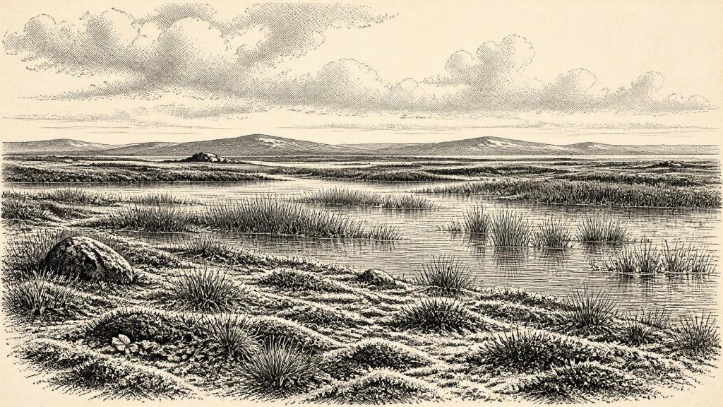
Derryvree is unusually important because the later glacier effectively sealed a fragment of an older landscape beneath its debris. The freshwater sediments contained poorly preserved herb pollen, plant remains and an insect and other small-fauna record of cold conditions. Moss macrofossils were especially significant: they provided rare direct evidence for Irish vegetation during the last glacial period. The assemblage also included aquatic and wet-ground plants, including bogbean, demonstrating that even an austere landscape had ponds, slow water and saturated margins rather than being an unbroken expanse of bare frost-shattered ground.
The evidence supports a picture of open tundra around the Fermanagh basin. Herbs, sedges, mosses and low-growing plants occupied exposed ground; water gathered in hollows; and the soil was subject to periglacial conditions, freezing for part of the year and thawing during the warmer season. Trees were not a defining feature of this local record. A few grains of tree pollen can travel long distances or be redeposited, so they do not demonstrate nearby woodland. This was a biologically active but thinly vegetated environment, with short growing seasons and strong seasonal constraints.
That conclusion is evidence-based, but it should not be stretched into a photographic reconstruction of every Irish region. Derryvree records one locality in what is now northern Ireland. Altitude, exposure, drainage and proximity to ice would have varied sharply across the island. South-western lowlands, uplands, cave valleys and coastal shelves may each have offered different mixtures of snow cover, bare ground, wetlands and sparse forage. In a changing glacial climate, the map of usable habitat could alter markedly over generations.
Ice on the Move
At about 33,210 calibrated years BP, Ireland was approaching a phase of major ice-sheet growth, not yet securely describable as uniformly buried beneath the ice of the Last Glacial Maximum. Reconstructions of the British–Irish Ice Sheet show that its southern Irish Sea sector expanded over a long interval beginning around 34,000 years ago, while its fullest late-glacial extent came later, broadly around 27,000–23,000 calibrated years BP. The Derryvree freshwater horizon, laid down before it was overridden by a later ice advance, independently shows that at least part of north-central Ireland had been ice-free during a relevant MIS 3 interval.
There is an important qualification. Evidence from western Ireland has also been interpreted as indicating substantial earlier ice loading and high relative sea levels before the Last Glacial Maximum. Ice cover was not a simple on-or-off condition across Ireland: local glaciers, advancing ice margins, sea ice, changing drainage and ice-dammed water could coexist with open terrain elsewhere. The exact configuration at 31,260 BCE remains unresolved. What can be said is that the Derryvree landscape belonged to a cold interval between glacial episodes and that, on the larger timescale, the advance that would reshape much of Ireland was drawing nearer.
Later ice was a destructive as well as a depositional force. It scoured bedrock, moved sediment and buried or removed older soils and campsites. That helps explain why the archaeological record is so meagre. Absence of a surviving campsite is not proof that no person ever stood in Ireland during MIS 3; equally, the loss of evidence is not a licence to fill the gap with presumed populations. The physical history of glaciation sets the limits within which early human archaeology must be read.
Castlepook’s Uneven Faunal Archive
In north County Cork, Castlepook Cave, also known as Mammoth Cave near Doneraile, supplies the principal Irish cave assemblage for animals of the last cold stage. Excavations undertaken mainly in the early twentieth century recovered remains attributed to reindeer, woolly mammoth, giant deer, brown bear, wolf, Arctic fox, spotted hyaena and lemmings, among other species. The cave is of national importance, and much of its surviving collection is held by the National Museum of Ireland. It demonstrates beyond doubt that an Ice Age fauna reached Ireland during different parts of the Late Pleistocene.
It does not, however, provide a single, neatly contemporaneous animal community for 31,260 BCE. The old excavations took place before modern standards of stratigraphic recording, sample treatment and dating. Carnivores could have dragged bones into the cave; water and sediment movement could have disturbed them; and finds from different episodes may have been mixed. Modern reassessment and improved collagen pretreatment have shown that several southern Irish faunal dates were appreciably older than previously thought. In particular, some species once assumed to have persisted close to the Last Glacial Maximum may have disappeared locally much earlier, around 40,000 calibrated years BP.
The proper conclusion is both more cautious and more interesting. Castlepook records repeated access by cold-adapted animals to Ireland in MIS 3, rather than one frozen tableau. Reindeer are especially relevant to a tundra setting, but their presence should not be turned into a claim that herds passed Castlepook in the precise numbered year. Mammoths, predators and herbivores occupied food webs whose membership altered with climate, geography and access routes. Cave bones reveal presence over spans of time, not the daily rhythms of a single landscape.
The Human Question
A reindeer femur from the Castlepook collection has been reported as bearing a mark interpreted by zooarchaeologist Ruth Carden as having been made by a sharp stone tool during the butchery of fresh bone. County Cork heritage material has placed the bone broadly at about 31,000 BC. If the cut-mark interpretation is sustained, it would be exceptionally important: it would indicate that one or more people processed a reindeer in Ireland during the Upper Palaeolithic, far earlier than the long-accepted evidence for human activity on the island.
Yet this is a possibility, not a demonstrated settlement history. No securely associated stone-tool assemblage, hearth, dwelling floor, burial, human remains, artwork or stratified processing area of comparable age has been recovered from Castlepook. The bone’s date is not a date for an exact cutting event, and the cave is not a sealed hunting camp. A mark on bone must be distinguished from damage made by carnivore teeth, sediment abrasion, excavation or other processes. Further excavations at Castlepook have sought surviving Pleistocene deposits precisely because a securely recorded context would allow these questions to be tested more decisively.
If people did visit Ireland in this broad period, the evidence permits only a modest inference: they may have been members of small, mobile foraging groups familiar with the wider north-west European world. A reindeer carcass could supply meat, marrow, fat, hide, sinew, antler and bone, and a sharp stone edge would be an effective tool for dismemberment. But hunting, scavenging, the duration of a visit, the route taken and whether the people returned are all unknown. There is no basis for identifying an Irish tribe, language, religious practice or lasting descent from such a possible episode.
Society Beyond Recovery
Consequently, conventional headings such as political affairs, diplomacy, war, economy and learning have no direct content for Ireland at this date. There were no documented rulers, territories, alliances, battles, trade agreements or institutions. Nor is there evidence for farming, permanent villages, monuments, metalworking, writing or formal religious sites. To project later Celtic, medieval or modern Ireland backwards into this glacial world would be a serious anachronism.
The evidence does nevertheless illuminate conditions that shaped any life possible here. Seasonal cold and sparse plant cover limited reliable resources. Wetlands created local ecological niches; herbivores and predators moved through a landscape exposed to climatic change; caves could trap, preserve and confuse traces of animal activity. Lower global sea levels altered coastlines, while ice loading and local sea-level change made the geography of approaches to Ireland complex. Animal dispersal demonstrates that connections existed at intervals, but the precise routes and their accessibility to people cannot be reconstructed for one calendar-like year.
What 31,260 BCE Can Mean
Ireland around this point was neither an empty abstraction nor a recoverable human society. It was a changing northern landscape in which freshwater wetlands could survive between ice advances, where tundra plants and mosses recorded a harsh seasonal climate, and where Ice Age mammals reached at least some regions during MIS 3. Derryvree’s sealed sediments are the clearest local witness; Castlepook’s cave fauna extends the picture into Cork and raises a provocative, still unconfirmed question about human activity.
The most defensible account therefore gives uncertainty its proper place. Modern calendar-year precision is unavailable. The broad calibrated range from Derryvree overlaps the date label, while the Castlepook material provides suggestive but contextually difficult evidence from a comparable era. Around 31,260 BCE, the history of Ireland is written not in events or names, but in buried freshwater silt, moss remains, cave bone and the approaching power of ice.
Primary Sources
- A Middle Midlandian Freshwater Series at Derryvree, Maguiresbridge, County Fermanagh, Northern Ireland
- Middle Midlandian Interstadial Deposits at Greenagho, Near Belcoo, County Fermanagh, Northern Ireland
- A Reconsideration of the Radiocarbon Dating of the Marine Isotope Stage 3 Fauna from Southern Ireland
- The Irish Quaternary Fauna Project
- Maximum Extent and Dynamic Behaviour of the Last British-Irish Ice Sheet West of Ireland
- Pattern and Timing of Retreat of the Last British-Irish Ice Sheet
- Growth and Retreat of the Last British–Irish Ice Sheet, 31,000 to 15,000 Years Ago: the BRITICE-CHRONO Reconstruction
- Radiocarbon Constraints on the History of the Western Irish Ice Sheet Prior to the Last Glacial Maximum
- Bayesian Modelling the Retreat of the Irish Sea Ice Stream
- New Age Constraints for the Maximum Extent of the Last British–Irish Ice Sheet (NW Sector)
- Marine Geophysical Evidence for Late Pleistocene Ice Sheet Extent and Recession off Northwest Ireland
- Vertical Dimensions and Age of the Wicklow Mountains Ice Dome, Eastern Ireland, and Implications for the Extent of the Last Irish Ice Sheet
- BRITICE-CHRONO Maps and GIS Data of the Last British-Irish Ice Sheet 31 to 15 ka
- Figure 6.— The Subdivision of the Quaternary Period in Ireland
- Palaeoecology
- Spotted Hyena Skull
- Mammals
- 2022:564 – Castlepook Cave, Castlepook South, Cork
- County Cork Areas of Scientific Interest: Castlepook Caves
- Ice Sheet Limits and Chronostratigraphy in the Southern Sector of the Last Irish Ice Sheet
- Ireland: Submerged Prehistoric Sites and Landscapes
- Menyanthes trifoliata