

BIRM-166’s Fermanagh Wetland31258 BCE
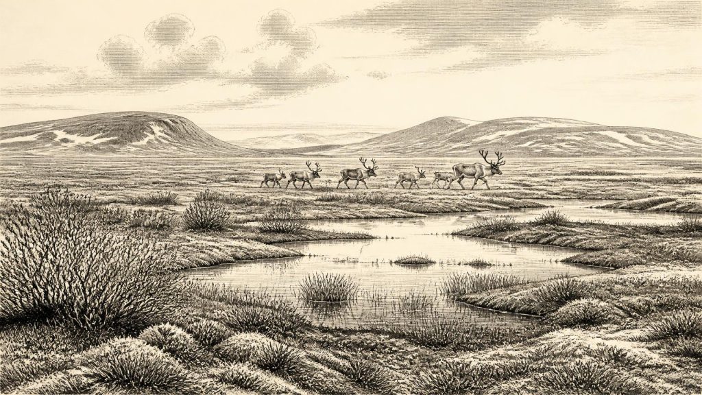
Around 31,258 BCE, Ireland lay within the unstable MIS 3 phase of the Late Pleistocene. Derryvree, County Fermanagh, preserves freshwater sediments between glacial tills, dated broadly to 36,900–31,700 calibrated years ago, indicating an ice-free tundra wetland with sedges, mosses, insects and seasonal liquid water. Cave and speleothem evidence from Cork and Kerry confirms recurring animal activity and intermittent unfrozen conditions elsewhere. Castlepook Cave yielded mammoth, reindeer, giant deer, bear and hyena remains, though these represent accumulated deposits rather than one community. A possibly cut-marked reindeer bone suggests human visitation, but permanent settlement remains unproven. Later ice expansion destroyed much evidence.
Dateline
The label 31,258 BCE is a modern chronological convenience, not a date that can be recovered from an Irish calendar, event or individual life. No written record, named community or annually resolved archaeological sequence exists for Ireland at this depth of time. In years before present (BP), conventionally counted from 1950, the label falls about 33,207 years ago. It belongs broadly to the later part of the Late Pleistocene, within Marine Isotope Stage 3 (MIS 3): an unstable phase of the last Ice Age, long before the Last Glacial Maximum.
Modern calendar-year precision is therefore unavailable. The responsible approach is to place this nominal year within calibrated ranges and to distinguish what the evidence demonstrates from what it merely suggests. The principal Irish evidence is environmental: sediment beneath drumlins in County Fermanagh, cave deposits in County Cork, and mineral deposits in caves in County Kerry. Together they reveal parts of an island that were, at different times, cold, open and biologically active before later ice advances erased or disturbed much of the record. They do not supply a diary of 31,258 BCE.
A Date Within a Wide Interval
The most relevant dated deposit is at Derryvree, near Maguiresbridge in County Fermanagh. Roadworks in 1969 cut through a drumlin and exposed a remarkable sequence: glacial till below, organic-rich freshwater silts and fine sands in the middle, and a further thick till above. Till is debris laid down directly by glacier ice. The order of layers is decisive evidence that, at this locality, an interval of open ground and freshwater conditions separated two episodes of glaciation.
Organic material from the intervening bed produced a conventional radiocarbon age of 30,500 radiocarbon years BP, with a substantial published uncertainty. Later calibration has expressed this broadly as about 36,900–31,700 calibrated years BP. The nominal year 31,258 BCE lies within that broad span. Yet the range cannot establish that a particular pool, sedge bed, insect or animal was present in that precise calendar year. It is a chronological envelope for a deposit accumulated over time, not a timestamp for a single scene.
The sample designation, BIRM-166, has become an important shorthand in Irish Quaternary research because of this combination of stratigraphy, fossils and dating. Its significance is not that it proves all Ireland was ice-free at once. It proves that Derryvree had an ice-free freshwater interval before the later ice sheet overrode and sealed the site. Other evidence, including deposits at Greenagho in Fermanagh and marine evidence from the north-west, supports the wider conclusion that areas of Ireland remained ice-free during portions of MIS 3, before the final great expansion of the Irish Ice Sheet.
Cold Water Beneath a Drumlin
Derryvree offers the clearest local portrait of conditions relevant to this period. Its plant remains, pollen and insect evidence indicate open tundra or muskeg-like wetland rather than woodland. Mosses, sedges and other herbs flourished around shallow freshwater; the assemblage includes plants such as bogbean and water-milfoil. Such evidence establishes that liquid water, seasonal biological productivity and patches of wet ground existed. It also points to a landscape in which frost processes were important and trees were absent or extremely scarce.
“Tundra” should not conjure an unchanging white wilderness. The Derryvree record indicates a mosaic: pool margins, saturated mossy ground, sedgy vegetation and more exposed mineral surfaces, all responding to strongly seasonal conditions. Insects are especially valuable because many have narrow environmental tolerances. Their presence helps to identify cold conditions and wetland habitats that pollen alone could not describe so closely. Nonetheless, this was a local basin, not a weather station for the entire island. Uplands, coasts and southern lowlands may have differed considerably.
Crag Cave in County Kerry provides a complementary, though differently dated, archive. Speleothems – mineral deposits such as stalagmites – can grow only when water penetrates caves. Uranium-thorium dating shows episodes of speleothem formation in south-west Ireland during MIS 3. This is evidence for intervals with liquid water, soil activity and no continuous ice cover above that cave, rather than proof of mild or stable weather. Irish climate during this wider age was marked by rapid shifts linked to North Atlantic and Greenland climate variability. A thaw at one site did not guarantee an island-wide refuge, nor did it necessarily last long.
Animals on an Open Island
In County Cork, Castlepook Cave near Doneraile is the most important Irish archive for the vertebrate fauna of the period leading towards the Last Glacial Maximum. Antiquarian excavations recovered more than 2,000 bones from its maze of limestone galleries. The cave assemblage includes woolly mammoth, reindeer, giant deer, brown bear and spotted hyena; later Ice Age layers also yielded cold-adapted small mammals and predators, including lemmings, Arctic fox and wolf.
These animals demonstrate that Ireland was not biologically empty throughout the period. Reindeer and mammoth indicate access to open, cold habitats, while hyena and wolf show that large predators could reach and exploit the same wider faunal world. But a cave is not a census of a single living community. Bones may have arrived through carnivore transport, death near an entrance, water movement and human excavation; specimens from separate millennia can become associated in one collection. Castlepook therefore supports a picture of recurring animal movement through Ireland, not a claim that every listed species stood together on the Doneraile landscape in 31,258 BCE.
Re-dating has made that caution more pressing. Modern work on southern Irish cave fauna has shown that some radiocarbon results obtained in the 1990s were too young, owing to difficulties in dating old bone and in removing contamination. At Castlepook, revised results pushed several specimens thousands of radiocarbon years older. The scientific lesson is constructive rather than merely sceptical: museum collections, careful pretreatment and improved dating can transform what is known. It also means that claims based on one early date or one bone should be expressed as provisional.
The Human Question
The most intriguing evidence for people is a reindeer femur from Castlepook, reported as about 33,000 years old and bearing a deep mark interpreted by the zooarchaeologist Ruth Carden as the trace of cutting or chopping with a sharp stone implement. If that interpretation is confirmed, it would indicate that people handled and butchered a reindeer in Ireland during this broad part of the Ice Age. It would be highly significant evidence for an Upper Palaeolithic visit, perhaps by a very small mobile hunting party.
It would not, however, prove an Irish settlement, a permanent population, a known migration route or descendants among later inhabitants. There is no securely associated Palaeolithic hearth, stone-tool assemblage, dwelling floor, burial or repeatedly occupied site from Castlepook of this age. The bone derives from an old collection whose original contexts were disturbed and incompletely recorded by modern standards. Carnivore damage, natural breakage, trampling and excavation damage must always be distinguished from deliberate cutting. The National Museum of Ireland accordingly continues to state that clear evidence for a Palaeolithic human presence on the island has not yet emerged.
That disagreement should not be disguised. The marked femur is a serious, potentially important observation; the absence of a stratified archaeological assemblage limits what can responsibly be inferred from it. The strongest conclusion for this nominal year is that human presence is possible and may be indicated, while sustained habitation remains unproven. No named people, political units or languages can be placed in Ireland on this basis.
Society, Exchange and Belief
There is no direct evidence at this date for government, diplomacy, warfare, institutions, trade networks, ritual monuments, art or formal learning in Ireland. It would be misleading to manufacture them from the better-known Upper Palaeolithic cultures of continental Europe. If people reached Ireland, their likely scale of organisation was small and mobile, because that is the most economical interpretation compatible with one possible butchery trace and an open, seasonal animal landscape. It remains an inference, not an Irish archaeological fact.
The island was nevertheless connected to a larger north-west European ecological region. Lower global sea levels exposed parts of the continental shelf, while the precise routes between Ireland, Britain and the continent varied with sea level, local ice and topography. The presence of large mammals means that routes existed during at least some intervals, but does not prove a continuous dry land bridge usable at every moment. “Trade” cannot be demonstrated: there are no securely dated Irish objects of exotic material, nor any artefacts identifying exchange or social contact.
Everyday life is better documented for plants and animals than for humans. Wetland plants trapped sediment at Derryvree; insects occupied cold ground and freshwater margins; herbivores fed across open country; predators and scavengers redistributed carcasses into caves. This was an economy of ecosystems, not a recoverable human economy. The evidence supports seasonal productivity amid severe winters, but cannot tell us whether any people camped, travelled, hunted or sheltered there in a particular year.
Before the Great Advance
The major historical development around this nominal date was environmental: Ireland was moving through a climatically volatile Ice Age world before the later expansion of the Irish Ice Sheet. Evidence from Derryvree and Greenagho indicates ice-free ground in north-central Ireland during relevant intervals; Castlepook records an unusually rich fauna in the south; Crag Cave preserves signs of episodic liquid-water conditions in the south-west. After about 34,000 calibrated years BP, the ice sheet built and expanded unevenly, eventually reaching a much greater extent during the Last Glacial Maximum, broadly 26,500–19,000 years ago.
Later glaciation is also why the record is so fragmentary. Ice eroded older land surfaces, reworked sediments and destroyed many possible campsites. The absence of a known settlement is therefore meaningful but not conclusive. For 31,258 BCE, Ireland’s recoverable past is principally the history of a Fermanagh wetland buried beneath a drumlin, animals entering Cork limestone caves, and an unresolved mark on a reindeer bone. That is not a thin story. It is the earliest securely illuminated chapter of an island repeatedly remade by ice, water and life.
Primary Sources
- A Middle Midlandian Freshwater Series at Derryvree, Maguiresbridge, County Fermanagh, Northern Ireland
- Middle Midlandian Interstadial Deposits at Greenagho, Near Belcoo, County Fermanagh, Northern Ireland
- Trimlines, Blockfields and the Vertical Extent of the Last Ice Sheet in Southern Ireland
- Episodic Speleothem Deposition Tracks the Terrestrial Impact of Millennial-Scale Last Glacial Climate Variability in SW Ireland
- Castlepook Cave: County Geological Site Report
- The Irish Quaternary Fauna Project
- A Reconsideration of the Radiocarbon Dating of the Marine Isotope Stage 3 Fauna from Southern Ireland
- Late Pleistocene Chronostratigraphy and Ice Sheet Limits, Southern Ireland
- Dimensions and Chronology of the Last Ice Sheet in Western Ireland
- Deglaciation Chronology of the Donegal Ice Centre, North-West Ireland
- BRITICE Glacial Map, Version 2: A Map and GIS Database of Glacial Landforms of the Last British-Irish Ice Sheet
- BRITICE: The Glacial Mapping Project
- Spatio-Temporal Dynamics of Speleothem Growth and Glaciation in the British Isles
- New Insights on the Fauna of Ireland’s Younger Dryas and Early Holocene from Alice & Gwendoline Cave
- Spotted Hyena Skull
- Prehistoric Details
- 2022:564 – Castlepook Cave, Castlepook South, Cork
- Heritage Artefacts of County Cork
- Irish Pleistocene Biostratigraphy
- Ice Sheet Limits and Chronostratigraphy in the Southern Sector of the Last Irish Ice Sheet
- Reindeer Bone Found in Cork Cave Shows Human Activity in Ireland 33,000 Years Ago
- What Was on the Menu in Prehistoric Ireland?
- On the Cave of Castlepook, Near Doneraile, Co. Cork