Maguiresbridge Grasses31144 BCE
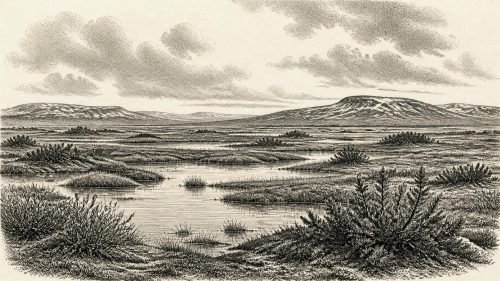
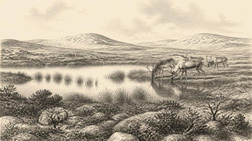
Around 31,144 BCE, Ireland lay within the unstable MIS 3 phase of the Late Pleistocene, not a datable historical moment. At Derryvree near Maguiresbridge, sediments between glacial tills preserve an ice-free, treeless freshwater wetland of sedges, grasses, mosses and Arctic-alpine plants, formed between advances. Southern caves, especially Castlepook, contain remains of mammoth, giant deer, reindeer, predators and other cold-stage fauna, though not necessarily contemporaneous. A possibly cut-marked reindeer bone suggests transient human activity, but no settlement is securely known. Ireland had no documented polities or farming; climatic change, shifting ice and ecological variation defined this severe, continually changing island landscape.
Dateline
“31,144 BCE” is a modern label, not a date from which Ireland preserves a calendar, a named community, or an event record. It falls roughly 33,094 years before the conventional radiocarbon reference year of AD 1950, within the Late Pleistocene and Marine Isotope Stage 3 (MIS 3), an unstable middle phase of the last Ice Age. Modern calendar-year precision is not available. The responsible account of Ireland at this point must therefore work with broad calibrated ranges, stratified deposits and fossil assemblages, distinguishing what they demonstrate from what they merely make plausible.
A Date Within a Range
The closest Irish environmental archive is at Derryvree, near Maguiresbridge in County Fermanagh. Roadworks exposed fine sands, freshwater silts and organic sediment trapped between two layers of till, the unsorted debris deposited by glacier ice. The sequence establishes a clear order: ice had affected the site; an interval followed in which water, plants and animals occupied the locality; then later ice buried the evidence. It does not identify a particular year, season or human generation.
Organic material from the Derryvree deposits produced a conventional radiocarbon age of about 30,500 years BP, with a substantial uncertainty. Revised calibration curves convert such measurements into calendar-age probability ranges rather than exact answers. The deposit has commonly been placed broadly within about 36,900–31,700 calibrated years BP, or approximately 34,950–29,750 BCE. The requested year lies within that span, but cannot be assigned to a particular layer, pool or episode in the sequence. It is best treated as a point within the life of a cold-stage landscape, not as a historical anniversary.
Fresh Water Between Glacial Advances
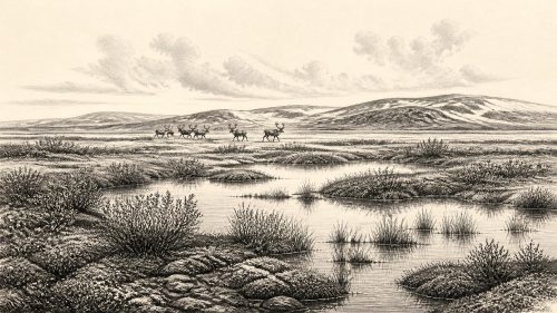
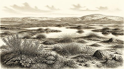
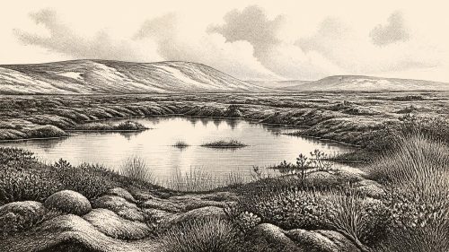
Derryvree is important because later ice sheets destroyed or concealed much older ground surface across Ireland. Here, organic material survived beneath a drumlin. Pollen, plant macrofossils, mosses and insect remains indicate a treeless, periglacial wetland: a landscape shaped by severe cold, frost action and a short growing season, but not permanently entombed beneath ice at that particular locality. Fresh or slow-moving water supported pools and wet margins during at least part of the year.
The evidence is strongest for an open mosaic rather than for a uniform plain. Sedges, grasses, herbs and mosses grew around waterlogged ground; low Arctic-alpine plants included indicators such as lesser clubmoss. The deposits have been described as a muskeg environment, meaning wet, organic-rich ground with shallow water and mossy or sedgy vegetation. There was no oak, hazel or ash woodland of the sort familiar from later prehistoric Ireland. Sparse tree pollen in cold-stage sediments cannot safely be treated as proof of nearby forest: pollen may travel long distances or be redeposited.
Interpretation must remain local. Derryvree demonstrates that this part of Fermanagh was ice-free long enough for a freshwater ecosystem to develop between glacial episodes. It does not prove that every Irish valley, coast and upland was open at once. The island lay within a changing north-west European climatic zone, where ice masses, sea level, drainage and animal ranges altered repeatedly. The later maximum of the British–Irish Ice Sheet came after this broad horizon, principally around 27,000 years ago and afterwards, but substantial earlier ice growth and regional advances are also recorded. Ireland was not moving steadily towards a single, simple freeze; its environment was geographically varied and chronologically unsettled.
An Open-Animal Landscape
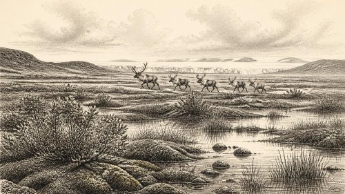
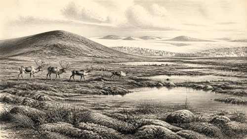
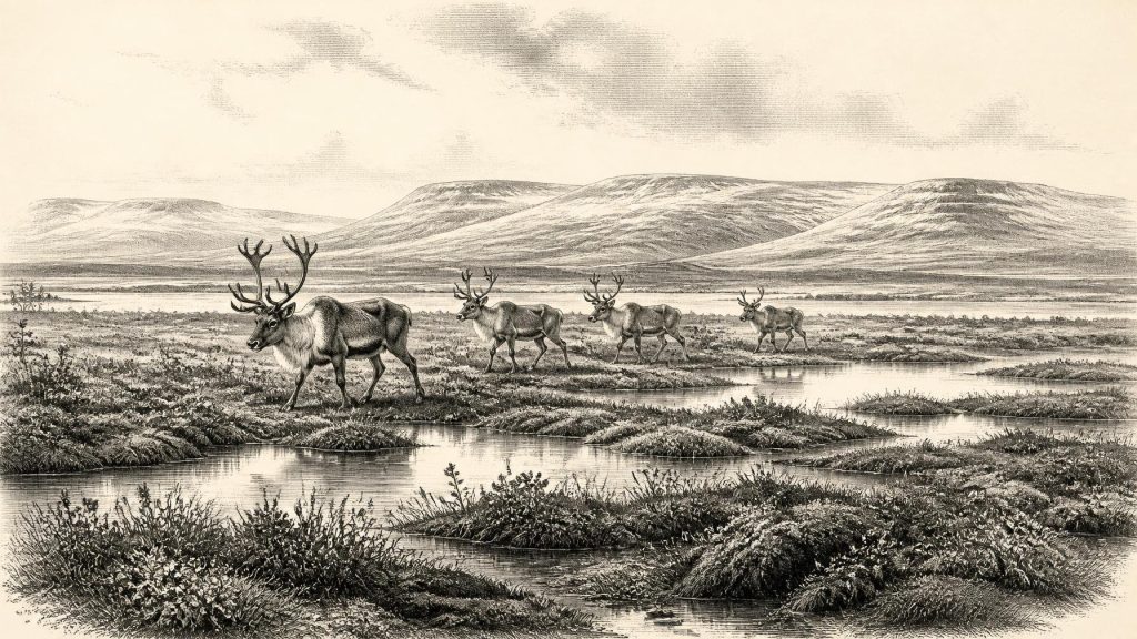
Caves in southern Ireland supply a second, very different line of evidence. Castlepook Cave, near Doneraile in north County Cork, has yielded remains attributed to several parts of MIS 3, including woolly mammoth, giant deer, reindeer, brown bear, wolf, fox, hare, lemmings and spotted hyaena. The list evokes a strikingly non-modern fauna, but it must not be made into a single scene. Cave deposits can accumulate over long periods, and nineteenth- and early twentieth-century excavations often removed bones from complex contexts. Modern redating has shown that some earlier determinations required major revision.
Even with that warning, the faunal evidence supports the broad environmental picture supplied by Derryvree. Ireland could support, or be reached by, cold-adapted grazers and browsers, predators and scavengers during suitable intervals of the Late Pleistocene. Reindeer and lemmings signal open northern habitats; mammoth and giant deer point to large herbivores moving through productive grass-herb country; spotted hyaena indicates a formidable carnivore and bone collector. Their presence need not mean that every species occupied every district simultaneously. It does show that Ireland was ecologically connected, intermittently, to wider north-west European animal populations.
Low sea levels altered the geography of the surrounding seas, but the precise opportunities for movement into Ireland at this date remain difficult to reconstruct. Animals may have crossed exposed or ice-influenced routes at some stages, while water, unstable ice and changing coasts impeded travel at others. Fossils record arrivals and survival, not the exact routes taken. There is no basis for depicting a dependable road into the island or a permanent land bridge available throughout the period.
The Human Question
Human history at this date is necessarily cautious. A reindeer bone from the old Castlepook collections, dated to roughly 33,000 years ago, bears marks interpreted by some researchers as cuts made during butchery with a stone tool. If that interpretation is confirmed, it would indicate that one or more Upper Palaeolithic people handled a reindeer carcass in Ireland during the wider period relevant here. It would be an important trace of a visit or brief activity, not proof of a settled population.
The qualification matters. The bone’s radiocarbon age dates the animal’s death, not automatically the cutting; it cannot identify the maker, establish whether the animal was hunted locally, or reveal how long people stayed. The cave collection also has complicated excavation and depositional histories. There is no securely dated house, hearth, stone-tool scatter, burial, campsite or settlement plan from Ireland that can be assigned to 31,144 BCE. Nor is there evidence for an enduring population continuous through the later full glacial conditions.
If people did enter Ireland during a milder or more accessible interval, their likely way of life can only be inferred from Upper Palaeolithic comparisons elsewhere in north-west Europe. Small, mobile hunter-gatherer groups would have required food, fuel, stone, hides, shelter and safe routes through a seasonal landscape. Such a reconstruction is plausible, but it is not direct evidence for a camp at Derryvree or Castlepook. Ireland’s evidence presently supports transient human presence as a possibility, not a detailed social map.
No Polities, Farms or Monuments
There were no known kingdoms, chiefs, borders, diplomatic alliances or wars in the historical sense. No written language, political institution or named people can be recovered from the evidence. Likewise, nothing supports claims for farming, domesticated stock, fields, pottery, metalworking, built monuments or long-distance commercial exchange. These belong to much later Irish prehistory. The economy visible here is ecological rather than political: plant growth in short summers, animal movement across open ground, carnivore activity, water collecting in hollows, and glacial processes reorganising the terrain.
Religion, art, learning and oral tradition are almost wholly beyond recovery for Ireland at this depth of time. It would be wrong to infer shrines, myths or ritual practices from an animal bone or wetland pollen record. People elsewhere in Upper Palaeolithic Europe certainly had complex cultural lives, but that wider fact cannot fill Ireland’s evidential silence. At most, a possible butchered bone suggests practical knowledge of animal carcasses and tools; it says nothing reliable about language, kinship, belief or ceremony.
What This Moment Means
The main Irish development around this notional year was environmental instability. At Derryvree, an ice-free freshwater habitat formed between glacial advances and preserved an unexpectedly rich sample of cold-stage life. In Cork, caves retained fragmentary testimony to animal communities that no longer exist in Ireland. Together, the sites show that the island was neither a timeless blank nor a familiar green landscape awaiting later settlers. It was a changing, open and often severe Ice Age world.
Its historical lesson is one of limits as well as discovery. Deposits can reveal water, vegetation, insects and animals; they can sometimes preserve a disputed sign of people. They cannot supply a diary for 31,144 BCE. The most defensible picture is therefore precise about the evidence and restrained about interpretation: cold wetlands in Fermanagh, varied faunal ranges in southern caves, episodic ice expansion, and—at most—the possibility of brief human incursions into a landscape repeatedly remade by climate.
Source References
Hover over a number to see the source. Select it to open the source.

- [1] A Middle Midlandian freshwater series at Derryvree, Maguiresbridge, County Fermanagh, Northern Ireland
- [2] Figure 6.— The subdivision of the Quaternary Period in Ireland
- [3] References and Recommended Reading
- [4] BSBI: Selaginella selaginoides
- [5] Irish Pleistocene biostratigraphy
- [6] The Irish Quaternary Fauna Project
- [7] A reconsideration of the radiocarbon dating of the Marine Isotope Stage 3 fauna from southern Ireland
- [8] Phylogeographic, ancient DNA, fossil and morphometric analyses reveal ancient and modern introductions of a large mammal: the complex case of red deer (Cervus elaphus) in Ireland
- [9] Quaternary deposits and glacial stratigraphy in Ireland
- [10] Radiocarbon constraints on the history of the western Irish ice sheet prior to the Last Glacial Maximum
- [11] Response of the Irish Ice Sheet to abrupt climate change during the last deglaciation
- [12] Maximum extent and readvance dynamics of the Irish Sea Ice Stream and Irish Sea Glacier since the Last Glacial Maximum
- [13] Timing and pace of ice-sheet withdrawal across the marine–terrestrial transition west of Ireland during the last glaciation
- [14] Advance and retreat of the marine-terminating Irish Sea Ice Stream into the Celtic Sea during the Last Glacial: Timing and maximum extent
- [15] New data for the Last Glacial Maximum in Great Britain and Ireland
- [16] The IntCal20 Northern Hemisphere Radiocarbon Age Calibration Curve (0–55 cal kBP)
- [17] New insights on the fauna of Ireland's Younger Dryas and Early Holocene from Alice & Gwendoline Cave
- [18] 2022:564 - Castlepook Cave, Castlepook South, Cork
- [19] Archaeological Heritage of County Cork
- [20] Heritage Artefacts of County Cork
- [21] Ireland's Palaeolithic Archaeology – Fleeting Footprints in a Frozen Land
- [22] The Irish elk: when and why did this giant deer go extinct and what did it look like?
Primary Sources
- A Middle Midlandian freshwater series at Derryvree, Maguiresbridge, County Fermanagh, Northern Ireland
- Figure 6.— The subdivision of the Quaternary Period in Ireland
- References and Recommended Reading
- BSBI: Selaginella selaginoides
- Irish Pleistocene biostratigraphy
- The Irish Quaternary Fauna Project
- A reconsideration of the radiocarbon dating of the Marine Isotope Stage 3 fauna from southern Ireland
- Phylogeographic, ancient DNA, fossil and morphometric analyses reveal ancient and modern introductions of a large mammal: the complex case of red deer (Cervus elaphus) in Ireland
- Quaternary deposits and glacial stratigraphy in Ireland
- Radiocarbon constraints on the history of the western Irish ice sheet prior to the Last Glacial Maximum
- Response of the Irish Ice Sheet to abrupt climate change during the last deglaciation
- Maximum extent and readvance dynamics of the Irish Sea Ice Stream and Irish Sea Glacier since the Last Glacial Maximum
- Timing and pace of ice-sheet withdrawal across the marine–terrestrial transition west of Ireland during the last glaciation
- Advance and retreat of the marine-terminating Irish Sea Ice Stream into the Celtic Sea during the Last Glacial: Timing and maximum extent
- New data for the Last Glacial Maximum in Great Britain and Ireland
- The IntCal20 Northern Hemisphere Radiocarbon Age Calibration Curve (0–55 cal kBP)
- New insights on the fauna of Ireland's Younger Dryas and Early Holocene from Alice & Gwendoline Cave
- 2022:564 – Castlepook Cave, Castlepook South, Cork
- Archaeological Heritage of County Cork
- Heritage Artefacts of County Cork
- Ireland's Palaeolithic Archaeology – Fleeting Footprints in a Frozen Land
- The Irish elk: when and why did this giant deer go extinct and what did it look like?