Derryvree Water-Milfoil30604 BCE
Thirty thousand six hundred and four BCE is not archaeologically recoverable as a specific Irish year, but falls within late Marine Isotope Stage 3. Derryvree, County Fermanagh, preserves freshwater sediments between glacial tills, radiocarbon dated broadly to 35,050–29,750 BCE. Its pollen, plants and insects indicate a cold, open, wetland tundra mosaic during an interval between ice advances. Castlepook Cave, County Cork, records reindeer, mammoth, giant deer and predators from the wider period, not a single contemporary fauna. A cut-marked reindeer bone may indicate Upper Palaeolithic human activity, but cannot demonstrate settlement. Environmental change, ice expansion and fragmentary preservation define history.
Dateline
30,604 BCE is a modern calendar label, not a year that can be recovered from Ireland’s archaeological record. No community on the island kept a calendar, made a written record, or left a securely dated settlement sequence capable of identifying this particular year. In modern chronological terms it falls roughly 32,553 years before AD 1950, within the Late Pleistocene and Marine Isotope Stage 3, an exceptionally unstable part of the last Ice Age. The responsible history of this point in time must therefore be written through broad, calibrated ranges, sediments, fossil plants, animal bone and glacial layers—not through named rulers, battles or annual events.
A Date Within a Range
The most useful Irish archive for this horizon lies at Derryvree, near Maguiresbridge in County Fermanagh. Roadworks in 1969 cut through a drumlin and exposed freshwater silts and fine sands caught between two substantial layers of glacial till. The deposit was not a settlement floor. It was a buried wetland landscape, sealed first by later sediment and ultimately by ice. Organic material from it produced a conventional radiocarbon determination of 30,500 years BP, with a large uncertainty of +1,170 and −1,030 years. Such measurements are not equivalent to modern calendar years. Their calibration gives a broad late-MIS-3 placement, approximately 37,000–31,700 calibrated years BP, or about 35,050–29,750 BCE.
30,604 BCE consequently belongs within the broad span represented by Derryvree, but cannot be pinned to one layer, season or generation. That distinction is crucial. Radiocarbon dates close to the practical limits of the method have wide ranges, and the deposit accumulated over time. What Derryvree can show is that this part of north-central Ireland was, during an interval of the last glaciation, not continuously buried beneath ice. It cannot establish the weather on a particular day in 30,604 BCE, still less identify an event that occurred then.
A Wetland Between Ice Advances
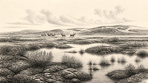
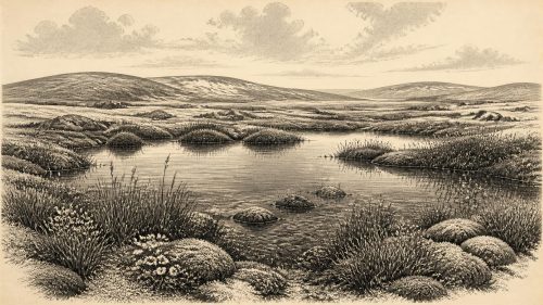
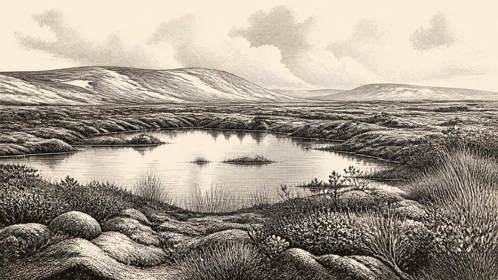
Derryvree nevertheless gives unusually vivid evidence for the sort of landscape that existed in at least one Fermanagh basin. The freshwater sediments contained a flora and fauna characteristic of severe, open conditions. Pollen and plant macrofossils indicate herb-rich, largely treeless ground rather than woodland. Mosses, sedges and grasses formed much of the vegetation; the record includes plants associated with cold, wet or open habitats, among them dwarf willow, bogbean and alternate water-milfoil. Their presence does not mean that every species grew together at precisely the same moment, but it demonstrates that shallow water, saturated ground and patches of vegetation could persist in a harsh periglacial setting.
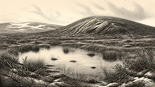
The scene was not a featureless snowfield. Fine sediments, aquatic plants and insect evidence point to pools and marshy margins, while sparse vegetation occupied nearby ground. In summer, the low plants of a tundra-like mosaic could have flowered and provided forage for insects and herbivores; in winter, frost, snow cover and frozen soil would have imposed severe limits. The term muskeg has sometimes been used for this mix of mossy, waterlogged ground and open pools. It is a useful comparison, provided it is not mistaken for a precise reconstruction of a whole county or island.
The two tills enclosing the freshwater bed supply the larger geological story. Ice had affected the area before the wetland formed and advanced over it again afterwards. Derryvree is therefore evidence of fluctuation: local non-glacial or periglacial conditions between episodes of glaciation. It is not proof that all Ireland was ice-free. Conditions varied sharply with altitude, latitude, proximity to ice margins and changing North Atlantic climate. Other buried organic sites in Ulster likewise show that the island’s glacial history was neither simple nor uniform.
The Animal World of Southern Caves
To understand the wider ecological possibilities of Ireland at this time, the principal comparison is Castlepook Cave—also called Mammoth Cave—near Doneraile in north County Cork. Its collections, excavated mainly in the early twentieth century and subsequently re-examined, contain one of Ireland’s most important Late Pleistocene faunal archives. Reindeer, woolly mammoth, giant deer, brown bear, wolf, Arctic fox, lemmings and spotted hyaena are among the animals represented in the wider Castlepook assemblage. Improved radiocarbon methods have shown that some southern Irish cave fauna is substantially older than formerly believed, falling within MIS 3 and preceding the Last Glacial Maximum.
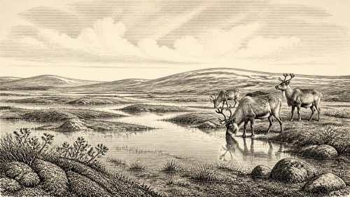
These bones make clear that Ireland could, at intervals, support or receive cold-adapted animals from the broader north-west European world. Reindeer imply open habitats and seasonal forage rather than closed forest. Mammoth and giant deer show that large herbivores reached the island during parts of the period; wolves and hyaenas remind us that predators and scavengers were also present. Yet Castlepook is not a census of animals living side by side in 30,604 BCE. A cave is a complicated archive. Carnivores may drag in limbs, water may move material, animals may die naturally, and old excavations can disturb or obscure original relationships between bones and sediments.
Nor should Castlepook’s fauna be projected directly on to Derryvree. The sites are far apart, preserve different environments and represent deposits accumulated over long periods. Derryvree offers a local wetland record; Castlepook offers a cave assemblage shaped by animal activity, deposition and recovery history. Together, however, they overturn any picture of a uniformly empty or featureless Ireland. Around this broad chronological horizon, the country contained changing cold-stage habitats with real biological richness, even though its surviving evidence is fragmentary.
The Uncertain Human Trace
Castlepook has also transformed discussion of Ireland’s earliest possible people. A reindeer femur in the old collection bears a deep linear mark which zooarchaeologist Ruth Carden has interpreted as damage made by a sharp stone implement during the processing of fresh bone. County Cork heritage material places the specimen broadly around 31,000 BCE, and public reports have described a radiocarbon age of roughly 33,000 years. If the mark is confirmed as anthropogenic, it would indicate that people handled a reindeer in Ireland during the Upper Palaeolithic—far earlier than the long-established evidence for post-glacial occupation.
The claim is important precisely because its limits are so clear. The femur was recovered from an antiquarian cave collection, not from a modern excavation of an intact camp. No securely associated hearth, stone-tool assemblage, dwelling, grave, art site or occupation surface of comparable age has yet demonstrated a settled human presence in Ireland. The date obtained from the bone chiefly dates the animal’s death, while interpreting a surface mark requires separate taphonomic judgement. The bone may point to butchery; it does not prove where the animal was killed, how many people were involved, or whether they lived on the island.
It follows that human society at this date remains unknown. There is no evidence from which to identify a language, kin group, territory, political authority, diplomacy, warfare, religious rite or system of learning in Ireland in 30,604 BCE. Even a confirmed butchery mark would show an episode of practical activity, perhaps by mobile hunters exploiting animal resources, rather than a permanent population. There is equally no basis for claiming farming, trade networks, villages, monuments or inherited institutions. The possible human story is tantalising; the demonstrable one remains extremely slight.
No Politics, but a Changing World
For that reason, political affairs and diplomacy have no recoverable history here. There were no states, kingdoms or documentary communities that archaeology can identify in Ireland at this depth of time. Conflict is also untraceable. Predation and scavenging certainly shaped animal life, but animal bones cannot be converted into evidence of human warfare. Religion and culture leave no secure material signature at Derryvree or Castlepook for this period. Silence on these subjects is not a failure of imagination; it is the appropriate result of the surviving evidence.
Environment was the dominant historical force. During the millennia surrounding this date, climate oscillated rapidly on geological timescales. Habitable patches of wetland, tundra and open ground expanded or contracted as temperature, precipitation, sea level and ice margins changed. These shifts affected which plants rooted, which herbivores could forage and whether travelling people, if present, could find viable routes and resources. The later growth of the British–Irish Ice Sheet would profoundly reshape the land, eroding older surfaces and burying or destroying much of the evidence that might otherwise survive.
The Last Glacial Maximum lay thousands of years ahead, broadly around 26,000–20,000 calibrated years BP, and brought more extensive ice cover to Ireland and its surrounding seas. Derryvree’s organic bed survived because it was protected beneath later deposits; its exceptional preservation is a reminder that most comparable landscapes have vanished. What now appears as a limited record may once have been part of a much wider environmental world.
What Can Be Said Responsibly
Ireland around 30,604 BCE was not the Ireland of fields, forests, parishes or Gaelic tradition. It was a changing Ice Age landscape in which open, cold-adapted vegetation and freshwater pools existed at Derryvree during a broad interval between ice advances. Southern caves preserve evidence that reindeer, mammoth and other animals reached the island at different times in the same long climatic phase. A single marked reindeer bone raises the possibility of an extraordinarily early human visit, but does not yet establish a permanent society. The richest history of this date is therefore ecological and geological: mossy pools, sparse tundra plants, shifting animal ranges and an ice sheet whose later advance would conceal much of the world that came before it.
Primary Sources
- A Middle Midlandian Freshwater Series at Derryvree, Maguiresbridge, County Fermanagh, Northern Ireland
- Palaeoecology: Irish Quaternary Association Field Guide No. 16
- The Subdivision of the Quaternary Period in Ireland
- A Reconsideration of the Radiocarbon Dating of the Marine Isotope Stage 3 Fauna from Southern Ireland
- The Irish Quaternary Fauna Project
- 2022:564 – Castlepook Cave, Castlepook South, Cork
- Heritage Artefacts of County Cork
- On the Cave of Castlepook, Near Doneraile, Co. Cork
- Dimensions and Chronology of the Last Ice Sheet in Western Ireland
- Trimlines, Blockfields and the Vertical Extent of the Last Ice Sheet in Southern Ireland
- Response of the Irish Ice Sheet to Abrupt Climate Change During the Last Deglaciation
- Timing and Pace of Ice-Sheet Withdrawal Across the Marine–Terrestrial Transition West of Ireland During the Last Glaciation
- New Insights on the Fauna of Ireland's Younger Dryas and Early Holocene from Alice & Gwendoline Cave
- IntCal20 Northern Hemisphere Radiocarbon Age Calibration Curve (0–55 cal kBP)
- BSBI Fermanagh: Menyanthes trifoliata
- BSBI Fermanagh: Salix herbacea
- BSBI Fermanagh: Myriophyllum alterniflorum
- Irish Quaternary Association Publications
- Irish Quaternary Association Field Guides
- Irish Quaternary Association Outreach and Education Resources
- Ancient Life and Environments
- Quaternary Map Services, Geological Survey Ireland