Habitable Tundra30904 BCE
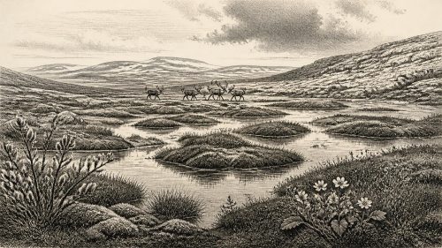
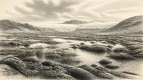
Around 30,904 BCE, Ireland lay within the fluctuating cold conditions of Marine Isotope Stage 3, although no exact annual reconstruction is possible. At Derryvree, County Fermanagh, freshwater sediments between glacial tills record an ice-free interval containing tundra wetland, sedges, mosses, aquatic plants and arctic-alpine species. They indicate local water and vegetation amid severe periglacial conditions before later ice expansion. Castlepook Cave, County Cork, produced remains of mammoth, reindeer, giant deer, predators and other cold-stage animals, accumulated across different episodes. A possibly cut-marked reindeer bone suggests human contact but not settlement. Evidence depicts a habitable cold-world frontier, not a frozen island.
Dateline
Modern calendar-year precision is not available for Ireland in 30,904 BCE. The label is a point on a retrospective modern timeline, not a date for which archaeology can identify an Irish event, ruler, community or season. In simple chronological terms it falls about 32,853 years before AD 1950, within Marine Isotope Stage 3 (MIS 3), a fluctuating part of the last Ice Age. The closest evidence is dated in broad scientific ranges. Most importantly, an organic deposit at Derryvree near Maguiresbridge, County Fermanagh, has a conventional radiocarbon determination of 30,500 +1,170/−1,030 radiocarbon years BP; published calibration places it broadly around 36,900–31,700 calibrated years BP. That range encompasses the approximate period represented by 30,904 BCE, but it cannot identify conditions in one exact year.
Freshwater Between Ice Advances
Derryvree is the key Irish environmental archive for this moment. Roadworks in 1969 cut through a drumlin and revealed freshwater silts and fine sands sealed between two substantial sheets of glacial till. The sequence establishes a valuable relative history: glacier ice had deposited the lower till; the site later supported freshwater and waterlogged ground; and renewed ice eventually overran or buried that landscape beneath the upper till. It does not demonstrate that all Ireland was ice-free at once, nor that the whole organic bed accumulated in a single generation. Yet it securely shows that a part of the Fermanagh interior experienced an ice-free interval during the wider Middle Midlandian cold stage.
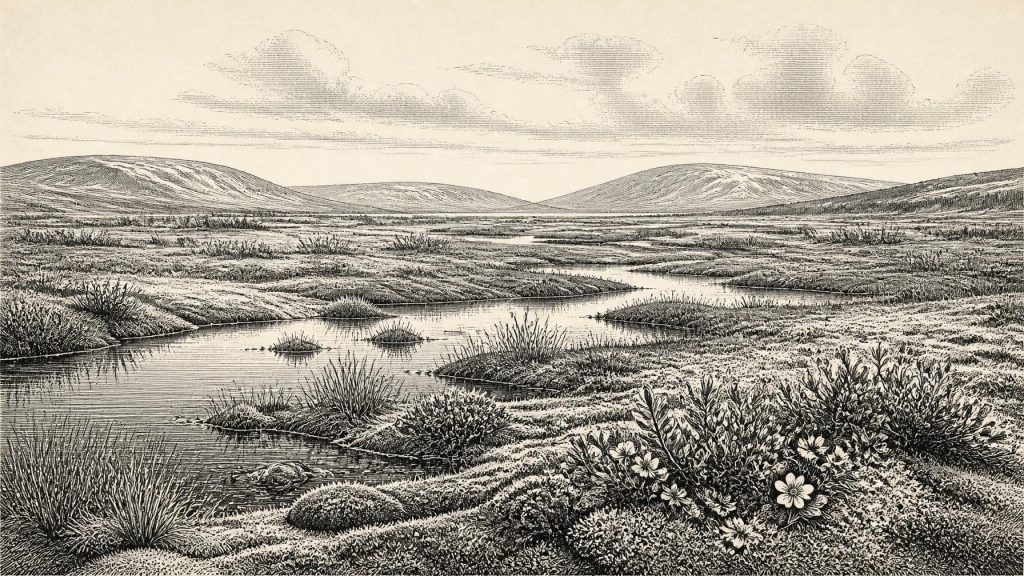
The Derryvree deposit was not a lost forest or a temperate lakeside. Its pollen, plant macrofossils, mosses and insect remains indicate a cold, open, largely treeless environment often described as tundra or muskeg. Such language should be understood as an ecological shorthand rather than a modern landscape label. Saturated ground, shallow pools, sedge-rich margins and patches of low vegetation lay within a periglacial regime shaped by prolonged winter cold and frost. Fossil evidence includes aquatic and wetland plants alongside hardy arctic-alpine species. These remains make the landscape more intelligible: water persisted locally despite severe conditions, while vegetation was sufficient to support insects and small ecological communities. They do not, however, provide a complete map of Fermanagh or a thermometer reading for 30,904 BCE.
An Unstable Ice-Age Island
Ireland was in the later Pleistocene, long before the familiar wooded landscapes, farms, monuments and named territories of later prehistory. Climate in MIS 3 was not uniformly frozen. North Atlantic conditions changed sharply between colder stadials and relatively milder interstadials, and the growth of the British-Irish Ice Sheet was neither instantaneous nor identical in every region. The Derryvree beds are especially important because they preserve a landscape before the later, more extensive glaciation erased or reworked much of the island’s older surface record. Research on the ice sheet indicates major expansion towards the continental shelf in the following millennia, with outer-margin advance commonly placed around 29,000–27,000 calibrated years BP. Therefore this date belongs not to a timeless white wilderness, but to a changing interval in which ice-free habitats could be lost as ice expanded.
Sea level was lower than today because great quantities of water were held in continental ice sheets. Coastlines and shallow seas around Ireland consequently differed greatly from modern ones. That fact does not licence an easy story of a permanent land bridge or unrestricted migration. The exact form, timing and passability of routes between Ireland, Britain and continental Europe varied with sea level, ice margins, currents and terrain. For animal populations, and perhaps for occasional people, Ireland was part of a north-west European environmental zone whose connections repeatedly narrowed or altered. The evidence is stronger for changing access and habitat than for any particular route used in this specific period.
Castlepook’s Animal Evidence
More than 300 kilometres south-west of Derryvree, Castlepook Cave near Doneraile in County Cork preserves the other major body of evidence relevant to this broad era. Antiquarian excavations there produced an exceptional but complicated collection of animal remains. Mammoth, reindeer, giant deer, brown bear, wolf, Arctic fox, mountain hare, lemmings and spotted hyaena are among species recorded from the cave system. Re-dating has shown that several earlier determinations underestimated the age of some bones, placing important parts of the fauna in MIS 3. The assemblage demonstrates that Ireland could support, or be reached by, a strikingly varied cold-stage fauna before the Last Glacial Maximum.
It would be misleading, though, to arrange every Castlepook species into one simultaneous scene. Cave deposits accumulate through many processes: carnivores drag in prey; animals die in cavities; water and sediment move bones; deposits collapse or are disturbed; and early excavators often removed material before modern stratigraphic recording existed. Individual dated bones can be highly informative, but the cave’s collection spans episodes rather than a single day or century. The reasonable picture is of open-country habitats capable of sustaining grazing animals and predators at different points in the middle of the last glacial cycle. It is not proof that mammoth, hyaena, reindeer and every other recorded animal stood together in north Cork in 30,904 BCE.
A Human Trace, Not a Settlement
One Castlepook reindeer femur has particular historical importance. It has been reported as bearing a mark interpreted as a cut made by a sharp stone tool, and the animal bone has been presented as approximately 33,000 radiocarbon years old. If the mark is correctly identified as butchery damage, it would be evidence that a person handled a reindeer in Ireland far earlier than the island’s better-established terminal-Pleistocene human evidence. But the distinction between a promising trace and a demonstrated settlement is crucial. The specimen derives from an old cave collection, not an intact excavated camp floor, and no securely associated hearth, stone-tool assemblage, dwelling, human remains or repeatedly used processing area of comparable age has yet been established at Castlepook.
Accordingly, there is no responsible basis for describing an Irish tribe, leader, language, ritual practice or political order in this year. There are no known states, alliances, warfare, diplomacy, trade networks or institutions to narrate. Nor is there evidence for agriculture, livestock keeping, pottery, metalworking, permanent villages or monuments. If people did reach Ireland during this part of MIS 3, they were more likely small, highly mobile hunter-gatherer groups operating at the extreme north-western edge of Upper Palaeolithic Europe. That is an inference from wider human ecology and the possible cut-marked bone, not a fact directly demonstrated by an Irish settlement.
What Everyday Life Cannot Yet Reveal
The environmental evidence does permit a restrained account of the practical demands of life. Animals and any human visitors would have faced exposed terrain, intense seasonality, limited tree cover and an environment in which shelter, food and movement were strongly conditioned by cold, wet ground and changing ice margins. Reindeer were well suited to open, cold landscapes; predators such as wolf and spotted hyaena indicate food webs with substantial prey, though their precise local relationships remain unknown. Freshwater pools and wetland plants at Derryvree show that even harsh landscapes possessed productive microhabitats. Beyond this, claims about clothing, family organisation, belief, artistic expression or exchange would be speculation.
The lasting significance of 30,904 BCE in Irish history is therefore geological and evidential rather than eventful. Derryvree’s organic silts preserve a rare glimpse of ice-free tundra wetland between glacial advances. Castlepook’s bones reveal that large mammals, carnivores and perhaps people reached an Ireland whose later ice cover would destroy much of the evidence. The records are fragmentary, locally specific and often difficult to date, but they replace the old image of an empty, uniformly frozen island with a more compelling one: a shifting cold-world frontier, intermittently habitable, in which water, mosses, sedges, herbivores and predators briefly left traces beneath the ice.

Primary Sources
- A Middle Midlandian Freshwater Series at Derryvree, Maguiresbridge, County Fermanagh, Northern Ireland
- A Reconsideration of the Radiocarbon Dating of the Marine Isotope Stage 3 Fauna from Southern Ireland
- The Irish Quaternary Fauna Project
- The Colonization of Ireland: A Human Ecology Perspective
- Exploring Controls of the Early and Stepped Deglaciation on the Western Margin of the British Irish Ice Sheet
- Early Deglaciation of the British-Irish Ice Sheet on the Atlantic Shelf Northwest of Ireland Driven by Glacioisostatic Depression and High Relative Sea Level
- Maximum Extent and Dynamic Behaviour of the Last British–Irish Ice Sheet West of Ireland
- Late Pleistocene Chronostratigraphy and Ice Sheet Limits, Southern Ireland
- Dimensions and Chronology of the Last Ice Sheet in Western Ireland
- Vertical Dimensions and Age of the Wicklow Mountains Ice Dome, Eastern Ireland, and Implications for the Extent of the Last Irish Ice Sheet
- Ireland: Submerged Prehistoric Sites and Landscapes
- Figure 6.— The Subdivision of the Quaternary Period in Ireland
- Palaeoecology
- Soils of County Waterford
- New Insights on the Fauna of Ireland's Younger Dryas and Early Holocene from Alice & Gwendoline Cave
- Occurrence of Mammalia Relicts at Site Castlepook Cave
- Castlepook Cave, County Cork, Excavation Report 2022
- Mammoth Cave, Castlepook
- Heritage Artefacts of County Cork 2021
- Sedimentary and Foraminiferal Records of Late Quaternary Environmental Change West of Ireland and Implications for the Last British–Irish Ice Sheet