Bogbean Milfoil30729 BCE
Thirty thousand years ago, Ireland lay in unstable Marine Isotope Stage 3, although dates cannot identify events in 30,729 BCE precisely. At Derryvree, County Fermanagh, freshwater sediments between glacial tills record an ice-free wetland interval, with tundra-like, open vegetation including bogbean, water-milfoil, mosses and dwarf willow. Castlepook Cave, County Cork, preserves mixed-age remains of mammoth, reindeer, giant deer and predators, demonstrating links to wider cold-stage ecosystems but not contemporaneity. A cut-marked reindeer bone suggests possible human presence, not settlement. Changing sea levels and ice complicated access. Later glaciation destroyed evidence, leaving environmental change in Ireland as the period’s principal story.
Dateline
The label 30,729 BCE is a modern chronological convenience, not a year that can be recovered from an Irish calendar or tied to a single recorded occurrence. It lies roughly 32,678 years before AD 1950, the conventional “present” used in radiocarbon reporting. At this depth in time, even well-dated material produces probability ranges rather than an exact calendar year. Ireland is best placed within the later part of Marine Isotope Stage 3 (MIS 3), an unstable interval of the last Ice Age marked by sharp climatic oscillations, changing ice margins and shifting habitats.
The closest direct Irish environmental evidence comes from Derryvree, near Maguiresbridge in County Fermanagh. There, road works in 1969 exposed fine sands, freshwater silts and organic material lying between two deposits of glacial till. The intervening sediments produced the radiocarbon determination BIRM-166, reported as 30,500 radiocarbon years BP, with a substantial error margin of +1,170 and −1,030 years. Calibration converts such a measurement into a broad calendar-age range, not a date for a specific season, generation or event. The Derryvree deposits can responsibly illuminate the kind of Irish environment that existed around this broad horizon; they cannot tell us what happened in the notional year 30,729 BCE.
A Wetland Between Ice Advances
Derryvree matters because it is an environmental archive physically bracketed by glacial deposits. The lower till records an earlier episode of ice activity; the freshwater sediments show that the locality later supported standing or slow-moving water and wet ground; the upper till shows that ice subsequently returned or overran the landscape. This sequence decisively rules out an image of Ireland as continuously buried beneath an unchanging ice sheet. At least in this part of Fermanagh, there was an ice-free interval sufficiently long for a wetland ecosystem to form, accumulate sediment and preserve its biological remains.
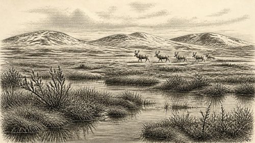
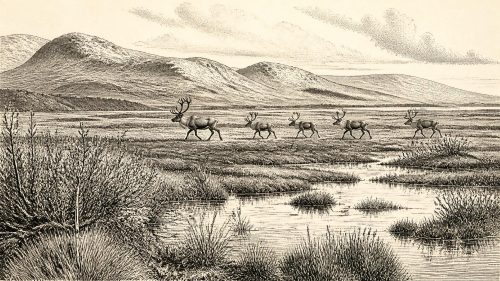
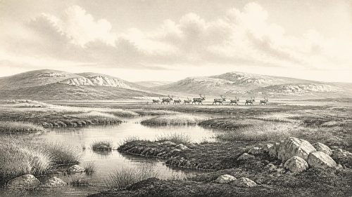
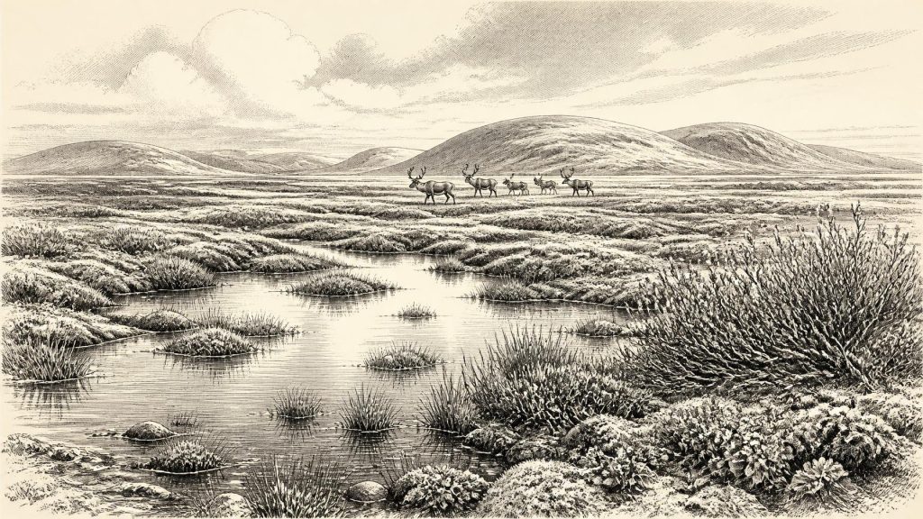
The evidence points to cold, open and largely treeless country. Pollen, plant macrofossils, mosses and invertebrate remains indicate tundra-like or muskeg conditions: saturated ground, shallow pools, sedge-rich margins and patches of sparse vegetation exposed to severe frost. Among the particularly useful plant finds are bogbean (Menyanthes trifoliata), a species associated with wet places, and alternate water-milfoil, an aquatic plant. Mosses, dwarf willow, mountain-avens and lesser clubmoss add to a picture of a low-growing flora able to exploit brief growing seasons, damp hollows and sheltered ground.
This was not modern Irish bogland transported unchanged into the past. The word “muskeg” is a useful shorthand for cold, waterlogged ground rich in mosses and organic matter, but Derryvree’s surroundings would have included mineral silts, frost-affected soils, shallow fresh water and sparsely vegetated terrain. Small pockets of seasonal productivity could coexist with long winters, high winds and permafrost-like ground conditions. The deposit shows a functioning ecosystem, not a lifeless snowy plain.
Evidence, Dates and Limits
The distinction between radiocarbon years and calendar years is essential. Radiocarbon dating measures the remaining carbon-14 in an organic sample, then reports an age in years before 1950. Atmospheric carbon-14 has varied through time, so a radiocarbon result cannot simply be subtracted from 1950 to create a BCE date. Calibration curves such as IntCal20 use independently dated records to model that variation. For ages around 30,000 radiocarbon years BP, calibration uncertainty is considerable and can produce wide ranges. Derryvree therefore offers chronological placement, not annual precision.
Nor should its evidence be stretched geographically. A wetland near Maguiresbridge does not prove that every Irish valley, upland and coast had the same climate or vegetation at the same moment. Ireland’s landscapes were regionally varied, while ice, sea level, drainage and exposure to Atlantic weather were changing. The Derryvree plants demonstrate local freshwater and open vegetation; they do not supply a complete island-wide map. Sparse grains of tree pollen, for example, are not secure evidence for nearby woodland: pollen may travel far or be redeposited. The broad assemblage is far more consistent with open, cold conditions than with forest.
Animals at the Western Margin
Southern Irish caves provide a second, different body of evidence. Castlepook Cave near Doneraile, County Cork—also known as Mammoth Cave—has yielded an exceptional collection of Late Pleistocene animal remains. These include woolly mammoth, reindeer, giant deer, brown bear, wolf, red fox, Arctic fox, mountain hare, collared lemming, Norwegian lemming and spotted hyaena. The National Museum of Ireland preserves material from the cave, including a spotted-hyaena skull. Such animals show that, during parts of the last glacial cycle, Ireland participated in a wider north-west European cold-stage ecological world.
That conclusion must be qualified. The cave deposits were excavated in the early twentieth century, often before modern recording practices, and the faunal assemblage contains material of more than one age. Some bones may have been moved within the cave, mixed by animal activity or disturbed during excavation. A bone from Castlepook proves that its animal was present or that its remains reached the cave; it does not establish that every listed species lived together, or that they all occupied County Cork in 30,729 BCE. The Irish Quaternary Fauna Project’s radiocarbon programme was important precisely because it showed how cautiously older cave collections must be handled.
Even with those cautions, Castlepook changes the scale on which Ireland’s Ice-Age past can be understood. Mammoth, reindeer and giant deer imply herbivore populations adapted to open landscapes; hyaenas, wolves and foxes indicate predators and scavengers within those food webs. Caves could have served as carnivore dens, natural traps, shelters or places where bones accumulated through several processes. The evidence is ecological rather than political: it reveals animals, changing habitats and routes of movement, not tribes, territories or alliances.
The Human Question
One Castlepook reindeer femur has become especially significant. Re-examination identified a deep linear modification interpreted as consistent with a sharp stone tool acting on fresh bone, while the bone itself was reported as about 33,000 years old in radiocarbon terms. If the interpretation is upheld, it could indicate that people butchered a reindeer in Ireland during MIS 3, vastly earlier than the previously secure record of post-glacial human activity. It is a striking possibility, but not a licence to describe a settled Palaeolithic population.
The caution is methodological as well as chronological. The date belongs to the death of the animal, not automatically to the making of the mark. The bone does not come from a securely excavated, intact archaeological floor associated with hearths, stone tools, structures or other butchered animals. There is no securely dated Irish settlement, burial, dwelling, tool assemblage or artwork that can be assigned to this horizon. The marked femur raises the prospect of a human visit; it does not demonstrate a permanent community, repeated occupation or a named Upper Palaeolithic culture on the island.
If people did reach Ireland, they would almost certainly have depended upon detailed practical knowledge of weather, animal movements, fuel, stone, shelter and the changing ground. That is an inference from hunter-gatherer lifeways elsewhere in Upper Palaeolithic Europe, not direct evidence for an Irish camp. It would be equally irresponsible to invent chiefs, warfare, diplomacy, trade routes, ritual sites, languages or social ranks. Nothing at Derryvree or Castlepook establishes these. There is no evidence for cultivation, livestock keeping, metalworking, monuments, formal exchange networks or institutional religion.
Changing Coasts and Ice
At lower global sea levels, the geography around Ireland differed greatly from today. Parts of the modern continental shelf were exposed or lay in shallower seas, changing the distances between landmasses and the configuration of river systems and coastlines. Yet a simple, continuous “land bridge” from Ireland to Britain or continental Europe should not be assumed. Research on relative sea level, glacial crustal movements and the Irish Sea indicates a far more complicated picture, involving changing water barriers, possible islands and ice-influenced routes. The animal record proves ecological connections; it does not reveal precisely how each species, or any people, travelled.
The principal long-term development was the approach of the Last Glacial Maximum. The major expansion of the last Irish Ice Sheet came later than Derryvree’s freshwater phase, with evidence from southern Ireland showing extensive glaciation after about 24,000 calibrated years BP. Later ice eroded, transported and buried older ground surfaces. This helps explain why the evidence near 30,729 BCE is so fragmentary: a road cutting through a Fermanagh drumlin and a disturbed cave collection in Cork have survived where whole landscapes have not.
Thus the most accurate account of Ireland around this point is neither an annual chronicle nor a tale of an empty wilderness. It is a carefully bounded reconstruction. Derryvree records fresh water, wetland plants, insects and open periglacial country during an ice-free interval. Castlepook records a cold-stage animal world that included large herbivores and formidable carnivores. A single marked reindeer bone makes an early human encounter possible, but unproven as a settlement history. Around this modernly numbered year, environmental change—not kings, wars or monuments—is the central Irish story.
Source References
Hover over a number to see the source. Select it to open the source.

- [1] A Middle Midlandian Freshwater Series at Derryvree, Maguiresbridge, County Fermanagh, Northern Ireland
- [2] Palaeoecology: The Middle Midlandian Palaeoenvironment of South Fermanagh
- [3] The Subdivision of the Quaternary Period in Ireland
- [4] Quaternary Site Descriptions: Sites of Quaternary Interest in Ireland
- [5] The Irish Quaternary Fauna Project
- [6] The Irish Quaternary Fauna Project
- [7] Spotted Hyena Skull
- [8] Heritage Artefacts of County Cork
- [9] Pleistocene Vertebrates in the British Isles
- [10] Late Pleistocene Chronostratigraphy and Ice Sheet Limits, Southern Ireland
- [11] Trimlines, Blockfields and the Vertical Extent of the Last Ice Sheet in Southern Ireland
- [12] Character of Advance and Retreat of the Southwest Sector of the British-Irish Ice Sheet During the Last Glaciation
- [13] Timing and Pace of Ice-Sheet Withdrawal Across the Marine–Terrestrial Transition West of Ireland During the Last Glaciation
- [14] Reconstruction and 36Cl Based Geochronology of the Deglaciation of Central Ireland
- [15] Episodic Speleothem Deposition Tracks the Terrestrial Impact of Millennial-Scale Last Glacial Climate Variability in SW Ireland
- [16] The IntCal20 Northern Hemisphere Radiocarbon Age Calibration Curve (0–55 cal kBP)
- [17] IntCal: Radiocarbon Calibration Curves
- [18] The Problem of a Late Quaternary Landbridge Between Britain and Ireland
- [19] The Colonization of Ireland: A Human Ecology Perspective
- [20] New Insights on the Fauna of Ireland’s Younger Dryas and Early Holocene from Alice & Gwendoline Cave
Primary Sources
- A Middle Midlandian Freshwater Series at Derryvree, Maguiresbridge, County Fermanagh, Northern Ireland
- Palaeoecology: The Middle Midlandian Palaeoenvironment of South Fermanagh
- The Subdivision of the Quaternary Period in Ireland
- Quaternary Site Descriptions: Sites of Quaternary Interest in Ireland
- The Irish Quaternary Fauna Project
- The Irish Quaternary Fauna Project
- Spotted Hyena Skull
- Heritage Artefacts of County Cork
- Pleistocene Vertebrates in the British Isles
- Late Pleistocene Chronostratigraphy and Ice Sheet Limits, Southern Ireland
- Trimlines, Blockfields and the Vertical Extent of the Last Ice Sheet in Southern Ireland
- Character of Advance and Retreat of the Southwest Sector of the British-Irish Ice Sheet During the Last Glaciation
- Timing and Pace of Ice-Sheet Withdrawal Across the Marine–Terrestrial Transition West of Ireland During the Last Glaciation
- Reconstruction and 36Cl Based Geochronology of the Deglaciation of Central Ireland
- Episodic Speleothem Deposition Tracks the Terrestrial Impact of Millennial-Scale Last Glacial Climate Variability in SW Ireland
- The IntCal20 Northern Hemisphere Radiocarbon Age Calibration Curve (0–55 cal kBP)
- IntCal: Radiocarbon Calibration Curves
- The Problem of a Late Quaternary Landbridge Between Britain and Ireland
- The Colonization of Ireland: A Human Ecology Perspective
- New Insights on the Fauna of Ireland’s Younger Dryas and Early Holocene from Alice & Gwendoline Cave