Sedge Silts at Maguiresbridge30674 BCE
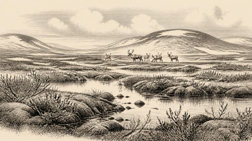
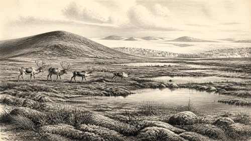
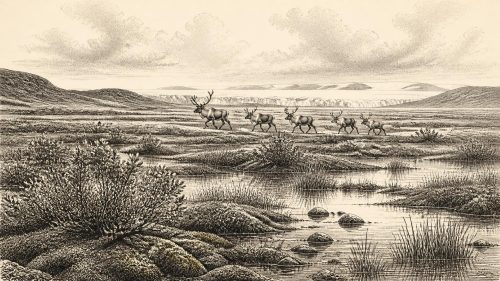
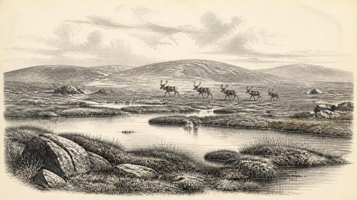
30,674 BCE is a modern label within Marine Isotope Stage 3, not a reconstructable Irish year. At Derryvree near Maguiresbridge, freshwater silts, dated broadly to 36,900–31,700 calibrated years BP, lay between glacial tills, showing a cold, tundra-like, intermittently ice-free landscape of sedges, mosses, pools and sparse vegetation. Ireland experienced unstable climate, shifting ice margins and altered coastlines. Castlepook Cave preserves diverse Ice-Age fauna, including mammoth, reindeer, giant deer and hyena, accumulated over time. A possibly cut-marked reindeer bone may indicate early human presence, but proves neither settlement nor continuous occupation. No political, religious or social history can be securely reconstructed.

Dateline
30,674 BCE is a modern calendar label, not a date at which Ireland’s past can be reconstructed year by year. No written records, named people, settlements or events survive from this depth of time, and archaeological dating cannot identify what happened in one particular calendar year. The responsible approach is to place it within a much broader Late Pleistocene interval. In conventional “before present” terms, this point lies about 32,623 years before AD 1950, during Marine Isotope Stage 3, a long and climatically unstable part of the last Ice Age.
The best directly relevant Irish evidence is environmental rather than historical. A radiocarbon determination from organic freshwater deposits at Derryvree, near Maguiresbridge in County Fermanagh, was reported as 30,500 radiocarbon years BP, with a substantial uncertainty. When calibrated, this is broadly consistent with an interval of roughly 36,900–31,700 calibrated years BP. The calendar label 30,674 BCE falls within that wide range, but it must not be mistaken for the date of a particular animal, pond, journey or human action. It is a convenient waypoint within a long-lived sedimentary record.
Fresh Water Between the Tills
Derryvree was exposed by roadworks in 1969, when a cutting through a drumlin revealed a striking sequence. Beneath lay a lower layer of till: unsorted debris deposited by glacier ice. Above it sat organic-rich freshwater silts and fine sands. These were in turn sealed beneath another thick till. The sequence records an important regional rhythm: glacial conditions, then an interval in which open water and vegetation existed at this locality, followed by renewed or expanded glaciation. It does not prove that every part of Ireland was ice-free at once, but it decisively complicates any picture of an island continuously buried beneath ice throughout the last cold stage.
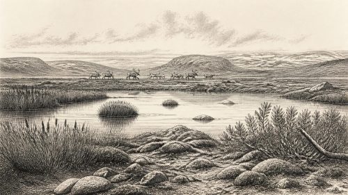
The freshwater bed contained plant and animal traces with a distinctly cold-climate character. Mosses, sedges and other herbaceous plants point to open tundra or tundra-like ground rather than woodland. Insect remains likewise suggest severe northern conditions. Pools and wet hollows could nevertheless sustain aquatic and marginal vegetation during the thawing season. The landscape around Maguiresbridge was therefore neither a featureless white ice sheet nor a modern Irish countryside. It was a periglacial mosaic: exposed mineral ground, sparse vegetation, wet depressions, seasonal water, frost-disturbed soils and, at some stages, nearby glacier ice.
This evidence is local, and its limits matter. The Derryvree silts preserve what accumulated in one basin, not an island-wide climate station. Their fossils demonstrate that freshwater life survived there during a cold interval; they do not provide a precise map of tree cover, snowfall or animal populations across Ireland. Nor can a single radiocarbon measurement settle the exact timing of ice margins. Yet the record is exceptionally valuable because water and fine sediment trapped fragile biological material which later ice covered and protected.
An Unstable Ice-Age Island
At this time Ireland belonged to the changing north-west European world of the last glacial period. Marine Isotope Stage 3 was not climatically uniform. Ice-core and other palaeoclimate records show repeated abrupt shifts between relatively milder interstadial conditions and colder stadials. Irish cave deposits, wetlands, raised beaches and glacial sediments indicate that the British–Irish Ice Sheet also changed through time and differed from region to region. The fully developed Last Glacial Maximum lay later; it is misleading to project its most extensive ice cover unchanged back onto every earlier millennium.
Sea level was far lower than today because vast volumes of water were locked in continental ice sheets. The coastlines around Ireland were consequently very different, with wider areas of continental shelf exposed. That altered the geography through which plants and animals could move, but it does not licence a simple claim that Ireland was always joined to Britain or mainland Europe by an easy, continuous land route. Changing sea channels, rivers, marshes, ice margins and local topography all mattered. The cautious conclusion is that the island was less geographically isolated than its modern outline suggests, while the exact pathways and dates of dispersal remain uncertain.
Glaciation also helps explain the fragmentary nature of the Irish record. Advancing ice eroded landscapes, reworked sediments and removed many places where camps or animal remains might once have survived. Later sea-level rise submerged former coastal lowlands. The absence of known open-air sites from this period therefore cannot demonstrate that no person ever set foot in Ireland, but neither can it be treated as positive evidence for a settled population. The ground has preserved a small and uneven archive.
Castlepook’s Animal Archive
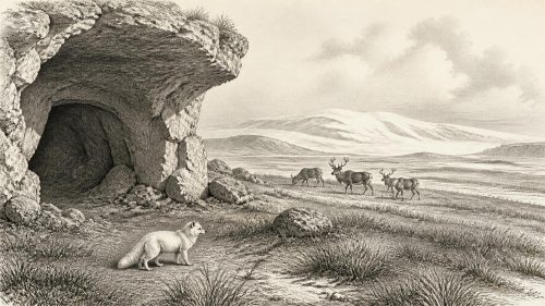
Far south of Fermanagh, Castlepook Cave near Doneraile in north County Cork offers a complementary view of Ice-Age Ireland. Also known as Mammoth Cave, it is Ireland’s richest known repository of vertebrate remains from the period before the Last Glacial Maximum. Antiquarian excavations in the early twentieth century recovered more than 2,000 bones from its narrow passages and chambers. Subsequent dating and reassessment have shown that its assemblage spans a long period, rather than representing one single moment or one undisturbed animal community.
The fauna includes woolly mammoth, giant deer, reindeer, brown bear, wolf, Arctic fox, lemmings and spotted hyena. The hyena evidence is especially striking: Castlepook is Ireland’s only known site for the Ice-Age spotted hyena. These animals should not be imagined as all standing together in one herd or arriving simultaneously. Cave assemblages accumulate through many processes—natural deaths, carnivore activity, water movement, scavenging and excavation disturbance. Still, taken together, they demonstrate that parts of Ireland could support a much richer cold-stage mammal fauna than the island has known in recent millennia.
For the broad period embracing 30,674 BCE, reindeer and giant deer are particularly evocative but must be interpreted carefully. Their remains show that large herbivores reached or lived in Ireland during favourable parts of the late Pleistocene. They do not reveal herd size, migration routes or seasonal habits in a particular year. Mammoth remains establish the presence of that species within the longer cave record; they do not demonstrate that mammoths were common at every time or throughout the island. The same caution applies to predators. A hyena den or carnivore-accumulated bone deposit is evidence of animal behaviour, not a human habitation site.
The Human Question
The possibility of people in Ireland at this remote date remains important but unresolved. A reindeer femur from Castlepook has been publicly reported as about 33,000 years old and as bearing an incision interpreted as a sharp-tool cut made during carcass processing. If that interpretation is confirmed by full specialist study, it would indicate that a person handled a reindeer in Ireland during the Upper Palaeolithic, dramatically earlier than the long-established evidence for post-glacial human activity.
It does not, however, demonstrate an Irish settlement, a hunting camp, or continuous occupation. The specimen derives from an older cave collection rather than a modern excavation of a clearly intact occupation floor. No securely associated stone-tool assemblage, hearth, dwelling surface, burial, human bone or artwork of comparable age has been published from Ireland. Dating establishes the age of the animal bone; deciding whether an incision is a human-made cut mark is a separate taphonomic judgement. These are reasons for careful investigation, not reasons to dismiss the find—but they set firm limits on what can presently be said.
If people did visit, they would have belonged to mobile Upper Palaeolithic hunter-gatherer worlds known elsewhere in Europe. It is reasonable only as a broad comparison to say that sharp stone edges, animal knowledge, warm clothing, fire and close co-operation would have been essential in such climates. Ireland itself has not supplied the evidence to reconstruct the visitors’ language, kinship, beliefs, routes, group size or duration of stay. Nor can regular reindeer hunting, trade, or a persistent seasonal round be asserted from one potentially modified bone.
No States, No Recorded Religion
Political history cannot responsibly be written for Ireland in 30,674 BCE. There is no evidence for rulers, territories, diplomacy, warfare, law or institutions. Equally, there are no Irish structures, graves, shrines, images or deposits from this date that permit confident statements about religion, ritual, art or formal learning. The deep human past elsewhere in Europe can provide valuable context, but it must not be imported wholesale into Ireland simply to make the story appear fuller.
Economy and society are illuminated chiefly through ecology. The Derryvree wetland indicates that life persisted in cold, open country between episodes of glaciation. Castlepook shows that herbivores and large predators formed part of the wider landscape in southern Ireland over a long span. Together they suggest environments capable, at least intermittently, of sustaining mobile animals and perhaps brief human incursions. They do not establish farming, herding, pottery, metalworking, permanent villages, organised exchange or maritime trade.
The most important development around this notional year is therefore not a recorded event but a condition: Ireland was a dynamic Ice-Age landscape, regionally variable and environmentally alive. At Maguiresbridge, freshwater sediment accumulated among sedges and mosses during an ice-free interval that later glaciers concealed. At Castlepook, bones entered a limestone cave through processes still being disentangled. Those deposits are modest remains, but they are the proper foundation for Ireland’s history at 30,674 BCE—evidence first, interpretation second, and no false precision where the past cannot provide it.
Primary Sources
- A Middle Midlandian Fresh-Water Series at Derryvree, Maguiresbridge, County Fermanagh, Northern Ireland
- Early Midlandian–Middle Midlandian, Pleistocene, Northern Ireland
- Palaeoecology
- The Subdivision of the Quaternary Period in Ireland
- The Irish Quaternary Fauna Project
- A Reconsideration of the Radiocarbon Dating of the Marine Isotope Stage 3 Fauna from Southern Ireland
- Castlepook Cave, County Geological Site Report
- Spotted Hyena Skull
- Occurrence of Mammalia Relicts at Site Castlepook Cave
- Archaeology Research Excavation Grant 2022: Castlepook Caves Project
- New Insights on the Fauna of Ireland's Younger Dryas and Early Holocene from Alice & Gwendoline Cave
- First Evidence of a Late Upper Palaeolithic Human Presence in Ireland
- Growth and Retreat of the Last British–Irish Ice Sheet, 31,000 to 15,000 Years Ago: The BRITICE-CHRONO Reconstruction
- The Timing and Magnitude of the British–Irish Ice Sheet Between Marine Isotope Stages 5d and 2
- Maximum Extent and Readvance Dynamics of the Irish Sea Ice Stream and Irish Sea Glacier Since the Last Glacial Maximum
- Late Pleistocene Chronostratigraphy and Ice Sheet Limits, Southern Ireland
- Episodic Speleothem Deposition Tracks the Terrestrial Impact of Millennial-Scale Last Glacial Climate Variability in SW Ireland
- The IntCal20 Northern Hemisphere Radiocarbon Age Calibration Curve (0–55 cal kBP)
- North GRIP – Greenland Ice Core Chronology 2005 (GICC05), 60,000 Year, 20 Year Resolution
- Quaternary Site Descriptions
- Irish Association for Quaternary Studies Field Guide 2014