BIRM-166’s Fermanagh Roadcut30553 BCE
At 30,553 BCE, Ireland lay within an unstable Ice Age landscape, not a recoverable year. At Derryvree, County Fermanagh, freshwater sediments between glacial tills yielded radiocarbon date BIRM-166, broadly calibrated to 34,950–29,750 BCE. They record a local ice-free wetland interval amid advancing and retreating ice, probably an open, cold, tundra-like environment. Castlepook Cave preserves bones of mammals, including mammoth, giant deer, reindeer and hyaena, but accumulated over long periods. No secure evidence demonstrates human settlement at this date; later evidence cannot establish continuity. Ireland’s deep past is therefore reconstructed from fragmentary environmental and faunal records, rather than events or societies.
Dateline
The label “30,553 BCE” is useful for arranging a modern timeline, but it cannot identify a recoverable year in Ireland’s prehistoric past. No written calendar, settlement sequence or event record exists for this point in the Late Pleistocene. The responsible history is therefore one of dated ranges, deposits and probabilities. Around this notional date, Ireland lay within the last cold stage of the Ice Age, during Marine Isotope Stage 3, as climates and ice margins changed sharply over millennia rather than in annual political or human chronologies.
The closest major Irish environmental record is at Derryvree, near Maguiresbridge in County Fermanagh. There, roadworks exposed organic freshwater silts and fine sands trapped between two substantial sheets of glacial till within a drumlin. The organic horizon produced the radiocarbon determination BIRM-166: 30,500 radiocarbon years before present, with a large quoted uncertainty of +1,170 and −1,030 years. Using modern calibration, that determination is broadly compatible with approximately 36,900–31,700 calibrated years before present, or roughly 34,950–29,750 BCE. The named year falls within that wide interval, not at a point which can be isolated from it.
A Wetland Between Ice Advances
Derryvree’s importance lies in its sequence. The lower till shows that ice had previously moved across the district. Above it, freshwater sediment accumulated while the locality was exposed and sufficiently unfrozen, at least seasonally, for standing or slow-moving water, plants and small animals to leave traces. Proglacial sands and a later till then sealed the deposit, recording renewed glacial conditions. This is not a picture of a permanently ice-covered Ireland, nor evidence that the whole island was temperate and habitable at the same time. It is strong local evidence for an ice-free interval in Fermanagh amid a climate system capable of repeated advance and retreat.
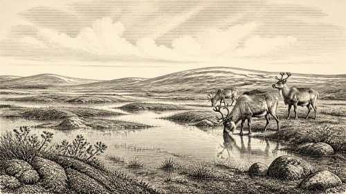
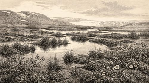
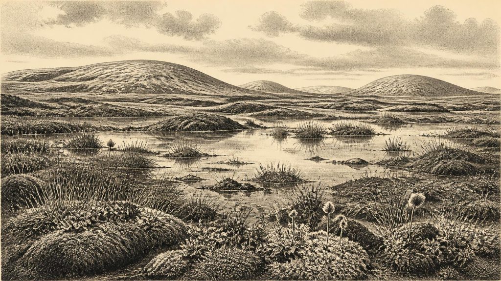
Researchers described the Derryvree flora and fauna as having a full-glacial character. The resulting landscape has commonly been interpreted as open tundra or muskeg: a waterlogged, treeless mosaic of mosses, sedges, shallow pools and low-growing arctic-alpine plants, set among frost-disturbed ground. Fossil evidence includes plants suited to cold, exposed and wet conditions, rather than a closed forest. The term “muskeg” should not be imagined as a modern northern bog copied exactly into ancient Fermanagh. It is an ecological interpretation, useful because it conveys poor drainage, low vegetation and a short growing season, but necessarily simplified.
At 30,553 BCE, then, the safest reconstruction is not of familiar Irish green fields or woodland, but of a cold and open northern landscape in which summer thaw supported wetland life. Permafrost or deeply seasonally frozen ground may have affected drainage and soil movement. Snow cover, wind exposure and the duration of thaw would have varied with topography. A freshwater basin near Maguiresbridge could preserve organic mud while nearby slopes, ridges and valleys experienced markedly different local conditions. The Derryvree deposit illuminates its own district best; it is not a weather report for every corner of Ireland.
An Island in a Changing Ice World
In the wider British–Irish Ice Sheet system, this was an era of instability and incomplete knowledge. Modern reconstructions show major ice-sheet growth, maximum extent and retreat did not happen everywhere at once. The best-constrained later phase of the last ice sheet spans roughly 31,000 to 15,000 years before present, with different sectors attaining their maxima at different times, broadly between 30,000 and 22,000 years ago. Evidence also suggests earlier glaciation and changing ice margins before the classical Last Glacial Maximum. Consequently, it would be misleading to state simply that Ireland was either wholly ice-free or wholly buried beneath ice in 30,553 BCE.
The date sits near the difficult transition into more severe conditions. Ice had already shaped the Irish landscape repeatedly, and expanding ice would later scour, bury or remove many deposits. That destructive power helps explain why the archaeological record is so thin. Open-air camps, hearths, tracks and light structures are especially unlikely to survive repeated glaciation, erosion and later sea-level change. Absence of such sites is not proof that no person ever entered the island, but it does mean that historians cannot turn possibility into a documented population.
Lower global sea levels altered coastlines and exposed parts of the continental shelf, yet coastlines, ice fronts and crossings changed through time. There is no basis for describing a fixed “land bridge” or a known travel route into Ireland at this precise date. Any movement of people or animals between Ireland, Britain and continental Europe would have been governed by a shifting combination of sea, exposed land, ice, rivers and hazardous coastal margins. Geography offered opportunities in some periods and barriers in others; the evidence does not let us map a journey for this year.
Animals Known From Caves
Southern Irish caves provide the clearest evidence that sizeable mammals occupied parts of Ireland during the middle and later phases of the Ice Age. Castlepook Cave, near Doneraile in north County Cork, is exceptionally important. More than 2,000 bones have been recovered from its galleries, and individual radiocarbon dates from the wider assemblage span a long period before and into the Last Glacial Maximum. The recorded fauna includes woolly mammoth, giant deer, reindeer, brown bear and spotted hyaena; later deposits have yielded Arctic fox, wolf and lemmings.
These remains establish that Ireland was not biologically empty in the broad period surrounding the Derryvree interval. They do not, however, form a single living herd photographed in time. Cave deposits accumulated over many thousands of years. Carnivores, natural deaths, water movement, excavation methods and disturbance all affected which bones survived and where they were found. A mammoth bone, hyaena jaw and reindeer antler may be evidence for species presence at different times, rather than proof that all shared one valley in 30,553 BCE. Castlepook is best read as a long faunal archive.
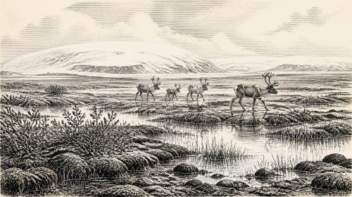
The animal evidence nevertheless suggests a food web appropriate to open, cold environments. Reindeer and other grazing or browsing herbivores could exploit seasonally productive tundra and steppe-like ground; carnivores followed prey or used caves as dens and feeding places. Mammoth and giant deer invoke spectacular Ice Age imagery, but their Irish remains should not be used to romanticise a stable “mammoth-steppe” across the island. The vegetation, climate and ice margin were changing, while the surviving fossils are unevenly distributed and often cave-biased.
People: A Necessary Caution
No securely dated settlement, hearth, stone-tool assemblage or human burial demonstrates that people were living in Ireland in 30,553 BCE. Nor can the earliest securely published evidence for human activity on the island answer that question: cut marks on a brown-bear patella from Alice and Gwendoline Cave, County Clare, date much later, around 12,810–12,590 calibrated years before present. That find proves a Late Upper Palaeolithic human presence long after the interval discussed here, not a continuous history reaching back through the coldest stages.
A reindeer femur from Castlepook Cave has been publicised as bearing marks consistent with butchery and as approximately 33,000 years old. It is an important prompt for further work, but it cannot by itself support a detailed account of society in 30,553 BCE. Its old collection history, cave context and the wide uncertainties that surround comparison between bone date, modification and deposition require caution. It may indicate an earlier human visit to Ireland; it does not establish a permanent settlement, a named group, or a year-specific hunt.
Accordingly, there are no identifiable political affairs, leaders, alliances, wars, diplomatic contacts, religious rites, languages, artistic traditions, trade networks or systems of learning to describe for Ireland at this date. It would be false precision to supply them. If people briefly reached the island during favourable intervals, they would have been mobile hunter-gatherers operating in an Ice Age world, but that is an inference from wider north-west European archaeology, not a documented Irish social history. There is no reliable evidence for villages, farming, domesticated animals, metalworking, monuments or exchange in Ireland at this time.
What This Date Can Mean
The historical significance of 30,553 BCE is therefore environmental rather than event-driven. The Derryvree roadcut preserves a rare moment when freshwater life occupied a Fermanagh basin between glacial episodes. Castlepook’s bones show that varied Ice Age mammals reached parts of Ireland in the broader pre-maximum period. Together, they replace an older, overly simple image of an island uniformly entombed beneath ice throughout the last glaciation.
Yet the evidence also sets strict limits. Derryvree does not furnish an annual chronology; Castlepook does not provide a single contemporary animal community; and neither site proves a human population in this particular year. Around 30,553 BCE, Ireland was a region of tundra wetlands, shifting ice influence and mobile wildlife, known through sediments and bones rather than through stories or states. That fragmentary record is not a failure of history. It is the real, scientifically recoverable beginning of Ireland’s deep past.
Primary Sources
- Middle Midlandian Freshwater Series at Derryvree, Maguiresbridge, County Fermanagh, Northern Ireland
- The Irish Quaternary Fauna Project
- Castlepook Cave, County Geological Site Report
- Growth and Retreat of the Last British–Irish Ice Sheet, 31,000 to 15,000 Years Ago: The BRITICE-CHRONO Reconstruction
- The Timing and Magnitude of the British–Irish Ice Sheet Between Marine Isotope Stages 5d and 2: Implications for Glacio-Isostatic Adjustment, High Relative Sea Levels and ‘Giant Erratic’ Emplacement
- Exploring Controls of the Early and Stepped Deglaciation on the Western Margin of the British Irish Ice Sheet
- The IntCal20 Northern Hemisphere Radiocarbon Age Calibration Curve (0–55 cal kBP)
- IntCal Publications
- IntCal History
- Radiocarbon Dating and Chronological Modelling
- First Evidence of a Late Upper Palaeolithic Human Presence in Ireland
- New Insights on the Fauna of Ireland’s Younger Dryas and Early Holocene from Alice & Gwendoline Cave
- Ireland: Submerged Prehistoric Sites and Landscapes
- Prehistoric Details
- Ice Age Ireland: Cool Fossils!
- Guide to the National Museum of Ireland – Natural History
- Figure 6: The Subdivision of the Quaternary Period in Ireland
- BRITICE-CHRONO: Constraining the Retreat of the Last British-Irish Ice Sheet
- BRITICE-CHRONO: Introduction
- Radiocarbon Constraints on the Age of the Maximum Advance of the British–Irish Ice Sheet in the Celtic Sea