

Castlepook Reindeer Cutmark30400 BCE
30,400 BCE is not a date for a recorded Irish event but an uncertain point within Marine Isotope Stage 3. Derryvree sediments in Fermanagh show that an ice-free or marginal wetland supported tundra vegetation, freshwater life and insects between glacial advances. Ireland was entering colder conditions before the Last Glacial Maximum, while ice expansion later erased much evidence. Castlepook Cave in Cork yielded diverse Late Pleistocene fauna, including reindeer. A deep cutmark on one reindeer femur may indicate stone-tool butchery around 31,000 BCE, suggesting a possible human visit. It cannot securely establish permanent settlement, hunting, culture, trade, or political life.
Dateline
A Date Beyond Calendar History
30,400 BCE is a modern chronological label, not a year for which Ireland preserves an event, a ruler, a community or a calendar. No written record, annually layered settlement sequence or securely dated human occupation allows historians to say what happened on the island in that particular year. In the archaeological convention that counts backwards from AD 1950, it lies roughly 32,350 years ago. Its proper setting is the later Pleistocene, within Marine Isotope Stage 3, a climatically volatile part of the last Ice Age.
Calendar-year precision is unavailable at this depth of time. Radiocarbon results carry statistical uncertainty and must be calibrated; beyond about 30,000 radiocarbon years, calibration is especially difficult. The closest important Irish environmental date is from Derryvree near Maguiresbridge, County Fermanagh: organic freshwater sediments there produced a conventional determination of 30,500 ± 1,100 radiocarbon years BP. One published conversion gives a broad range of about 36,900–31,700 calibrated years BP, or approximately 34,950–29,750 BCE. That range encompasses 30,400 BCE, but it does not turn the deposit into evidence for a single year. It is a window onto a changing landscape over a long interval.
Freshwater Beneath Future Ice
Derryvree is exceptionally revealing because the silts and fine sands lay between two thick sheets of glacial till in a road cutting through a drumlin. The lower till records an earlier ice advance; the organic sediments formed during an intervening ice-free or ice-marginal phase; the upper till shows that glacier ice later returned and sealed the wetland beneath it. The sequence therefore contradicts any simple picture of Ireland as continuously ice-covered throughout the last Ice Age. At the same time, it is a local record in Fermanagh, not a map of every valley and coast.
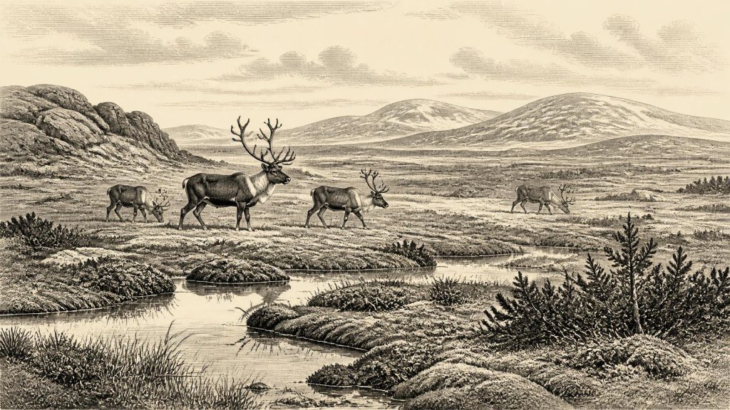
The plant and animal remains from the organic beds indicate cold, open terrain with freshwater pools, wet ground and sparse tundra-like vegetation. Grasses, sedges, herbs, juniper and mosses occur in the published assemblage, alongside aquatic plants including water-milfoil and bogbean. Such evidence supports the interpretation of a treeless, wet, periglacial landscape sometimes termed muskeg in older literature. That term is useful as a rough ecological comparison, but it should not imply an exact modern equivalent. The important point is that shallow water, saturated sediments and short-lived growing seasons supported more life than an image of featureless frozen ground suggests.
Insects and plant fossils can reveal conditions unavailable from large landforms alone. They suggest a severe continental climate, with winter cold, frost action and an abbreviated summer, but also enough seasonal thaw for freshwater vegetation and invertebrate life. The landscape was likely patchy: sedge-rich margins and mossy ground near water, drier mineral soils beyond them, and more exposed slopes subject to wind and frost. Rivers and shallow basins would have shifted as frozen ground thawed and refroze. For any people or animals moving through such country, water, shelter and season mattered more than modern county boundaries.
Before the Last Maximum
This was not yet the fullest expansion of the last Irish ice sheet. Evidence from Derryvree, Greenagho and offshore records indicates that substantial parts of Ireland remained ice-free until roughly 34,000 calibrated years ago, after which the last ice sheet built up and expanded. The Last Glacial Maximum came later, broadly during the period from about 27,000 to 19,000 years ago, although its timing, thickness and margins varied between regions and remain actively studied. By then ice had transformed most of the island and extended onto adjoining shelves.
Thus 30,400 BCE belongs to a long deterioration rather than an instant when all Ireland changed at once. Local glaciers and expanding ice centres may already have affected uplands and northern routes, while other sectors retained open ground. The later ice advance was historically important in the deepest sense: it eroded surfaces, carried debris, overrode valleys and buried or destroyed much of the evidence that might otherwise identify Palaeolithic camps. Modern reconstructions must therefore work with a record biased towards caves, sheltered sediment traps and deposits protected beneath later glacial material.
Lower global sea levels altered the shape of the surrounding lands and seas, but they do not by themselves demonstrate a walkable route or a particular migration corridor into Ireland. The Irish Sea basin, ice margins and changing coastlines were formidable and variable. It is reasonable to see Ireland as part of a wider north-west European environmental zone, connected by animal movement and changing geography; it is not responsible to specify a route, season or population movement for this date without direct evidence.
The Castlepook Question
The most arresting evidence close to this timescale comes from Castlepook Cave, also called Mammoth Cave, near Doneraile in north County Cork. Antiquarian excavations between 1904 and 1912 recovered a rich assemblage of Late Pleistocene bones. Subsequent work has shown that the cave’s fauna includes animals suited to very different parts of an Ice Age landscape: reindeer, red deer, giant deer, horse, mountain hare, Arctic fox, lemmings, wolf, brown bear, spotted hyaena and woolly mammoth. Re-dating has demonstrated that some specimens from Castlepook are substantially older than formerly believed, placing elements of the fauna in Marine Isotope Stage 3.
A reindeer femur in the old collection has particular importance. Zooarchaeologist Ruth Carden has interpreted a deep mark on it as damage made on fresh bone by a sharp stone tool during carcass processing. County Cork heritage material places the bone broadly around 31,000 BCE, close enough to the present chronological horizon to make it directly relevant. If that interpretation and broad association are sustained, it would be evidence that a person used a cutting edge on a reindeer carcass in Ireland during the Upper Palaeolithic.
It would not, however, prove a permanent Irish population. The femur was not recovered from a modern excavation of a sealed hearth with stone tools, butchered carcass parts and an occupation floor in their original relationship. A cave bone can be moved by carnivores, water, frost, collapse, excavation disturbance and later handling. The age of an animal does not independently date every mark on its surface. Nor can one incision reveal whether people killed the reindeer, scavenged it, removed meat or sinew, stayed for an afternoon, or returned in later seasons. The defensible conclusion is narrower and more interesting: a possible human episode is present, but settlement remains unproved.
Animals, Predators and Resources
Even without assuming human hunters, the faunal evidence makes Ireland around this period an active ecological landscape. Reindeer and horse suggest open grazing country; hares, foxes and lemmings point to cold-adapted habitats; mammoth and giant deer evoke a broader mosaic of grassland, herb-rich ground and scrub. Brown bears, wolves and spotted hyaenas were not merely a backdrop. Carnivores could kill prey, scavenge carcasses and carry bones into caves, complicating the archaeological record while also demonstrating an ecosystem with substantial food webs.
Should the Castlepook mark prove human-made, a reindeer carcass had obvious value: meat and fat for food, hide for clothing or shelter material, sinew for bindings, and bone and antler for tools. Those are well-established possibilities for Upper Palaeolithic groups elsewhere in Europe, not demonstrated industries in Ireland. No securely associated Irish stone-tool assemblage, hearth, built shelter, burial, personal ornament, rock art or worked-bone industry has been published for 30,400 BCE. Continental comparisons can establish what mobile foragers were capable of; they cannot supply Ireland with an invented camp or culture.
No Polities, No Trade Record
There is no evidence for political affairs, warfare, diplomacy, named territories or institutions in Ireland at this date. Nor is there evidence for farming, herding, fields, pottery, metalworking, long-distance trade or a settled economy. A possible act of butchery would imply practical knowledge and perhaps movement within wider foraging ranges, but not exchange networks or leadership structures. Religion, language, kinship rules and learning likewise leave no recoverable Irish trace from this horizon. To fill these silences with assumed chiefs, clans or rituals would mistake analogy for evidence.
The everyday reality that can be responsibly imagined is environmental rather than biographical: a cold, seasonal land of wet basins, open vegetation, large herbivores and predators, increasingly shaped by the approach of expanding ice. If people entered it, they did so in numbers and on terms that remain unknown. Ireland’s importance at 30,400 BCE lies precisely in that fragile evidence: a freshwater archive below later till, cave fauna preserved in limestone country, and one marked reindeer bone that asks a large question without yet supplying a complete answer.
Primary Sources
- A Middle Midlandian Freshwater Series at Derryvree, Maguiresbridge, County Fermanagh, Northern Ireland
- Trimlines, Blockfields and the Vertical Extent of the Last Ice Sheet in Southern Ireland
- A Reconsideration of the Radiocarbon Dating of the Marine Isotope Stage 3 Fauna from Southern Ireland
- Red Deer in Ireland: Current Knowledge and Future Research
- New Insights on the Fauna of Ireland's Younger Dryas and Early Holocene from Alice & Gwendoline Cave
- The Irish Quaternary Fauna Project
- Radiocarbon Constraints on the Age of the Maximum Advance of the British–Irish Ice Sheet in the Celtic Sea
- Late Pleistocene Chronostratigraphy and Ice Sheet Limits, Southern Ireland
- Last Glacial Maximum Cirque Glaciation in Ireland and Implications for Reconstructions of the Irish Ice Sheet
- New Data for the Last Glacial Maximum in Great Britain and Ireland
- Dating Constraints on the Last British-Irish Ice Sheet: A Map and Database
- Pattern and Timing of Retreat of the Last British-Irish Ice Sheet
- The Last Irish Ice Sheet: Extent and Chronology
- The Timing and Magnitude of the British–Irish Ice Sheet Between Marine Isotope Stages 5d and 2
- Irish Pleistocene Biostratigraphy
- Figure 6.— The Subdivision of the Quaternary Period in Ireland
- Heritage Artefacts of County Cork
- Castlepook Cave, County Geological Site Report
- The Mesolithic in Ireland: When Was It?
- Ice Sheet Limits and Chronostratigraphy in the Southern Sector of the Last Irish Ice Sheet





