
Doneraile’s Incised Femur30401 BCE
About 30,401 BCE, Ireland experienced unstable Late Pleistocene conditions during the Midlandian cold stage, not a recordable historical year. Derryvree sediments in Fermanagh document an ice-free freshwater interval between glacial advances, supporting tundra-like wetland life. Crag Cave calcite records episodic warmer phases amid severe climatic shifts. Castlepook Cave near Doneraile preserves diverse MIS 3 fauna, including reindeer, mammoth and predators, although its deposits span long periods. A cut-marked reindeer femur may indicate human handling around 33,000 years ago, but cannot prove settlement, routes or society. Lower sea levels altered geography, while later ice likely destroyed evidence of brief human visits.
Dateline
The label 30,401 BCE is useful only as a modern point on a very long timescale. It cannot identify a recorded Irish year, season, expedition or individual. No calendar then used in Ireland can be correlated with it, and no archaeological deposit can be dated with annual precision at this depth of time. In calendar terms it lies roughly 32,350 years before AD 1950, within the later part of the Late Pleistocene and Marine Isotope Stage 3 (MIS 3), during the Irish Midlandian cold stage. The responsible history of this moment is therefore not a chronicle of events, but a reconstruction from sediments, fossil plants, animal bones, cave deposits and the behaviour of ice.
Those records suggest a land of severe environmental instability. Ireland was not yet at the fullest expansion of the Last Glacial Maximum, which came later, but its climate was already cold and changeable. Ice had advanced and retreated more than once; open ground, wetlands and animal corridors could exist in some places during milder intervals, only to be altered or buried by renewed glaciation. Much of the evidence has consequently been removed, mixed or sealed beneath later deposits. What survives is unusually valuable precisely because it is fragmentary.
A Date Without a Recorded Year
The closest relevant chronological evidence comes from radiocarbon measurements, but these require care. Radiocarbon years are not calendar years: the amount of carbon-14 in the atmosphere changed through time, so laboratory results must be calibrated against independently dated records. At more than 30,000 years ago, calibration ranges are broad and may be revised as techniques improve. A named BCE year should not be treated as an exact match for a layer of mud, a fossil bone or a climatic shift.
The most important northern Irish environmental sequence is at Derryvree, near Maguiresbridge in County Fermanagh. Road works in 1969 cut through a drumlin and exposed freshwater silts, fine sands and organic-rich muds lying between two substantial till sheets. Till is debris deposited directly by glacier ice. The sequence thus supplies firm local evidence for three stages: ice had covered the site; a non-glacial interval allowed water, sediment and organic remains to accumulate; then ice returned and sealed the basin. The organic horizon produced the famous BIRM-166 measurement of 30,500 radiocarbon years before present, with a large uncertainty. Modern calibration places the deposit broadly around 36,900–31,700 calibrated years before present, rather than in one narrowly fixed date.
That broad range overlaps the chronological neighbourhood of 30,401 BCE, but it does not prove that Derryvree was a wetland in that particular year. It is evidence for an ice-free freshwater episode in this part of Fermanagh over an extended interval. The distinction is essential. Archaeology can responsibly describe conditions represented by the sequence; it cannot restore an annual weather report for Ireland.
Fresh Water Beneath the Drumlins
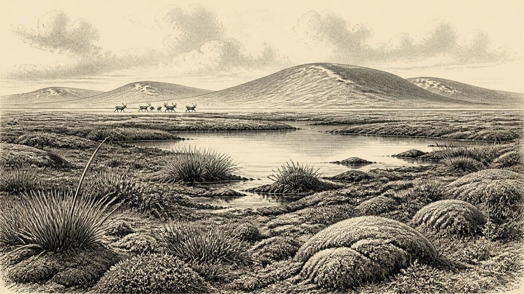
Derryvree nevertheless gives the clearest picture of an Irish landscape relevant to this date. Its plant and insect remains indicate cold, open conditions of northern aspect. Freshwater mosses and sedges demonstrate that water persisted locally. The setting was not a forest, farmed valley or settled lakeshore. It was a periglacial wetland landscape: seasonally exact conditions are unknown, but the organisms recovered point to tundra-like ground around shallow or slow-moving fresh water.
Such an environment was neither lifeless nor uniform. Mossy margins, sedge beds, bare mineral ground, snow patches, small pools and short-lived summer vegetation could have created distinct ecological niches within a small area. Yet the organic bed tells us principally about Derryvree itself. It cannot be enlarged into a map of every Irish county. The island’s relief, distance from ice margins, exposure to Atlantic weather and changing drainage meant that conditions varied regionally. Local freshwater survival in Fermanagh is compelling evidence against any simple image of Ireland as continuously and uniformly entombed beneath ice; it is not evidence that the entire island was hospitable at once.
Crag Cave in County Kerry adds a second, differently dated line of evidence for climatic volatility. Uranium-thorium dates from cave calcite show that speleothems grew episodically during warmer Greenland Interstadials in the last glacial period. Because dripstone formation requires liquid water moving through the cave system, these growth phases imply intervals when conditions in south-west Ireland rose above persistent freezing. Their interruptions register the return of colder conditions. Together, the cave calcite and the Fermanagh silts reveal an Ireland responding sharply to millennial-scale North Atlantic climate shifts.
Castlepook and the Animal World
Nearly 300 kilometres south-west of Derryvree, Castlepook Cave near Doneraile in north County Cork preserves Ireland’s best-known pre-Last Glacial Maximum animal archive. The cave’s early excavations recovered a remarkable range of Pleistocene remains, including mammoth, reindeer, wolf, giant deer and spotted hyaena. Subsequent re-dating has shown that some older radiocarbon determinations underestimated the true ages of southern Irish bones by thousands of years. The revised work confirms that Castlepook and related caves preserve a deep and complex MIS 3 record, rather than a single brief occupation of the landscape.
The cave does not provide a neat census for 30,401 BCE. Its deposits accumulated over long spans; bones may have entered through carnivore activity, natural deaths, water movement and excavation practices that predated modern recording standards. Nor should all species in the collection be imagined grazing together outside the cave mouth. Some may belong to substantially earlier phases of MIS 3, and the 2020 reassessment argued that giant deer and spotted hyaena may already have disappeared locally before about 40,000 calibrated years ago. The secure conclusion is more modest and more important: during portions of the period before the Last Glacial Maximum, Ireland supported a much richer cold-stage mammal fauna than later, post-glacial Ireland.
For a landscape near this date, reindeer are especially evocative but should not be romanticised. Their presence indicates connections to wider north-west European cold-environment ecosystems and the availability, at least intermittently, of open terrain suitable for mobile herbivores. Predators and scavengers, including wolves and hyaenas at broader MIS 3 timescales, were part of that world. The animals themselves were the central agents of movement across the landscape: following forage, avoiding danger, using sheltered valleys and passing through terrain repeatedly reshaped by frost, water and advancing ice.
The Doneraile Incision
One Castlepook object gives this remote period unusual archaeological significance: a reindeer femur bearing a deep linear mark. Zooarchaeologist Ruth Carden has interpreted the modification as consistent with cutting or chopping fresh bone using a sharp stone implement. Public accounts associate the bone with an age of roughly 33,000 years ago. If that interpretation is confirmed, it would indicate human handling of a reindeer in Ireland at a time vastly earlier than the previously accepted evidence for Late Upper Palaeolithic activity on the island.
It is an important possibility, not a licence to invent a settlement. The date obtained from bone measures the animal’s death within a statistical range; it does not independently date the surface mark, name the tool-user or establish where the animal was killed. Castlepook has not yielded a securely associated stone-tool assemblage, hearth, dwelling, burial, human skeleton or intact butchered food deposit of this age. The incision may point to a brief visit by people who processed part of a carcass. It cannot show whether they arrived in a small party or a larger group, stayed for hours or weeks, travelled by a particular route, or ever returned.
There is likewise no evidence from which to reconstruct political affairs, diplomacy, territorial rule or organised conflict in Ireland at this time. There were no farms, fields, villages, metalwork, written traditions or monuments known from this horizon. If people were present, their likely economy would have depended upon mobility, close attention to animals and weather, and the flexible use of stone, wood, hide and bone. Yet even that is an inference from Upper Palaeolithic lifeways elsewhere in north-west Europe, not a directly excavated Castlepook camp. No exchange network, language, ritual practice, art or formal system of learning can be responsibly identified in Irish evidence for this date.
A Changing Geography
Sea levels were lower than today because vast amounts of water were held in continental ice sheets, so the outlines of the Irish coast and surrounding seas differed markedly from the modern map. But low sea level did not automatically create an easy dry route between Ireland and Britain. The configuration of land, water, ice, sea ice and exposed shelf varied through time, while glacial loading altered relative sea levels. Scholarship on Irish land bridges remains cautious and contested; the exact practical routes available around 32,350 years before present cannot be demonstrated from the evidence now known.
This uncertainty matters most for the human question. The Castlepook femur, if its mark is anthropogenic, would show that people reached Ireland despite formidable environmental barriers. It would not reveal the route. It is equally possible that many traces of short-lived visits were destroyed by later ice or now lie beneath the sea. Absence of known camps is therefore not proof that no one ever entered the island, but nor does the single marked bone establish enduring settlement.
The Evidence That Endures
Ireland around 30,401 BCE was not yet a historical society in the conventional sense. It was a shifting cold-stage environment in which local fresh water could survive between glacial advances, large mammals moved through open country, caves accumulated bones, and perhaps humans briefly handled a reindeer near Doneraile. Derryvree’s silts, Castlepook’s fauna and Crag Cave’s calcite are not substitutes for lost chronicles; they are the records themselves. Their lesson is one of change rather than permanence: a living but precarious Irish landscape, repeatedly transformed by climate long before any kingdom, town or remembered name existed.
Primary Sources
- A Middle Midlandian Freshwater Series at Derryvree, Maguiresbridge, County Fermanagh, Northern Ireland
- Early Midlandian–Middle Midlandian, Pleistocene, Northern Ireland
- Figure 6.— The Subdivision of the Quaternary Period in Ireland
- Quaternary Site Descriptions
- A Reconsideration of the Radiocarbon Dating of the Marine Isotope Stage 3 Fauna from Southern Ireland
- The Irish Quaternary Fauna Project
- Heritage Artefacts of County Cork
- Archaeology Research Excavation Grant 2022
- Episodic Speleothem Deposition Tracks the Terrestrial Impact of Millennial-Scale Last Glacial Climate Variability in SW Ireland
- Spatio-Temporal Dynamics of Speleothem Growth and Glaciation in the British Isles
- Growth and Retreat of the Last British–Irish Ice Sheet, 31,000 to 15,000 Years Ago: the BRITICE-CHRONO Reconstruction
- BRITICE Glacial Map, Version 2: A Map and GIS Database of Glacial Landforms of the Last British–Irish Ice Sheet
- The Problem of a Late Quaternary Landbridge Between Britain and Ireland
- Deglaciation, Earth Crustal Behaviour and Sea-Level Changes in the Determination of Insularity: A Perspective from Ireland
- The Island of Ireland: Drowning the Myth of an Irish Land-Bridge?
- The IntCal20 Northern Hemisphere Radiocarbon Age Calibration Curve (0–55 cal kBP)
- IntCal Publications
- First Evidence of a Late Upper Palaeolithic Human Presence in Ireland
- First Evidence of a Late Upper Palaeolithic Human Presence in Ireland
- New Insights on the Fauna of Ireland’s Younger Dryas and Early Holocene from Alice & Gwendoline Cave
