BIRM-166’s Tundra Assemblage30240 BCE
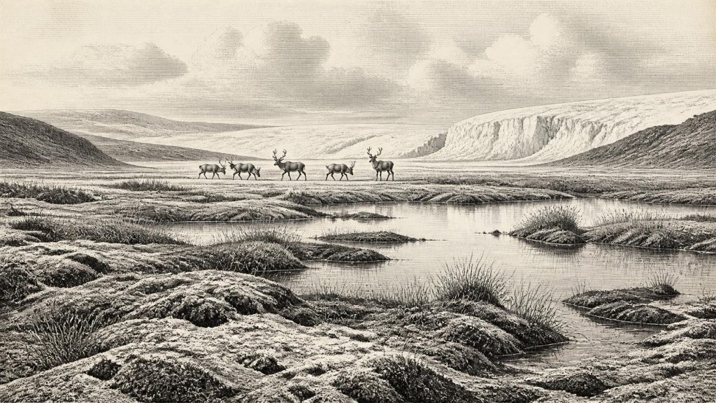
Thirty thousand years BCE is not recoverable as a precise Irish historical year, but falls within a broadly dated, unstable Marine Isotope Stage 3 interval. At Derryvree, County Fermanagh, organic freshwater sediments between glacial tills, including BIRM-166, record a treeless tundra wetland during an ice-free phase. Plant and insect remains indicate pools, sedges, mosses and severe periglacial conditions. Speleothems at Crag Cave show episodic milder conditions. Castlepook fossils demonstrate intermittent access by cold-adapted mammals, but cannot provide a contemporary national fauna. No secure evidence establishes human settlement, culture, politics or economy. Later glaciation obscured landscapes, leaving environmental archives not events.
Dateline
30,240 BCE cannot be treated as a recoverable year in Ireland’s past. It is a modern numerical label applied to a point roughly 32,189 years before AD 1950, not a date that anyone living then recorded or could have recognised. No Irish deposit can presently be assigned to that single calendar year. The responsible history of this moment therefore lies in dated ranges, layers of sediment and fossil assemblages. The most informative evidence comes from the later part of Marine Isotope Stage 3, within the Midlandian cold stage: a long and climatically unstable phase of the last Ice Age.
For Ireland, this is not yet a story of named peoples, kingdoms, settlements or monuments. It is a history of ground ice, water, plants, animals and the fluctuating reach of glaciers. The central question is not who governed the island, but which parts of it could sustain life, how long those conditions lasted, and how quickly they were erased or sealed beneath later ice.
Dating a Vanished Landscape
The principal Irish archive relevant to this date is Derryvree townland, near Maguiresbridge in County Fermanagh. Road-cutting in 1969 exposed a drumlin made of two substantial layers of till: stony, unsorted sediment deposited by glacier ice. Between them lay finer sands and silts, including organic-rich freshwater deposits. Their sequence is unambiguous even if their calendar age is not. Ice had occupied the locality; then an interval without glacier cover allowed freshwater sediment and organic matter to accumulate; later ice advanced across the site and sealed the earlier landscape below a second till.
A sample from this organic series, BIRM-166, produced a conventional radiocarbon age of 30,500 years BP, with a large uncertainty of +1,170 and −1,030 years. A radiocarbon age is not a calendar age: the amount of carbon-14 in the atmosphere has changed through time. Modern calibration places this determination broadly at about 36,900–31,700 calibrated years BP, approximately 34,950–29,750 BCE. That broad interval encompasses 30,240 BCE, but it does not demonstrate what happened at Derryvree in that particular year. The sample represents material within an accumulating deposit, not an annual census of a landscape.
This distinction matters. It is sound to say that Derryvree preserves evidence of a cold, ice-free or non-glacial freshwater interval during the wider period relevant to 30,240 BCE. It is not sound to claim that a particular bogbean seed, beetle or sedge grew there in that year, nor that all the organisms recovered from the deposit lived together at precisely the same time.
Fresh Water Between the Ice
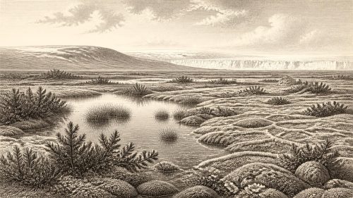
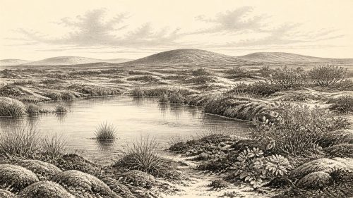
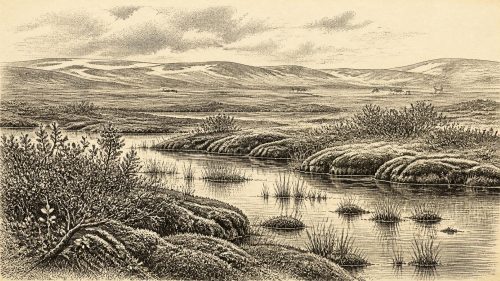
The Derryvree flora and fauna nevertheless offer an unusually vivid local picture. Plant macrofossils, pollen and insect remains indicate a treeless tundra or periglacial wetland rather than woodland, farmland or settled country. Mosses, sedges and small northern or Arctic-alpine plants grew around open pools and waterlogged ground. Aquatic species show that liquid fresh water was available, at least seasonally or locally, despite severe cold. The insect assemblage has been interpreted as fitting a mossy, organic-rich wetland with open water and exposed ground.
This was not a featureless white wasteland. Periglacial environments contain sharp contrasts over short distances: shallow pools, saturated sedge margins, frost-disturbed mineral soil, low vegetation and sheltered hollows. Yet it was also a hard country. Treelessness reflects both low temperatures and a short growing season; frost action would have repeatedly disturbed soils; and winters were severe. The organic layer is evidence for life and water, but not for a mild climate by modern Irish standards.
Crag Cave in County Kerry supplies a separate, more distant environmental clue. U-series dating of cave calcite has shown that speleothems in south-west Ireland grew episodically during Marine Isotope Stage 3. As calcite growth in that shallow cave required infiltrating liquid water and conditions generally above freezing, these pulses support the wider conclusion that the island experienced abrupt climatic ameliorations amid the long cold stage. They do not prove that Fermanagh and Kerry had identical weather, but they warn against imagining Ice Age Ireland as climatically uniform.
Animals on an Unstable Island
Irish cave deposits show that a varied Late Pleistocene fauna reached the island during parts of this broader era. The best-known collection is from Castlepook Cave, near Doneraile in north County Cork. Its bones include reindeer, woolly mammoth, giant deer, brown bear, wolf, Arctic fox, lemmings and spotted hyaena. Re-dating has revised several older radiocarbon results and confirms that cave collections must be handled cautiously: some species seem to have disappeared locally well before the Last Glacial Maximum, while individual bones may have entered a cave through carnivore activity, water movement, natural death or excavation disturbance.
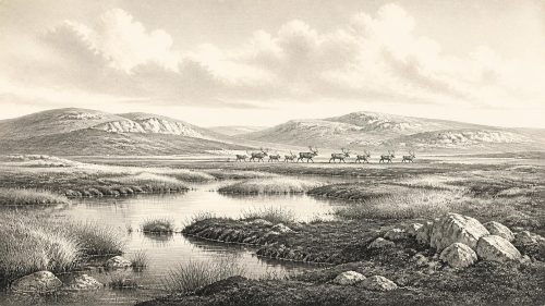
Consequently, Castlepook cannot furnish a single, island-wide animal list for 30,240 BCE. It does establish something important: Ireland was not permanently biologically isolated during the earlier and middle parts of the last glaciation. At different times, cold-adapted mammals and their predators occupied or reached landscapes now separated by sea. Reindeer and mammoth evoke open, productive grazing country; hyaena and wolf indicate carnivore communities able to exploit large-animal carcasses and prey. But the chronology and geography of each species remain unevenly known. A bone from Cork cannot show that the same animal stood beside a Fermanagh pool.
Nor should modern labels mislead. “Irish elk”, the traditional name for giant deer, does not make it an exclusively Irish animal; it was a widespread Eurasian species. Its presence in Irish fossil deposits is evidence for Pleistocene connectivity and changing habitats, not for a distinct Irish fauna untouched by the wider north-west European world.
People: Possibility Is Not Settlement
There is no securely excavated camp, hearth, house, burial or stone-tool assemblage in Ireland that can responsibly be assigned to 30,240 BCE. Thus there is no basis for describing a resident human community, its family life, language, beliefs, trade or political organisation. Continental Europe had Upper Palaeolithic hunter-gatherer populations at this time, but their art, tools and social practices must not be projected across the sea onto Ireland without Irish evidence.
A reindeer bone from Castlepook has been publicised as bearing a possible sharp-tool modification and as potentially very old. If that interpretation were confirmed, it could indicate a brief human encounter with an animal in Ireland far earlier than the well-established post-glacial settlement record. It does not, however, establish a permanent population, and its old cave context cannot yet provide the firm association required for a detailed historical narrative. The better-dated evidence for Upper Palaeolithic human activity in Ireland comes much later, from a butchered brown-bear bone in County Clare dated to around 12,810–12,590 calibrated BP.
For 30,240 BCE, then, human presence remains unproven as a settled reality. Absence of evidence is not proof that no person ever crossed the landscape, especially when later ice has scoured, buried and drowned many possible sites. But possibility must remain possibility. Archaeology cannot turn an undocumented visit into a society.
No Politics, No Trade Network
Political affairs, warfare, diplomacy and formal religious institutions are beyond the evidence for this Irish date. There are no written sources, no recognisable monuments and no material indicators of authority. Likewise, there is no evidence for agriculture, livestock keeping, markets, long-distance exchange networks or craft production on the island at this point. Any “economy” visible in the record is ecological: plants fixing energy during brief growing seasons, herbivores moving through open habitats, and predators or scavengers using the same food web.
If people did occasionally reach Ireland, their survival would have depended on mobility, knowledge of seasonal terrain and access to animal and plant resources. That is a reasonable general inference from Upper Palaeolithic lifeways elsewhere, not an observation from a known Irish camp. Nothing at Derryvree identifies shelters, hunting parties, social rank, ritual places or teaching traditions. The deposit records an environment, not a culture.
An Island Becoming Harder to Reach
At lower global sea levels, the outlines of Ireland and the surrounding shelves differed greatly from those of today. Exposed land on the continental shelf altered coastlines, river systems and possible routes between Britain, Ireland and the European mainland. Yet access was controlled by more than distance. Ice margins, meltwater, sea ice, terrain, weather and the changing configuration of the British–Irish Ice Sheet could each obstruct movement. Derryvree’s paired tills are a local reminder that viable ground could be temporary.
Recent reconstructions place the final major growth and maximum extent of the British–Irish Ice Sheet after the earlier interstadial evidence represented at Derryvree. Around the date represented by this article, Ireland was moving through a climatic world in which cold phases and warmer interludes could reorganise habitats on millennial and sometimes shorter scales. The later Last Glacial Maximum would erase or conceal much of this earlier surface, leaving scattered caves, buried organic beds and landforms as survivors.
What This Year Can Mean
The most defensible portrait of Ireland around 30,240 BCE is therefore a qualified one. In Fermanagh, the BIRM-166 series documents a freshwater tundra landscape during a broadly dated ice-free interval between glacial advances. In south-west Ireland, cave calcite records episodes when liquid water again moved through the ground. In Cork caves, a complex fossil archive shows that cold-stage mammals reached Ireland across the wider Late Pleistocene. Together these sources reveal environmental opportunity within profound instability.
They do not yield an annual chronicle. No individual can be named; no battle, journey, treaty or ceremony can be placed in 30,240 BCE. What survives instead is more elemental but no less historical: pools and sedges between ice sheets, animals moving through open country, and the evidence of climates capable of changing the very map on which later Irish history would unfold.
Primary Sources
- A Middle Midlandian Freshwater Series at Derryvree, Maguiresbridge, County Fermanagh, Northern Ireland
- Exploring Controls of the Early and Stepped Deglaciation on the Western Margin of the British Irish Ice Sheet
- Trimlines, Blockfields and the Vertical Extent of the Last Ice Sheet in Southern Ireland
- Growth and Retreat of the Last British–Irish Ice Sheet, 31,000 to 15,000 Years Ago: The BRITICE-CHRONO Reconstruction
- BRITICE Glacial Map, Version 2: A Map and GIS Database of Glacial Landforms of the Last British–Irish Ice Sheet
- Episodic Speleothem Deposition Tracks the Terrestrial Impact of Millennial-Scale Last Glacial Climate Variability in SW Ireland
- The IntCal20 Northern Hemisphere Radiocarbon Age Calibration Curve (0–55 cal kBP)
- A Reconsideration of the Radiocarbon Dating of the Marine Isotope Stage 3 Fauna from Southern Ireland
- The Irish Quaternary Fauna Project
- First Evidence of a Late Upper Palaeolithic Human Presence in Ireland
- The Colonization of Ireland: A Human Ecology Perspective
- New Insights on the Fauna of Ireland's Younger Dryas and Early Holocene from Alice & Gwendoline Cave
- Pleistocene Glaciations in Ireland
- Response of the Irish Ice Sheet to Abrupt Climate Change During the Last Deglaciation
- The Late Quaternary History of East-Central Ireland
- Subglacial Bedforms of the Irish Ice Sheet
- The Geological Heritage of County Leitrim
- References and Recommended Reading: Irish Quaternary Association Guide
- Archaeological Heritage of County Cork
- Marine Archaeology Technical Report: Oriel Wind Farm Project
- Proceedings of the Post-Glacial Colonisation Conference
- A Middle Midlandian Freshwater Series at Derryvree, Maguiresbridge, County Fermanagh, Northern Ireland