
Athlone Causeway
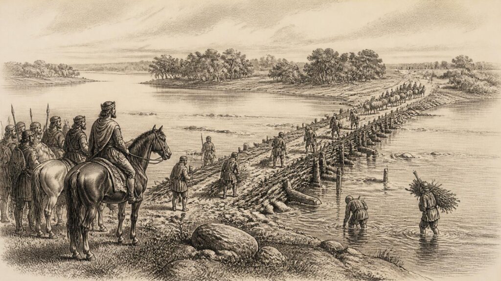
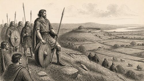
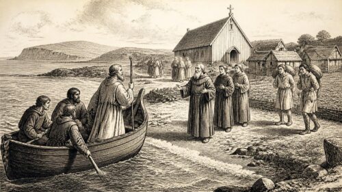
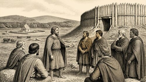
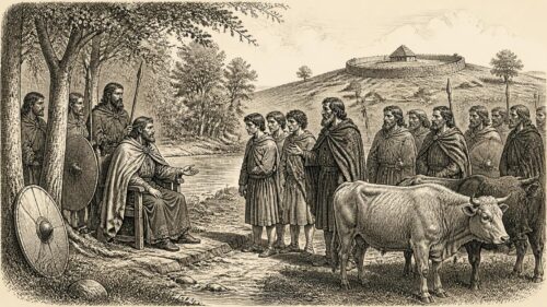
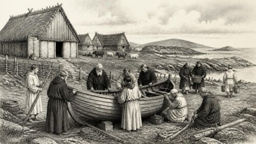
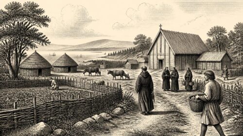
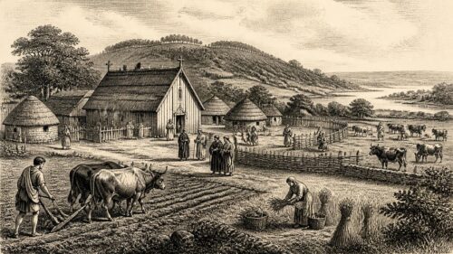
AI generated historical illustration, not a contemporary photograph.
At a Glance
Long before Athlone became a castle town, garrison centre and commercial crossing, its importance lay in one decisive advantage: the River Shannon could be approached and crossed there. The Athlone Causeway, recorded in the annals for the year conventionally given as 1001, was an early attempt to turn that advantage into an organised work of power. Although its precise form, line and fabric remain uncertain, the causeway stands securely in the documentary record as a co-operative undertaking of major rulers on either side of the river. Its history is therefore not merely one of engineering. It concerns frontier politics, warfare, kingship, travel and the making of a place which became one of Ireland’s most consequential inland gateways.
River Crossing
Athlone occupies a setting that invited movement and conflict alike. The River Shannon, flowing south from Lough Ree towards Clonmacnoise and the lower river, was both a route and a barrier. At Athlone it met an east-west gravel ridge formed within the glacial landscape. The shallower conditions associated with that meeting point made a ford possible, while the wider geography made the crossing valuable. To the east lay the political world of Mide; to the west lay Connacht. The river was consequently more than a physical feature. It marked a zone at which provincial interests, military expeditions, trading journeys and ecclesiastical connections could converge.
The Irish name Áth Luain is conventionally understood as ‘Luan’s ford’. Whether Luan was an historical individual, a remembered guide, or a figure shaped by place-name tradition cannot be demonstrated from the surviving evidence. The name nevertheless preserves the central fact that the site was understood primarily through its ford. This is important. The early medieval causeway was not created in empty country or at an arbitrary point on the Shannon. It was built where the river had already furnished an exceptional crossing-place, a place whose geographic usefulness was sufficiently established to give the later town its name.
Modern surveys and archaeological assessments describe a broad scatter of material recovered from the river and its vicinity: stone axes, Bronze Age objects, ornaments and other finds. Such discoveries suggest repeated human activity in the wider Athlone landscape across long periods. They do not, however, prove a continuous settlement beneath the modern town, nor do they reveal a prehistoric predecessor of the documented causeway. Finds in a river may have been lost, placed, deposited, moved by water or recovered without their original contexts. The responsible conclusion is narrower, but still significant: the Shannon crossing at Athlone had long attracted people and movement before the causeway was entered in the written record.
The difference between a ford and a constructed crossing should also be kept clear. A ford depends principally on natural topography, even if users improve it. A causeway implies deliberate alteration or support: a raised route, prepared bed, embankment, structure through shallow water or wet ground, or a combination of such works. The medieval Irish term often rendered in English as ‘causeway’, tóchar, has a range of possible practical meanings. It cannot safely be converted, simply from the annalistic word, into a detailed reconstruction of stone piers, timber trestles or a road of any particular width. The record establishes construction; it does not supply an engineer’s drawing.
Athlone’s position also explains why a crossing there carried a political charge. A force moving west from Mide towards Connacht, or east from Connacht towards Mide, had to negotiate the Shannon somewhere. Control of a dependable passage could regulate armies, cattle raids, messengers, churchmen and goods. A crossing was therefore an instrument of government as well as a convenience. Later castle-builders, bridge-makers and military commanders did not invent Athlone’s strategic value; they inherited it.
Annal Record
The firm documentary starting point is a short but unusually consequential entry in the Annals of Ulster. Under U1001, the annal states that ‘the causeway of Áth Luain’ was made by Máel Sechnaill and Cathal son of Conchobor. The entry is laconic, as annals often are. It provides no description of materials, labour force, duration, purpose or exact route. Yet its economy is itself revealing. The construction was important enough to be preserved as an event alongside kings’ deaths, raids and ecclesiastical notices. The causeway belonged, in the annalist’s judgement, among actions of wider political consequence.
The date deserves careful handling. The online scholarly edition labels the entry U1001 and gives ‘AD 1000 alias 1001’, reflecting familiar difficulties in aligning annalistic year systems with modern calendrical reckoning. Many local and historical accounts therefore speak of the Athlone Causeway as having been built in 1001. That conventional date is useful and widely established, but it should not be treated as if it possessed the day-by-day precision of a modern official record. What is beyond reasonable doubt is that the annal places the work at the opening of the eleventh century.
The named builders mattered greatly. Máel Sechnaill mac Domnaill was ruler of Mide and a leading claimant to the high kingship of Ireland. Cathal son of Conchobor was king of Connacht. Their association in the construction of a crossing at Áth Luain joins two rulers whose territories faced each other across the Shannon. The entry thus points to a political agreement expressed in landscape. The causeway was a work at a border, but not necessarily a work of peace in any modern sense. It may have served mutual security, royal display, military mobility or a temporary alignment of interests. The annal does not specify which. Its central evidence is that both rulers claimed, or were credited with, responsibility.
Other annalistic traditions reinforce the basic event. The later Annals of the Four Masters also preserve the association of Athlone with royal works and, in their account of 1129, record the erection of a castle and bridge at Áth Luain by Toirdhealbhach Ua Conchobhair. The Four Masters were compiled in the seventeenth century from older historical materials, and their testimony must be read with an awareness of that editorial distance. Nonetheless, when used beside the earlier annalistic tradition and modern archaeological surveys, they help trace a consistent historical theme: Athlone was repeatedly improved, attacked and reconstructed because a Shannon crossing there was too important to leave unsecured.
The phrase ‘causeway of Áth Luain’ should therefore be allowed to retain its evidential strength without being burdened by unsupported detail. It is not a romantic label retrospectively attached to an old ford. It is an early medieval written notice of a construction project. Conversely, it is not evidence that a complete masonry bridge, identifiable in plan and surviving below the river, was built in 1001. The physical remains of that particular work have not been securely identified. Historical interpretation must live within those two boundaries.
Political Alliance
The early eleventh century was a period in which major Irish kings competed through alliances, hostings, submissions and control of routes. Máel Sechnaill’s position was under pressure from Brian Bóruma of Munster, whose campaigns brought him repeatedly into the political heartlands of the island. The annal containing the Athlone causeway entry also notes a foray by the men of Mumu, or Munster, in southern Mide. That immediate context cannot prove the exact intention behind the project, but it makes a strategic reading reasonable. A strengthened crossing on the Shannon could assist communication and military movement between Mide and Connacht at a moment when the balance of royal power was being contested.
It is tempting to imagine the causeway as a simple defensive barricade against Munster. Some later accounts interpret the work in that light, and its location certainly made it relevant to defence. But the documentary wording says that a causeway was made; it does not explicitly say that it was built against a named enemy. A crossing could facilitate movement as easily as prevent it. It might carry an allied force west or east, enable royal progress, strengthen a claim to authority over a ford, or provide a controlled route where a natural passage had been seasonal or unreliable. The best historical conclusion is that the undertaking had strategic significance, while its immediate operational purpose remains unrecorded.
The partnership itself is revealing. Major works in early medieval Ireland could mobilise labour, materials and local obligations. Royal authority was expressed not only in battle but in the capacity to organise people and reshape a route through difficult terrain. A causeway over or through the Shannon shallows would have demanded planning, manpower and command of resources. Its attribution to Máel Sechnaill and Cathal indicates that it was understood as the work of kings rather than a purely local improvement. The crossing thereby became a visible statement of sovereignty at the meeting point of their spheres.
Such works also had consequences beyond warfare. A more dependable crossing could affect pastoral movement, markets, hospitality networks and journeys between important religious centres. Clonmacnoise lay downstream; Lough Ree and its shores connected Athlone to northern routes; roads and trackways approached from east and west. The evidence does not permit a quantified account of traffic, and no toll list survives for the 1001 causeway. Still, it would be artificial to divide an early medieval route into ‘military’ and ‘civilian’ uses as if those worlds were separate. The same crossing could carry a king’s warband, a cleric’s party, livestock, tribute and ordinary travellers.
The Athlone Causeway also illustrates how infrastructure could outlast the political arrangement that produced it. Máel Sechnaill and Cathal were individuals operating in a turbulent age; the river crossing was a geographical fact. Subsequent rulers did not necessarily preserve their structure intact, but they inherited the problem it addressed. Whoever sought influence in Connacht, Mide or the central Shannon basin had to reckon with Athlone. The record of later bridges, castles and attacks is in that sense the long afterlife of the causeway’s original political logic.
Material Questions
The question most naturally asked of the Athlone Causeway is also the least securely answered: what did it look like? No excavated structure can presently be identified with certainty as the work recorded in U1001. There is no contemporary illustration, no surviving specification, and no reliable account of its dimensions. Statements that describe it confidently as a stone bridge, a timber bridge, a paved ford or a continuous raised roadway go beyond what the annal itself establishes unless additional physical evidence is produced.
A causeway at a river crossing need not have been one uniform object. It may have involved improvement of the ford itself, raised approaches across marshy margins, a prepared passage through shallows, and timber or stone elements where water conditions demanded them. The Shannon at Athlone was not a static channel. Seasonal levels, floodplain ground, shifting gravel and the needs of users would all have shaped any construction. An early medieval crossing might moreover be repaired, renewed or altered without later writers distinguishing every phase. To speak of ‘the causeway’ is convenient, but it may conceal a changing sequence of works.
The material evidence from the broader Athlone area provides context rather than identification. Official surveys note early Christian grave slabs on the east bank, as well as objects from the river and neighbouring districts. The grave slabs may indicate an important church site, though their original location and implications have been debated. Finds connected with the ninth and tenth centuries, including material discussed alongside Viking activity around Lough Ree, show that the river corridor was far from isolated. Yet none of this demonstrates the construction method of the 1001 causeway. Context must not be mistaken for direct proof.
The absence of a confirmed archaeological trace is not surprising. A river crossing is among the most difficult kinds of monument to preserve and interpret. Later bridges, embankments, dredging, river works, urban building and repeated repair can destroy, obscure or incorporate earlier features. Timber may decay; stone may be robbed or reused; surfaces may be buried under altered banks or washed away. The present urban form of Athlone has developed around centuries of crossings. That makes the place historically rich, but it complicates any attempt to isolate the earliest engineered passage.
Recent archaeological assessments prepared in connection with development and conservation projects continue to treat the causeway as a key element in Athlone’s early history. Their value lies partly in making clear the distinction between documentary certainty and archaeological possibility. They can map known monuments, assess potential impacts and gather earlier scholarship, but they do not transform a brief annal into excavated fact. A prudent account should say that the Athlone Causeway is historically attested, physically unlocated and materially unresolved.
That uncertainty should not diminish its importance. Historians are often forced to work with structures that survive only in records, particularly where later towns occupy earlier strategic sites. In this case, the annal provides the event and the named patrons; the landscape explains why the event mattered; later history shows that the location retained its exceptional value. Together these forms of evidence yield a substantial history, even if they do not yield a reconstructed cross-section.
Royal Ambition
During the twelfth century Athlone became the focus of an even clearer programme of royal expansion. Toirdhealbhach Ua Conchobhair, king of Connacht, is recorded in the Annals of the Four Masters as having erected the castle of Athlone and a bridge in 1129, in what the annal calls the summer of drought. The pairing of castle and bridge is revealing. A bridge made movement possible; a castle defended and controlled that movement. Together they converted a strategic crossing into a fortified bridgehead.
The 1129 work should not be confused with the causeway made more than a century earlier. It was a later construction under different political conditions and a different patron. Its relationship to the earlier route cannot be precisely defined. It may have occupied the same general crossing zone, replaced or superseded earlier arrangements, or drawn upon approaches already shaped by older use. What can be said is that the choice of Athlone was consistent with the place’s established role. Ua Conchobhair did not choose an obscure riverbank; he developed the recognised passage between Connacht and Mide.
The official urban archaeology survey for County Westmeath describes Athlone as an essential bridgehead into Mide for the expansionist Connacht kings Toirdhealbhach and Ruaidhrí Ua Conchobhair. Annalistic records repeatedly note destruction and reconstruction of bridges and fortifications during the twelfth century. This pattern is a powerful corrective to any picture of medieval infrastructure as permanent and settled. Crossings were targets. Destroying a bridge could obstruct an enemy, disrupt supply, weaken a garrison and proclaim control. Rebuilding it was equally political: it declared that the builder expected to move armies and govern across the river again.
Athlone’s growing ecclesiastical and settlement history belongs to this development. A Cluniac priory was established on the western side in the mid-twelfth century, while other religious communities appeared in later medieval Athlone. The evidence should not be used to claim that the causeway itself created each foundation. Nonetheless, a protected and strategically valuable crossing encouraged the concentration of people, institutions and services. The town was not born in a single act of construction, but the recurrent investment in its passage made urban growth more likely.
The Anglo-Norman intervention intensified rather than removed the importance of Athlone. In 1210, according to the local conservation history, King John’s administration was associated with the building of a royal castle and bridge there through Bishop John de Gray. The Annals of the Four Masters also record English castle-building at Athlone in 1213. Variations in dating and attribution reflect the complexity of medieval building phases and the use of different sources. The larger point is firm: successive regimes treated Athlone’s crossing as an asset requiring fortification, rebuilding and possession.
By the later thirteenth century, the connection between bridge and conflict was explicit. The Four Masters record that when Meath was burned in 1272, Athlone too was burned and its bridge broken down. In such a setting, a crossing was never merely an improvement to travel. It was vulnerable infrastructure whose destruction could alter the course of a campaign. The eleventh-century causeway forms the earliest securely documented stage in this durable pattern of contested connectivity.
Medieval Continuity
It would be misleading to tell Athlone’s story as a neat advance from ford to causeway to bridge to modern town. Historical development was more uneven. Fords continued to matter even where bridges existed, especially when structures were damaged or river conditions changed. Bridges could be destroyed deliberately or by neglect; castles could be rebuilt, altered or reduced; routes could shift with new streets and defences. Continuity at Athlone was therefore continuity of strategic location rather than an unbroken survival of one structure.
That distinction helps explain why the causeway remains historically significant even though it cannot be pointed out as a visible monument. Its legacy was not necessarily its fabric. It was the establishment, or confirmation, of Athlone as a place where rulers invested in crossing the Shannon. The building recorded in 1001 demonstrated that the ford could be transformed into an object of royal policy. The castle and bridge of 1129 developed that principle. The Anglo-Norman and later fortifications adapted it to new military systems. The seventeenth-century sieges showed that control of Athlone’s river passage could still shape national conflict.
The town’s later military history is well known because of the Williamite sieges of 1690 and 1691, but it should not eclipse the earlier story. The dramatic battles and surviving castle can make the early medieval crossing seem like a mere prelude. In fact, the logic of those later struggles had deep roots. Athlone remained valuable because it offered one of the central routes across the Shannon. The particular weapons, armies and political claims changed; the geographic problem endured.
Medieval Athlone also reminds us that rivers joined as well as divided. The Shannon enabled waterborne travel and linked Lough Ree with communities to the south. A crossing created a meeting point between land routes and river movement. The strategic vocabulary of frontiers and bridgeheads should therefore be balanced by a social one: Athlone was a place of exchange, encounter and passage. Documentary evidence most often records elite actions—kings, castles, raids and construction—but ordinary movement was the necessary background against which such elite interventions made sense.
There is no basis for claiming that the people of Athlone in 1001 thought of themselves as founding a town through the causeway. Town formation was gradual and involved later ecclesiastical, royal and Anglo-Norman developments. Nor is there evidence that the causeway alone generated a market. Yet royal infrastructure could make a crossing more predictable and more governable, and those qualities mattered to settlement over time. The causeway belongs in the prehistory of medieval Athlone’s urban emergence, not as a single founding moment but as an important early intervention in the landscape.
Later Memory
Because no certain physical remnant survives in public view, the Athlone Causeway has been preserved above all through writing, local history and inherited place-consciousness. The annalistic entry has been repeated in county histories, conservation plans, archaeological surveys and educational accounts. This process is valuable: it keeps attention on a formative element of Athlone’s past which might otherwise be overwhelmed by more visible monuments. It also introduces risk. Each retelling can add confidence, detail or imagery that the original evidence does not support.
Folklore and local tradition have their place in this history, but they should be marked as such. The name Luan, attached to the ford, has generated explanatory stories about a man associated with the crossing. These narratives may illuminate how later communities made sense of the name and landscape. They cannot, without independent contemporary evidence, establish the biography of Luan or the exact origin of the place-name. Similarly, statements that the causeway extended to particular lost landmarks or can be traced beneath specific modern streets require archaeological confirmation before being presented as fact.
The distinction is not pedantic. Athlone is a town with a very long and politically resonant past; it deserves an account that does not blur evidence simply because a more complete story is attractive. The Annals of Ulster provide documentary evidence for the construction of the causeway and name its patrons. Archaeological material demonstrates a heavily used historic landscape around the crossing. Later records document bridges, castles, destruction and rebuilding. Interpretation connects those elements into a history of strategic passage. Folklore adds cultural meaning, but it should not fill evidential gaps unnoticed.
There is also a useful lesson in the word ‘causeway’ itself. Modern readers may picture a road carried high above marshland or water, perhaps made of stone. The medieval record does not force that image. Its meaning lies in the fact of a made crossing at Áth Luain, rather than in a recoverable architectural type. A historically grounded imagination can acknowledge labourers carrying timber, stone, brushwood or packed material, and can recognise the engineering challenges of the Shannon margins. It must still leave the exact arrangement open.
The causeway’s survival in memory has another consequence: it binds the two sides of Athlone together. The town today spans counties and historical provinces, but its early story cannot be confined to one bank. The work of Máel Sechnaill and Cathal was, by definition, a work across a boundary. It belonged to the relationship between Mide and Connacht and to a river that separated while it connected. In this respect, the Athlone Causeway is an especially fitting historical emblem for the town’s dual geography.
Historical Meaning
The Athlone Causeway matters because it compresses large themes in Irish history into one brief annalistic notice. It is evidence of early medieval political co-operation, or at least co-ordinated royal action, across the Shannon. It reveals an awareness that infrastructure could serve power. It illuminates the importance of river crossings in a society whose political landscapes were structured by kingdoms, kin-groups, ecclesiastical territories and seasonal movement. And it provides an early documentary anchor for Athlone’s later prominence.
Its importance is not dependent on certainty about every plank or stone. Many historical structures are known from standing ruins; others are known from plans, accounts and excavations. The Athlone Causeway belongs to a third category: a consequential work known through a concise contemporary or near-contemporary record, situated within a landscape whose strategic properties are clear, but whose material form remains elusive. That is enough to warrant serious attention, but not enough to justify a false precision.
The evidence also counsels against presenting the causeway as an isolated technological achievement. Ireland possessed many forms of route-making across difficult ground, including trackways, fords, bridges and causeways. What distinguishes Athlone is the location and the political attribution. The Shannon was among the island’s great internal arteries and barriers. At Áth Luain, a made crossing was commissioned by rulers whose authority met at the river. The work mattered because of the network in which it stood: Mide, Connacht, Munster, royal competition, waterways and roads.
In the centuries after 1001, Athlone’s crossing would repeatedly be claimed, strengthened, attacked and remade. The constructions of Toirdhealbhach Ua Conchobhair, the Anglo-Norman castle and bridge, the medieval urban settlement and the later military town all testify to the enduring pull of the site. None should be collapsed into the original causeway. Rather, they show why that short annalistic record was the beginning of a long documentary sequence. Each later intervention answered the same basic question: how could power move across, control or defend the Shannon at Athlone?
For modern readers, the most compelling image may be not a vanished road but a decision. Around the turn of the eleventh century, two kings ordered a crossing to be made at Áth Luain. The decision was recorded. The work altered a place already shaped by a ford. Its exact physical traces may be lost, but its historical consequence remains visible in the town which grew around the passage. Athlone’s later bridges and walls stand in a long shadow cast by that early act of construction.
Evidence Limits
The surviving evidence supports a substantial but carefully bounded account. It supports the existence of a causeway at Áth Luain around 1001; the association of Máel Sechnaill and Cathal son of Conchobor with its construction; the exceptional strategic importance of the Athlone crossing; and the later sequence of bridges, castles and conflicts at the same location. It does not support an exact plan, a secure list of materials, a measured alignment, a precise construction season, or a definite archaeological identification of the structure.
Nor should the wider prehistoric and early medieval material be used to manufacture a direct line from every recovered river find to the causeway. The evidence is suggestive of long use of the landscape, not a complete narrative of continuous occupation or transport infrastructure. The same restraint applies to folk explanations of Luan and to later topographical claims. Athlone’s history is rich enough without converting possibility into fact.
What survives is still remarkable. A single line in the Annals of Ulster records a royal construction at Ireland’s central river crossing. Later annals and official surveys show that the place became a continuing focus of bridges, fortifications and warfare. Read together, they permit a confident conclusion: the Athlone Causeway was an early medieval intervention of real political importance, and it belongs at the beginning of Athlone’s long history as the Shannon’s most famous inland passage.
The article presents Athlone’s causeway as a royal collaborative project at a natural ford, while cautioning that neither its construction nor its immediate purpose can be securely reconstructed. This creates an intriguing tension: the annals establish political significance, but archaeology cannot yet show whether the work chiefly improved travel, enabled military movement, asserted sovereignty, or served several aims simultaneously. Later castles and bridges confirm the crossing’s lasting strategic value, although they should not be treated as direct evidence for 1001. How might comparisons with other early medieval Irish crossings, alongside future riverine archaeology, refine interpretations of this joint undertaking today?