Derryvree Under Drumlin Ice31788 BCE
31,788 BCE is an orientating date within Marine Isotope Stage 3, not a documented year. At Derryvree, County Fermanagh, organic freshwater deposits between glacial tills indicate an interval of cold, treeless, wet tundra-like conditions before renewed ice advance; radiocarbon calibration gives a broad range rather than certainty. Pollen, mosses, insects and plants reveal diverse microhabitats. Castlepook Cave, County Cork, preserves evidence of mammals including mammoth, reindeer, giant deer, predators and lemmings, although their coexistence cannot be assumed. Ireland’s shifting ice, seas, vegetation and animal routes created environments. No reliable evidence establishes human settlement, society, trade or activity at this time.
Dateline
The label 31,788 BCE creates an unavoidable illusion of precision. No written record, settlement sequence or archaeological layer allows Ireland to be described one modern calendar year at a time at this depth in the past. The date is best treated as a point of orientation within the Late Pleistocene, specifically Marine Isotope Stage 3 (MIS 3), not as the date of a recorded event. In the conventional archaeological system of calibrated years before present, where “present” is AD 1950, it corresponds mechanically to about 33,737 years ago. That conversion is not a direct measurement. The evidence available consists instead of broad radiocarbon ranges, layers of sediment, pollen, plant remains, insects, animal bones and the traces left by glaciers.
For Ireland around this broad horizon, the most responsible picture is not of a named people or an ancient polity, but of a changing cold-stage landscape. It was a world before the Last Glacial Maximum, when the British-Irish Ice Sheet later expanded to cover most of the island. Ireland was neither a timeless white wilderness nor securely ice-free everywhere. Conditions and ice margins changed repeatedly. Local deposits show that some ground supported freshwater, plants and animals during intervals that were subsequently buried beneath glacial sediment. The exceptional challenge is to separate what individual sites demonstrate from wider reconstructions drawn from them.
A Date Range, Not a Dated Year
The closest Irish environmental archive to this notional year lies at Derryvree, near Maguiresbridge in County Fermanagh. Road works in 1969 cut through a drumlin and exposed freshwater silts and fine sands, including an organic, moss-rich deposit, lying between two bodies of glacial till. This stratigraphy is crucial. Till below the organic beds records an earlier glacial episode; the silts and biological remains show that freshwater and vegetation later occupied the locality; deposits above them indicate renewed glacial conditions. Derryvree therefore preserves a sequence of environmental change rather than an unbroken annual diary.
An early radiocarbon measurement on the organic material gave 30,500 radiocarbon years BP, with a large uncertainty of +1,170/-1,030 years. Radiocarbon years are not equivalent to calendar years, because atmospheric carbon-14 levels have varied greatly. Using modern calibration, discussion of the Derryvree result places it broadly in the region of 36,900–31,700 calibrated years BP. The nominal date of 31,788 BCE falls near the younger end of that broad interval. It cannot identify the exact year in which a particular moss grew, an insect flew or a pool formed. Nor should a date derived from one Fermanagh deposit be made to stand for every valley, upland and coast in Ireland.
A Wet, Open Fermanagh Landscape
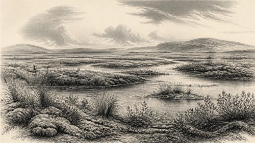
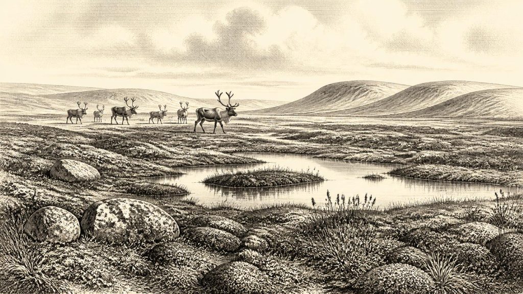
What Derryvree does illuminate is a cold, open local environment. Pollen was poorly preserved but was dominated by herbaceous types rather than woodland trees. Plant macrofossils included a notably rich collection of mosses, while insects added evidence about the character of the ground. Taken together, these remains support an interpretation of tundra or muskeg-like country: wet patches, shallow water, sedges and mosses, herbs and low vegetation, with frost shaping soils and drainage. Dryas octopetala, the mountain avens, is among the plants recorded from the deposit and remains a familiar emblem of cold, lime-rich ground.
“Tundra” should not conjure a featureless plain. The Derryvree evidence suggests varied microhabitats: waterlogged hollows, pool margins, exposed mineral surfaces and drier, sparsely vegetated ground. In a severe, strongly seasonal climate, the growing season would have been short, while frozen ground and thawing water could alter channels and slopes. There is no evidence here for the dense oak, elm and hazel forests of much later Holocene Ireland. Equally, there is no basis for saying that every part of the island looked precisely like Derryvree. Altitude, geology, drainage, distance from ice and Atlantic exposure would all have mattered.
Animals at the Edge of the Record
Southern cave deposits show that Ireland’s cold-stage fauna was more varied than the Fermanagh wetland alone can reveal. Castlepook Cave, also called Mammoth Cave, near Doneraile in north County Cork is the outstanding Irish site for mammal remains from this part of the Pleistocene. Its collections include woolly mammoth, reindeer, giant deer, brown bear, wolf, Arctic fox, lemmings and spotted hyena. The National Museum of Ireland’s collections preserve, among other material, an incomplete spotted-hyena skull from the cave. These bones make a powerful case that large herbivores and predators reached Ireland during broad pre-Last Glacial Maximum intervals.
They do not, however, supply a census for 31,788 BCE. Many of the cave bones were recovered in early excavations, before modern standards of recording sediment, position and association. Subsequent radiocarbon work has shown that some older measurements require reassessment as methods of extracting and purifying bone collagen improve. Castlepook is consequently best used as evidence for a long and episodic faunal history, roughly within the wider 45,000–30,000-years-ago span proposed for several species, not as proof that every listed animal shared the same Cork hillside on one day.
The presence of predators is nevertheless historically meaningful in the broadest sense. Hyenas, wolves and bears, together with mammoth, reindeer and deer, point to food webs unlike any in modern Ireland. Caves may have served as dens, traps for washed-in material, or places where bones accumulated through scavenging and other natural processes. Tooth marks, breakage and the choice of bones can help specialists reconstruct such processes, but do not automatically indicate hunting, human butchery or a human campsite. The animals were part of a mobile northern European fauna whose movements depended on changing climates, available vegetation and the changing geography of the Irish Sea basin.
No Demonstrable Community
There is no reliable evidence for a human community in Ireland around 31,788 BCE. Accordingly, no political affairs, leaders, alliances, warfare, diplomacy, religion, language, economy, trade network or system of learning can responsibly be assigned to this year. There are no houses, hearths, burials, tools securely dated to this horizon, or food-processing areas that would establish a human settlement. A flint flake from Mell, County Louth, is sometimes presented as Ireland’s earliest artefact, but the National Museum explains that it was made elsewhere in a far earlier period and was later transported by ice. It is not evidence for people living in Ireland at this time.
This caution also matters because claims for a very early human presence can be compellingly dramatic. Recent research at Alice and Gwendoline Cave, County Clare, has strengthened evidence for human activity in the terminal Pleistocene, around 12,700 calibrated years BP, from a butchered brown-bear patella. That is a major discovery for Irish prehistory, but it is more than twenty millennia later than the date considered here. It cannot be projected backwards to make an Upper Palaeolithic population at Derryvree or Castlepook. For 31,788 BCE, the archaeological evidence supports fauna and environment, not society.
Movement Without Trade
There was movement in this landscape, but it was animal movement rather than documented human travel or exchange. Lower sea levels and different ice conditions meant that the geography around Ireland was unlike that of today. The exposed shelf and periodically altered routes through the Irish Sea region could facilitate, obstruct or redirect dispersal. Yet the exact configuration of coasts, sea ice, land connections and ice margins changed through time and remains actively researched. The prudent conclusion is simply that Ireland was not ecologically isolated in the way it later became, as shown by the arrival of continental mammal species.
The terms “economy” and “settlement” therefore have to be used carefully. Mammoths and reindeer grazed; predators and scavengers obtained food; plants colonised wet and dry ground. These were ecological relationships, not evidence of an Irish human subsistence economy. Likewise, a cave full of bones is not a village. The nearest thing to regional change visible in the record is environmental: ice advanced and retreated, lakes and wetlands formed, vegetation shifted, and animal habitats expanded or contracted. In time, renewed glaciation would erase, bury or rework much of the evidence, helping to explain why the surviving archive is so fragmentary.
What Can Be Said Responsibly
Ireland around the broad period represented by 31,788 BCE was a place of profound climatic instability. Derryvree offers unusually direct evidence for an ice-free freshwater setting in south Fermanagh within a cold, treeless and heterogeneous landscape. Castlepook demonstrates that, over comparably ancient pre-Last Glacial Maximum phases, Ireland supported an imposing range of cold-adapted and large mammals. These sites do not prove that all regions were ice-free, that all species were contemporaries, or that people were present. Their real importance is that they replace a simple image of “Ice Age Ireland” with a more exact one: a landscape repeatedly transformed by ice, water, frost, vegetation and animal migration, long before the island’s securely documented human history began.
Primary Sources
- A reconsideration of the radiocarbon dating of the Marine Isotope Stage 3 fauna from southern Ireland
- The Irish quaternary fauna project
- New insights on the fauna of Ireland's Younger Dryas and Early Holocene from Alice & Gwendoline Cave
- The IntCal20 Northern Hemisphere Radiocarbon Age Calibration Curve (0–55 cal kBP)
- The subdivision of the Quaternary Period in Ireland
- Palaeoecology
- Exploring controls of the early and stepped deglaciation on the western margin of the British-Irish Ice Sheet
- Last Glacial Maximum cirque glaciation in Ireland and implications for reconstructions of the Irish Ice Sheet
- Dimensions and chronology of the last ice sheet in Western Ireland
- Timing and pace of ice-sheet withdrawal across the marine-terrestrial transition west of Ireland during the last glaciation
- Stratigraphic and palaeo-geomorphological evidence for the glacial-deglacial history of the last British-Irish Ice Sheet in the north-western Irish Sea
- Maximum extent and readvance dynamics of the Irish Sea Ice Stream and Irish Sea Glacier since the Last Glacial Maximum
- Prehistoric Details: Mell Flint Flake
- Spotted Hyena Skull
- Learn About: The Ice Age
- Archaeological Heritage of County Cork
- Castlepook Cave, County Cork, 2022
- Mammoth Cave
- Occurrence of mammalia relicts at site Castlepook Cave
- The Climate and Landscape of the Middle Part of the Weichselian Glaciation in Europe: The Stage 3 Project