

Derryvree’s Arctic Mosses31693 BCE
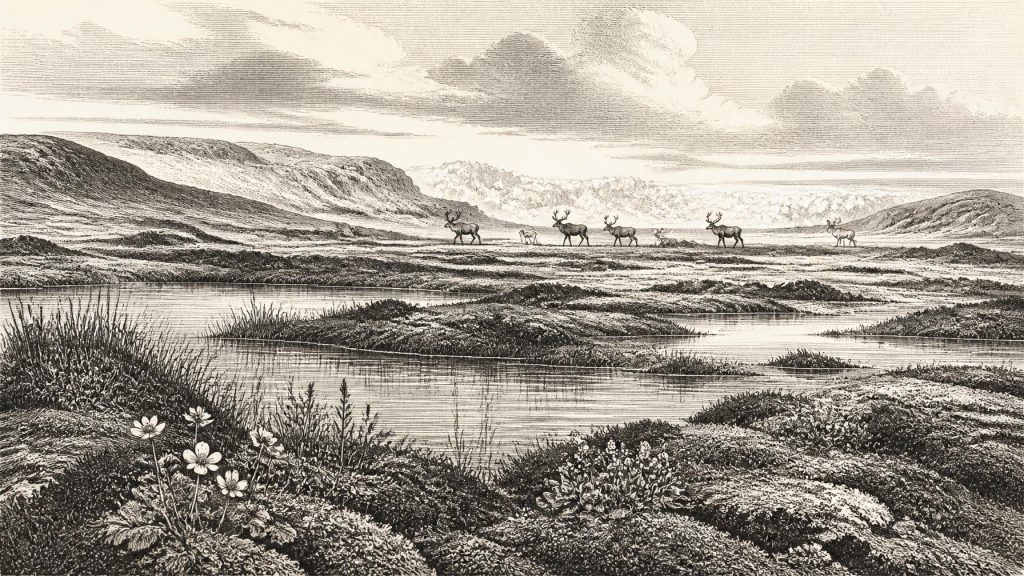
31,693 BCE denotes a broad Late Pleistocene interval, rather than a recoverable Irish year. At Derryvree, County Fermanagh, freshwater sediments between glacial tills reveal an ice-free episode with mosses, sedges, pools and sparse Arctic-alpine vegetation on treeless periglacial ground. Castlepook Cave, County Cork, preserves mixed MIS 3 animal remains, indicating connections with north-west European cold-stage ecosystems, though specimens cannot form a contemporary census. A possibly tool-marked reindeer bone raises, but does not prove, early human visitation. Expanding regional ice later overwhelmed habitats. Lower sea levels altered routes, while glaciation and coastal change destroyed evidence. Ireland was environmentally varied and uncertain.
Dateline
31,693 BCE is a modern numerical label, not a date that can be isolated in Ireland’s archaeological record. No Irish calendar, writing, named community or event survives from this depth of time. In terms used by Quaternary scientists, it falls about 33,642 calendar years before AD 1950, within the later part of the Late Pleistocene and Marine Isotope Stage 3 (MIS 3), a climatically unstable interval of the last Ice Age. The responsible history of this point is therefore a history of deposits, radiocarbon measurements and broad environmental ranges—not a narrative of a single year.
The most revealing Irish evidence belongs to spans that may overlap this nominal year. A freshwater sequence at Derryvree, near Maguiresbridge in County Fermanagh, produced a radiocarbon age of 30,500 +1,170/−1,030 radiocarbon years BP. With modern calibration, that determination covers a broad range extending from roughly the late thirty-seventh into the early thirty-second millennium calibrated BP. It cannot date a particular season, generation or event. Yet it offers an unusually direct window onto an ice-age landscape in Ireland which existed between advances of glacier ice.
A Date Between Ice Advances
At Derryvree, roadworks in 1969 cut through a drumlin and exposed a remarkable sequence: glacial till below, freshwater silts and fine sands with organic material in the middle, and a further body of till above. The order matters. Ice had occupied the locality before the freshwater sediments accumulated; later ice crossed it again and sealed the deposit beneath the drumlin. The site is thus powerful evidence for environmental change, but it does not provide a map of the whole island at 31,693 BCE.
That caution is especially important because Irish ice-sheet history was uneven. The British–Irish Ice Sheet was a changing complex of ice centres, fast-flowing outlets and marine margins, not a single static white cover. Large-scale reconstructions indicate that substantial ice was developing across the wider region by about 31,000 years BP and that maximum ice extent across Ireland and its continental shelf came later, broadly between about 27,000 and 23,000 calibrated BP. At the date considered here, local ice may already have occupied uplands and some northern sectors, while other ground supported freshwater habitats. The exact limits, thickness and timing remain matters of reconstruction rather than established facts for one calendar year.
Freshwater on a Treeless Plain
Derryvree’s organic sediments contain pollen, seeds, mosses and insect remains. Taken together, they indicate an open tundra or muskeg-like environment: wet ground rich in mosses and sedges, shallow pools, exposed mineral surfaces and sparse dry-land vegetation. This was not a landscape of oak woods, enclosed pasture or peat bogs familiar from much later Ireland. It was a periglacial world shaped by long cold seasons, frost action and a short productive summer.
Macrofossils provide some of the clearest clues. They include bogbean, Menyanthes trifoliata, and mountain avens, Dryas octopetala, plants now associated in Ireland with wet places and Arctic-alpine conditions respectively. Mosses were exceptionally well represented. Pollen was chiefly herbaceous, including grasses and sedges, while any tree pollen is too scarce and potentially transported to demonstrate local woodland. The most defensible conclusion is not that every part of Ireland was identical, but that the Derryvree district contained cold, largely treeless ground bordering freshwater during the interval represented by the deposit.
Insects sharpen that picture. They point to waterlogged, plant-rich pools and mossy margins rather than a uniformly dry polar desert. Such places could be biologically productive during the brief growing season. Nevertheless, the environment was harsh. Frost, seasonal snow, low temperatures and limited woody vegetation restricted shelter and fuel. The freshwater beds preserve a living ecosystem, but one vulnerable to the renewed advance of ice that eventually buried it.
Animals and the Cave Record
County Cork’s Castlepook Cave, near Doneraile, supplies a different kind of evidence. Its old excavations recovered a large, mixed assemblage of animal bones from cave passages. Modern redating has shown that some specimens are substantially older than earlier radiocarbon results suggested, placing parts of the fauna in MIS 3. The cave record includes species such as reindeer, brown bear, Arctic fox, hare, lemming, wolf, spotted hyaena, giant deer and woolly mammoth. These animals should not be treated as a census of Ireland in 31,693 BCE: bones can be separated in age by thousands of years, cave deposits may have been reworked, and many finds lack the detailed stratigraphic context expected of modern excavation.
Even so, the assemblage demonstrates that Ireland was at times ecologically connected to the north-west European ice-age world. Reindeer and lemming fit open cold-country habitats. Mammoth, giant deer and hyaena indicate that, during particular pre-Last Glacial Maximum phases, larger grazing and scavenging food webs existed somewhere within reach of southern Irish caves. Re-dating suggests that spotted hyaena and giant deer may have disappeared locally before about 40,000 calibrated BP, so neither should automatically be placed in the Derryvree interval. The stronger claim is that Late Pleistocene Ireland had supported a richer and less familiar fauna than its later, post-glacial landscape.
Caves were not necessarily animal homes in the human sense. They could act as traps, dens, scavenging sites, temporary shelters and sediment basins. Bone accumulation may result from carnivores, water movement, collapse or nineteenth- and early twentieth-century collecting practices as well as from human activity. Castlepook is invaluable precisely because it preserves traces usually erased from open landscapes by later glaciation; it is also difficult evidence which requires taphonomic care.
The Human Question
The most consequential, and most uncertain, issue is a reindeer femur from Castlepook reported as bearing a cut or chopping mark consistent with a sharp stone tool. The bone has been presented as possible evidence that people butchered reindeer in Ireland around 33,000 years ago. If that interpretation is sustained, it would extend the island’s human story far beyond the formerly accepted terminal-Pleistocene evidence. It would imply a brief Upper Palaeolithic incursion, probably by highly mobile hunter-gatherers rather than a permanent and populous settlement.
But possibility is not proof of an inhabited island. The marked bone comes from older excavations, without a securely excavated living floor, hearth, stone-tool assemblage, dwelling or repeated occupation sequence attached to it. Natural damage, carnivore modification and post-depositional wear can sometimes resemble human marks, while a date on the animal establishes when it died, not automatically when a person handled it. Consequently, no responsible account can name a group, describe a hunt or claim a settlement for 31,693 BCE. The evidence supports an important research question, not an annual historical event.
There can be no discussion of Irish political affairs, diplomacy, formal warfare, religion, literacy or institutions at this date because none is evidenced. Nor is there evidence for farming, fixed villages, pottery, metalworking, long-distance trade or monumental construction. Should humans have reached Ireland during this phase, their economy would have depended on hunting, gathering and movement through a severe seasonal landscape. That is a comparative inference from Upper Palaeolithic lifeways elsewhere in north-west Europe, not a directly demonstrated Irish social system.
Coasts, Routes and Lost Ground
Modern Ireland was not the map experienced by Ice Age animals or any visiting people. Global sea level was lower than today, but the surrounding palaeogeography was complicated by local ice loading, changing coastlines and the deep basins of the Irish Sea. It is unsafe to imagine a simple, continuous land bridge from Ireland to continental Europe. Some exposed shelf ground and narrower sea crossings may have altered routes at different times, yet the availability of a route does not demonstrate that it was used.
Much potential evidence has also vanished. Advancing ice eroded older soils and surface camps; later meltwater, rising seas and coastal processes removed or submerged landscapes. The survival of Derryvree’s buried wetland and Castlepook’s cave bones is therefore exceptional. Their fragmentary nature should not be mistaken for insignificance. They record the ecological setting from which Ireland’s later human history ultimately emerged: a cold, mobile and frequently disrupted world, in which water, vegetation, animals and ice were the principal historical forces.
What Can Be Said Responsibly
Around the broad interval denoted by 31,693 BCE, Ireland lay within a volatile late-Ice-Age environment before the full island-wide maximum of the last glaciation. At Derryvree, freshwater, sedges, Arctic-alpine plants and mosses occupied open periglacial ground during an ice-free interval. In southern caves, an assemblage of cold-stage and large mammal remains attests to ecological links beyond the modern island. Ice was advancing on a regional scale and would eventually transform or destroy many of these habitats.
That is already a major development in Irish history. It replaces the false image of a timeless, empty, uniformly frozen island with a better evidenced picture: Ireland contained changing ecological refuges and corridors, though their extent shifted dramatically. Whether people briefly entered that world remains unresolved. The archaeological task is not to fill the silence with invented clans or episodes, but to preserve the distinction between what the sediments and bones show, what they plausibly suggest, and what remains unknown.
Primary Sources
- A Middle Midlandian Freshwater Series at Derryvree, Maguiresbridge, County Fermanagh, Northern Ireland
- Palaeoecology: The Middle Midlandian Palaeoenvironment of South Fermanagh
- The Subdivision of the Quaternary Period in Ireland
- Irish Pleistocene Biostratigraphy
- A Reconsideration of the Radiocarbon Dating of the Marine Isotope Stage 3 Fauna from Southern Ireland
- The Irish Quaternary Fauna Project
- Heritage Artefacts of County Cork 2021
- Archaeology Research Excavation Grant Report: Castlepook Cave Project
- Growth and Retreat of the Last British–Irish Ice Sheet, 31,000 to 15,000 Years Ago: the BRITICE-CHRONO Reconstruction
- Growth and Retreat of the Last British–Irish Ice Sheet, 31,000 to 15,000 Years Ago: the BRITICE-CHRONO Reconstruction
- Maximum Extent and Dynamic Behaviour of the Last British–Irish Ice Sheet West of Ireland
- Ireland: Submerged Prehistoric Sites and Landscapes
- Ireland: Submerged Prehistoric Sites and Landscapes
- The IntCal20 Northern Hemisphere Radiocarbon Age Calibration Curve (0–55 cal kBP)
- The IntCal20 Northern Hemisphere Radiocarbon Age Calibration Curve (0–55 cal kBP)
- New Insights on the Fauna of Ireland’s Younger Dryas and Early Holocene from Alice & Gwendoline Cave
- New Insights on the Fauna of Ireland’s Younger Dryas and Early Holocene from Alice & Gwendoline Cave
- Phylogeographic, Ancient DNA, Fossil and Morphometric Analyses Reveal Ancient and Modern Introductions of a Large Mammal: the Complex Case of Red Deer in Ireland
- Ancient Hybridization and an Irish Origin for the Modern Polar Bear Matriline
- The Last Scottish Ice Sheet
- Late Pleistocene Sediments, Landforms and Events in Scotland: a Review of the Terrestrial Stratigraphic Record
- Dryas octopetala L.
- Menyanthes trifoliata L.