Arctic Sandwort31661 BCE
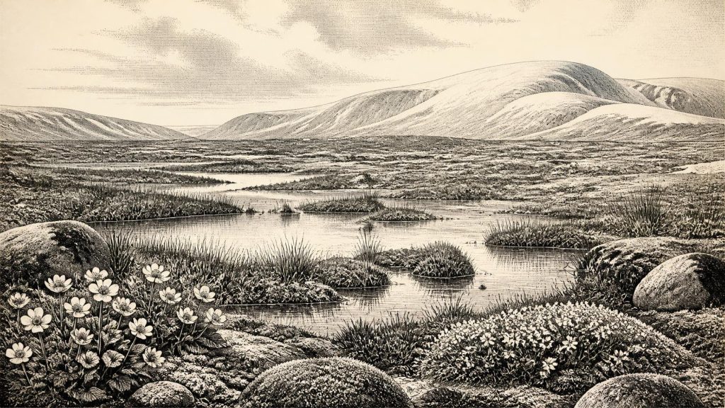
Around 31,661 BCE, Ireland lay within the climatically unstable Late Pleistocene, but the date is only a broad modern approximation. At Derryvree, County Fermanagh, freshwater sediments beneath glacial till preserve tundra-like wetlands with Arctic sandwort, mountain avens, mosses, sedges and shallow pools, formed before renewed ice advance. Cave deposits, especially Castlepook in Cork, record Ice Age fauna including mammoth, reindeer, giant deer, predators and lemmings, though not as one contemporaneous community. A marked reindeer bone may indicate human butchery, but cannot establish settlement or continuous occupation. Evidence reveals changing environments and animals, not identifiable societies, politics, routes or annual events.
Dateline
“31,661 BCE” is a modern label imposed on a time far beyond written history. No community in Ireland recorded a year, season, ruler or event by which this point can be fixed. In archaeological terms it falls approximately 33,600 calibrated years before present, where “present” conventionally means AD 1950, but that conversion must not suggest false precision. At this depth of time, radiocarbon measurements have substantial uncertainties, calibration produces ranges rather than exact dates, and deposits often record prolonged episodes. The responsible subject is therefore Ireland during a broad span around this nominal year, not an invented event in one calendar year.
That span belongs to the Late Pleistocene, within Marine Isotope Stage 3 (MIS 3), a climatically unsettled interval of the last Ice Age. Ireland’s evidence is exceptionally fragmentary. It consists chiefly of sediments, fossil plants and insects, cave bones, landforms and chemical dates. It does not provide a named population, a settlement plan, a political boundary or a continuous human story. Yet one freshwater deposit beneath a drumlin in County Fermanagh offers an unusually vivid, if local, view of the sort of Irish environment that existed during part of this period.
A Wetland Beneath the Drumlin
In 1969 road works cut through a drumlin at Derryvree, near Maguiresbridge in south Fermanagh. Beneath later glacial deposits, investigators found silts and fine sands laid down in freshwater, sandwiched between two thick tills. The sequence matters because the upper till demonstrates that ice later crossed the locality, while the intervening organic-rich beds preserve a landscape that existed before that renewed advance. A conventional radiocarbon determination of 30,500 +1,170/−1,030 years BP from the deposit has subsequently been expressed as a broad calibrated range of roughly 31,700–36,900 cal BP. The nominal year in this article falls within that wide interval, but cannot be matched to a particular layer, day or generation at Derryvree.
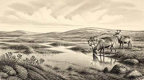
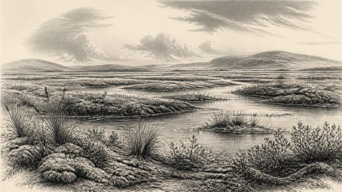
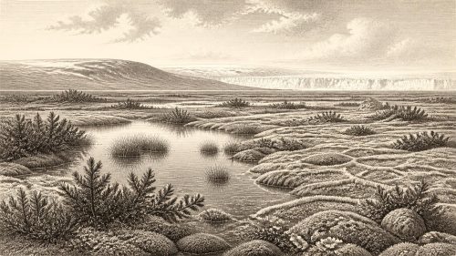
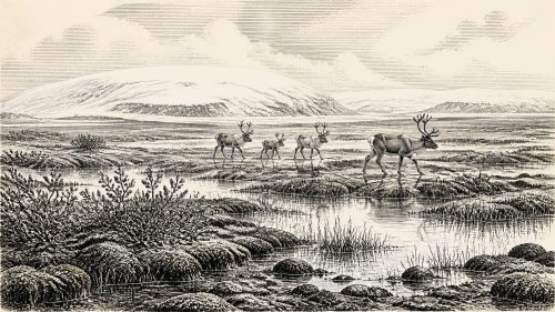
The recovered evidence points to an open, cold and periglacial environment: ground shaped by repeated freezing and thawing near an ice margin, rather than a familiar green and wooded Ireland. Pollen was poorly preserved, but it was mainly herbaceous. Plant macrofossils and mosses included species associated with cold northern or alpine habitats. Fossil records from the deposit include mountain avens (Dryas octopetala), Arctic sandwort (Arenaria ciliata) and bogbean (Menyanthes trifoliata). Sedges, moss-rich ground and patches of shallow water formed a wetland mosaic. The original investigators compared it to muskeg: waterlogged, organic ground broken by pools, not a uniform lake or a simple grassland.
This was not necessarily bleak in every sense. During the brief growing season, wet ground could support specialised plants, insects and grazing animals. But it was a landscape of exposure, frost, short summers and sparse dry-ground cover. Trees were either absent locally or too scarce to form woodland. Occasional pollen grains of pine or hazel do not overturn that conclusion; they may have travelled far on the wind or derived from reworked material. The evidence supports tundra-like vegetation around the wetland. It does not license an exact reconstruction of the whole island’s plant cover, still less a weather report for 31,661 BCE.
Ice, Water and Uncertain Coasts
At this date Ireland stood in the long approach to the Last Glacial Maximum, not necessarily at its coldest or most extensively ice-covered moment. The maximum phase came later, principally during MIS 2. Earlier ideas of a single, simple advance have been replaced by a picture of a dynamic British–Irish Ice Sheet, growing and retreating in response to repeated climatic shifts. Recent synthesis suggests that ice may have developed substantially before the global maximum, including advances and retreats during MIS 3; the precise extent of ice over Ireland at any one time remains debated because securely dated pre-maximum till is rare.
Derryvree therefore proves something important but limited. It demonstrates that this part of Fermanagh was ice-free long enough for a freshwater deposit and its living community to form before later ice buried it. It does not prove that all Ireland was simultaneously ice-free, nor that its coasts, mountains and western lowlands experienced identical conditions. Crag Cave in County Kerry supplies a complementary clue: episodes of calcite growth in the cave during MIS 3 required liquid water and conditions not persistently below freezing. Together, cave calcite and buried wetland sediments show climatic oscillation rather than a single unchanging frozen landscape.
Lower global sea levels altered the geography of the Irish region, exposing parts of the continental shelf and changing the size and configuration of coastal plains. Whether a particular route between Ireland, Britain and continental Europe was dry, marine, marshy or obstructed by ice depended on the phase in question. The safe conclusion is that the island’s ecological connections were different from those of the modern Irish Sea. There is no evidence, however, for a mapped route, a regular crossing system or a maritime economy in Ireland at this time.
The Cave-Animal Record
Southern Irish caves preserve another kind of evidence. Castlepook Cave, near Doneraile in north County Cork, is Ireland’s richest known pre-Last Glacial Maximum vertebrate archive. Excavations between 1904 and 1918 recovered more than 2,000 bones from passages given evocative names including Hyaena Hall and Elephant Hall. The fauna includes woolly mammoth, reindeer, giant deer, brown bear, wolf, Arctic fox, lemmings and spotted hyaena. Direct dates from individual bones extend across a long interval, broadly from about 45,700 to 19,950 radiocarbon years BP.
Those bones establish that Ice Age animals occupied parts of Ireland at different times during the last cold stage. They do not show that every listed species shared one valley in 31,661 BCE. Cave deposits accumulate slowly and irregularly; carnivores carry in prey, water moves sediment, and later excavation can disturb relationships between finds. Improved ultrafiltration methods have also shown that several older Irish cave radiocarbon determinations were inaccurate, with some Castlepook samples returning dates thousands of years older than their earlier measurements. The lesson is methodological as well as historical: a cave collection must be read bone by bone, context by context.
Even so, the animal record makes the Derryvree wetland intelligible within a wider Ice Age world. Reindeer and lemmings are consistent with open, cold habitats; hyaenas, wolves and bears indicate large-ranging carnivores and complex food chains; mammoth and giant deer speak to the intermittent presence of large herbivores. These were not domestic herds or managed game. There is no evidence for farming, herding, field boundaries, crop cultivation or permanent animal ownership. The economy visible in the fossils is ecological, not agricultural.
A Possible Human Trace
The most arresting, and most disputed in implication, item is a reindeer femur from Castlepook. County Cork heritage material describes a deep mark on it as consistent with the use of a sharp stone implement during butchery, and presents the bone as dating to about 31,000 BCE. If the mark is correctly identified as human-made and contemporary with processing of the fresh carcass, it would be evidence that people reached Ireland in the Upper Palaeolithic, vastly earlier than the well-established post-glacial archaeological record.
That proposition must be stated narrowly. The femur is not a settlement. No securely associated hearth, stone-tool assemblage, dwelling floor, burial, human bone, food-preparation area or stratified occupation surface of comparable age has been identified in Ireland. Its cave context is difficult, and the date of the animal does not automatically date the modification, identify the person who made it, or tell where the reindeer was killed. A single marked bone can support the possibility of carcass processing; it cannot demonstrate a resident population, continuous occupation or a named culture.
It is consequently unsafe to call any possible visitors “Irish” in an ethnic, linguistic or political sense. They cannot be assigned to later Gaelic, Celtic or tribal identities. Nor can an Irish Gravettian or Aurignacian community be inferred merely because such cultural traditions are known elsewhere in Europe. People on the European mainland and in Britain used sophisticated stone technologies and, in some regions, made art and ornaments during the Upper Palaeolithic; that is valuable context, not evidence that equivalent objects or practices existed in Ireland.
No Polities, No Proven Diplomacy
Political affairs, warfare and diplomacy leave no trace here because there is no evidence for states, chiefs, territories, treaties or organised armed conflict in Ireland around this horizon. A small, mobile hunting party—if one was present—would have organised food-sharing, movement and care within a social group, but this is a general inference from human lifeways, not a documented Irish institution. The same restraint applies to religion and learning. There are no Irish monuments, burials, images, ritual deposits, writing systems or formal teaching places that can be securely dated to this period.
What can responsibly be said about everyday life is conditional. Any people who briefly entered this cold landscape would have needed seasonal knowledge: where animals moved, where water remained available, how weather affected travel, and how to manage clothing, fire and stone tools. Reindeer, if hunted or scavenged, could have provided meat, hides, sinew and bone. Yet none of these uses is directly demonstrated at Derryvree or Castlepook. There is equally no direct evidence for exchange between groups. The broad north-west European setting makes mobility plausible; Irish evidence does not reveal its scale or direction.
A Landscape More Durable Than Memory
The chief development around 31,661 BCE was environmental, not political: an unstable Ice Age landscape in which wetlands, tundra vegetation, animal corridors and expanding ice repeatedly rearranged the possibilities for life. Later glaciation destroyed, buried or reworked much of the record, helping to explain why the human past is so much harder to see than the geological past. Derryvree’s plants preserve an interval when cold freshwater habitats endured beneath an ultimately transient sky; Castlepook’s bones preserve animal lives drawn into a cave over millennia.
For Ireland at this remote point, the honest history is therefore one of evidence and limits. There may have been a human encounter with a reindeer carcass in the broader period. There certainly were changing cold-stage environments and Ice Age animals. But there were no recoverable annual events, no known leaders and no demonstrable society from which to write a conventional chronicle. The Arctic sandwort beneath the Fermanagh drumlin is more eloquent than any imagined king: a small fossil witness to an Ireland still being remade by frost, water and ice.
Primary Sources
- A Middle Midlandian Freshwater Series at Derryvree, Maguiresbridge, County Fermanagh, Northern Ireland
- Palaeoecology
- Quaternary Deposits and Glacial Stratigraphy in Ireland
- Irish Pleistocene Biostratigraphy
- The Irish Quaternary Fauna Project
- A Reconsideration of the Radiocarbon Dating of the Marine Isotope Stage 3 Fauna from Southern Ireland
- Episodic Speleothem Deposition Tracks the Terrestrial Impact of Millennial-Scale Last Glacial Climate Variability in SW Ireland
- The Timing and Magnitude of the British–Irish Ice Sheet Between Marine Isotope Stages 5d and 2
- Growth and Retreat of the Last British–Irish Ice Sheet, 31,000 to 15,000 Years Ago: the BRITICE-CHRONO Reconstruction
- BRITICE-CHRONO Maps and GIS Data of the Last British-Irish Ice Sheet 31 to 15 ka
- Spatio-Temporal Dynamics of Speleothem Growth and Glaciation in the British Isles
- Castlepook Cave: County Geological Site Report
- Heritage Artefacts of County Cork
- Karst of Ireland
- Geological Heritage Audit Report: County Cork
- New Insights on the Fauna of Ireland’s Younger Dryas and Early Holocene from Alice & Gwendoline Cave
- New Data on the Last Glacial Maximum in Great Britain and Ireland
- Dynamic Cycles, Ice Streams and Their Impact on the Extent, Chronology and Deglaciation of the British-Irish Ice Sheet
- Pleistocene Glacial History of the NW European Continental Margin
- The Mesolithic in Ireland: When Was It?