
Maguirebridge’s Moss Basin31613 BCE
Around 31,613 BCE, Ireland experienced a fluctuating Ice Age environment during Marine Isotope Stage 3. Derryvree, near Maguiresbridge, preserves freshwater sediments between glacial tills, showing temporary ice-free Fermanagh with treeless tundra, mossy wetlands, grasses, sedges and juniper. Crag Cave records intermittent milder episodes within the wider cold phase. Southern caves, especially Castlepook, demonstrate recurring presence of mammoth, reindeer, giant deer, predators and other cold-adapted animals, although their deposits are not contemporaneous. A possibly cut-marked reindeer bone suggests, but cannot confirm, human activity. Later ice-sheet expansion reshaped Ireland, leaving environmental evidence fragmentary and no secure evidence for settlement, society or trade.
Dateline
A label such as 31,613 BCE is useful for arranging a long chronology, but it cannot identify an event in Ireland that happened in a particular year. No calendar, writing, named community or dated human occupation survives from this depth of time. On simple modern arithmetic the label sits about 33,560 years before AD 1950; archaeology, however, works here with broad and revisable ranges rather than with single years. The best Irish evidence is the organic deposit at Derryvree, near Maguiresbridge in County Fermanagh. Its calibrated radiocarbon range, about 31.7–36.9 thousand calendar years before present, encompasses this notional date. It offers a rare, local glimpse of an Ice Age landscape, not an annual chronicle.
A Cold-Phase Landscape
The period belongs to the later part of Marine Isotope Stage 3, an unstable interval within the last glacial cycle, known in Irish usage as part of the Midlandian cold stage. This was not the Last Glacial Maximum itself. The island would later be far more extensively overridden by the British–Irish Ice Sheet, but around the broad Derryvree interval there were ice-free parts of Ireland capable of supporting cold-adapted plants and animals. The important qualification is regional variation: the precise position, thickness and behaviour of ice changed through time, and evidence from one valley cannot furnish a weather report for the whole island.
At Derryvree, roadworks in 1969 exposed a drumlin section with freshwater silts and fine sands trapped between two substantial sheets of glacial till. The lower till records an earlier advance of ice; the upper one shows that ice later returned. Between them is a short-lived archive of conditions when the basin held water and accumulated sediment instead of being occupied by glacier ice. The deposit’s conventional radiocarbon determination, Birm-166, was 30,500 radiocarbon years before present, with a wide laboratory uncertainty. Calibration is essential because radiocarbon years and calendar years are not interchangeable. Modern calibration work therefore expresses the age as a range, not as an exact conversion to 31,613 BCE.
That stratigraphic position is the central historical fact. Ireland was neither a timeless white wilderness nor a stable, wooded country. It was a place repeatedly altered by glacial advance, meltwater, frost and sediment movement. The survival of the Derryvree silts is exceptionally fortunate: later ice reshaped much of Ireland and commonly removed, mixed or buried older surfaces. Consequently, the apparent scarcity of evidence should not be mistaken automatically for proof that cold-stage landscapes were empty of life.
Wet Ground Under Open Skies
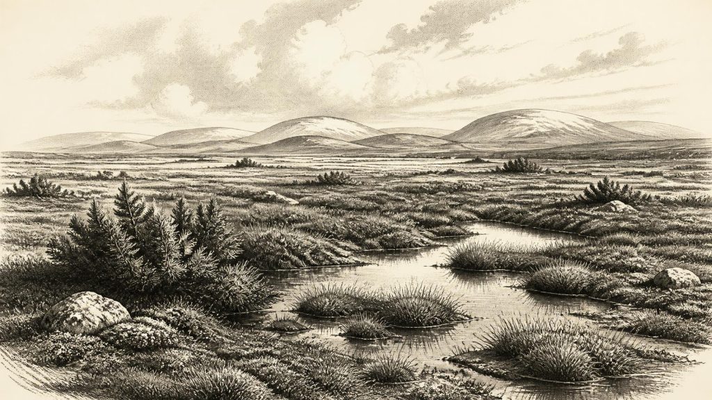
The Derryvree samples contain pollen, plant remains and insects that point to treeless tundra and a periglacial regime. Grasses, sedges, juniper and herb pollen, alongside mosses and aquatic or wet-ground plants, indicate an open mosaic rather than forest. The term muskeg, used by the original investigators, conveys waterlogged, peat-forming ground with mossy surfaces and shallow pools. It should not conjure a modern Canadian scene transplanted unchanged to Fermanagh; it is a useful ecological comparison for saturated, cold terrain rich in plant matter.
Such a setting would have been seasonal and difficult. Frozen ground, snow cover and bitter winters constrained plant growth, while the short growing season made sheltered wet places disproportionately valuable. In summer, meltwater and local drainage could sustain sedges, mosses and low herbs; in other seasons the same ground could be frozen, snowbound or churned by frost. The evidence establishes broad habitat, not the precise temperature, rainfall or appearance of an individual year. Estimates of climate must remain interpretations derived from biological indicators, sedimentary context and comparison with other northern records.
Crag Cave in County Kerry adds a second, differently formed line of evidence. Its calcite formations grew only intermittently during Marine Isotope Stage 3, when liquid water could percolate through the cave system. Uranium-thorium dates link these episodes broadly to North Atlantic climatic oscillations recorded in Greenland ice. This does not mean that a specific Greenland interstadial can be assigned with certainty to every Irish deposit. It does demonstrate that Ireland’s climate responded to abrupt, millennial-scale changes, and that warmer intervals within an overall glacial world could make a material difference to landscapes at the Atlantic edge.
Animals, Caves and Caution
Southern Irish caves preserve the other major body of evidence. Castlepook Cave, near Doneraile in north County Cork, has yielded remains of woolly mammoth, reindeer, giant deer, brown bear, wolf, foxes, hare, lemmings and spotted hyaena. Together they show that parts of Ireland supported a richer cold-stage fauna than its later historical wildlife would suggest. Reindeer and lemmings are particularly compatible with open, cold habitats; hyaenas and mammoths underline Ireland’s connection to the wider north-west European Pleistocene fauna.
Yet Castlepook is not a neatly sealed village deposit, nor are all its bones contemporary. Much material was recovered in early twentieth-century excavations, when recording methods did not meet present standards. Caves accumulate remains through scavenging, carnivore denning, natural deaths, sediment movement and excavation disturbance. Recent redating has shown that several older radiocarbon results from southern Irish caves were unreliable and that some Castlepook animals were substantially older than previously thought. The assemblage is therefore powerful evidence for recurring animal presence during Marine Isotope Stage 3, but it cannot establish that every listed species stood together in Cork in the notional year 31,613 BCE.
A reindeer femur from Castlepook has been reported as bearing a deep mark interpreted as a stone-tool cut made during carcass processing. If that interpretation is confirmed, it would be an extraordinarily early indication of people in Ireland. It is not, however, a licence to populate the country with a settled hunting society. The bone has no accompanying stone-tool assemblage, hearth, dwelling, human remains or securely excavated occupation floor. Nor does a date for the animal’s bone necessarily date the alleged cut precisely. Natural damage and carnivore action can complicate surface-mark analysis. The responsible conclusion is that the femur raises a serious and important possibility of human activity, while the evidence remains too slight to describe a confirmed population at this date.
No Polities, No Proven Trade
There is no basis for political history in Ireland at this horizon. Archaeology supplies no chiefs, territories, assemblies, alliances, conflicts between human groups or diplomacy. Equally, there is no Irish evidence for religion, burial rite, art, language, formal learning or social rank. The silence is not an invitation to fill the landscape with imagined clans and rituals. It reflects both the fragility of evidence from mobile hunter-gatherers and the destruction wrought by later glaciation.
Economy and trade must be framed just as cautiously. If people entered Ireland, they may have practised short-term, highly mobile hunting and carcass processing, as groups elsewhere in glacial north-west Europe did. Reindeer would have offered meat, hide, sinew, bone and antler; other large mammals were potential resources. But these are general possibilities, not demonstrated Irish activities. No contemporary worked flint, weapon point, butchered assemblage in secure context, imported material or exchange route has been recovered for this specific interval. It is safer to describe a potentially usable animal landscape than an Irish hunting economy.
Nor should the sea be treated as a settled fact. Lower global sea levels exposed broad shelves around north-west Europe, and later modelling indicates land connections between Ireland and Britain during portions of the last glacial period. The exact routes, dates and practical passability of crossings depended on sea level, ice extent, terrain and seasonal conditions. Whether animals and any people reached the island over exposed ground, ice, narrow water gaps or a changing combination of these remains an open geographical question. Evidence of fauna proves arrival, but does not reveal the route.
Regional Change Before the Ice Maximum
The most important development around this notional year was environmental rather than political: an ice-free, periglacial interval was preserved within a landscape bookended by glaciation. Derryvree shows that freshwater pools, mossy wet ground and tundra plants occupied part of Fermanagh. Castlepook and other cave sites show that cold-adapted mammals repeatedly reached Ireland during the broader period. Crag Cave suggests that climatic ameliorations could register even in the island’s karst systems. Together these records replace an outdated picture of a uniformly lifeless Ireland before the final great ice expansion.
They do not make Ireland continuously habitable or continuously inhabited. Subsequent growth of the British–Irish Ice Sheet transformed the island again, at its greatest extent covering most of it and eroding many older landscapes. What can responsibly be said for 31,613 BCE is therefore modest but significant: Ireland lay within a dynamic North Atlantic Ice Age world; at least some ground was open and wet rather than buried beneath ice; tundra biota occupied it; and rare deposits now allow that vanished environment to be studied. The human story, if there was one, remains a question being tested rather than a chapter securely written.
Primary Sources
- A Middle Midlandian Freshwater Series at Derryvree, Maguiresbridge, County Fermanagh, Northern Ireland
- Irish Pleistocene Biostratigraphy
- The Irish Quaternary Fauna Project
- A Reconsideration of the Radiocarbon Dating of the Marine Isotope Stage 3 Fauna from Southern Ireland
- Episodic Speleothem Deposition Tracks the Terrestrial Impact of Millennial-Scale Last Glacial Climate Variability in SW Ireland
- Quaternary Deposits and Glacial Stratigraphy in Ireland
- Growth and Retreat of the Last British–Irish Ice Sheet, 31,000 to 15,000 Years Ago: the BRITICE-CHRONO Reconstruction
- BRITICE-CHRONO Maps and GIS Data of the Last British-Irish Ice Sheet 31 to 15 ka
- Dimensions and Chronology of the Last Ice Sheet in Western Ireland
- The Island of Ireland: Drowning the Myth of an Irish Land-Bridge?
- The Problem of a Late Quaternary Landbridge Between Britain and Ireland
- The IntCal20 Northern Hemisphere Radiocarbon Age Calibration Curve (0–55 cal kBP)
- First Evidence of a Late Upper Palaeolithic Human Presence in Ireland
- New Insights on the Fauna of Ireland’s Younger Dryas and Early Holocene from Alice & Gwendoline Cave
- Heritage Artefacts of County Cork
- Archaeological Heritage of County Cork
- Castlepook Cave, Co. Cork: 2022 Excavation
- The Mesolithic in Ireland: When Was It?
- Figure 6—The Subdivision of the Quaternary Period in Ireland
- Quaternary Site Descriptions
- The Geology of the Irish Sea: UK Offshore Regional Report
- Ireland’s Palaeolithic Archaeology – Fleeting Footprints in a Frozen Land
