
Derryvree’s Tundra Lake31574 BCE
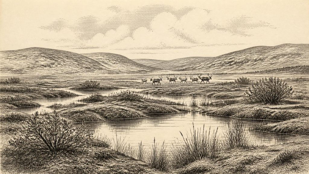
Around 31,574 BCE, Ireland was entering an increasingly cold, unstable phase before the Last Glacial Maximum, not yet entirely ice-covered. Organic deposits beneath later glacial tills at Derryvree, County Fermanagh, preserve evidence of an ice-free freshwater tundra landscape, with sedges, mosses, Arctic-alpine plants and shallow pools. Greenagho provides comparable pre-glacial evidence. Southern caves, notably Castlepook in County Cork, contain remains of cold-stage mammals including reindeer, mammoth and hyaena, though their dates are not necessarily contemporary. A possibly cut-marked reindeer bone suggests an unconfirmed early human visit. Glacial erosion has severely limited surviving evidence, preventing detailed accounts of society or events.
Dateline
31,574 BCE is a modern calendar label, not a year for which the Irish archaeological record can identify an event, ruler, migration or battle. At this depth of time, precision comes from scientific dating ranges rather than from an annual chronology. In conventional archaeological terms, the label falls roughly 33,500 years before AD 1950, the reference point used for “cal BP” dates. It belongs to the later part of the Pleistocene, within Marine Isotope Stage 3, and before the Last Glacial Maximum, when the British–Irish Ice Sheet covered Ireland far more extensively. The responsible historical question is therefore not “what happened in Ireland that year?” but what evidence can illuminate the island during the climatic interval into which it falls.
Before the Great Ice
Ireland was not yet the uniformly ice-covered land of the glacial maximum. Research synthesising organic deposits beneath later tills indicates that substantial parts of the island remained ice-free until about 34,000–32,000 years ago, although conditions and ice margins varied sharply between regions. The subsequent growth of the last Irish Ice Sheet was prolonged and uneven: its advance towards offshore limits occurred over thousands of years, not in a single sudden freeze. The peak phase generally belongs later, approximately 27,000–23,000 calibrated years BP around Ireland’s margins. Thus the calendar label 31,574 BCE should be placed near a threshold: a cold, unstable world in which the landscape was becoming increasingly vulnerable to glaciation, rather than an already featureless island-wide ice cap.
This matters because later ice was an extraordinarily effective destroyer and rearranger of evidence. Glaciers eroded ground surfaces, redeposited sediment and buried earlier landforms beneath till. The scarcity of Irish sites from this era is therefore not proof that nothing happened; it is partly a record of poor survival and difficult discovery. Caves, protected sediment lenses and deposits trapped beneath glacial material are unusually valuable precisely because they preserve fragments of landscapes that later ice might otherwise have removed. The history of Ireland at this date is consequently reconstructed from pollen, seeds, mosses, insects, animal bone, sedimentology and radiocarbon measurements, rather than from buildings or written testimony.
A Wetland Beneath a Drumlin
The clearest environmental window is Derryvree near Maguiresbridge in County Fermanagh. Road works there exposed organic silts and fine sands sealed between two thick till sheets within a drumlin. The deposit produced the radiocarbon determination Birm-166, 30,500 radiocarbon years BP with a substantial uncertainty. Calibration does not turn that result into a single calendar year; instead, it places the deposit broadly within a late Middle Midlandian cold interval, and later syntheses treat it as evidence for ice-free conditions before the last major ice-sheet advance. It is close enough in age to the nominal date under discussion to provide a meaningful local guide, while still requiring caution about its broad chronological margins.
The Derryvree sediments indicate a freshwater setting in open, treeless terrain under a periglacial climate. Their botanical record includes sedges, mosses and cold-adapted plants such as mountain avens, dwarf willow and Arctic-alpine herbs; aquatic and wetland species show that standing or slow-moving water lay among the open ground. This was not a modern bogland and not a forested Ireland. A more useful image is a low, wet basin with sedgy margins, patches of moss, shallow pools and sparse vegetation exposed to long cold seasons. Such deposits record plants growing locally or near-locally, but they cannot tell us whether a particular pool was frozen on any given winter day, nor can they describe the entire island from one Fermanagh locality.
Greenagho, near Belcoo in the same county, supplies an important comparison. Organic material from lacustrine deposits beneath till has yielded a very early radiocarbon age, conventionally understood as showing that north-central Ireland had ice-free episodes before the final expansion of the Irish Ice Sheet. Together, Greenagho and Derryvree warn against treating “Ice Age Ireland” as a single climatic condition. Lakes, wet hollows and tundra vegetation could exist in one phase, only to be overridden, buried or transformed as ice later accumulated. Regional change was driven by climate and ice dynamics, not by political frontiers or human land management.
Animals and Open Country
Southern Irish caves, especially Castlepook Cave or Mammoth Cave near Doneraile in north County Cork, reveal that the wider late Pleistocene landscape supported a striking fauna during Marine Isotope Stage 3. The cave collections include remains attributed to reindeer, woolly mammoth, giant deer, brown bear, wolf, Arctic fox, lemmings and spotted hyaena. Castlepook is especially significant because it is Ireland’s principal site for last-cold-stage mammal remains and the only known Irish locality for spotted hyaena. These animals do not all demonstrate a single, perfectly synchronous community at 31,574 BCE: many bones came from early twentieth-century excavations, and deposits or collections were disturbed or mixed. They do, however, show that Ireland was periodically part of a wider north-west European world of cold-climate mammals.
Recent redating has made the cave evidence both more valuable and more complicated. Improved pretreatment of bone samples showed that several older Castlepook radiocarbon determinations were unreliable and that some fauna belonged much earlier in Marine Isotope Stage 3 than previously supposed. Giant deer and spotted hyaena may have disappeared locally before about 40,000 calibrated years BP. Reindeer, however, are well suited to the open, cold environments indicated by the Fermanagh sediments, and their presence in Irish Pleistocene assemblages is secure. The sound interpretation is not that a mammoth, hyaena and reindeer certainly shared one view at the nominal date, but that fluctuating cold-stage habitats repeatedly allowed large grazers, browsers and carnivores to occupy parts of Ireland.
The Human Question
A reindeer femur from Castlepook has made this period unusually important for Irish prehistory. Zooarchaeological examination has interpreted a deep mark on the bone as damage from a sharp stone implement used in butchery, and the bone has been publicly associated with an age of about 33,000 years ago. If that interpretation is confirmed, it would indicate a brief human presence in Ireland tens of millennia earlier than the long-accepted terminal-Pleistocene evidence from Alice and Gwendoline Cave in County Clare. Yet it is not a settlement site: there is no securely associated hearth, stone-tool assemblage, dwelling floor, human bone or occupation layer. The animal’s date and the diagnosis of the surface mark are separate questions, and the old cave collection has limited contextual control.
Accordingly, it would be irresponsible to describe Ireland in 31,574 BCE as inhabited, colonised or populated. At most, Castlepook raises the serious possibility that one or more people reached the island and processed an animal during this broad interval. Such a visit could have been brief and left almost no durable trace. Current excavation and survey work at the cave seeks surviving deposits that may connect the museum collection to a clearer stratigraphy, environmental samples and new dates. Until corroborating evidence appears, the bone is best treated as an important claim under investigation rather than as a foundation for a detailed story of Irish Palaeolithic society.
What Cannot Be Recovered
There is no evidence from Ireland at this time for political communities, leaders, warfare, diplomacy, permanent villages, farming, formal religion, monuments, art or learning in the sense of a transmissible written tradition. Nor can archaeologists reconstruct households, language, kinship rules, clothing or seasonal routes. If people were present, they would have depended on hunting, scavenging and expert movement through a cold landscape, as Upper Palaeolithic groups elsewhere in Europe did; but that is a wider comparative inference, not an observation from an Irish camp. No Irish evidence currently supports claims for a named people, an organised trading network or a religious practice in this interval.
Even Ireland’s physical connectedness must be phrased carefully. Lower global sea levels altered coasts and the Irish Sea basin, while animal movements prove that barriers could sometimes be crossed. But the routes remain uncertain: changing sea level, ice, short sea crossings, islands and seasonal conditions all complicate any simple “land bridge” picture. Faunal colonisation establishes ecological connection at particular times; it does not demonstrate an easy, continuous path for people in the year named by a modern calendar.
A Landscape of Evidence
The most historically meaningful development around 31,574 BCE was environmental, not political: Ireland stood within the long transition towards full glaciation. Derryvree preserves wet tundra beneath a later drumlin; Greenagho records another pre-glacial freshwater world; Castlepook preserves the fragmentary remains of a changing cold-stage fauna and a contested hint of human butchery. Together they reveal an island of open ground, wet basins and mobile animals, intermittently connected to neighbouring lands and poised before the major advance of the last ice sheet. They also demonstrate the discipline required by deep prehistory: evidence can illuminate landscapes and possibilities, but it cannot honestly be compressed into a year-by-year narrative of events.
Primary Sources
- A Middle Midlandian Freshwater Series at Derryvree, Maguiresbridge, County Fermanagh, Northern Ireland
- Middle Midlandian Interstadial Deposits at Greenagho, Near Belcoo, County Fermanagh, Northern Ireland
- A Reconsideration of the Radiocarbon Dating of the Marine Isotope Stage 3 Fauna from Southern Ireland
- The Irish Quaternary Fauna Project
- The Last Irish Ice Sheet: Extent and Chronology
- Trimlines, Blockfields and the Vertical Extent of the Last Ice Sheet in Southern Ireland
- Late Pleistocene Chronostratigraphy and Ice Sheet Limits, Southern Ireland
- Pattern and Timing of Retreat of the Last British-Irish Ice Sheet
- Growth and Retreat of the Last British–Irish Ice Sheet, 31,000 to 15,000 Years Ago: the BRITICE-CHRONO Reconstruction
- Archaeology Research Excavation Grant 2022: Castlepook Cave, Co Cork
- 2022:564 – Castlepook Cave, Castlepook South, Cork
- Spotted Hyena Skull
- Quaternary Site Descriptions
- Palaeoecology: Irish Quaternary Association Field Guide
- Ireland: Submerged Prehistoric Sites and Landscapes
- The Problem of a Late Quaternary Landbridge Between Britain and Ireland
- The Deglaciation of the Western Sector of the Irish Ice Sheet from the Inner Continental Shelf to its Terrestrial Margin
- New Insights on the Fauna of Ireland’s Younger Dryas and Early Holocene from Alice & Gwendoline Cave
- Advances in Irish Quaternary Studies
- Dimensions and Chronology of the Last Ice Sheet in Western Ireland