
Doneraile’s Palaeolithic Femur31575 BCE
31,575 BCE is a label for a late-Pleistocene interval, not a datable Irish event. Derryvree, County Fermanagh, preserves wetland deposits dated broadly to 36,900–31,700 cal BP, indicating treeless, cold, plant-rich terrain between glacial advances. Castlepook Cave, County Cork, contains MIS 3 remains of mammoth, reindeer, giant deer, predators and Arctic fauna, accumulated over time rather than contemporaneously. A cut-marked reindeer femur may indicate human butchery, but cannot establish settlement, chronology or continuous occupation. Lower seas may have aided movement, yet routes remain unknown. Ice expansion reshaped Ireland and destroyed sites, leaving evidence of habitats, animal movement and possible human presence.
Dateline
31,575 BCE is a modern chronological label, not a year anybody in Ireland could have named, recorded or experienced as a discrete date. On the conventional archaeological conversion it falls around 33,524 years before AD 1950, or roughly 33.5 thousand calibrated years before present (cal BP). At that depth of time, calendar-year precision is unavailable: radiocarbon results carry substantial ranges, deposits may have formed over generations or longer, and later ice has removed or disturbed much evidence. The responsible subject is therefore not an event in a particular year, but Ireland during a broad late-Pleistocene interval.
A Date Within a Range
The closest securely dated environmental evidence comes from Derryvree near Maguiresbridge, County Fermanagh. Roadworks there exposed organic silts and fine sands caught between two separate sheets of glacial till. The deposit produced a conventional radiocarbon age of 30,500 ± 1,200 radiocarbon years BP; later calibration places it broadly between about 36.9 and 31.7 thousand calendar years BP. That is a long interval by historical standards, but it encompasses the nominal date of 31,575 BCE. It establishes that, sometime within that range, freshwater and wetland conditions existed in north-central Ireland before a later ice advance sealed the evidence beneath a drumlin.
The date belongs to Marine Isotope Stage 3, a fluctuating part of the last glacial period, and to the opening stages of the growth of the last British–Irish Ice Sheet. It was not yet the Last Glacial Maximum, when ice later reached its greatest overall extent. Reconstructions of the ice sheet remain necessarily provisional at this early stage: they combine landforms, sediments, dates and numerical modelling, and are more secure for broad patterns than for a single valley in a single century. They nevertheless show an Ireland of sharp regional contrasts. Ice accumulated in northern uplands and perhaps in some south-western mountains, while parts of the lowlands retained ice-free landscapes and freshwater habitats.
Derryvree’s Cold Wetland
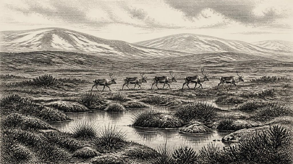
Derryvree is valuable precisely because it preserves a local world rather than an imagined national panorama. Plant remains, pollen and fossil insects point to a treeless, cold environment often described as muskeg: wet, peaty ground with pools, sedges, mosses and low-growing arctic or alpine vegetation. The record includes plants suited to shallow water and saturated ground, alongside dwarf-shrub and tundra elements. Insects reinforce the conclusion that open pools and plant-rich wetland lay amid a cold, exposed landscape. Such evidence does not give a weather report for 31,575 BCE, but it strongly supports the picture of severe winters, short growing seasons and no closed forest.
This was not necessarily a featureless snowfield. A cold-stage wetland could hold standing water in summer, provide forage for herbivores, shelter small animals among vegetation and mark a route through otherwise open terrain. Yet it was fragile in geological terms. Snow accumulation, frost action, changing drainage and advancing ice repeatedly altered the landscape. The two tills above and below the organic layer show that Derryvree was a temporary environmental window between glacial episodes, not a stable countryside enduring unchanged for millennia.
The Castlepook Animal Archive
Over 300 kilometres south-west of Derryvree, Castlepook Cave near Doneraile in north County Cork supplies the most important Irish animal archive relevant to this era. Also known as Mammoth Cave, it was excavated chiefly in the early twentieth century under the Royal Irish Academy’s cave-exploration programme. Its collections, now associated principally with the National Museum of Ireland – Natural History, contain remains of a striking Ice Age fauna: woolly mammoth, reindeer, giant deer, brown bear, wolf, Arctic fox, mountain hare, lemmings and spotted hyaena.
This list must be handled carefully. The cave was a place of accumulation over a long period, not a snapshot of one day or one community. Carnivores could drag carcass parts into galleries; animals might die naturally; water and sediment could move bones; and early excavations did not produce the stratigraphic records expected today. Modern redating has also shown that several old radiocarbon determinations from Castlepook underestimated the age of specimens, by thousands of radiocarbon years in some cases. The cave confirms that cold-adapted and open-country mammals reached Ireland during MIS 3, but it cannot demonstrate that every listed species shared precisely the same landscape at 31,575 BCE.
The hyaena evidence is especially revealing. Spotted hyaenas were not merely occasional visitors to a frozen wilderness: their bones, teeth and droppings indicate a carnivore able to exploit animal-rich open habitats. Their presence alongside mammoth and reindeer remains suggests food webs with large herbivores, predators and scavengers. It also cautions against treating caves as domestic sites. Castlepook was, at least in part, a carnivore archive. A bone from its deposits may record hunting, scavenging, transport or denning rather than a human camp.
A Single Mark and Human Possibility
The article’s title refers to a reindeer femur from Castlepook, reported as bearing a deep incision interpreted by the zoologist Ruth Carden as a cut made with a sharp stone tool on fresh bone. County Cork heritage material associates the bone with about 31,000 BC, while public accounts have described it as roughly 33,000 years old. These are useful approximations, not a licence to assign the specimen to 31,575 BCE itself. Radiocarbon dating dates the animal bone, and assessment of the mark’s origin is a separate taphonomic judgement. Neither process identifies the precise time, place or people responsible for the action.
If the incision is anthropogenic, it is potentially momentous: it would indicate that people processed a reindeer in Ireland tens of millennia before the better-established terminal-Palaeolithic evidence from County Clare. It could reflect removal of meat, hide, sinew or access to marrow; the surviving mark cannot choose among those possibilities. It also does not prove that hunters killed the animal. They might have found a carcass, butchered it elsewhere before carnivores moved the limb, or made a brief visit from a mobile group operating across wider north-west European territories.
Equally important is what has not been found. There is no securely associated hearth, stone-tool assemblage, dwelling surface, burial, art object or repeated butchered-bone concentration at Castlepook that establishes a settled population in Ireland around 33.5 ka cal BP. Consequently, it would be wrong to claim a town, tribe, kingdom or continuous ancestry from this possible encounter. The femur offers evidence for a particular action, if its interpretation is sustained by further study; it is not a foundation charter for Ireland.
Mobility Across Changing Shores
Lower sea levels exposed considerably more of the continental shelf than exists today, changing the outlines of coasts and narrowing some sea crossings. That did not automatically create a dependable land bridge between Ireland and Britain. Sea-level history depended on both global ocean volume and the uneven rise and fall of land under ice loading, while glaciers and marine channels complicated movement. Animals clearly reached Ireland during suitable intervals, and people could in principle have followed similar routes, whether over exposed ground, short crossings or a mixture of both. The exact route is not known.
There is no basis for describing trade, diplomacy or organised conflict in the ordinary historical sense. No exchanged objects, territorial monuments, weapons caches or recognisable political institutions belong to this Irish interval. The most that can responsibly be inferred is mobility: any humans present would probably have travelled in small, highly adaptable groups, with portable equipment and a close practical knowledge of animal behaviour, weather, raw materials and safe routes. Such capacities are familiar from Upper Palaeolithic Europe, but their application to Ireland remains an interpretation rather than direct proof.
Society Beyond the Evidence
The same restraint applies to religion, language, art, learning and daily life. The evidence has not yielded a shrine, grave, engraving, ornament, musical instrument, house or hearth from Ireland at this date. People may have possessed complex social lives, spoken rich languages and observed rituals, as contemporary populations elsewhere in Europe certainly did; Ireland’s record simply cannot recover them. Archaeology can describe the conditions that made life possible, not supply stories where no material trace survives.
What can be said is that the island was environmentally connected to a wider Pleistocene world. Reindeer, mammoth, hyaena and Arctic small mammals did not evolve in isolation on Ireland. Their presence reflects changing distributions across Britain, the exposed shelves and continental Europe, shaped by climate and access. Ireland’s regional history at this point was therefore one of ecological connection combined with geographic uncertainty: accessible enough for animals, and perhaps occasional people, but peripheral, cold and repeatedly vulnerable to the advance of ice.
On the Edge of Glaciation
The most important development around 31,575 BCE was not a documented human deed but the mounting instability of the Irish landscape. The Derryvree wetland records an interval when water, plants and insects occupied ground later overridden by ice. Castlepook preserves the remains of animals that lived in an open, cold ecosystem during the same broad climatic phase. Ice-sheet research shows that major expansion followed, eventually transforming and eroding the island on a vast scale. That later glaciation helps explain the scarcity of older archaeological traces: camps on exposed ground were exceptionally unlikely to survive intact.
Thus the Ireland of this nominal year should be pictured neither as an empty ice cap nor as a settled prehistoric homeland. It was a variable cold-stage landscape of wetlands, open ground, large mammals and advancing ice. Derryvree provides the strongest dated environmental anchor; Castlepook supplies the crucial, contested hint of human activity. Between them lies a disciplined conclusion: Ireland was habitable in parts of this period, fauna moved through it, and people may have done so too—but modern research cannot turn that possibility into a year-specific event or a continuous human history.
Primary Sources
- A Middle Midlandian Freshwater Series at Derryvree, Maguiresbridge, County Fermanagh, Northern Ireland
- A Reconsideration of the Radiocarbon Dating of the Marine Isotope Stage 3 Fauna from Southern Ireland
- Growth and Retreat of the Last British–Irish Ice Sheet, 31,000 to 15,000 Years Ago: the BRITICE-CHRONO Reconstruction
- Trimlines, Blockfields and the Vertical Extent of the Last Ice Sheet in Southern Ireland
- Last Glacial Maximum Cirque Glaciation in Ireland and Implications for Reconstructions of the Irish Ice Sheet
- The IntCal20 Northern Hemisphere Radiocarbon Age Calibration Curve (0–55 cal kBP)
- Spotted Hyena Skull
- Heritage Artefacts of County Cork
- Figure 6: The Subdivision of the Quaternary Period in Ireland
- Quaternary Site Descriptions
- Occurrence of Mammalia Relicts at Site Castlepook Cave
- The Irish Quaternary Fauna Project
- First Evidence of a Late Upper Palaeolithic Human Presence in Ireland
- New Insights on the Fauna of Ireland's Younger Dryas and Early Holocene from Alice & Gwendoline Cave
- Deglaciation, Earth Crustal Behaviour and Sea-Level Changes in the Determination of Insularity: A Perspective from Ireland
- The Problem of a Late Quaternary Landbridge Between Britain and Ireland
- Ireland: Submerged Prehistoric Sites and Landscapes
- BRITICE-CHRONO Maps and GIS Data of the Last British-Irish Ice Sheet 31 to 15 ka
- Restricted Cirque Glaciers in the Wicklow Mountains, Ireland, During the Nahanagan Stadial
- The IntCal20 Approach to Radiocarbon Calibration Curve Construction: A New Methodology Using Bayesian Splines and Errors-in-Variables