BIRM-166’s Bogbean Horizon31449 BCE
31,449 BCE is a modern label within volatile Late Pleistocene MIS 3, not a datable Irish year. Derryvree, County Fermanagh, preserves freshwater silts between glacial tills, radiocarbon-calibrated broadly to 34,950–29,750 BCE. Its bogbean, dwarf willow, clubmoss, pollen and insects demonstrate locally ice-free, treeless tundra-like wetlands before later ice advance. Castlepook Cave’s fauna, including mammoth, reindeer, giant deer, predators and small mammals, confirms links with wider Pleistocene Europe. A possibly cut-marked reindeer bone may indicate early human butchery, but remains disputed and cannot prove settlement. No Irish evidence establishes society, institutions or regular exchange. They reveal a living Ice Age landscape.

Dateline
The label 31,449 BCE is a modern way of indexing deep time, not a year that anyone in prehistoric Ireland could have named or recorded. Calendar-year precision is not available at this depth. In conventional archaeological terms it lies about 33,398 years before AD 1950, within the Late Pleistocene and Marine Isotope Stage 3 (MIS 3), a climatically volatile part of the last Ice Age. The responsible history of Ireland at this point must therefore be written through broad calibrated ranges, fossil deposits and geological sequences rather than through a supposed event of a single year.
A Date Within a Long Cold Age
Ireland’s evidence is especially fragmentary because later ice advances eroded, buried and rearranged much of the earlier landscape. A year such as 31,449 BCE should not be treated as a weather report for the whole island. The nearest useful evidence comes from deposits formed across spans of centuries or millennia, and even their relationship to one another is often uncertain. What can be said is that Ireland formed part of the north-west European Ice Age world: not invariably a single unbroken ice sheet, but a shifting mosaic of ice, exposed ground, wetlands, sparse vegetation and animal corridors.
The broad period was moving towards the Last Glacial Maximum, when the British–Irish Ice Sheet would become far more extensive. Yet that later maximum should not be projected automatically backwards. Ice sheets advanced and retreated unevenly; coastal, lowland and upland environments could differ markedly. North Atlantic climate also changed abruptly between colder stadials and relatively milder interstadials. Such fluctuations mattered profoundly to plants, animals and any people who might have entered the region, but they cannot be resolved into a dependable Irish narrative for one numbered year.
The Derryvree Freshwater Record
The most revealing Irish archive for this general interval was exposed in 1969 during road works at Derryvree, near Maguiresbridge in County Fermanagh. Workmen cut through a drumlin and revealed fine sands and organic freshwater silts lying between two substantial layers of till: unsorted sediment deposited by ice. The sequence preserved a remarkable interlude. Before the upper till overran and sealed the ground, there had been standing or slowly moving freshwater and an active cold-climate ecosystem.
A conventional radiocarbon measurement from the organic layer, Birm-166, was reported as 30,500 radiocarbon years before present, with a large uncertainty of +1,170 and −1,030 years. Radiocarbon years are not calendar years. When treated through modern calibration, the determination has been expressed as a wide range of roughly 36,900–31,700 calibrated years before present, or approximately 34,950–29,750 BCE. That range encompasses 31,449 BCE, but does not date the Derryvree wetland to that particular year. Its importance is environmental: it demonstrates that this part of Fermanagh was ice-free during part of a broad late-MIS-3 interval, and that later glaciation covered rather than wholly erased its evidence.
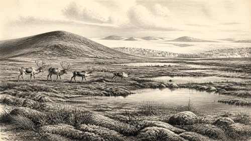
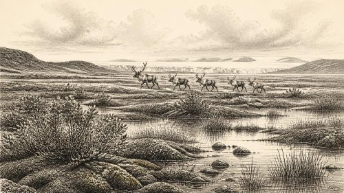
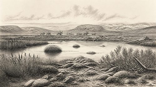
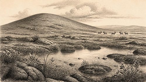
The fossils offer a rare glimpse of the terrain. Pollen was dominated by herbaceous plants, while seeds, mosses, spores and insect remains indicated open tundra or muskeg-like ground, with wet hollows and freshwater margins. Finds included bogbean (Menyanthes trifoliata), dwarf willow (Salix herbacea) and alpine clubmoss (Selaginella selaginoides), plants whose modern distributions evoke cold, exposed and often waterlogged settings. Their survival in the sediment is evidence, not a complete landscape painting: pollen can travel, and a basin samples its own immediate catchment especially strongly. Still, Derryvree rules out an image of a lifeless, permanently ice-covered Ireland.
Open Ground and Wet Hollows
For people familiar with modern Ireland’s woods, hedges and pasture, the difference would have been extreme. Derryvree’s evidence points to largely treeless terrain where low herbs, sedges, mosses and dwarf shrubs occupied ground affected by frost, short growing seasons and intermittent wetness. There may have been patches of more sheltered vegetation, but there is no basis for imagining broad forests. Freeze–thaw action, seasonal snow cover, cold winds and permafrost-related processes helped shape the exposed land.
Water was nevertheless central. Fine sediments and aquatic plant remains show that pools, marshy margins and sluggish freshwater existed locally. Such places concentrated vegetation, insects and animals, making them ecological nodes in an otherwise sparse landscape. They also created the conditions that preserved small biological traces for tens of millennia. The freshwater bed, trapped beneath the drumlin, is thus both a record of life and a reminder of later destruction: ice subsequently advanced over the site, depositing the upper till and transforming the surface into the landform visible today.
The Ice-Age Fauna
Caves in southern Ireland, especially Castlepook Cave near Doneraile in north County Cork, supply another line of evidence. Castlepook is Ireland’s richest known site for vertebrate fauna dating to the period before the Last Glacial Maximum. Its collections include remains attributed to woolly mammoth, reindeer, giant deer, brown bear, wolf, Arctic fox, hare, lemmings and spotted hyaena. These animals were not all necessarily present at the same moment, and a cave assemblage is never a simple census of the countryside. Carnivores can transport bones, water can move deposits, and animals can die in crevices or use caves at different times.
Even so, the combined fauna is compelling evidence for ecological connections with the wider Pleistocene lands of Britain and continental Europe. Reindeer and lemmings point towards cold, open habitats; mammoth and giant deer belong to a wider large-herbivore fauna; hyaenas, wolves and bears indicate competing predators and scavengers. The old popular name “Irish elk” for giant deer can mislead. Megaloceros giganteus was neither uniquely Irish nor an elk in the modern zoological sense, but a Eurasian giant deer which later became famously abundant in Irish fossil deposits.
The Castlepook Human Question
Castlepook also raises the most consequential question about people. A reindeer femur from the cave has been reported as roughly 33,000 years old and as carrying a deep incision interpreted by zooarchaeologist Ruth Carden as a mark made by a sharp stone tool while fresh bone was being butchered. If that interpretation is confirmed, it could represent extraordinarily early evidence of humans handling an animal in Ireland, placing a visit by Upper Palaeolithic hunter-gatherers many millennia before the securely established post-glacial settlement record.
That possibility must not be converted into a story of a permanent Irish population. The bone comes from an old cave collection rather than a modern excavation of an intact occupation floor. Its radiocarbon result dates the animal’s death, not independently the incision, the place where it was killed or the duration of any human presence. No securely associated hearth, stone-tool assemblage, dwelling, burial, art or repeated food-processing surface of comparable antiquity has yet been recovered in Ireland. Natural abrasion, carnivore action, breakage and the disturbance of cave deposits all require close taphonomic comparison before a mark can be accepted as humanly made.
The National Museum of Ireland consequently retains the cautious position that there is no clear, generally accepted evidence for Palaeolithic human presence on the island. Castlepook is best understood as a significant and still unresolved challenge to that conclusion, rather than as proof that a settled community lived near Doneraile in 31,449 BCE.
What Society Cannot Yet Be Seen
There is no evidence from Ireland at this time for political institutions, named groups, diplomacy, warfare, leadership or territorial boundaries. Nor can archaeologists responsibly identify religious rites, formal learning, language, art or family structure. If people did reach the island, comparison with better documented Upper Palaeolithic societies elsewhere suggests that they would have depended on mobility, expert knowledge of seasonal animals and plant resources, stone technology, clothing and fire. But comparison is interpretation, not direct Irish evidence.
Nor can economy and trade be reconstructed as they can for later prehistoric periods. The possible movement of people and animals implies that Ireland was not ecologically isolated from north-west Europe, yet it does not demonstrate regular voyages, exchange networks or a stable route across the Irish Sea. Sea level, ice margins and coastlines changed repeatedly, while the exact geography of crossings remains debated. The only safe conclusion is narrower: the fauna proves that some terrestrial mammals reached Ireland during the broader Pleistocene, and Castlepook raises the possibility that humans did too.
A Landscape Rather Than a Chronicle
The principal development around this notional date was therefore environmental. Ireland contained, at least in some regions and at some points within the relevant range, cold open ground with freshwater basins, specialised tundra plants and Pleistocene animals. Derryvree’s buried silts preserve that world with unusual clarity; Castlepook’s bones show how rich, and how difficult to interpret, the island’s cave archives can be. Subsequent ice expansion would reshape the land and greatly reduce the chances of finding surviving traces.
For 31,449 BCE, the historical task is not to invent a lost episode but to acknowledge the scale of uncertainty. Ireland’s deep past is illuminated here by a bogbean seed, mosses, insect remains, glacial tills and animal bones. They do not give us a calendar year, a ruler or a settlement. They do reveal a living Ice Age landscape on the western edge of Europe, long before later peoples made Ireland a place of villages, monuments and written memory.
Primary Sources
- A Middle Midlandian Freshwater Series at Derryvree, Maguiresbridge, County Fermanagh, Northern Ireland
- The Irish Quaternary Fauna Project
- A Reconsideration of the Radiocarbon Dating of the Marine Isotope Stage 3 Fauna from Southern Ireland
- Castlepook Cave, County Geological Site Report
- Archaeological Heritage of County Cork: A Guide
- Prehistoric Details: Mell Flint Flake
- Ireland’s Palaeolithic Archaeology – Fleeting Footprints in a Frozen Land
- New Insights on the Fauna of Ireland’s Younger Dryas and Early Holocene from Alice & Gwendoline Cave
- The IntCal20 Northern Hemisphere Radiocarbon Age Calibration Curve (0–55 cal kBP)
- IntCal Data
- The Greenland Ice Core Chronology 2005, 15–42 ka. Part 1: Constructing the Time Scale
- The Greenland Ice Core Chronology 2005, 15–42 ka. Part 2: Comparison to Other Records
- New Data for the Last Glacial Maximum in Great Britain and Ireland
- British–Irish Ice Sheet and Polar Front History of the Goban Spur, Offshore Southwest Ireland Over the Last 250,000 Years
- Exploring Controls of the Early and Stepped Deglaciation on the Western Margin of the British Irish Ice Sheet
- Deglaciation, Earth Crustal Behaviour and Sea-Level Changes in the Determination of Insularity: A Perspective from Ireland
- The Problem of a Late Quaternary Landbridge Between Britain and Ireland
- Palaeoecology: Origins of Ireland’s Biodiversity
- BSBI: Menyanthes trifoliata
- BSBI: Selaginella selaginoides
- BSBI: Salix herbacea
- Occurrence of Mammalia Relicts at Site Castlepook Cave