
BIRM-166’s Periglacial Pool31443 BCE
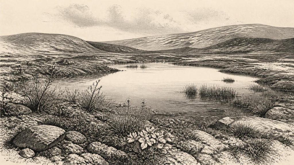
Around 31,443 BCE, Ireland lay within the unstable cold climate of Marine Isotope Stage 3, before the Last Glacial Maximum. Derryvree, County Fermanagh, preserves Birm-166, organic freshwater sediments between glacial tills, dated broadly to 36,900–31,700 cal BP. Its plants and insects indicate an ice-free local tundra wetland with mosses, sedges and cold-adapted flora, rather than continuous national ice cover. Greenagho supports episodic ice-free terrain. Lower sea levels altered coastlines, while cave remains indicate reindeer, mammoth and hyaena regionally. A marked Castlepook reindeer bone may suggest human activity, but lacks secure context. No evidence supports permanent settlement, polities, farming or trade.
Dateline
The modern label “31,443 BCE” suggests a precision that the evidence cannot bear. No written record, settlement sequence or annually dated deposit allows historians to describe a particular Irish year at this depth of time. In archaeological terms, the point corresponds approximately to 33,392 years before AD 1950, the reference point conventionally used for “cal BP” dates. It belongs to the later part of Marine Isotope Stage 3 (MIS 3), within the last glacial period but before the Last Glacial Maximum. The responsible task is therefore not to invent an event for a named year, but to assemble a cautious picture from wide calibrated ranges, fossils, sediments and changing ice-sheet reconstructions.
The clearest Irish evidence relevant to this broad interval comes not from human dwellings but from a long-vanished freshwater landscape at Derryvree, near Maguiresbridge in County Fermanagh. There, a road cutting through a drumlin exposed organic silts and fine sands trapped between two distinct layers of glacial till. The deposit, catalogued in the radiocarbon record as Birm-166, yielded a conventional age of about 30,500 radiocarbon years BP. When calibrated, its broad range is approximately 36,900–31,700 cal BP. The notional date of 31,443 BCE falls within that range, but it neither dates the beginning nor the end of the deposit, let alone a single season.
A Landscape Between Ice Advances
Derryvree’s position is its great importance. The lower till shows that glacier ice had earlier affected the district; the organic freshwater beds demonstrate a subsequent interval in which ice was absent locally; and the upper till records renewed glaciation. This is powerful evidence against any simple image of Ireland as continuously buried beneath ice throughout the last glacial period. It does not, however, prove that every part of the island was ice-free at the same time. A sedimentary basin in Fermanagh is a local witness, not a national weather report.
Its plant and insect remains nevertheless describe a recognisable environment. The evidence points to open, treeless tundra or muskeg: a wet, peaty, periglacial landscape of mosses, sedges, grasses and herbaceous plants, with pools or slow water rich in decaying vegetation. Macrofossils include species now characteristic of cold or upland environments, among them mountain avens, dwarf willow, alpine clubmoss and bogbean. Such remains make a lush prehistoric forest impossible here. The ground was likely seasonally frozen or affected by intense frost, and winters were severe. Yet freshwater persisted long enough to sustain aquatic and wetland plant communities. This was not a lifeless ice desert.
Greenagho, also in County Fermanagh, provides a related constraint. Organic detritus beneath till there has been calibrated to about 37,200–35,700 cal BP. Taken with Derryvree, it indicates that north-central Ireland retained ice-free terrain during part of MIS 3, before the large late-glacial expansion of the Irish Ice Sheet. Later ice frequently reworked, eroded or buried earlier landscapes. That destructive history helps explain why the evidence is so fragmentary: survival of a small organic lens beneath a drumlin is exceptional, while campsites on exposed ground would have been highly vulnerable.
Cold, But Not Climatically Still
The wider North Atlantic climate was unstable. Greenland ice cores show repeated abrupt shifts between colder stadials and relatively milder interstadials during MIS 3. Ireland lay at the Atlantic edge of that volatile system. The Derryvree archive is not resolved finely enough to connect 31,443 BCE to one precisely named Greenland event, and it would be misleading to do so. It does show that the relevant centuries belonged to a climate regime capable of changing sharply, with consequences for snow cover, frozen ground, vegetation, animal ranges and the ease of movement across the landscape.
The Last Glacial Maximum had not yet arrived. Recent reconstructions place the maximum expansion of the British–Irish Ice Sheet considerably later, with Ireland and its offshore shelf extensively glaciated around 27,000–23,000 cal BP. At the date considered here, the ice sheet was in a long and uneven process of build-up rather than at its known maximum. Some areas may already have been affected by local or regional ice, while other terrain remained open. The island’s later drumlins, scoured rock, moraine systems and offshore landforms are the physical legacy of those glacial episodes, but they cannot be assigned to this calendar year.
Sea level was lower than today because much water was locked in northern ice sheets. The coastline was therefore far from its modern position in many places, and plains now beneath the Irish Sea and Atlantic shelf formed part of the wider physical setting. That fact matters for animals and any potential human travellers: the map of land and water was different. But lower sea level does not, by itself, demonstrate a walkable route, an Irish land bridge, or regular traffic. The geography and glaciation of the intervening shelf were changing, and no securely dated route or crossing is known for this time.
Animals in a Sparse Record
Southern Irish caves preserve another, differently imperfect, archive. Antiquarian excavations at Castlepook Cave near Doneraile, County Cork—once popularly called Mammoth Cave—recovered remains of cold-stage mammals including reindeer, woolly mammoth and spotted hyaena. Modern redating has been essential because many older bone dates were produced before improvements in collagen pretreatment and ultrafiltration. Reassessment has shown that some cave specimens are substantially older than dates once assigned to them, and that certain animals were present in Ireland during MIS 3 before disappearing locally ahead of the Last Glacial Maximum.
These finds make a wider cold-open animal world plausible. Reindeer are well adapted to seasonal, largely treeless country; mammoth and hyaena remains likewise indicate that Ireland was connected ecologically to the Pleistocene faunas of north-west Europe at different moments. Yet the cave record should not be compressed into a single illustrated herd grazing at Derryvree in 31,443 BCE. Cave assemblages may accumulate over long intervals, through carnivore activity, natural deaths, water movement and excavation disturbance. The evidence supports regional possibility and changing animal distributions, not a census of one locality on one date.
The Human Question
The most arresting issue is whether people entered Ireland during this earlier phase. A reindeer femur from Castlepook, recovered in 1972 and later reported as roughly 33,000 years old, bears a deep mark interpreted by some researchers as a possible stone-tool or butchery trace. If that interpretation is confirmed through secure contextual evidence, it would point to a remarkably early Upper Palaeolithic human incursion, far earlier than the island’s well-established Mesolithic settlement. It would suggest hunters exploiting a large animal in a cold, shifting landscape.
But the qualification is central, not incidental. There is presently no securely associated stone-tool assemblage, hearth, dwelling floor, burial, repeated occupation surface or human skeleton of this age from Ireland. The femur derives from an old cave collection rather than a newly excavated, intact hunting camp. Natural damage can sometimes resemble human modification, while a date on bone does not automatically date the moment when a mark was made. Scholars therefore differ over how much weight the specimen can carry. It is evidence for a serious research question, not proof of a settled Palaeolithic population.
Even the better-established late Upper Palaeolithic signal is much later: the cut-marked brown-bear patella from Alice and Gwendoline Cave in County Clare has two calibrated ranges of about 12,810–12,590 and 12,810–12,685 cal BP. Its importance is methodological as well as chronological. It shows what a directly dated bone with documented modification can contribute, while also underlining the enormous gap between rare Pleistocene traces and a continuous account of human life. Around 31,443 BCE, Ireland may have received brief visits by highly mobile hunter-gatherers; equally, the present record cannot rule out that no people were present at the particular time imagined.
No Polities, No Proven Trade
Political affairs, warfare, diplomacy and named communities cannot be recovered for Ireland at this date. There were no states, kingdoms, borders or written institutions whose actions can be described. Nor is there evidence for farming, livestock management, fields, permanent villages, monuments, metalworking or long-distance exchange networks in Ireland. To supply them would turn the silence of the record into fiction.
The same restraint applies to religion, art and learning. Upper Palaeolithic people elsewhere in Europe created ornaments, images and sophisticated stone technologies, but no Irish material securely demonstrates comparable cultural practice at 31,443 BCE. The absence of evidence is not evidence that any visitors lacked language, memory, ritual or social bonds; it means only that Ireland has yielded no defensible archaeological trace of those things for this interval. A small, mobile visiting group could leave little behind, and later ice could erase much of what it did leave.
What Can Be Said Responsibly
Ireland around the notional year 31,443 BCE was part of a changing north-west European cold-stage world. At Derryvree, within a calibrated range encompassing this point, freshwater and wetland vegetation occupied an ice-free Fermanagh setting between glacial advances. Across the island, conditions were uneven, exposed and environmentally demanding rather than uniform. Cave faunas show that large cold-adapted mammals formed part of Ireland’s broader MIS 3 story. A marked reindeer bone from Castlepook raises the possibility of a human encounter with that world, but cannot yet furnish a biography, a camp or an Irish population.
The most meaningful development is thus geological and ecological: landscapes capable of supporting tundra wetland and Pleistocene fauna existed before later ice transformed the country again. Birm-166 is not a chronicle of one year. It is better than that for this purpose: a physical remnant of an Irish environment that survived, improbably, between the tills.
Primary Sources
- A Middle Midlandian Freshwater Series at Derryvree, Maguiresbridge, County Fermanagh, Northern Ireland
- Trimlines, Blockfields and the Vertical Extent of the Last Ice Sheet in Southern Ireland
- A Reconsideration of the Radiocarbon Dating of the Marine Isotope Stage 3 Fauna from Southern Ireland
- First Evidence of a Late Upper Palaeolithic Human Presence in Ireland
- New Insights on the Fauna of Ireland's Younger Dryas and Early Holocene from Alice & Gwendoline Cave
- Growth and Retreat of the Last British–Irish Ice Sheet, 31,000 to 15,000 Years Ago: the BRITICE-CHRONO Reconstruction
- BRITICE Glacial Map, Version 2: a Map and GIS Database of Glacial Landforms of the Last British–Irish Ice Sheet
- Timing and Pace of Ice-Sheet Withdrawal Across the Marine–Terrestrial Transition West of Ireland During the Last Glaciation
- Dimensions and Chronology of the Last Ice Sheet in Western Ireland
- The Deglaciation of the Western Sector of the Irish Ice Sheet from the Inner Continental Shelf to its Terrestrial Margin
- Radiocarbon Constraints on the Age of the Maximum Advance of the British-Irish Ice Sheet in the Celtic Sea
- Early Midlandian–Middle Midlandian, Pleistocene, Northern Ireland
- Palaeoecology
- The Subdivision of the Quaternary Period in Ireland
- Dryas octopetala L.
- Salix herbacea L.
- Selaginella selaginoides (L.) P. Beauv.
- The IntCal20 Northern Hemisphere Radiocarbon Age Calibration Curve (0–55 cal kBP)
- Radiocarbon Dating
- A New Greenland Ice Core Chronology for the Last Glacial Termination
- Dansgaard–Oeschger Events in Climate Models: Review and Baseline Marine Isotope Stage 3 Protocol
- Ireland: Submerged Prehistoric Sites and Landscapes
- The Colonization of Ireland: A Human Ecology Perspective
