
Trifoliate Seeds Below Ice31442 BCE
31,442 BCE lies within Marine Isotope Stage 3, a climatically unstable Late Pleistocene interval for which precise annual dating is impossible. At Derryvree, County Fermanagh, organic freshwater sediments between glacial tills indicate locally ice-free tundra, with dwarf willow, mountain avens, sedges, mosses and bogbean. Southern Irish caves preserve remains of reindeer, mammoth, hyaena, bear, fox, hare and lemmings, although their chronology and associations require caution. A possibly tool-marked Castlepook reindeer bone suggests, but cannot confirm, human visitation. Later ice expansion destroyed much evidence, leaving sediment, seeds and bones as fragmentary records of cold ecosystems in Ireland and possible human contact.
Dateline
A Date Without a Chronicle
31,442 BCE is a modern way of placing a point deep in the Late Pleistocene, not a year that anyone in Ireland could have named, recorded or commemorated. It equates approximately to 33,400 calendar years before the conventional radiocarbon present of AD 1950. At this depth of time, calendar-year precision is not available. Radiocarbon determinations have statistical errors; calibration converts radiocarbon years into ranges rather than single dates; and the surviving Irish deposits rarely preserve uninterrupted annual layers. The responsible question is therefore not what happened in Ireland in this particular year, but what the evidence can show about the broader interval into which it falls.
That interval belongs to Marine Isotope Stage 3, an unstable middle phase of the last Ice Age. It preceded the Last Glacial Maximum, when the British–Irish Ice Sheet later expanded much more extensively across Ireland and adjacent seas. Conditions did not move steadily from warmth to cold. Instead, North Atlantic climate shifted repeatedly, with abrupt changes registered especially clearly in Greenland ice cores. Irish environmental sequences are too sparse and their dating too broad to match every one of those fluctuations to a numbered calendar year. Yet they establish an important reality: parts of Ireland could support tundra life during intervals before the great later ice advance.
The Freshwater Archive at Derryvree
The best local evidence relevant to this broad date comes from Derryvree near Maguiresbridge, County Fermanagh. A section exposed beneath a drumlin revealed organic freshwater silts and fine sands sandwiched between two bodies of till, deposits left by glacier ice. The sequence records a period in which ice was absent from that locality, allowing a shallow-water, marshy or wet-ground environment to form, before a subsequent glacial advance sealed it beneath another till. This is an exceptional survival. Later ice erosion and deposition destroyed or concealed much of Ireland’s older Pleistocene landscape.
The key radiocarbon measurement from the organic deposit, Birm-166, was reported as 30,500 radiocarbon years before present, with a substantial uncertainty of +1,170 and −1,030 years. It should not be converted mechanically into a precise historical year. Modern calibration work confirms that ages in this part of the radiocarbon curve must be expressed as broad calendar ranges, and different chronological treatments can change the apparent span. The Derryvree horizon can responsibly be placed in late Marine Isotope Stage 3 and may encompass the approximate temporal neighbourhood of 31,442 BCE. It is not, however, a sample taken in that year, nor proof that every part of Ireland had identical conditions at the same moment.
An Open, Cold Landscape
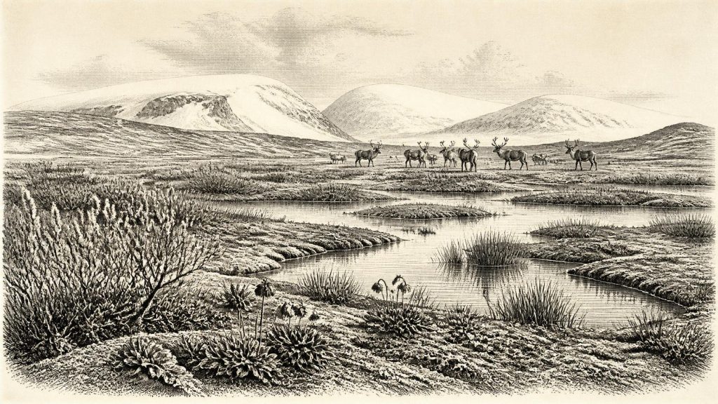
Plants and small animal remains from Derryvree point towards open tundra vegetation and a periglacial climate: a landscape shaped by severe frost, seasonal freezing and thawing, sparse cover and exposed ground, rather than by closed woodland. The fossil flora includes cold-adapted plants such as dwarf willow and mountain avens, alongside sedges, mosses and aquatic or wetland species. A fossil seed of bogbean, or marsh trefoil, is especially evocative. It demonstrates that freshwater habitats existed amid a generally cold setting. Such evidence gives texture to the landscape: shallow pools, saturated margins, low vegetation and patches of ground capable of supporting plants through a brief growing season.
It would be misleading, however, to turn these remains into a painted panorama of the entire island. Pollen can travel long distances; organic sediments accumulate in particular local settings; and one basin tells us more securely about its own catchment than about distant coasts or mountain interiors. The most defensible picture is a mosaic. Locally ice-free ground in Fermanagh supported a cold freshwater ecosystem, while ice masses, bare mineral surfaces and harsh exposed terrain lay elsewhere in a rapidly changing north-west European region.
Animals in a Changing Islandscape
Caves in southern Ireland provide the principal evidence for the larger animals that could reach the island in the pre-Last Glacial Maximum world. Castlepook Cave, near Doneraile in north Cork, has yielded remains attributed to reindeer, woolly mammoth, spotted hyaena, brown bear, fox, hare and lemmings, as well as other Pleistocene fauna. Taken with due caution, these assemblages indicate that Ireland was not biologically empty. Reindeer and lemmings belong readily within cold, open habitats; large grazers and their predators point to food webs extending beyond a single marsh or cave entrance.
The cave material is not a straightforward census of one community living together in one year. Much was excavated in the late nineteenth and early twentieth centuries, often before modern standards of stratigraphic recording, and some deposits were disturbed or mixed. Improved radiocarbon pre-treatment has also shown that several earlier dates need reassessment. A mammoth bone, for example, is evidence that mammoths reached Ireland at some point in the relevant broad Pleistocene period; it is not evidence that a mammoth stood beside Derryvree in 31,442 BCE. The scientific value of the caves lies in their cumulative record of changing faunas, not in false precision.
People: A Possibility, Not a Population
The most consequential archaeological question is whether people were present. A reindeer femur from Castlepook has been reported as bearing an incision interpreted by palaeozoologist Ruth Carden as a possible mark made by a sharp stone tool during butchery. Direct dating has placed the specimen at roughly 33,000 years ago in popular summaries, making it potentially relevant to the broad period considered here. If the mark is confirmed as human-made, it would provide striking evidence that an Upper Palaeolithic visitor or visitors handled a reindeer in Ireland long before the better-established post-glacial settlement record.
But the limits matter as much as the possibility. There is no securely associated hearth, stone-tool assemblage, dwelling floor, burial, food store or repeatedly occupied campsite of this age in Ireland. Nor can a single modified bone establish a permanent population, the size or identity of a group, a language, a voyage route, or a continuous tradition of occupation. Natural damage, carnivore activity and the complicated histories of old cave collections demand rigorous taphonomic testing. Around 31,442 BCE, human presence in Ireland remains a research question supported by a provocative item of evidence, not a settled national origin story.
Society Beyond the Evidence
Accordingly, there is no basis for describing political affairs, rulers, territories, warfare, diplomacy, law or institutions. There is equally no direct Irish evidence for a religion, formal ritual, art, music, literacy, teaching, monument building or named cultural group at this date. It would be tempting to borrow the well-documented cave art and hunting societies of continental Europe and apply them to Ireland. That would be interpretation by analogy, not Irish history. Comparable Upper Palaeolithic communities elsewhere certainly demonstrate what humans of the period could do, but capability elsewhere is not proof of activity here.
The same restraint applies to economy and trade. Reindeer, mammoth and other animals imply ecological opportunities, while lowered sea levels altered coastlines and may have changed routes through the Irish Sea region. They do not demonstrate trade, exchange networks, seasonal markets or organised hunting territories in Ireland. Should people have visited, they would probably have depended on highly mobile foraging, close knowledge of weather and animals, and portable stone technology; even that is a cautious inference from wider Upper Palaeolithic lifeways rather than a directly excavated Irish camp.
Ice, Water and Future Loss
The dominant development was environmental. The habitats represented at Derryvree and in Irish cave faunas existed before later glacial growth reshaped the island. Reconstructions of the British–Irish Ice Sheet show that its maximum extent belongs substantially later, especially between about 27,000 and 21,000 years ago, although the advance was neither uniform nor identical in every sector. As ice expanded, it scoured bedrock, reworked sediments and closed ecological corridors. The familiar physical Ireland of drumlins, glacial sediments and altered drainage owes much to those later processes, while they also explain why evidence for earlier landscapes is so fragmentary.
For this reason, the tiny organic remains at Derryvree and the bones preserved in Cork caves have an importance out of proportion to their size. They preserve a glimpse of Ireland before the fullest late-glacial transformation: a cold, treeless country with freshwater refuges; animal populations adapted to open ground; and, perhaps, occasional human contact at Europe’s north-western edge. The historical record begins here not with a king, battle or settlement, but with sediment, seed and bone—and with an honest acknowledgement of how much has been lost.
Primary Sources
- A Middle Midlandian Freshwater Series at Derryvree, Maguiresbridge, County Fermanagh, Northern Ireland
- A Reconsideration of the Radiocarbon Dating of the Marine Isotope Stage 3 Fauna from Southern Ireland
- The Irish Quaternary Fauna Project
- Irish Quaternary Vertebrates
- Growth and Retreat of the Last British–Irish Ice Sheet, 31,000 to 15,000 Years Ago: The BRITICE-CHRONO Reconstruction
- BRITICE-CHRONO Maps and GIS Data of the Last British-Irish Ice Sheet 31 to 15 ka
- Exploring the Chronology of the Last British-Irish Ice Sheet in the Southern Irish Sea
- Deglaciation Chronology of the Donegal Ice Centre, North-West Ireland
- Trimlines, Blockfields and the Vertical Extent of the Last Ice Sheet in Southern Ireland
- A Stratigraphic Framework for Abrupt Climatic Changes During the Last Glacial Period Based on Three Synchronized Greenland Ice-Core Records
- The IntCal20 Northern Hemisphere Radiocarbon Age Calibration Curve (0–55 cal kBP)
- Quaternary
- BSBI: Salix herbacea
- BSBI: Menyanthes trifoliata
- New Insights on the Fauna of Ireland’s Younger Dryas and Early Holocene from Alice & Gwendoline Cave
- 32564: Castlepook Cave, Castlepook, Cork
- UCD School of Archaeology Research Day 2022
- The Archaeological Heritage of County Cork
- Heritage Artefacts of County Cork
- Ireland’s Palaeolithic Archaeology – Fleeting Footprints in a Frozen Land