

BIRM-166’s Tundra Witness31425 BCE
At the nominal date of 31,425 BCE, Ireland lay within the climatically unstable Marine Isotope Stage 3. Derryvree sediments in County Fermanagh, dated broadly to this period, record ice-free freshwater wetlands and open tundra vegetation amid severe periglacial conditions. Later glaciation preserved these deposits beneath till. Castlepook Cave in County Cork contains a Late Pleistocene fauna, including mammoth, reindeer, giant deer, predators and scavengers, demonstrating ecological links with north-west Europe. A marked reindeer femur may show stone-tool butchery around 31,000 BCE, potentially indicating brief human presence. However, insecure context and limited evidence preclude claims for settlement, society, culture or events.
Dateline
There was no calendar in Ireland in 31,425 BCE, and no evidence can identify an event in that single modern-style year. The label is nevertheless a useful point of orientation: it corresponds to roughly 33,374 years before AD 1950, the conventional reference point for “BP” dating. At this depth of time, archaeology and Quaternary science work with ranges, layers and probabilities rather than annual chronicles. The most relevant evidence places parts of Ireland within Marine Isotope Stage 3, a long, climatically unstable phase of the last Ice Age. It comes chiefly from fossil-bearing sediments in County Fermanagh and animal remains from a cave near Doneraile, County Cork.
The strongest conclusion is environmental. Ireland was not the familiar green, wooded island of later millennia. At least some districts contained cold, open and seasonally severe landscapes, while ice masses and sea levels changed across the wider Irish and British region. The evidence also permits a carefully limited possibility of human activity. It does not support a named people, permanent settlement, political community, battle, trade network, religious monument or individual life story for this nominal year.
Dating A Landscape, Not A Year
The key northern archive was exposed during roadworks in 1969 at Derryvree, near Maguiresbridge in County Fermanagh. Excavation cut through a drumlin: a streamlined hill later shaped by glacier ice. Between two thick sheets of till, sediment deposited directly by ice, lay freshwater silts, fine sands and organic material. The lower till records an earlier glacial episode; the overlying till shows that ice returned and sealed the intervening deposit. In between was a period when local ground was ice-free enough for water, plants and small animals to leave traces.
An organic sample from this middle deposit, laboratory number Birm-166, produced a radiocarbon age of 30,500 with a substantial uncertainty of roughly a thousand radiocarbon years. Radiocarbon years are not identical to calendar years because atmospheric carbon-14 has varied through time. Later calibration has placed that age broadly at about 36,900–31,700 calibrated years BP, approximately 34,950–29,750 BCE. The nominal year 31,425 BCE therefore falls within the broad calibrated range, but it cannot be singled out as the date at which the Derryvree plants flowered, insects lived, or sediment entered the water.
This distinction is more than technical. A date range establishes that a deposit is relevant to a period; it does not turn a fossil assemblage into a diary. Nor does one site describe the whole island. Derryvree gives an unusually precious local view of south Fermanagh. It is best used alongside other evidence for shifting ice margins, cave faunas and changing sea levels, always allowing for regional variation and for later erosion of much of the ancient land surface.
A Wet, Open Fermanagh
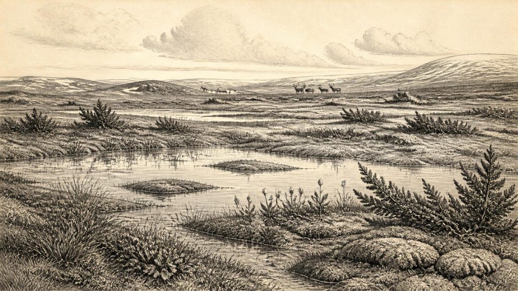
The Derryvree fossils indicate open tundra vegetation and a periglacial regime: a very cold climate with intense frost processes outside the edge of permanent glacier ice. Pollen, plant remains, mosses and insects point away from closed forest. Sedges, grasses, herbs and cold-tolerant plants occupied wet ground and shallow-water margins. Bogbean, a plant of marshy pools and fens, is represented by a fossil seed. Mosses and insects add texture to the picture, suggesting a mosaic of waterlogged vegetation, peaty ground, open pools and more exposed surfaces.
“Tundra” should not conjure an unchanging white desert. During the growing season, low plants could grow quickly where meltwater and mineral-rich sediment made conditions favourable. Invertebrates, water birds and grazing mammals could exploit this patchwork. Yet the landscape was harsh: winters were long, soils were thin or disturbed by freezing and thawing, and woody vegetation was sparse. Juniper may have occurred locally, but the combined evidence does not justify imagining woodland across Fermanagh. A few tree pollen grains can travel far; the broader assemblage carries more weight.
The place was also dynamic. Frost heave, seasonal snowmelt, pond formation and sediment movement continually altered small habitats. The drumlin seen today is itself a reminder that the scene did not endure. A later ice advance overrode the locality, depositing the upper till and helping to preserve the freshwater sequence beneath it. Glaciation also removed or scrambled countless other deposits. The scarcity of evidence for this period is partly a result of that destructive geological history, rather than proof that every Irish landscape was lifeless or inaccessible.
Ice, Water And Uneven Regions
At the scale of Ireland, 31,425 BCE belongs to a long approach towards the more extensive glaciation of the Last Glacial Maximum, which came later. Modern reconstructions do not depict a simple island-wide switch from ice-free ground to total ice cover. Instead, they identify advances, retreats and differing conditions between uplands, coasts, lowlands and marine basins. The Derryvree sequence demonstrates ice-free conditions in north-central Ireland during its dated interval. Other records show that ice and marine environments were active elsewhere in the north Atlantic realm.
For this reason, no single map can responsibly claim to show an exact ice edge on this particular BCE year. In north-western Ireland, deposits around Donegal Bay have been used to explore earlier ice presence and high relative sea levels, but some interpretations depend on reworked shells or complex stratigraphy. More recent work has refined the timing and extent of the later, maximum British–Irish Ice Sheet. What remains secure for this article is the wider setting: Ireland lay close to a changing ice-sheet system, and its coastlines, waterways and travel routes were unlike those of the present.
Lower global sea levels exposed more continental shelf than today, but that fact alone does not demonstrate a walkable route into every part of Ireland. Ice, water depth, changing shorelines and local topography all mattered. Any movement of animals or people across the wider region must therefore be treated as a question of routes and opportunities, not as proof of a permanent land bridge or a simple migration corridor.
Castlepook’s Animal Record
In north County Cork, Castlepook Cave near Doneraile—also called Mammoth Cave—offers a different kind of evidence. It is Ireland’s richest known site for Ice Age vertebrate remains. Its old collections include bones of woolly mammoth, reindeer, giant deer, brown bear, wolf, Arctic fox, hare, lemmings and spotted hyaena. This is compelling evidence that southern Ireland, across a broad span of the Late Pleistocene, was connected ecologically to the cold-open-country faunas of north-west Europe.
It does not mean that every listed species stood together outside the cave in 31,425 BCE. Cave assemblages are accumulations. Carnivores can carry bones into dens; animals may die at different times; water and later disturbance can shift material; early excavations did not meet modern standards of recording. Improved radiocarbon dating of identified Castlepook bones has shown that several older determinations understated the antiquity of the fauna. The revised work indicates a significant MIS 3 presence for mammals in Ireland and suggests that giant deer and spotted hyaena may have disappeared locally before the Last Glacial Maximum, around 40,000 calibrated years BP.
Reindeer are especially relevant to the Derryvree-style environment. They are well adapted to open northern landscapes, although their presence in a cave deposit cannot specify herd size, season or migration path. Mammoth and giant deer reinforce the impression that productive patches of grassland, herb-rich ground and wetlands existed within a cold mosaic. Spotted hyaena and wolf indicate predators and scavengers competing for carcasses and shelter. The cave was not a tranquil natural museum; it was part of an ecological system in which bones could be broken, gnawed, moved and redeposited.
The Marked Reindeer Femur
One Castlepook reindeer femur has made this period important for the human history of Ireland. County Cork heritage material dates the specimen to about 31,000 BCE and identifies a deep mark on the bone that zooarchaeologist Ruth Carden has interpreted as damage from a sharp stone tool during carcass processing. If that interpretation is upheld, it is potentially the earliest evidence that people were present in Ireland: not a legend of first settlers, but a material trace of somebody using a lithic edge on a reindeer.
The appropriate conclusion remains conditional. The femur derives from an old cave collection rather than a recently excavated, intact occupation surface. There is no securely associated hearth, stone-tool assemblage, dwelling, burial, food-preparation area or repeated sequence of camps from this time. Radiocarbon dating establishes the age of the animal’s bone collagen, not the identity, language, origin or duration of any person who may have made the mark. Specialists must also distinguish deliberate modification from damage caused by carnivores, weathering, breakage, trampling and excavation.
Even if the mark proves to be a butcher’s cut, the evidence would indicate a brief episode rather than a settled population. A small mobile Upper Palaeolithic group may have reached Ireland and processed a carcass, perhaps away from the cave before scavengers brought remains inside. That is an interpretation consistent with the object and its setting, not a demonstrated camp. No evidence permits claims about permanent homes, family size, clothing, boats or hunting weapons in Ireland at this date.
What Cannot Yet Be Written
Consequently, political affairs are absent from the record. There are no chiefs, territories, alliances, diplomatic exchanges or wars that can responsibly be assigned to Ireland in 31,425 BCE. Nor is there evidence for farming, herding, pottery, metalwork, markets or long-distance trade. The economy visible in the fossils is ecological rather than institutional: plants captured a short season’s growth; herbivores fed; predators and scavengers followed; water and frost redistributed material.
Religion, art and learning must be approached with the same restraint. Upper Palaeolithic communities elsewhere in Europe made images, ornaments, tools and complex social worlds, but such discoveries cannot be imported into Ireland as local facts. Castlepook has not produced securely dated Irish cave art, portable art or a ritual deposit of this age. The absence of these finds does not prove that visitors lacked beliefs or knowledge; it means the Irish evidence cannot reveal them.
The most significant development around this nominal date was therefore the making—and later survival—of evidence. Freshwater mud at Derryvree preserved the imprint of a cold wetland beneath later ice. Cave sediments at Castlepook retained bones from a changing animal community and perhaps one humanly modified reindeer limb. These fragile archives replace false precision with a more remarkable reality: Ireland was part of a severe, inhabited-by-animals Ice Age world, and it may already have been touched, briefly and uncertainly, by human hands.
Primary Sources
- A Middle Midlandian Freshwater Series at Derryvree, Maguiresbridge, County Fermanagh, Northern Ireland
- A Reconsideration of the Radiocarbon Dating of the Marine Isotope Stage 3 Fauna from Southern Ireland
- Trimlines, Blockfields and the Vertical Extent of the Last Ice Sheet in Southern Ireland
- Growth and Retreat of the Last British–Irish Ice Sheet, 31,000 to 15,000 Years Ago: The BRITICE-CHRONO Reconstruction
- The Timing and Magnitude of the British–Irish Ice Sheet Between Marine Isotope Stages 5d and 2
- Early Deglaciation of the British-Irish Ice Sheet on the Atlantic Shelf Northwest of Ireland Driven by Glacioisostatic Depression and High Relative Sea Level
- Response of the Irish Ice Sheet to Abrupt Climate Change During the Last Deglaciation
- Dimensions and Chronology of the Last Ice Sheet in Western Ireland
- Irish Pleistocene Biostratigraphy
- The Irish Quaternary Fauna Project
- The Quaternary History of Ireland
- Quaternary Deposits and Glacial Stratigraphy in Ireland
- Figure 6: The Subdivision of the Quaternary Period in Ireland
- References and Recommended Reading: Irish Association for Quaternary Research Guide
- Quaternary: Geological Survey Ireland and Geological Survey Northern Ireland
- Castlepook Cave: County Geological Site Report
- Heritage Artefacts of County Cork 2021
- 2022:564 – Castlepook Cave, Castlepook South, Cork
- Mammoth Cave, County Cork
- The IntCal20 Northern Hemisphere Radiocarbon Age Calibration Curve (0–55 cal kBP)
- IntCal Publications
- Bogbean (Menyanthes trifoliata) Fossil Record in Fermanagh
- Biogeography of Ireland: Past, Present, and Future
- Pleistocene Vertebrates in the British Isles





