

Derryvree’s Bogbean Wetland31413 BCE
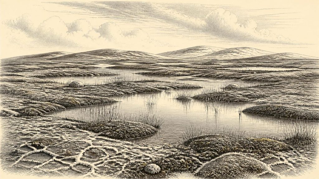
At the notional date of 31,413 BCE, Ireland’s evidence records environmental change rather than history. Derryvree, County Fermanagh, preserves freshwater sediments between glacial tills, dated broadly to 36,900–31,700 calibrated BP. Pollen, plants, mosses and insects indicate exposed, treeless tundra-like wetland, with bogbean, sedges and standing water, during an ice-free interval later overwhelmed by glaciers. Castlepook Cave, County Cork, confirms Marine Isotope Stage 3 fauna including reindeer and mammoth. A marked reindeer femur may indicate human butchery, yet cannot prove occupation. Ireland was a climatically unstable, intermittently habitable landscape approaching extensive glaciation, with no securely evidenced society or settlement at all.
Dateline
Modern calendar-year precision is not available for Ireland in 31,413 BCE. No people on the island recorded years, and no archaeological method can isolate a particular twelve-month interval so far back. The label is therefore a convenient point on a modern timescale, roughly 33,360 years before 1950. The most responsible approach is to place it within broad calibrated ranges and ask what Ireland’s surviving deposits can reveal about its landscape, animals and possible human visitors.
The closest unusually informative Irish evidence comes from Derryvree townland, near Maguiresbridge in County Fermanagh. There, roadworks in 1969 cut through a drumlin and exposed fine freshwater sands, silts and organic muds lying between two thick layers of glacial till. The lower till records an earlier presence of ice; the wet sediments accumulated during an intervening ice-free episode; the upper till shows that glacier ice later returned and buried the whole sequence. Organic material from the deposit, laboratory sample BIRM-166, gave a conventional radiocarbon age of 30,500 +1,170/−1,030 years BP. Later calibration places its broad age at about 36,900–31,700 calibrated years BP, approximately 34,950–29,750 BCE. The requested year sits within that wide span, but cannot be assigned to an individual layer, season or event.
A Wet Hollow Between Glaciers
Derryvree is important precisely because so little of Ireland’s older Ice Age ground surface survived later glaciation. Ice, meltwater, erosion and subsequent soils have destroyed or obscured many traces of the Middle Midlandian, the Irish name commonly applied to this portion of the last glacial cycle. At Derryvree, however, a low wet basin preserved material from a short-lived landscape before a later ice advance incorporated it into a drumlin. It is not a settlement site and it does not supply a narrative of human acts. It is an environmental archive: a record made from sediment, pollen, seeds, mosses and insect remains.
That archive points firmly towards open, treeless tundra or muskeg-like country under a periglacial climate. “Periglacial” does not mean continuously covered by ice. It describes ground subject to severe frost, seasonal thaw and the environmental influence of nearby glaciers or ice masses. The country around the freshwater hollow was probably uneven, wet and exposed. Shallow pools, saturated peat-rich margins and patches of drier mineral ground could exist together. Such a mosaic would have altered greatly through the year, as snow cover, frozen soil, meltwater and summer plant growth redistributed food and shelter.
The biological evidence makes this reconstruction more concrete without making it over-precise. Herb pollen, freshwater mosses and sedges indicate sparse vegetation rather than woodland. Plant macrofossils include bogbean, a wetland species whose three-part leaves are familiar beside Irish lakes and fens today, and pollen attributed to alternate water-milfoil indicates standing or slow-moving fresh water. Other recorded plants and mosses belonged to cold, open habitats. A few grains from trees such as pine or hazel do not demonstrate a nearby forest: pollen can travel considerable distances, and ancient sediments can include redeposited material. The secure conclusion is an open, cold landscape with freshwater and wet ground, not a detailed map of every plant community.
Climate on a Changing Island
In global terms this was Marine Isotope Stage 3, a fluctuating cold interval before the Last Glacial Maximum. Ireland was not yet simply the fully ice-covered island often imagined for the height of the Ice Age. The Derryvree deposit itself establishes that this part of Fermanagh was ice-free when its freshwater sediments formed. Yet ice had existed there earlier and would advance again afterwards. Wider reconstructions of the British–Irish Ice Sheet suggest that, by about 31,000 calibrated years BP, ice was building in northern Irish uplands, including the Derryveagh–Sperrin region, while mountain glaciers and ice fields occupied other high areas. The precise timing and extent of that expansion remain uncertain, especially before the later maximum.
For 31,413 BCE, then, the key historical fact is instability. Some regions may have been open terrestrial environments while uplands and northern districts supported growing ice bodies. Lower sea level made the geography of north-west Europe very different from today’s. The sea basins around Ireland were narrower and shallower in places, but Ireland was not thereby a simple, reliable land bridge to Britain or continental Europe. Routes available to animals and people changed with ice margins, coastlines, river systems and climate. Any movement into Ireland would have taken place across a difficult, shifting frontier rather than across a stable road.
The next major glacial expansion eventually reached a much greater scale. During the Last Glacial Maximum, broadly around 27,000–23,000 calibrated years BP in reconstructions of the British–Irish Ice Sheet, ice covered much of Ireland and the adjoining shelf. Derryvree’s organic bed therefore preserves a world that was vulnerable to disappearance: its pools and mossy ground were sealed beneath sediment brought by later ice. This sequence gives Ireland’s deep past an important environmental rhythm—ice, an interval of living landscape, then ice again—rather than a single uninterrupted frozen age.
Animals and the Castlepook Question
Southern Irish caves provide a second, very different line of evidence. At Castlepook Cave near Doneraile in north Cork, nineteenth- and early twentieth-century investigations recovered a rich collection of Pleistocene animal remains, including reindeer, brown bear, wolf, hare, spotted hyaena and woolly mammoth. Reassessment using improved radiocarbon pretreatment has shown that several old Irish cave dates needed revision, and has confirmed that parts of the Castlepook fauna belong in Marine Isotope Stage 3. The cave assemblage demonstrates that cold-adapted animals reached Ireland during portions of the last glacial cycle, but it must not be treated as a photograph of a single herd or season: specimens may differ markedly in age and were accumulated by natural processes as well as by carnivores.
One Castlepook object has particular relevance to this date. A reindeer femur from the old collection has been presented as approximately 33,000 years old—often rendered in public interpretation as about 31,000 BCE—and bears a deep mark which zooarchaeologist Ruth Carden has interpreted as a cut or chop made on fresh bone by a sharp stone implement. If that diagnosis and association are sustained, it would be remarkable evidence that people processed a reindeer in Ireland during the Upper Palaeolithic, far earlier than the island’s formerly accepted evidence for human presence.
But the distinction between evidence and interpretation is essential. The dated bone proves the age of the animal, not automatically the precise date, location or agent of the mark. Castlepook was excavated long ago, its cave deposits were affected by carnivores and water, and the femur does not come from a newly excavated, sealed camp floor. No stone-tool assemblage securely associated with a 33,000-year-old occupation, nor a hearth, house, burial or repeated working surface of that age, has yet been recovered in Ireland. The femur is a serious and potentially transformative clue, not proof of permanent settlement or a continuous Irish population.
What Society Cannot Yet Be Seen
Accordingly, there is no responsible account of named leaders, political territories, diplomacy, warfare, laws, languages or institutions in Ireland at this point. Nor is there evidence for farming, domesticated stock, metalworking, trade routes, monuments, formal cemeteries or organised religion. It would be equally unwarranted to invent a tribe, a camp at Derryvree or a reindeer hunt at Castlepook. The archaeological record supports none of these as a specific Irish occurrence in 31,413 BCE.
If people did enter the island during a favourable interval, comparison with Upper Palaeolithic groups elsewhere in north-west Europe suggests only a cautious possibility of small, mobile parties using stone tools and exploiting animal resources. That comparison may help frame questions, but it cannot fill Ireland’s evidential gap. A mobile visit leaves far slighter traces than a village, and later ice has removed or buried much of the land surface on which such traces might have lain. Absence of a camp is therefore not conclusive proof of absence; neither does it license a detailed social reconstruction.
The same restraint applies to culture and learning. Humans elsewhere in Europe possessed sophisticated practical knowledge of seasonal animals, raw materials and changing terrain, and some made striking visual art and personal objects. No equivalent artefact, image or ritual deposit of this age has been securely demonstrated in Ireland. What can be said is that survival in an open, frost-affected landscape required close attention to water, weather, animal movement and shelter. The Derryvree sediments preserve the ecological setting in which such knowledge would have mattered, whether or not people were present locally.
A Landscape Before History
For Ireland around this notional date, environmental change deserves greater emphasis than politics because the evidence is environmental. Derryvree records freshwater amid tundra-like vegetation in Fermanagh; Castlepook preserves the remains of animals adapted to a cold and open world in Cork; modern dating and renewed cave fieldwork continue to test the chronology and meaning of both archives. Together they show that Ireland was neither empty abstraction nor familiar green island. It was a changing Pleistocene peninsula-edge landscape, intermittently habitable for plants and animals, increasingly shaped by ice and perhaps, on the most cautious reading of one marked reindeer bone, briefly visited by people.
Its history is therefore not a story of a year but of evidence at different scales. A buried wetland can establish that life persisted between glacial advances. A cave bone can reveal the presence of reindeer and raise a difficult question about human activity. Radiocarbon ranges can bracket intervals, but they cannot name the day a pool froze, a herd crossed limestone country or a person handled a carcass. Around 31,413 BCE, Ireland’s recoverable past remains fragmentary—but those fragments are sufficient to reveal a cold, dynamic country on the threshold of more extensive glaciation.
Primary Sources
- A Middle Midlandian Freshwater Series at Derryvree, Maguiresbridge, County Fermanagh, Northern Ireland
- A Reconsideration of the Radiocarbon Dating of the Marine Isotope Stage 3 Fauna from Southern Ireland
- Growth and Retreat of the Last British–Irish Ice Sheet, 31,000 to 15,000 Years Ago: the BRITICE-CHRONO Reconstruction
- The Timing and Magnitude of the British–Irish Ice Sheet Between Marine Isotope Stages 5d and 2: Implications for Glacio-Isostatic Adjustment, High Relative Sea Levels and ‘Giant Erratic’ Emplacement
- Trimlines, Blockfields and the Vertical Extent of the Last Ice Sheet in Southern Ireland
- The Irish Quaternary Fauna Project
- New Insights on the Fauna of Ireland’s Younger Dryas and Early Holocene from Alice & Gwendoline Cave
- First Evidence of a Late Upper Palaeolithic Human Presence in Ireland
- Early Midlandian–Middle Midlandian, Pleistocene, Northern Ireland
- Palaeoecology
- The Subdivision of the Quaternary Period in Ireland
- BSBI: Menyanthes trifoliata
- BSBI: Myriophyllum alterniflorum
- Archaeology Research Excavation Grant 2022: Final Report
- 2022:564 – Castlepook Cave, Castlepook South, Cork
- Heritage Artefacts of County Cork
- The Mesolithic in Ireland: When Was It?
- Deglacial Rates and Controls for the British-Irish Ice Sheet’s Western Margin
- Stratigraphic and Palaeo-Geomorphological Evidence for the Glacial-Deglacial History of the Last British-Irish Ice Sheet in the North-Western Irish Sea
- A North-Western Habitat: the Paleoethology and Colonisation of a European Peninsula
- Ireland’s First Settlers: Time and the Mesolithic
- A New Bayesian Chronology for Mesolithic Occupation at Mount Sandel, Northern Ireland