
Derryvree’s Mosses and Midges31040 BCE
31,040 BCE is a modern label within a broad radiocarbon range, not a dateable Irish year. At Derryvree, County Fermanagh, freshwater silts between glacial tills record an ice-free interval during Marine Isotope Stage 3. Fossils reveal a cold, treeless wetland mosaic of mosses, sedges, herbs, pools and damp ground, demonstrating environmental variation before the last ice sheet’s maximum. Castlepook Cave, County Cork, preserves cold-stage fauna; a cut-marked reindeer bone may indicate early human carcass processing, but remains inconclusive. No secure evidence supports settlement, institutions, trade or culture. The sparse record chiefly documents changing ice, habitats, animals, and possible human visits.
Dateline
“31,040 BCE” is a useful modern label, not a date at which an Irish event can be placed with calendar-year accuracy. No written record, settlement sequence or annually resolved environmental archive exists for Ireland at this depth of time. The responsible frame is the later part of the Pleistocene, within Marine Isotope Stage 3, during the Midlandian cold stage. The most informative Irish evidence is a buried freshwater deposit at Derryvree, near Maguiresbridge in County Fermanagh. Its radiocarbon determination, 30,500 +1,170/−1,030 radiocarbon years BP (BIRM-166), calibrates broadly to about 36,900–31,700 years before AD 1950. In approximate BCE terms, that is c. 34,950–29,750 BCE. The nominal year 31,040 BCE falls within that wide range, but cannot be tied to a particular season, generation or layer of mud.
A Wetland Between Ice Advances
Derryvree was exposed in 1969 when roadworks cut through a drumlin, revealing organic silts and fine sands sealed between two distinct tills. Till is unsorted debris laid down by glacier ice; the sequence therefore has a powerful basic message. An earlier advance had deposited the lower till. During a later interval, freshwater accumulated and plants, insects and other small organisms left traces in the sediment. A subsequent ice advance overran and buried the wetland beneath the upper till. The deposit is not an ancient village, but it is a rare surviving document of a landscape that later glaciation mostly erased.
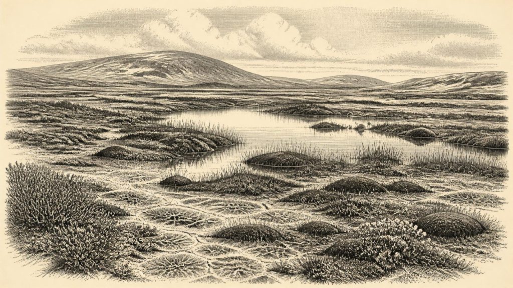
The fossils point to an open tundra or muskeg environment in south Fermanagh. Herb pollen, plant macrofossils, mosses and invertebrate remains indicate cold, treeless ground with wet hollows and pools rather than continuous woodland. Sedges and mossy vegetation could exploit saturated ground; hardy herbs and low shrubs occupied more exposed surfaces. The evidence supports a patchwork of shallow water, marsh, damp mineral soil and sparse dry ground. It does not justify a detailed painted panorama of every plant or a claim that the whole island looked identical. Fossil pollen can travel, preservation is uneven, and one enclosed basin records its own locality most clearly.
Nevertheless, Derryvree decisively complicates the old picture of a uniformly ice-covered Ireland throughout the latter Ice Age. At some point during its dated interval, this part of north-central Ireland was ice-free long enough for freshwater sediment and a cold-climate biological community to develop. That conclusion is local, not national. Elsewhere, uplands may have supported glaciers or persistent snowfields, and the surviving evidence for earlier ice advances is difficult to disentangle from the effects of later ones. Ireland was a changing, regionally varied northern landscape, not a fixed frozen island.
Before the Greatest Expansion
This date also preceded the fullest known development of the last British-Irish Ice Sheet. Research on the surrounding continental shelf and on Irish landforms places the major maximum considerably later, broadly around 27,000–23,000 calibrated years BP in many Irish reconstructions, with regional advances and retreat histories differing around the coast. Thus the wetland at Derryvree belongs to a phase of climatic severity and instability before the later ice sheet achieved its greatest extent. It must not be imagined as a gentle interval: periglacial conditions involved repeated freezing and thawing, seasonally frozen ground, strong winds, short growing seasons and a landscape in which water and ice constantly rearranged sediment.
The geography was also unlike that of the present. Global sea level was lower than today because enormous volumes of water were held in ice sheets, enlarging coastal plains and altering the shape of the surrounding seas. Yet neither Derryvree nor the cave finds of southern Ireland provide a secure map of routes across those landscapes. It is unsafe to state that people or particular animals walked to Ireland across a known land bridge at this exact time. The appropriate conclusion is narrower: the island’s coasts, sea crossings and ecological connections were different, while their precise configuration and accessibility changed through time.
Animals and the Castlepook Question
County Cork supplies a second, very different kind of evidence. Castlepook Cave, near Doneraile, has yielded remains of cold-stage animals including reindeer, mammoth and spotted hyaena. Modern redating has shown that several older cave chronologies required revision, an important warning against treating antiquarian collections as simple time capsules. Cave deposits may mix bones accumulated over long periods; carnivores can drag carcasses underground; water, excavation and later disturbance can move material. Animal remains from a cave can demonstrate that a species occurred in the wider region, but not necessarily that all species lived together, or that the cave was a human campsite.
One Castlepook reindeer femur has attracted particular attention because it was directly dated to roughly 33,000 years ago and bears a deep mark interpreted by zooarchaeologist Ruth Carden as damage from a sharp stone implement during carcass processing. If that interpretation is sustained, it would be exceptionally early evidence of human activity in Ireland. It would indicate at least one episode in which people handled a reindeer carcass, not a settled population, a named group or a permanent colony. There are no securely associated hearths, dwelling floors, stone-tool assemblage, burials, ornaments, art or human remains from Ireland at this date. The National Museum of Ireland’s long-standing caution that clear Palaeolithic human evidence is lacking captures why the claim requires continued testing through stratified excavation, taphonomic analysis and further dating.
The marked bone should therefore be neither dismissed nor enlarged into a story it cannot bear. It makes a human visit plausible; it does not tell us whether the animal was hunted, scavenged, butchered elsewhere and carried to the cave, or encountered by a group travelling through. It offers no direct evidence for language, kinship, leadership or belief. The most defensible human history for this date is a question under investigation, not a recovered biography.
Society Without Institutions
For that reason, political affairs, diplomacy and organised conflict cannot responsibly be described for Ireland in 31,040 BCE. There is no evidence for polities, territories, chiefs, treaties, fortifications or warfare. Nor can religion be reconstructed from the Derryvree wetland or a marked bone. The absence of proof does not mean that any visitors lacked social relationships or ideas; all human communities have social lives. It means that Irish evidence has not preserved traces sufficient to identify their institutions, rituals or cultural identities.
What can be said about possible everyday practice is similarly modest. In the wider European Upper Palaeolithic, mobile hunter-gatherers possessed sophisticated knowledge of animals, stone, clothing, fuel and seasonal terrain. That broad comparison can suggest what a short visit to cold-stage Ireland might have required: warm garments, portable equipment, careful food planning and close attention to weather and game. It cannot establish that any particular technology was used at Castlepook, because no securely contemporaneous toolkit has been recovered there. The reindeer femur, if humanly modified, implies practical carcass processing; it does not document a local economic system.
No Trade, No Settlement Record
There is likewise no evidence for trade in the usual historical sense: no imported objects, exchange network, boats, market place or specialised production can be assigned to Ireland around this date. The economy visible at Derryvree is ecological rather than human: plants converting a brief growing season into biomass; insects and grazing animals using the available habitats; water collecting and draining across frost-affected ground. If people were present, animals such as reindeer would have represented valuable food, hide, sinew, bone and perhaps seasonal knowledge. But this remains an inference from hunter-gatherer lifeways elsewhere, not a demonstrated Irish practice.
Settlement evidence is absent. Derryvree was a wetland, not a house site, and Castlepook’s old faunal collection lacks the stratigraphic certainty needed to identify a habitation surface of this age. The best historical image is consequently one of intermittent possibility. Ice-free patches supported cold-adapted vegetation and animals; changing ice and climate could close those landscapes again; any human presence may have been brief, mobile and archaeologically fragile. Later glaciation would have scoured, buried or redeposited much of what once existed.
The Value of a Thin Record
The principal development around this notional year was environmental, not political: Ireland contained at least some non-glacial terrain during an unstable phase before the last ice sheet’s major expansion. In Fermanagh, a freshwater wetland sustained tundra vegetation and small animal life between separate glacial episodes. In Cork, cave fauna show that cold-adapted large mammals entered the Irish landscape, while one reindeer bone raises the unresolved prospect of a very early human encounter. These records are precious precisely because they are thin. They replace invented certainty with a truer history of water, moss, insects, animals, advancing ice and the faint possibility of people at Europe’s north-western edge.
Primary Sources
- A Middle Midlandian Freshwater Series at Derryvree, Maguiresbridge, County Fermanagh, Northern Ireland
- A Reconsideration of the Radiocarbon Dating of the Marine Isotope Stage 3 Fauna from Southern Ireland
- Trimlines, Blockfields and the Vertical Extent of the Last Ice Sheet in Southern Ireland
- Deglaciation Chronology of the Donegal Ice Centre, North-west Ireland
- Timing and Pace of Ice-sheet Withdrawal Across the Marine–Terrestrial Transition West of Ireland During the Last Glaciation
- Pattern and Timing of Retreat of the Last British-Irish Ice Sheet
- Stratigraphic and Palaeo-geomorphological Evidence for the Glacial-deglacial History of the Last British-Irish Ice Sheet in the North-western Irish Sea
- The Timing and Magnitude of the British–Irish Ice Sheet Between Marine Isotope Stages 5d and 2
- Dimensions and Chronology of the Last Ice Sheet in Western Ireland
- Palaeoecology
- The Subdivision of the Quaternary Period in Ireland
- Quaternary Data and Maps
- Ireland Through Geological Time
- Prehistoric Details: Mell Flint Flake
- 2022:564 – Castlepook Cave, Castlepook South, Cork
- Archaeological Heritage of County Cork
- The Irish Quaternary Fauna Project
- New Insights on the Fauna of Ireland’s Younger Dryas and Early Holocene from Alice & Gwendoline Cave
- The IntCal20 Northern Hemisphere Radiocarbon Age Calibration Curve (0–55 cal kBP)
- The IntCal20 Approach to Radiocarbon Calibration Curve Construction: A New Methodology Using Bayesian Splines and Errors-in-Variables
- Irish Quaternary Association: Outreach and Education Resources
- Irish Quaternary Association: Field Guides