Derryvree’s Sedge Hollow31467 BCE
Around 31,467 BCE, Ireland lacked written records, so evidence offers only calibrated reconstructions. During Marine Isotope Stage 3, before the Last Glacial Maximum, conditions were cold, open and harsh, though not uniformly ice-covered. Organic sediments at Derryvree, County Fermanagh, between glacial tills, preserve sedges, aquatic plants and treeless wetlands, demonstrating an ice-free interval later sealed by glaciation. Cave remains at Castlepook, County Cork, show Late Pleistocene fauna including reindeer, mammoth and hyaena. A cut-marked reindeer femur may indicate human activity, but proves neither settlement nor continuous occupation. These records reveal changing landscapes capable of sustaining wildlife and perhaps mobile hunter-gatherers.
Dateline
The label 31,467 BCE is useful for arranging a modern chronology, but it cannot identify a witnessed Irish event. No calendar, writing system or historical record existed on the island, and archaeology cannot resolve human or environmental change to one numbered year this far back. In radiocarbon scholarship, this point lies roughly around 33.4 thousand calendar years before present (cal BP, where “present” conventionally means 1950), within the Late Pleistocene and Marine Isotope Stage 3. The appropriate evidence is therefore regional, layered and probabilistic: fossil bone from caves, waterlogged plant remains trapped beneath later glacial deposits, pollen, insects, sediments, and the changing footprint of ice. Calibrated ranges, rather than a single date, are the responsible measure of time here.
A Landscape Before Maximum Ice
Ireland at this broad horizon was not yet in the fullest grip of the Last Glacial Maximum, which came substantially later. It belonged to an unstable cold-stage world in which climatic shifts could be abrupt and the advance of ice was neither simple nor simultaneous across the island. The British–Irish Ice Sheet had grown and retreated repeatedly during the wider Pleistocene, but the greatest late-glacial expansion is generally placed after this period, principally in the later part of Marine Isotope Stage 3 and Marine Isotope Stage 2. Thus it would be wrong to picture every Irish valley as continuously buried beneath a single, island-wide sheet of ice in 31,467 BCE. Equally, it would be wrong to imagine a mild, wooded Ireland. The available evidence indicates a cold, open, highly seasonal environment, increasingly vulnerable to glaciation.
Sea level was far lower than today because so much water was locked in continental ice. Ireland’s surrounding seas, coasts and connections to neighbouring lands consequently differed greatly from the modern map. Yet the exact geography of possible routes between Ireland, Britain and continental Europe remains a matter for palaeogeographical reconstruction, not a fact recoverable from a single bone or wetland deposit. Lower seas may have narrowed or altered crossings at different times, but they do not by themselves prove an easy land bridge, a settled migration route, or regular traffic into Ireland.
The Derryvree Evidence
The clearest Irish environmental window relevant to this date is at Derryvree, near Maguiresbridge in County Fermanagh. There, investigators found organic freshwater sediments between two bodies of glacial till. This is an exceptionally valuable arrangement: the lower till demonstrates an earlier ice advance; the organic layers preserve an interval when liquid water, plants and shallow wetland conditions existed; and the upper till records renewed glacial influence. The deposit is not a diary of one season, still less one year. It is a compressed natural archive, preserved because later ice and sediment sealed it.
A conventional radiocarbon measurement from Derryvree, reported as about 30,500 radiocarbon years BP with a large uncertainty, is old by modern standards and must be treated cautiously. Calibration converts radiocarbon ages into calendar-age probability ranges, but around 30,000–35,000 years ago those ranges remain broad and the curve itself has limits of resolution. The Derryvree sequence is commonly placed in the later part of MIS 3 and has sometimes been correlated with the wider Denekamp interstadial complex of north-west Europe, broadly around 35,000–28,000 years ago. That correlation is an informed interpretation, not a precise identification of a particular Greenland warming or of conditions on 31,467 BCE itself.
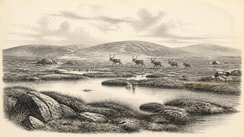
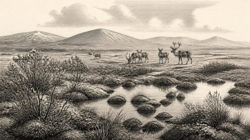
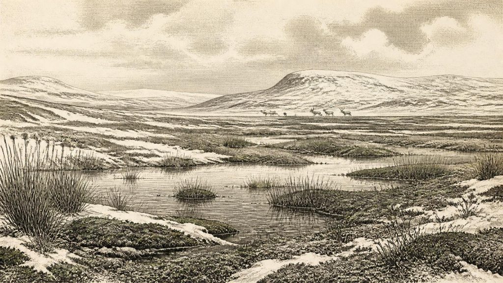
What the Derryvree remains do securely show is an open freshwater landscape. Plant macrofossils included sedges and other wetland vegetation, while pollen and associated evidence point away from closed forest. The traditional description of a treeless muskeg captures the mixture of saturated ground, mosses, sedges, shallow pools and cold-tolerant plants, though no modern habitat is an exact equivalent. Water-milfoil and bogbean-like aquatic or wetland indicators suggest water was locally available during the formation of the organic beds. Dwarf shrubs and herb-rich patches may have occupied better-drained ground nearby. This was not barren ice desert: it was a mosaic in which water, snow, frozen soil and vegetation met.
Cold, Open Country
The wider Irish record supports that picture. Comparable inter-till organic deposits at Hollymount and Greenagho in Fermanagh, and the more complex sequence at Aghnadarragh in County Antrim, show that intervals without overriding ice occurred during the Midlandian, Ireland’s name for the last glacial cycle. Aghnadarragh preserves evidence from an earlier, relatively temperate MIS 3 interval with birch, pine and spruce, whereas the later Derryvree-type evidence is markedly colder and more open. Such sites demonstrate environmental variety through time; they must not be blended into one imaginary national landscape. At the requested horizon, Derryvree is more relevant than the earlier woodland evidence from Aghnadarragh.
For people who might have stood in this country, visibility would probably have been extensive across open ground. Winters were severe, growing seasons short, and shelter scarce beyond limestone caves, river cuts, rock outcrops and local changes in terrain. Summer wetlands could have supplied freshwater and plant material, while sedge-rich ground might support grazing animals. But temperature, rainfall and snow cover cannot responsibly be assigned to a particular day, decade or valley. The environmental archive tells of ecological conditions accumulated over time, not weather forecasts for prehistoric Ireland.
Castlepook and Its Animals
Some 300 kilometres south-west of Derryvree, Castlepook Cave near Doneraile in north Cork provides the most evocative animal evidence for this broad phase of Irish prehistory. Excavations begun in the early twentieth century recovered a striking mixture of Pleistocene remains, including reindeer, woolly mammoth, giant deer, brown bear, wolf, fox, mountain hare, Arctic and Norway lemmings, and spotted hyaena. Not every specimen is necessarily of identical age, and antiquarian digging disturbed or removed much of the original stratigraphy. The cave collection therefore establishes that these animals reached Ireland at intervals during the Late Pleistocene; it cannot demonstrate that they all grazed or hunted together outside the entrance in one year.
Reindeer are especially pertinent to an open, cold landscape. Their presence is consistent with tundra or mammoth-steppe-like terrain, while lemmings and mountain hare reinforce the cold-climate signal. Mammoth and giant deer point to the capacity of parts of Ireland, at favourable times, to sustain large herbivores. Spotted hyaenas were important agents as well: caves could be dens or places where carnivores dragged carcass parts, chewed bones and mixed deposits. Castlepook should therefore be read as a record of animal movement, predation, scavenging and bone accumulation, not simply as a menu of game available to people.
The Human Question
A reindeer femur from Castlepook has made this period central to discussion of Ireland’s earliest possible human presence. A deep surface incision has been interpreted as a stone-tool mark made while fresh bone was being processed, and reassessment of the cave fauna has placed this material within MIS 3 rather than the much later dates formerly obtained for some Irish cave bones. If that interpretation withstands further testing, it indicates that people may have handled a reindeer carcass in Ireland around this broad period—potentially far earlier than the better-known terminal-Pleistocene evidence.
That conclusion must remain carefully bounded. The find is not a house floor, hearth, burial, tool assemblage or securely stratified campsite. No known Irish evidence currently allows historians to name a band, define a permanent population, trace a route, reconstruct a language, or claim continuous occupation from this time. Nor can a mark on one bone distinguish hunting from scavenging, tell how many people were involved, or prove that the cave was their living place. The exact identification of cut marks requires taphonomic comparison because trampling, carnivore damage, excavation damage and natural breakage can all complicate surfaces. The most defensible wording is that Castlepook preserves a promising and important indication of human activity, under continuing scientific assessment.
No Polities, But Real Lives
There is no evidence for political institutions, chiefs, diplomacy, territorial states, formal religion, farming, metalworking, pottery, long-distance commerce or literacy in Ireland at this horizon. These absences matter. It would be misleading to fill them with later Irish traditions or with generic Stone Age scenes. If people did enter the island, they would have belonged to mobile Palaeolithic hunter-gatherer worlds shared, in broad ecological terms, with north-western Europe. Their social arrangements, beliefs and learning were embodied in kinship, memory, skill and movement rather than documents. Yet no Irish artefact assemblage of this age presently permits a detailed account of any of these things.
Economy, in the narrow sense, was ecological survival rather than market exchange. An opportunistic visitor could potentially have sought meat, marrow, hide, sinew, antler, bone and fuel from animal remains, but Castlepook does not establish which materials were taken from its particular reindeer. Reindeer herds and other mobile fauna may have made Ireland part of a wider seasonal range; that is a plausible ecological inference, not proof of a scheduled human migration. The cave finds and Fermanagh wetlands instead reveal an Ireland on the threshold of harsher conditions: a place intermittently capable of supporting life, but subject to dramatic climatic and glacial change.
What This Year Can Mean
The significance of 31,467 BCE lies not in a named episode but in a period of possibility. Derryvree’s buried freshwater sediments show that parts of Ireland sustained cold wetland ecosystems before later ice sealed them. Castlepook’s bones show that a distinctive Late Pleistocene fauna reached the island, and its marked reindeer femur raises the serious possibility of a very early human encounter. The evidence is fragmentary because ice, erosion, shifting seas and early excavations have destroyed or disturbed so much. Rather than inventing a lost Irish society, this date invites attention to the surviving traces: sedges in a Fermanagh hollow, animal bones in a Cork cave, and a landscape changing towards the great glaciation still to come.
Primary Sources
- A Middle Midlandian Freshwater Series at Derryvree, Maguiresbridge, County Fermanagh, Northern Ireland
- Early Midlandian–Middle Midlandian, Pleistocene, Northern Ireland
- Aghnadarragh
- Introduction to the Late Quaternary and Holocene of Northern Ireland
- Figure 6.— The Subdivision of the Quaternary Period in Ireland
- Irish Pleistocene Biostratigraphy
- The Irish Quaternary Fauna Project
- A Reconsideration of the Radiocarbon Dating of the Marine Isotope Stage 3 Fauna from Southern Ireland
- New Insights on the Fauna of Ireland's Younger Dryas and Early Holocene from Alice & Gwendoline Cave
- Maximum Extent and Dynamic Behaviour of the Last British–Irish Ice Sheet West of Ireland
- British–Irish Ice Sheet and Polar Front History of the Goban Spur, Offshore Southwest Ireland Over the Last 250,000 Years
- Dating Constraints on the Last British-Irish Ice Sheet: A Map and Database
- The IntCal20 Northern Hemisphere Radiocarbon Age Calibration Curve (0–55 cal kBP)
- The Greenland Ice Core Chronology 2005, 15–42 ka. Part 2: Comparison to Other Records
- A 60,000 Year Greenland Stratigraphic Ice Core Chronology
- Phylogeographic, Ancient DNA, Fossil and Morphometric Analyses Reveal Ancient and Modern Introductions of a Cryptic Species, the Field Vole (Microtus agrestis), to Ireland
- The Mesolithic in Ireland: When Was It?
- Heritage Artefacts of County Cork
- Ireland: Submerged Prehistoric Sites and Landscapes
- The Tolsta Interstadial, Scotland: Correlation with D–O Cycles GI-8 to GI-5?