

Maguirebridge Under Two Tills31507 BCE
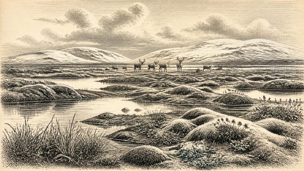
Around 31,507 BCE, Ireland was a climatically unstable Late Pleistocene landscape, not a documented historical year. At Derryvree near Maguiresbridge, freshwater organic sediments between glacial tills preserve pollen, plants and insects indicating treeless, cold wetland with pools, sedges, herbs, mosses and juniper during an ice-free interval. Castlepook Cave in Cork records diverse MIS 3 fauna, including mammoth, reindeer, hyaena and predators, although dates and deposits remain chronologically complex. The British–Irish Ice Sheet expanded unevenly, reshaping habitats and routes. A possibly cut-marked reindeer bone may suggest human visitation, but no settlement evidence exists. Surviving evidence instead documents an uncertain ecological frontier.
Dateline
A Year That Cannot Be Isolated
31,507 BCE is a modern chronological label, not a year that anyone in Ireland could have named, recorded or remembered. No writing, calendar, ruler, polity or historical community can be recovered from the island at this depth of time. In the archaeological convention of years before present, whose reference point is AD 1950, it lies about 33,456 years BP. That places it in the Late Pleistocene, within Marine Isotope Stage 3 (MIS 3), a long, climatically unstable part of the last Ice Age. It does not permit a year-by-year narrative in the ordinary historical sense.
Modern calendar-year precision is unavailable. Radiocarbon measurements from this period have laboratory uncertainties and must be calibrated against changing past atmospheric carbon levels; even then they yield probability ranges rather than a dated incident. The best responsible approach is therefore to ask what deposits, fossils and landforms can illuminate Ireland broadly around the mid-30,000s calibrated years BP, while keeping observations distinct from interpretation.
The answer is necessarily fragmentary. Ireland’s later glaciation destroyed, disturbed or buried many older surfaces. There are no securely dated dwellings, hearths, burials, stone-tool assemblages, art objects, cultivation traces or settlement landscapes that can be assigned to 31,507 BCE. Nor is there evidence from which to reconstruct political affairs, diplomacy, formal warfare, religion, trade partnerships or a permanent Irish population. What survives is a small but important environmental and faunal record.
Freshwater Beneath a Drumlin
The closest and most informative Irish archive is at Derryvree, near Maguiresbridge in County Fermanagh. Road construction exposed a sequence in which organic-rich freshwater sediments, sands and silts lay between two tills: unsorted sediment deposited by glaciers. The basic stratigraphic fact is strong. An earlier phase of ice deposited the lower till; an interval without overriding local ice allowed wetland and freshwater deposits to accumulate; a later advance sealed them below the upper till.
The original Derryvree investigation obtained a radiocarbon determination of 30,500 ± 1,170 radiocarbon years BP from the organic series. Under modern calibration, this should not be rewritten as an exact calendar age. It belongs broadly in the middle part of MIS 3, and ranges derived from it are wide. The numbered year in this article may sit within the general span illuminated by Derryvree, but there is no basis for claiming that a particular pool, plant, animal or weather event existed in that precise twelve-month period.
What the sediment preserves is nonetheless vivid. Pollen, plant macrofossils, mosses and insect remains point to an open, predominantly treeless landscape. Grasses, sedges, herbs and juniper formed part of the recorded vegetation, while the celebrated seed record of bogbean (Menyanthes trifoliata) and the associated aquatic and moss flora indicate standing or slowly moving freshwater amid wet ground. Insect evidence complements this picture. The resulting interpretation is of a cold, periglacial muskeg or tundra-like mosaic: shallow pools, waterlogged vegetation, exposed mineral ground and frost-affected terrain rather than forest.
This was not the familiar green, wooded Ireland of later millennia. Nor should it be imagined as a uniform snow desert. Wetland plants demonstrate liquid water in at least part of the local landscape and, by implication, seasons or microhabitats able to sustain them. Yet the fossil combination also supports harsh winters, short growing seasons and an environment vulnerable to abrupt climatic shifts. Derryvree was a local basin, not a complete map of the island; its value lies in showing that an ice-free or ice-margin landscape could preserve freshwater life in northern Ireland before renewed glaciation.
An Island of Moving Ice and Water
At this date Ireland was part of the changing north-west European world of the British–Irish Ice Sheet, but it was not simply either wholly ice-covered or wholly ice-free. Recent reconstructions show that ice-sheet growth and maximum extent varied markedly by sector. Their maps and modelled time slices are strongest for broad patterns, not for determining conditions in every Irish valley in every century. They indicate extensive and growing ice after about 31,000 years BP, with maximum conditions in many sectors occurring later, roughly during the interval around 30,000–22,000 years BP and with the ice-sheet-wide volume maximum about 23,000 years BP.
For 31,507 BCE, the important point is regional change. Some uplands and western or northern sectors may already have supported substantial ice, while refuges, ice-free ground, lakes, wetlands and cave entrances survived elsewhere at different times. A small ice cap has been inferred in south-west Ireland in reconstructions around 31,000 BP, but the timing and outlines of early ice are less securely constrained than its later maximum. Derryvree’s inter-till deposits are precisely the kind of evidence that prevents an over-simple picture of a permanently frozen island.
Sea level was far lower than today because enormous quantities of water were locked in continental ice sheets. However, low sea level does not automatically demonstrate a simple, dry land bridge from Ireland to Britain at this particular time. The geography of the Irish Sea basin, ice margins, coastlines and possible routes changed repeatedly; evidence for actual crossings must be separated from possibilities suggested by maps. Animals evidently reached Ireland during favourable Late Pleistocene phases, but the frequency, routes and duration of their movements remain debated.
Castlepook’s Animal Archive
In north County Cork, Castlepook Cave near Doneraile is the principal Irish archive for the larger mammals of this broad era. Its collections include remains attributed to woolly mammoth, spotted hyaena, giant deer, reindeer, brown bear, wolf, Arctic fox, mountain hare, stoat and lemmings. Direct radiocarbon dates obtained from Castlepook mammoth and hyaena material in older work fall around 33,500 ± 1,200 and 34,300 ± 1,800 radiocarbon years BP respectively. Those measurements show that a diverse cold-stage fauna reached Ireland during MIS 3, but they must be calibrated and treated as broad chronological indicators, not as proof that every listed species occupied the cave together or lived there in 31,507 BCE.
Caves also demand taphonomic caution. Bones may have been carried in by carnivores, washed or reworked from older deposits, moved by excavation, or collected with incomplete stratigraphic records in the nineteenth and early twentieth centuries. A cave assemblage is thus an archive of deaths, scavenging, denning and preservation processes, not a photographic census of a living landscape. Hyaena activity is particularly significant: the animals could accumulate prey remains and modify bones, complicating any attempt to identify human action solely from damage to a specimen.
The Castlepook fauna nevertheless allows a defensible ecological inference. Ireland contained enough connected or intermittently connected habitat for sizeable grazing animals and their predators. Mammoth and reindeer evoke open vegetation, while hyaena, wolf and bear remind us that large carcasses and sheltered cavities were part of a wider food web. These are not grounds for calling the island a classic “mammoth steppe” in its entirety; rather, they support a patchwork of open cold-country habitats, locally constrained by topography, moisture and advancing ice.
The Human Question
A reindeer femur from Castlepook has been publicised as bearing a mark consistent with cutting or chopping by a stone implement while the bone was fresh. If that interpretation withstands continued study, it could indicate a human visit to Ireland around 33,000 years ago and would transform the older picture in which convincing human evidence began much later. But a single modified bone is not a settlement site. It does not establish the visitors’ number, identity, language, route, season, technology beyond the proposed use of a sharp implement, or whether they returned. No associated hearth, tool kit, dwelling floor or cemetery has yet demonstrated a resident Upper Palaeolithic community in Ireland at this date.
Accordingly, society and everyday life must be stated conditionally. If people did reach Ireland during this broad interval, they were likely highly mobile hunter-gatherers operating in a severe and variable environment, with animal resources, shelter and seasonal movement central to survival. That is an inference from the wider Upper Palaeolithic world, not a direct description of an Irish band. There is no evidence for farming, domesticated animals, villages, chiefs, monuments, formal religious institutions or sustained exchange networks on the island.
There is equally no evidence for Irish political conflict or diplomacy. Predation, scavenging and competition between carnivores are visible ecological processes, not warfare. The central drama was environmental: ice advancing and retreating across regions; wetland habitats briefly forming and being buried; animals dispersing into and out of an unstable island landscape. The absence of direct human evidence is itself historically meaningful, reflecting both genuinely sparse occupation and the destructive force of later glaciation.
What Can Be Said Responsibly
Around the modern label 31,507 BCE, Ireland was a cold Late Pleistocene landscape undergoing profound regional change. At Derryvree, a freshwater wetland preserved evidence for sedges, mosses, herbs, pools and treeless periglacial ground between separate glacial episodes. At Castlepook, animal bones attest to a richer but chronologically complex cold-stage fauna, including large herbivores and formidable carnivores. The British–Irish Ice Sheet was expanding unevenly towards its later maximum, continually altering habitats and routes.
That is not a story of kings or battles, but it is a formative Irish history. The buried silts at Maguiresbridge and the cave bones of north Cork reveal that the island’s deep past was not empty time before people. It was a changing ecological frontier whose surviving evidence is precious, local and incomplete. The responsible account of this notional year is therefore one of calibrated ranges, carefully tested traces and acknowledged uncertainty—not invented events on an exact date.
Primary Sources
- A Middle Midlandian Freshwater Series at Derryvree, Maguiresbridge, County Fermanagh, Northern Ireland
- Early Midlandian–Middle Midlandian, Pleistocene, Northern Ireland
- Figure 6.— The Subdivision of the Quaternary Period in Ireland
- The Irish Quaternary Fauna Project
- Occurrence of Mammalia Relicts at Site Castlepook Cave
- The Exploration of Some Caves Near Castletownroche, Co. Cork
- 32564: Castlepook Cave, Co. Cork
- Growth and Retreat of the Last British–Irish Ice Sheet, 31,000 to 15,000 Years Ago: the BRITICE-CHRONO Reconstruction
- The Timing and Magnitude of the British–Irish Ice Sheet Between Marine Isotope Stages 5d and 2
- The IntCal20 Northern Hemisphere Radiocarbon Age Calibration Curve (0–55 cal kBP)
- A Stratigraphic Framework for Abrupt Climatic Changes During the Last Glacial Period Based on Three Synchronized Greenland Ice-Core Records
- The Last Glacial Maximum
- Exploring Controls of the Early and Stepped Deglaciation on the Western Margin of the British Irish Ice Sheet
- Maximum Extent and Dynamic Behaviour of the Last British–Irish Ice Sheet West of Ireland
- Maximum Extent and Readvance Dynamics of the Irish Sea Ice Stream and Irish Sea Glacier Since the Last Glacial Maximum
- The Mesolithic in Ireland: When Was It?
- New Insights on the Fauna of Ireland's Younger Dryas and Early Holocene from Alice & Gwendoline Cave
- Ireland: Submerged Prehistoric Sites and Landscapes
- Pleistocene Mammals in Ireland (Pre-10,000 Years B.P.)
- Biogeography of Ireland: Past, Present, and Future