Maguirebridge’s Silt Lens31266 BCE
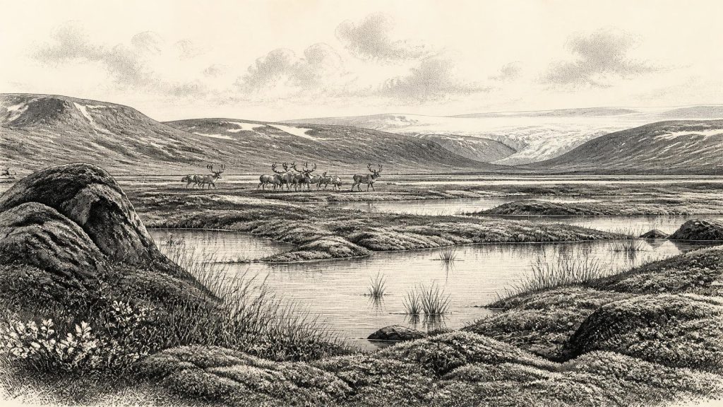
The label 31,266 BCE cannot identify a precise event, but falls within MIS 3, a climatically unstable phase of the Midlandian cold stage. At Derryvree near Maguiresbridge, freshwater silts between glacial tills record an ice-free interval dated broadly to 36,900–31,700 years BP. Wetlands, tundra-like vegetation, insects and aquatic plants indicate severe periglacial conditions. Castlepook Cave preserves a long-accumulated fauna including mammoth, giant deer, reindeer, bear and hyena, demonstrating intermittently productive habitats. A possibly cut-marked reindeer bone suggests early human activity, but without associated tools or settlements it cannot prove occupation. The evidence depicts shifting ice, water, vegetation and animal movement.
Dateline
“31,266 BCE” is a modern calendar label, not a date that can be recovered from Irish deposits with year-by-year precision. No event, person, settlement or political act can responsibly be assigned to that particular year. The useful historical frame is the later part of Marine Isotope Stage 3 (MIS 3), within the Midlandian cold stage of the Irish Pleistocene. In calendar terms, the label falls roughly 33,215 years before the radiocarbon reference year of AD 1950, but such arithmetic must not be mistaken for an archaeological date. The relevant evidence is measured in broad calibrated ranges, sediment sequences and changing animal communities.
The closest and most informative Irish record is at Derryvree, near Maguiresbridge in County Fermanagh. There, roadworks in 1969 cut through a drumlin and exposed freshwater silts and sands containing organic remains between two separate tills: unsorted debris deposited by glacier ice. The order of events is clear even if its calendar precision is not. Ice laid down the lower till; later, water and vegetation accumulated sediments in an ice-free locality; eventually another advance of ice sealed the deposits under upper till. A radiocarbon determination from the organic material, Birm-166, was reported as 30,500 ± 1,170/1,030 radiocarbon years BP. Modern calibration places it broadly around 36,900–31,700 calibrated years BP, approximately 34,950–29,750 BCE. The requested year lies within that very wide interval, not at an identifiable moment within the bed.
An Island in a Changing Cold Stage
This was not yet the Last Glacial Maximum, when ice later became far more extensive across Ireland and the surrounding seas. Nor was it a mild, stable prelude to it. MIS 3 was characterised across the North Atlantic world by sharp climatic shifts, registered especially clearly in Greenland ice cores. Irish deposits cannot be matched securely to a single short-lived Greenland warming or cooling episode merely because their broad dates overlap. What the Fermanagh sequence establishes is more limited, and more valuable: at some point within its dated span, ground near Maguiresbridge was not beneath glacier ice and supported a freshwater environment in a severe periglacial climate.
That distinction matters for Ireland as a whole. Derryvree is firm evidence for local conditions in south Fermanagh, not proof that every coast, mountain and lowland was simultaneously ice-free. Glaciers respond to local topography, snowfall, temperature and the dynamics of neighbouring ice masses. Other evidence from Ireland, including marine shells and glacial deposits, suggests that the last Irish Ice Sheet expanded over a long interval rather than appearing everywhere at once. Around the time represented by this article, some landscapes could have been open, wind-exposed and biologically productive while other regions were affected by advancing ice or lay beyond the available evidence.
The familiar outlines of the modern island were also misleading guides to movement. Sea level was considerably lower than today because large volumes of water were locked in continental ice sheets. Coastlines lay farther out, and the Irish Sea basin had a different geography. Yet no securely demonstrated land route, sea crossing or seasonal passage can be assigned to a particular year around 31,266 BCE. The presence of mammals shows that animals reached Ireland during favourable parts of the wider cold-stage interval; it does not reveal every route, every generation or the exact shape of the shore.
Freshwater Among the Tundra
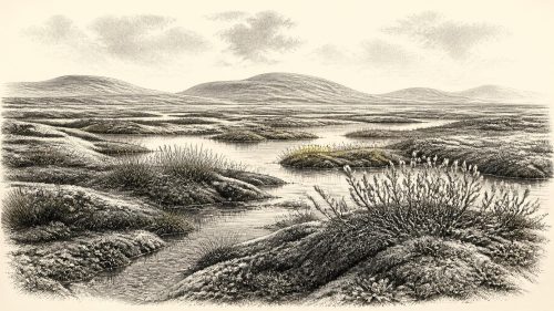
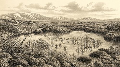
Derryvree’s organic horizon is a rare environmental archive. Plant macrofossils, pollen, mosses, sedges and fossil insects preserve a picture of cold, largely treeless country. The vegetation was not woodland. It was an open mosaic of wet ground, shallow water, sedge-rich margins and sparsely vegetated mineral soils, shaped by frost, short growing seasons and strong seasonality. The recovery of aquatic and wetland plants, including bogbean, shows that liquid water persisted during the warmer part of the year. Mosses and herbs associated with northern or alpine environments indicate conditions far colder than those of modern Fermanagh.
Such evidence is direct evidence for particular organisms and habitats, but reconstruction requires care. A pollen grain can travel; an insect or plant remains only where sedimentation and preservation allow it to survive; a buried pool tells us little about an upland ridge a few kilometres away. Still, the combined record strongly supports a tundra-like, periglacial setting rather than a forested Irish landscape. In places, seasonally frozen ground would have affected drainage and vegetation. Pools and sedge marshes could have been biologically rich in summer, while winter imposed darkness, cold and restricted plant growth.
There is no basis for imagining farms, fields, villages or a managed countryside. There was no agriculture in Ireland at this depth of time, no domesticated livestock, no pottery, metalworking or written learning. What can be discussed instead is an ecosystem in which the annual productivity of grasses, herbs, mosses and wetland plants sustained mobile animal populations. The principal history is therefore environmental: water collecting between glacial episodes, plants recolonising exposed ground, animals moving through available habitat, and ice eventually returning to transform or destroy that landscape.
Castlepook and the Mammal Record
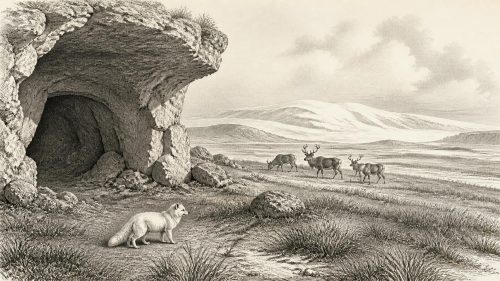
County Cork provides another essential, though differently preserved, window. Castlepook Cave near Doneraile, historically called Mammoth Cave, has yielded Ireland’s richest known assemblage of vertebrate remains from the period leading towards the Last Glacial Maximum. Excavations in the early twentieth century recovered more than 2,000 bones from cave sediments. Subsequent direct radiocarbon dating has shown that its fauna represents a long span, broadly from about 45,700 to 19,950 years BP. It is therefore not a snapshot of one living community, still less of a single year, but a repository assembled over millennia by natural processes as well as animal activity.
Its fauna demonstrates that, during parts of MIS 3, Ireland supported mammals now absent from the island: woolly mammoth, giant deer, reindeer, brown bear and spotted hyena, alongside wolf, Arctic fox and lemmings in later cold-stage deposits. A cave containing bones does not necessarily mark a hunting camp. Carnivores may have carried prey into chambers; scavengers, water, sediment movement and repeated disturbance can mix material of different ages. At Castlepook, the presence of spotted hyena is especially significant, because hyenas can accumulate bones and alter them through gnawing and transport. Their denning behaviour is part of the explanation for the assemblage, not an inconvenience to be ignored.
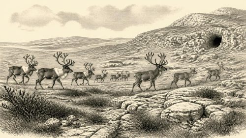
For the date in question, reindeer are particularly evocative but should not be romanticised. Their bones show that cold-adapted deer occurred in Ireland during this broad era and that open country could support grazing or browsing herds. They do not demonstrate a permanent annual migration route through every Irish region. Mammoth and giant deer similarly belong to a changing fauna rather than to a guaranteed cast of animals visible together at Maguiresbridge in 31,266 BCE. The sound conclusion is that Irish landscapes were capable, at intervals, of sustaining a much richer Pleistocene mammal community than survives today.
The Human Question
A reindeer femur from Castlepook has been publicised as bearing a deep mark consistent with cutting or butchery using a stone tool, and the bone has been dated to roughly 33,000 years ago. If that interpretation is sustained, it may be Ireland’s earliest evidence of human handling of an animal and would push possible human activity far earlier than the well-known post-glacial evidence. It is an important claim, but it remains necessarily narrow. A radiocarbon determination dates the animal bone, while deciding whether an incision was made by a tool rather than another process is a separate taphonomic judgement.
Crucially, no securely associated stone-tool assemblage, hearth, dwelling floor, burial, repeated occupation surface or food-processing area of comparable age has been recovered at Castlepook. One marked bone cannot establish a resident population, a language, ancestry, a route of arrival or continuous occupation of Ireland. It cannot support invented hunters around a campfire, however tempting such a scene may be. Recent work at the cave is valuable precisely because new excavation and modern scientific techniques may test the old collections and their disturbed contexts more rigorously.
Accordingly, there are no political affairs, diplomacy, named communities or conflicts that can be responsibly narrated for Ireland in this year. If people did reach the island during this part of MIS 3, they would have been mobile Upper Palaeolithic hunter-gatherers operating at the north-western edge of Europe. Their social relations, beliefs, speech, exchange networks and artistic practices are unknown in an Irish context. Continental European evidence shows that such populations possessed sophisticated stone technologies and rich cultural lives, but transferring those details to Ireland without Irish finds would be speculation.
What This Date Can Mean
The most historically meaningful development around this notional date was the unstable availability of habitable ground. Fermanagh’s buried freshwater deposits show that an ice-free interval allowed a cold wetland ecosystem to exist between glacial advances. Castlepook’s bones show that large mammals, carnivores and cold-adapted species entered Irish environments during the broader period. Together, the sites challenge any simple picture of an Ireland either wholly frozen or continuously inhabited. They reveal a landscape repeatedly opened and closed by climate: a place of tundra pools, sparse vegetation, animal movement and encroaching ice.
That is both a substantial history and the limit of the evidence. Ireland around 31,266 BCE was not a blank before later human settlement, but neither can it be populated with invented tribes, rulers or events. The surviving record is geological and biological, preserved by chance beneath drumlins and in limestone caves. Its restraint is its strength: silts, mosses, insects and bones allow us to see an island undergoing profound environmental change long before historical time.
Primary Sources
- A Middle Midlandian Freshwater Series at Derryvree, Maguiresbridge, County Fermanagh, Northern Ireland
- Palaeoecology: The Middle Midlandian Palaeoenvironment of South Fermanagh
- Early Midlandian–Middle Midlandian, Pleistocene, Northern Ireland
- Trimlines, Blockfields and the Vertical Extent of the Last Ice Sheet in Southern Ireland
- A Reconsideration of the Radiocarbon Dating of the Marine Isotope Stage 3 Fauna from Southern Ireland
- Castlepook Cave: Cork County Geological Site Report
- The Exploration of Castlepook Cave, County Cork
- Late Pleistocene Chronostratigraphy and Ice Sheet Limits, Southern Ireland
- Timing and Pace of Ice-Sheet Withdrawal Across the Marine–Terrestrial Transition West of Ireland During the Last Glaciation
- Timing and Pace of Ice-Sheet Withdrawal Across the Marine–Terrestrial Transition West of Ireland During the Last Glaciation
- Deglaciation Chronology of the Donegal Ice Centre, North-West Ireland
- New Insights on the Fauna of Ireland’s Younger Dryas and Early Holocene from Alice & Gwendoline Cave
- The Irish Quaternary Fauna Project
- Irish Quaternary Vertebrates
- Introduction to the Late Quaternary and Holocene of Northern Ireland
- Introduction to the Glacial Sand and Gravel Landscapes of Northern Ireland
- Dimensions and Chronology of the Last Ice Sheet in Western Ireland
- Maximum Extent and Readvance Dynamics of the Irish Sea Ice Stream and Irish Sea Glacier Since the Last Glacial Maximum
- Stratigraphic and Palaeo-Geomorphological Evidence for the Glacial-Deglacial History of the Last British-Irish Ice Sheet in the North-Western Irish Sea
- 2022:564 – Castlepook Cave, Castlepook South, Cork
- The IntCal20 Northern Hemisphere Radiocarbon Age Calibration Curve (0–55 cal kBP)
- A Stratigraphic Framework for Abrupt Climatic Changes During the Last Glacial Period Based on Three Synchronized Greenland Ice-Core Records