

Maguirebridge’s Intertill Flora31083 BCE
The modern label 31,083 BCE denotes a broad Late Pleistocene interval, not a recoverable year. Ireland experienced unstable cold conditions, with changing ice, low sea levels and largely treeless grassland, wetland and tundra mosaics. Derryvree, County Fermanagh, preserves freshwater sediments dated broadly to the mid-to-late 30,000s calibrated years before present, containing cold-adapted plants and insects that disprove permanent island-wide ice cover. Castlepook Cave, County Cork, records diverse cold-stage fauna, although mixed deposits prevent a single contemporaneous reconstruction. A possibly tool-marked reindeer femur suggests, but cannot prove, brief human carcass processing. No settlements, institutions or sustained population are securely documented locally.
Dateline
“31,083 BCE” is a modern chronological label, not a year that anyone in prehistoric Ireland could have named or recorded. No written calendar, dated event, ruler, settlement or individual can be recovered at that level of precision. In archaeological terms, the label points broadly to the later part of Marine Isotope Stage 3, a climatically unstable interval of the Late Pleistocene. The responsible history of Ireland at this depth in time must therefore be built from calibrated ranges, fossil deposits and probabilities rather than an annual chronicle.
The date lies roughly 33,000 calendar years before the conventional radiocarbon reference year of AD 1950, but that arithmetic should not be mistaken for precision. A conventional radiocarbon result measures radiocarbon years before present and must be converted through a calibration curve; its calendar equivalent is a range, sometimes a wide one. The current IntCal20 curve extends to 55,000 calibrated years before present, yet neither it nor any Irish deposit can identify an occurrence on one particular day, season or numbered year around 31,083 BCE.
An Unstable Ice-Age Ireland
This was Ireland before the fullest expansion of the last ice sheet. Later glaciation would reshape and strip much of the landscape, leaving a fragmentary record. It is misleading, however, to picture the entire island as a single, permanent white wilderness at this point. The evidence instead indicates regional and chronological variation: ice margins advanced and retreated, while some areas supported exposed ground, wetlands and freshwater basins during milder or less glacial phases. The central historical development was environmental instability on the north-western edge of Europe.
Sea level was substantially lower than today because enormous quantities of water were stored in continental ice. Ireland’s coastlines and connections to neighbouring lands cannot be reconstructed as a fixed map for this one nominal year. Animal movements demonstrate that Ireland was ecologically connected to Britain and the wider European landmass during parts of the Late Pleistocene, but they do not prove a continuously open, easily traversed land bridge at 31,083 BCE. Routes may have changed with sea level, ice, rivers, coastal lowlands and local conditions.
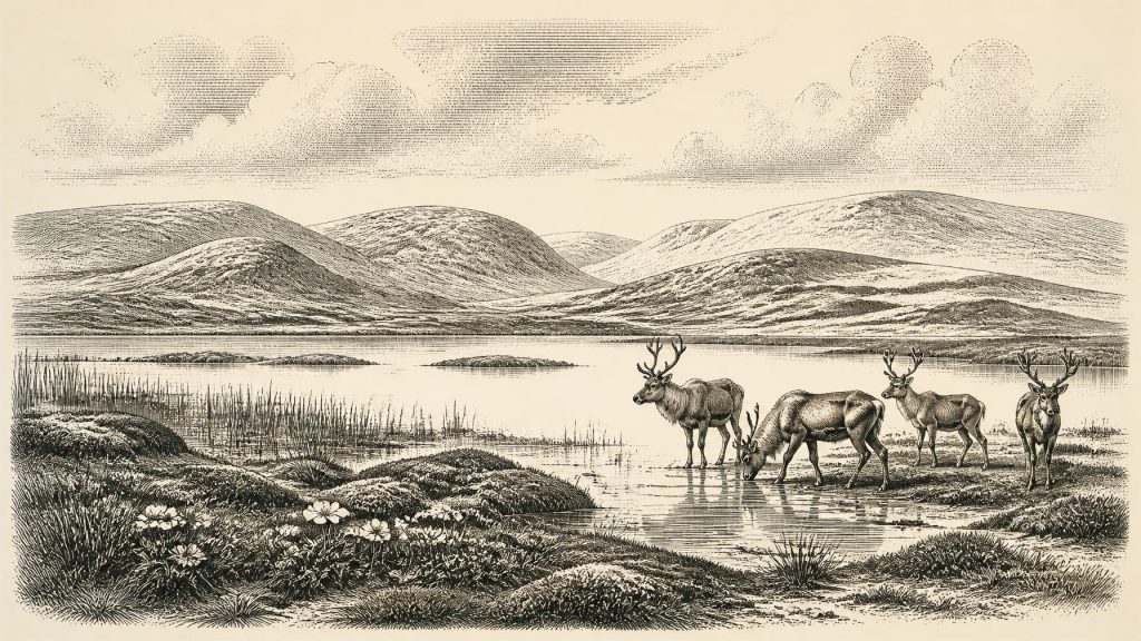
Nor was the familiar green, wooded island present. The most defensible general picture is of cold, largely treeless terrain, with grassland and herb-rich open patches, dwarf shrubs, mosses, sedges and wet hollows. Frost action, short growing seasons and severe winters constrained vegetation. Such country could nevertheless be biologically productive in places: water margins and sheltered basins offered plants, insects and grazing, while open ground could support large herbivores. This was a shifting mosaic, not a uniform tundra plain.
Derryvree’s Buried Wetland
The most informative Irish environmental evidence close to this broad timescale comes from Derryvree near Maguiresbridge, County Fermanagh. Road works exposed organic silts and fine sands trapped beneath a drumlin between glacial tills. The deposit produced the radiocarbon determination BIRM-166, conventionally reported as 30,500 radiocarbon years before present with a substantial uncertainty. Calibration places the evidence broadly in the mid-to-late 30,000s calibrated years before present, rather than at a pinpoint date. It is consequently relevant to the world represented by 31,083 BCE, not a diary entry from that year.
The Derryvree sediments are direct evidence that freshwater existed locally before later ice enclosed the deposit. Their pollen, plant macrofossils, mosses and insect remains support an interpretation of open, periglacial vegetation around pools and saturated ground. Fossils of bogbean (Menyanthes trifoliata), mountain avens (Dryas octopetala) and lesser clubmoss (Selaginella selaginoides) are particularly useful because they indicate cold-adapted wetland and open-ground communities. They do not provide a complete map of Ireland, but they firmly reject any simple claim that the country was everywhere covered by thick, permanent ice.
The term “muskeg” is sometimes used as a modern ecological comparison for this sort of wet, mossy, sedge-rich terrain. It should remain a comparison, not a literal reconstruction. What the buried material securely demonstrates is a freshwater environment and a local assemblage of plants and small animals; the wider image of a tundra-wetland mosaic is an interpretation based on those remains, sedimentary context and comparison with other north-west European cold-stage landscapes. Such distinctions matter because Derryvree is among the rare Irish deposits to survive the destructive work of later ice.
Cork’s Cave Fauna
Limestone caves in southern Ireland provide a second, very different archive. Castlepook Cave, near Doneraile in north County Cork, yielded Ireland’s principal assemblage of pre-Last Glacial Maximum vertebrate remains. Reassessment of the old collections and improved radiocarbon dating have shown both their importance and their difficulty. Nineteenth- and twentieth-century excavations disturbed deposits; cave sediments were affected by carnivores, water and collapse; and bones from different episodes may have become mixed. A cave collection is not automatically a single contemporaneous animal community.
Even so, the Castlepook record establishes that a varied cold-stage fauna reached Ireland during parts of Marine Isotope Stage 3. Dated and identified material includes reindeer, woolly mammoth, giant deer, brown bear, wolf, Arctic fox, mountain hare, collared lemming, Norwegian lemming and spotted hyaena. Some of these animals belong to periods earlier than the notional date under discussion, and their presence in the collection must not be turned into a census for 31,083 BCE. The important conclusion is more restrained: Ireland contained, at changing times, habitats capable of supporting large grazers and browsers, smaller cold-adapted mammals, predators and scavengers.
That faunal evidence also changes how caves should be understood. Castlepook was not necessarily a home or hunting camp for every creature represented in it. Hyaenas and other carnivores could drag bones into shelters; floods could move material; animals could die naturally in or near cavities; and excavators could merge deposits that were originally separate. Taphonomy—the study of what happened to remains between death and recovery—is therefore essential. It prevents dramatic but unsupported stories about mammoths, hyaenas and people meeting in one cave at one time.
The Reindeer Bone Question
The most consequential possible human trace near this broad period is a reindeer femur from Castlepook. County Cork heritage interpretation has presented it as approximately 31,000 BCE, and Ruth Carden has identified a deep surface modification as a mark made by a sharp stone tool during carcass processing. If that assessment is confirmed through continuing specialist scrutiny, it would suggest that people handled a reindeer in Ireland far earlier than the long-recognised evidence for post-glacial settlement. It is an important proposition, but it must remain conditional.
A radiocarbon date establishes the age of the animal bone within a range; it does not independently date the incision, identify its maker or show where the animal died. Equally, a possible cut mark requires a separate taphonomic judgement, distinguishing human tool damage from carnivore activity, trampling, sediment movement, excavation damage and later handling. The femur derives from an old cave collection, not from a modern excavation of an intact occupation floor. No securely associated hearth, stone-tool assemblage, dwelling, burial, food-processing area or repeated sequence of occupation has been published for Ireland at this age.
The most that can responsibly be inferred, if the mark is anthropogenic, is an episode of human contact with a reindeer carcass by people able to use a sharp lithic edge. It could represent a short visit by a small mobile group, rather than a resident population. It cannot establish whether people hunted the animal, scavenged it, removed hide, meat, sinew or marrow, travelled from Britain or continental Europe, or left descendants in Ireland. The evidence is tantalising precisely because it is so slight.
No Polities, No Proven Settlements
There is no basis for political history in the ordinary sense. Ireland at this point has no known kingdoms, leaders, laws, boundaries, diplomacy, warfare, ports or formal institutions. There is likewise no Irish evidence from which to reconstruct language, kinship rules, religious rites, art, formal learning or social rank. Such absences do not prove that any people who may have visited lacked beliefs, stories, practical knowledge or social relationships. They show only that the surviving archaeological record cannot describe them.
There is also no demonstrated economy of farming, herding, trade or permanent settlement. Agriculture and domestic livestock lay many millennia in the future. If people entered Ireland during a favourable interval, their subsistence would most plausibly have resembled that of mobile Upper Palaeolithic hunter-gatherers elsewhere in north-west Europe: careful knowledge of weather, animal movement, stone, fuel, shelter and seasonal risk. Yet this is a comparative model, not a documented Irish way of life. Castlepook supplies no recovered toolkit from which to reconstruct a local technology or exchange network.
For this reason, the most important development around the modern label 31,083 BCE was neither political nor cultural in the later historical sense. It was the creation of an intermittently habitable Ice-Age frontier. Derryvree’s buried freshwater flora shows that cold wetlands and open ground existed in at least one northern setting; Castlepook’s bones show that large mammals and predators reached southern Ireland during the wider interval; the marked reindeer femur raises, but does not settle, the question of human presence. These small, difficult archives are the proper foundation for Ireland’s history at the threshold of the last great ice advance.
Primary Sources
- A Middle Midlandian Freshwater Series at Derryvree, Maguiresbridge, County Fermanagh, Northern Ireland
- Irish Quaternary Association Field Guide 16: Section 1 and References
- Menyanthes trifoliata (Bogbean) – BSBI Fermanagh
- Dryas octopetala (Mountain Avens) – BSBI Fermanagh
- Selaginella selaginoides (Lesser Clubmoss) – BSBI Fermanagh
- The Irish Quaternary Fauna Project
- A Reconsideration of the Radiocarbon Dating of the Marine Isotope Stage 3 Fauna from Southern Ireland
- Radiocarbon, Volume 16, Number 1: Geological Sample D-122, Castlepook 1
- Pleistocene Vertebrates in the British Isles
- Heritage Artefacts of County Cork
- The IntCal20 Northern Hemisphere Radiocarbon Age Calibration Curve (0–55 cal kBP)
- The Timing and Magnitude of the British–Irish Ice Sheet Between Marine Isotope Stages 5d and 2
- Late Pleistocene Chronostratigraphy and Ice Sheet Limits, Southern Ireland
- Trimlines, Blockfields and the Vertical Extent of the Last Ice Sheet in Southern Ireland
- Maximum Extent and Dynamic Behaviour of the Last British–Irish Ice Sheet West of Ireland
- New Data for the Last Glacial Maximum in Great Britain and Ireland
- Ice Sheet Limits and Chronostratigraphy in the Southern Sector of the Last Irish Ice Sheet
- The Mesolithic in Ireland: When Was It?
- First Evidence of a Late Upper Palaeolithic Human Presence in Ireland
- New Insights on the Fauna of Ireland’s Younger Dryas and Early Holocene from Alice & Gwendoline Cave




