BIRM-166’s Thawline30912 BCE
30,912 BCE denotes an imprecise Late Pleistocene interval in Ireland, rather than a recoverable historical year. Derryvree, County Fermanagh, preserves freshwater deposits between glacial tills, indicating locally ice-free, cold, treeless wetlands during MIS 3. Radiocarbon calibration places the BIRM-166 deposit across a broad range encompassing this date. Plants, insects and sediments reveal varied periglacial habitats, while southern caves contain fragmentary remains of reindeer, mammoth, giant deer and predators. A possibly tool-marked reindeer bone suggests occasional human contact, not proven settlement. Changing ice, sea levels and later glaciation reshaped landscapes and obscured evidence, leaving a dynamic, chiefly environmental, not social, history.

Dateline
“30,912 BCE” is a modern label, not a year that can be recovered from the Irish evidence with calendar-like precision. No written record, settlement sequence or dated event identifies a particular season, person or action on the island at that point. In radiocarbon terms it lies roughly 32,900 calendar years before AD 1950, in the Late Pleistocene and broadly within Marine Isotope Stage 3 (MIS 3), a climatically unstable part of the last Ice Age. The responsible subject is therefore an interval, not an annual chronicle.
The best evidence close to this horizon comes from environmental deposits, animal remains and the geological traces of ice, not from monuments or villages. They show a changing Ireland in which cold, exposed, locally ice-free landscapes existed before the fullest expansion of the last British–Irish Ice Sheet. They do not support a narrative of kingdoms, warfare, organised religion, trade networks or permanent communities. Around this notional date, the history of Ireland is principally the history of land, water, climate and animal life.
A Date Inside a Range
The key archive is at Derryvree, near Maguiresbridge in County Fermanagh. Roadworks exposed a sequence within a drumlin: glacial till below, freshwater silts, sands and organic deposits in the middle, and a later till above. Till is the unsorted debris laid down directly by glacier ice. The order of these layers is powerful evidence. An earlier glacier had crossed the site; a subsequent ice-free interval allowed standing or slow-moving freshwater, sediments and organic material to accumulate; later ice advanced again and sealed the record.
Organic material from the Derryvree freshwater bed, laboratory code BIRM-166, produced a conventional radiocarbon determination of about 30,500 years before present, with a substantial uncertainty. Radiocarbon years are not identical to calendar years, because atmospheric carbon-14 levels have varied over time. When calibrated, the deposit has been placed broadly at about 36,900–31,700 calibrated years before present, approximately 34,950–29,750 BCE. The requested date falls within that wide span. It cannot be attached to a particular pool, plant, animal movement or human visit within it.
This limitation is not a weakness to be concealed; it is the central fact of deep-time history. A calibrated range expresses what the evidence can bear. Derryvree is an unusually valuable window onto an Irish environment between glacial episodes, but it is not a diary. Nor can one Fermanagh wetland stand for every region of the landmass now called Ireland.
Waterlogged Open Country
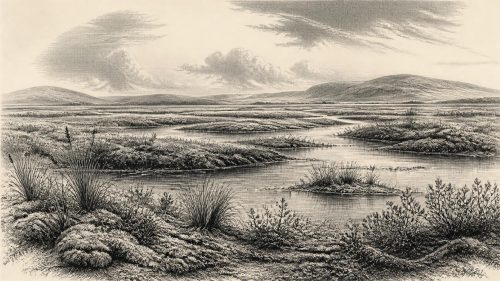
The plants and small creatures preserved at Derryvree indicate cold, largely treeless ground rather than the familiar green, wooded Ireland of later millennia. Pollen, mosses, plant macrofossils and insect remains point to a periglacial wetland mosaic: shallow freshwater, sedge-rich margins, damp peaty ground and open terrain exposed to severe seasonal conditions. Finds associated with such deposits include hardy northern and alpine-tundra plants, such as dwarf willow, mountain avens, clubmosses and bogbean, alongside aquatic vegetation. Their combination suggests that water was locally abundant even in a cold climate.
“Tundra” is a useful shorthand, provided it is not imagined as a featureless plain. Derryvree’s record instead implies variation at a small scale: pools, wet hollows, mineral ground, mossy patches and sedge beds. Summer growth could be brief but productive in sheltered, wet places; winters would have been long and hard. Frost action, frozen ground and sparse vegetation would have made much of the surface unstable or difficult to travel across. This was an environment capable of sustaining specialised plant and animal communities, not an empty wasteland.
The broader setting was unstable. MIS 3 contained abrupt cold and relatively milder phases, while the ice sheet itself changed shape and extent over time. Recent reconstructions emphasise that the British–Irish Ice Sheet did not behave as one fixed white cover. Ice accumulated, advanced and retreated asynchronously in different sectors. Around this horizon, evidence is insufficient to map its margin in Ireland to a particular year, but Derryvree demonstrates that north-central Ireland was locally free of overriding ice for part of the wider interval. The much more extensive Last Glacial Maximum lay ahead, with its principal Irish phase broadly between 26,500 and 19,000 calibrated years before present.
Caves and Cold-Stage Fauna
Southern cave deposits provide a second, more fragmentary record. Castlepook Cave near Doneraile in County Cork has yielded remains attributed to a Late Pleistocene fauna that includes reindeer, woolly mammoth, giant deer, brown bear, wolf, Arctic fox, mountain hare, lemmings and spotted hyaena. Taken together, these finds show that Ireland supported animals adapted to cold, open habitats during parts of MIS 3. Grazers and browsers were accompanied by predators and scavengers; caves may have served as dens, traps, sheltered resting places or places where bones accumulated through several processes.
That qualification matters. The bones do not demonstrate that every listed species stood together in one Cork valley, still less that they lived in the same year as the Derryvree wetland. Cave deposits are often mixed and were collected in part through early excavations that did not meet modern standards of stratigraphic recording. Improved radiocarbon pretreatment has shown that some Castlepook specimens are thousands of years older than earlier dates suggested. Re-dating has nonetheless confirmed that important elements of the fauna belong to MIS 3, while also warning against compressing a long ecological history into a single scene.
Reindeer are especially evocative, because their presence is compatible with wide-ranging seasonal movement through open country. Mammoth, giant deer and hyaena point to a richer Late Pleistocene animal world than survives in Ireland today. Yet the fossil record is sparse, unevenly preserved and biased towards caves and bones robust enough to survive. Absence from the record does not prove absence from the landscape; presence at a site proves only that the animal, or part of it, reached that site within its dated range.
The Human Question
A reindeer femur from Castlepook has attracted particular attention because one mark on it has been interpreted as damage made by a stone tool during carcass processing. If that interpretation is confirmed, it may indicate a human visit to Ireland around 33,000 years ago, far earlier than the well-established post-glacial settlement record. It is an important possibility, but it must remain proportionate to the evidence.
The marked bone is not a securely excavated camp. It is not accompanied by a hearth, a stone-tool assemblage, a dwelling floor, a burial or repeated occupation deposits of comparable age. Its radiocarbon date concerns the animal; the mark’s diagnosis concerns bone modification; neither alone proves a resident population. The most defensible interpretation is that occasional Upper Palaeolithic contact or hunting activity is possible. Permanent settlement, population size, language, kinship and routes of arrival remain unknown.
This distinction also clarifies what cannot be written for Ireland at this date. There is no evidence for political authority, diplomacy, territorial boundaries, warfare or formal institutions. There is no evidence for farming, livestock, crop cultivation, pottery, metalworking, long-distance commerce or managed exchange. Nor are there monuments, graves or images from which religious practice can be responsibly reconstructed. If people did reach the island, their lives may have involved mobile foraging and the careful use of seasonal resources, but that is an inference from wider Upper Palaeolithic patterns, not a demonstrated Irish social history.
An Island Still in Formation
Modern Ireland’s coastlines should not be projected backwards unchanged. During glacial periods, much water was stored in continental ice sheets and sea level was lower than today, exposing parts of the surrounding continental shelves. At the same time, advancing ice, meltwater, shifting shorelines and difficult marine channels made access variable. Any route between Ireland, Britain and mainland Europe around 30,912 BCE is therefore uncertain and cannot be assumed to have been an easy land bridge.
The regional story is one of repeated transformation. Freshwater sediments at Derryvree were eventually buried by renewed glacier activity; later ice reshaped terrain on a far larger scale, producing many of the drumlins, tills and scoured surfaces visible in Ireland today. Those later processes also destroyed, reworked or concealed much earlier evidence. The scarcity of archaeological traces is thus partly a record of human uncertainty, but also a consequence of preservation.
For this deep prehistoric horizon, the most meaningful Irish development was not a human event but a fragile interval of life between ice advances. At Derryvree, wet ground supported cold-climate plants and insects; elsewhere, animals moved through open country and caves accumulated bones. The record is thin, local and difficult, yet it establishes an essential truth: Ireland’s Ice Age past was dynamic. Long before farms, monuments and named peoples, its landscapes were already being remade by water, frost, fauna and ice.
Primary Sources
- Prehistoric Details
- The Subdivision of the Quaternary Period in Ireland
- A Reconsideration of the Radiocarbon Dating of the Marine Isotope Stage 3 Fauna from Southern Ireland
- First Evidence of a Late Upper Palaeolithic Human Presence in Ireland
- New Insights on the Fauna of Ireland’s Younger Dryas and Early Holocene from Alice & Gwendoline Cave
- The Timing and Magnitude of the British–Irish Ice Sheet Between Marine Isotope Stages 5d and 2: Implications for Glacio-Isostatic Adjustment, High Relative Sea Levels and ‘Giant Erratic’ Emplacement
- Growth and Retreat of the Last British–Irish Ice Sheet, 31,000 to 15,000 Years Ago: The BRITICE-CHRONO Reconstruction
- BRITICE-CHRONO Maps and GIS Data of the Last British-Irish Ice Sheet 31 to 15 ka
- Timing, Pace and Controls on Ice Sheet Retreat: An Introduction to the BRITICE-CHRONO Transect Reconstructions of the British–Irish Ice Sheet
- Oscillating Retreat of the Last British-Irish Ice Sheet on the Continental Shelf Offshore Galway Bay, Western Ireland
- Trimlines, Blockfields and the Vertical Extent of the Last Ice Sheet in Southern Ireland
- Geology of Ireland
- The IntCal20 Northern Hemisphere Radiocarbon Age Calibration Curve (0–55 kcal BP)
- Radiocarbon Dating
- Irish Quaternary Association
- Irish Quaternary Association Field Guides
- BRITICE-CHRONO Project Introduction
- Phylogeographic, Ancient DNA, Fossil and Morphometric Analyses Reveal Ancient and Modern Introductions of a Large Mammal: The Complex Case of Red Deer (Cervus elaphus) in Ireland
- First Evidence of a Late Upper Palaeolithic Human Presence in Ireland
- National Monuments Service