
BIRM-166’s Marshland30911 BCE
Around 30,911 BCE, Ireland lay in a fluctuating Late Pleistocene interval before the Last Glacial Maximum. Derryvree in County Fermanagh preserves freshwater sediments between glacial tills, dated broadly to 36,900–31,700 calibrated years BP. Its mosses, sedges and cold-adapted plants indicate an ice-free, periglacial wetland amid open tundra, not conditions across all Ireland. Castlepook Cave in Cork yielded mammoth, reindeer, giant deer, bear and hyaena remains, demonstrating intermittent large-mammal habitats but not contemporaneity. A possibly cut-marked reindeer bone suggests brief human visits, yet no securely dated settlement, hearth or tools confirm occupation. Later ice obscured evidence, leaving a changing ecological record.
Dateline
30,911 BCE is a modern chronological label, not a year that anyone in Ireland could have named or recorded. It falls roughly 32,861 years before the conventional radiocarbon reference year of AD 1950, in the Late Pleistocene and Marine Isotope Stage 3 (MIS 3), a fluctuating phase of the last Ice Age. Modern calendar-year precision is not available at this depth of time. No Irish settlement, person, journey or event can responsibly be assigned to this particular year. The evidence instead consists of deposits, animal bones and landforms dated across broad ranges, many of them later disturbed, buried or eroded by ice.
A Date Within a Wide Range
The best Irish environmental evidence relevant to this point comes from Derryvree, near Maguiresbridge in County Fermanagh. Roadworks in 1969 cut through a drumlin and revealed a remarkable sequence: a lower glacial till, freshwater silts and fine sands rich in organic material, and then a second, upper till. Till is sediment deposited directly by glacier ice. The arrangement therefore establishes a relative sequence: ice had crossed the district; an interval followed in which fresh water, plants and animals occupied the locality; later ice covered and sealed it again.
Organic material from the intervening deposit produced radiocarbon determination BIRM-166, conventionally reported as 30,500 radiocarbon years BP, with a substantial uncertainty of +1,170 and −1,030 years. Radiocarbon years are not calendar years. Calibration is necessary because atmospheric carbon-14 has varied over time, and at this age the resulting calendar ranges are broad. Later discussion has placed the Derryvree material approximately within 36,900–31,700 calibrated years BP. Thus 30,911 BCE falls within a useful chronological horizon for the deposit, but it is not the date of a particular pool, leaf, animal death or human action.
This is more than a technical qualification. The numbered year must not create an illusion of a precise Irish annal. BIRM-166 describes sampled carbon from one buried wetland sequence. It does not date all of Ireland, and it cannot tell us what occurred in one season at a site dozens or hundreds of kilometres away. Its great value is that it preserves a local environment from a period otherwise badly obscured by later glaciation.
Wet Ground Between Glaciers
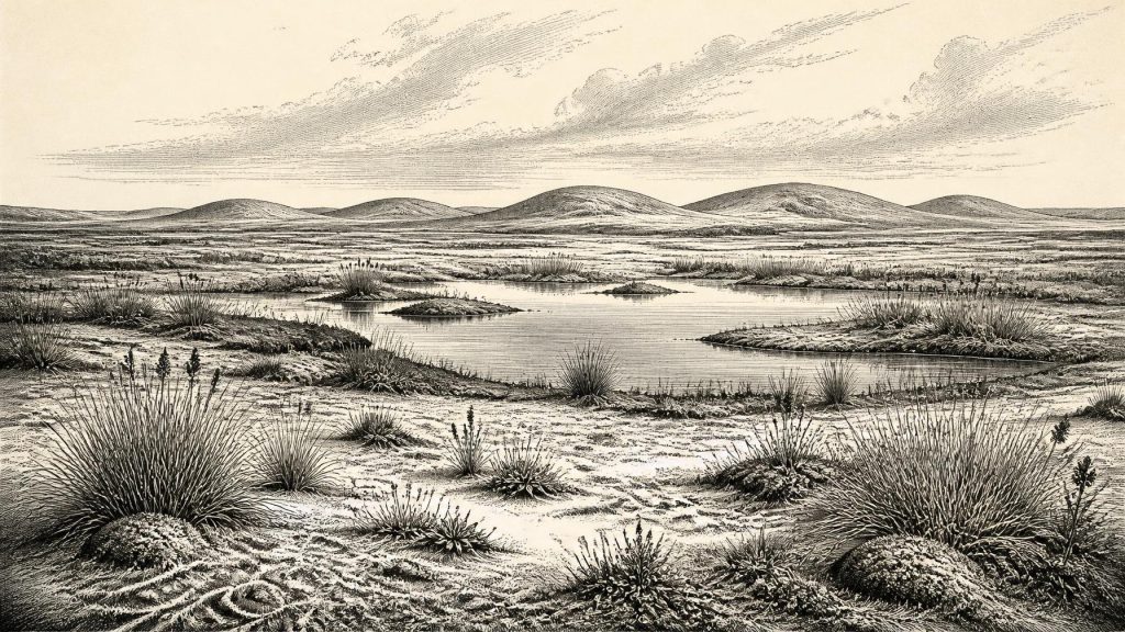
Derryvree was not an image of a mild, wooded island. The flora and fauna recovered from its freshwater beds indicate open tundra vegetation and a periglacial climate: a landscape shaped by frost, seasonal thaw, wind exposure and a short growing season. Mosses, sedges and other herbaceous plants grew in wet ground and around shallow water. Fossil botanical remains, including cold-adapted species, demonstrate that this was not sterile terrain. Pools and marshy margins could sustain aquatic and semi-aquatic life even where nearby ground was sparsely vegetated and vulnerable to frost action.
The evidence supports a mosaic rather than an unbroken white wilderness. During warmer months, meltwater and standing freshwater could create productive patches of mossy ground, sedge beds and herb-rich margins. In winter, the same landscape would have offered far less food and shelter. Such seasonal contrast is an interpretation based on the sedimentary setting and cold-climate assemblage; it is not a direct record of temperatures, snowfall or the duration of any particular season.
Nor should one small Fermanagh basin stand for the whole island. Derryvree lay in north-central Ireland, with its own drainage, relief and exposure. Southern limestone country, Atlantic-facing coasts, uplands and areas now beneath the Irish Sea may have differed markedly. Other deposits at Hollymount and Greenagho in Fermanagh likewise indicate cold, non-glacial intervals, but their dates and records do not combine into a uniform national landscape. At this time Ireland’s environments were changing on long timescales as the British–Irish Ice Sheet developed towards its later maximum.
Mammoths and Hyenas in Cork
At the opposite end of the island, Castlepook Cave near Doneraile in County Cork provides the principal animal archive for Ireland before the Last Glacial Maximum. Also known as Mammoth Cave, it has yielded more than 2,000 bones from deposits accumulated over a long span, rather than from one occupation surface. Its fauna includes woolly mammoth, reindeer, giant deer, brown bear and spotted hyaena, while later cold-stage layers include Arctic fox, wolf and lemmings. Modern re-dating has also shown that some older cave radiocarbon results underestimated the age of MIS 3 animals.
These remains establish that, during suitable pre-maximum intervals, large herbivores and predators reached Ireland and formed parts of a wider north-west European ecological world. They do not show that all these animals lived together at one moment, or that they ranged across every part of the island. A cave is especially difficult evidence: carnivores may drag in prey, water can move bones, and nineteenth- and early twentieth-century excavations did not always recover or record deposits to modern standards. Castlepook nevertheless overturns any simple idea that Ice-Age Ireland was permanently empty of large mammals.
The animals also point to the practical conditions any human visitor would have faced. Herbivores represented potential food, hide, bone and sinew; carnivores represented danger and competition for carcasses and sheltered places. Yet this is a statement about possibilities, not proof of a settled hunting economy in Ireland. No securely dated camp, hearth, tool assemblage or dwelling belongs specifically to 30,911 BCE.
The Human Question
A reindeer bone from Castlepook has been reported as carrying a mark interpreted as a cut made with a sharp stone tool, and it has been publicised as possible evidence for very early human butchery in Ireland. It is an important lead, because a genuine cut mark on fresh bone would indicate a person handling an animal carcass. But one modified bone is not a settlement, and a cave assemblage accumulated through complex natural processes cannot by itself reveal the size, origin, language or duration of any human presence. The interpretation remains far less secure than evidence from a well-excavated site containing tools, hearths and stratified occupation debris.
The responsible conclusion is therefore limited. Ireland may have received brief Upper Palaeolithic visits during favourable intervals before the Last Glacial Maximum; the Castlepook evidence makes that possibility harder to dismiss. It does not demonstrate continuous occupation. Later glacial erosion may have removed many open-air sites, while rising post-glacial seas and difficult offshore preservation conditions may conceal or have damaged others. Absence of sites is not absolute proof of absence of people, but neither is it permission to fill the gap with an imagined population.
No Polities, No Proven Trade
There is no evidence for political institutions, leaders, diplomacy, warfare between human groups, formal religion, monuments, art, agriculture, livestock, trade routes or permanent settlements in Ireland at this date. These are not merely missing details: the surviving record is unable to demonstrate that any human community was living on the island then. It would be misleading to describe a chiefdom, clan territory, exchange network or ritual landscape.
If people did enter Ireland, comparison with Upper Palaeolithic groups elsewhere suggests that mobility, careful knowledge of animal movements, stone resources, fuel and weather would have been crucial. That comparison can help frame questions, but it cannot substitute for Irish finds. The demonstrable Irish economy was ecological rather than social: wetland plants, insects, grazers, scavengers and predators occupying shifting habitats at the edge of expanding ice.
Approaching a Colder Future
30,911 BCE belongs before the Last Glacial Maximum, not within it. The major expansion of the last British–Irish Ice Sheet came later, with maximum conditions broadly falling between about 26,500 and 19,000 years ago, though the timing and extent varied across regions and remain subjects of research. Derryvree’s position between tills is therefore a powerful reminder that the Ice Age was not one static freeze. Ice advanced and retreated; freshwater basins formed; vegetation returned locally; and later glacier ice buried much of the evidence.
The most faithful portrait of Ireland around this notional year is consequently neither a kingdom nor an empty void. It is a changing cold-stage island or near-island landscape, locally ice-free in places such as the Derryvree wetland, inhabited by hardy plant and animal communities, and connected intermittently to wider environmental systems beyond its shores. Its history survives not in names or dates but in silt, pollen, moss, bone and the difficult science required to read them.
Primary Sources
- A Middle Midlandian Freshwater Series at Derryvree, Maguiresbridge, County Fermanagh, Northern Ireland
- Early Midlandian–Middle Midlandian, Pleistocene, Northern Ireland
- Palaeoecology: A Guide to the Quaternary of Northern Ireland
- Trimlines, Blockfields and the Vertical Extent of the Last Ice Sheet in Southern Ireland
- Growth and Retreat of the Last British–Irish Ice Sheet, 31,000 to 15,000 Years Ago: The BRITICE-CHRONO Reconstruction
- A Reconsideration of the Radiocarbon Dating of the Marine Isotope Stage 3 Fauna from Southern Ireland
- The Irish Quaternary Fauna Project
- Castlepook Cave, County Geological Site Report
- Quaternary Site Descriptions
- Archaeological Heritage of County Cork
- Heritage Artefacts of County Cork
- The IntCal20 Northern Hemisphere Radiocarbon Age Calibration Curve (0–55 cal kBP)
- IntCal: International Radiocarbon Calibration
- First Evidence of a Late Upper Palaeolithic Human Presence in Ireland
- Revisiting Alice and Gwendoline Cave, Co. Clare: New Light on the 1902 Excavations
- New Insights on the Fauna of Ireland’s Younger Dryas and Early Holocene from Alice and Gwendoline Cave
- Ireland: Submerged Prehistoric Sites and Landscapes
- Ireland: Submerged Prehistoric Sites and Landscapes (Author Manuscript)
- Phylogeographic, Ancient DNA, Fossil and Morphometric Analyses Reveal Ancient and Modern Introductions of a Large Mammal: The Complex Case of Red Deer (Cervus elaphus) in Ireland
- Last Glacial Maximum Cirque Glaciation in Ireland and Implications for Reconstructions of the Irish Ice Sheet
- The Late Quaternary History of East-Central Ireland
- Mammoth Cave, County Cork
