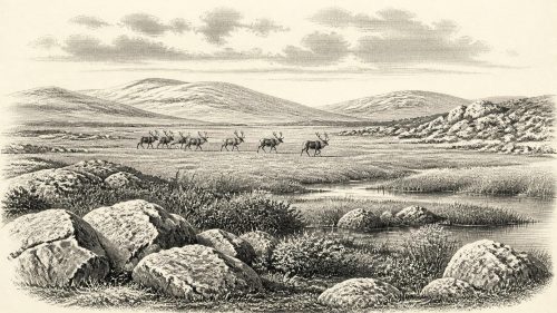
Derryvree’s Sealed Tundra30913 BCE
At around 30,913 BCE, Ireland’s evidence records unstable Ice Age environments rather than identifiable events or communities. Derryvree, County Fermanagh, preserves freshwater organic deposits between glacial tills, dated broadly to 34,950–29,750 BCE, indicating ice-free periglacial wetland with open, treeless vegetation, pools and insects. Cave assemblages, notably Castlepook in Cork, contain remains of mammoth, reindeer, giant deer, predators and cold-adapted mammals, though not necessarily contemporaneous. Crag Cave calcite documents climatic oscillation. A possibly cut-marked reindeer bone suggests, but cannot prove, early human presence. No secure habitation evidence exists; Ireland’s landscape was repeatedly altered, buried and eroded by advancing ice over time.

Dateline
The label 30,913 BCE cannot identify a known Irish event, ruler, journey or settlement. No calendar, written record or archaeological sequence can be resolved to a single year so far back. In archaeological terms this notional date lies about 32,862 calendar years before AD 1950, in the Late Pleistocene and broadly within Marine Isotope Stage 3 (MIS 3), an interval of abrupt climatic fluctuation during the last Ice Age. The responsible account is therefore one of dated ranges, sediments, animal remains and limits on what can be inferred.
The closest Irish evidence is not a settlement but an exceptional buried landscape at Derryvree, near Maguiresbridge in County Fermanagh. Its dated organic deposits overlap the requested point in time, but they are not an annual snapshot. Elsewhere, cave deposits in southern Ireland demonstrate that large mammals entered the island during the same broad climatic era. A controversial marked reindeer bone raises the possibility of an early human encounter. Taken together, these records illuminate a cold and changing country, while also showing how little can safely be said about people within it.
A Date Within a Range
At Derryvree, roadworks in 1969 cut through a drumlin and exposed a striking sequence: one thick glacial till beneath freshwater silts and fine sands, followed by another till above. Till is the unsorted mixture of clay, stones and other debris laid down directly by glacier ice. The order of the layers is firm evidence for a local sequence of change. Ice occupied the site; an interval without overriding ice allowed standing or slow-moving freshwater, sediment and organisms to develop; then later ice advanced across the locality and sealed that evidence beneath fresh glacial debris.
Organic material from the intervening freshwater deposits produced the conventional radiocarbon determination Birm-166, 30,500 radiocarbon years BP, with a substantial published uncertainty of +1,170/−1,030 years. Radiocarbon years are not calendar years. Calibration against the modern IntCal20 curve gives a broad calendar range rather than a single answer: approximately 36,900–31,700 calibrated years BP, or roughly 34,950–29,750 BCE. The year 30,913 BCE falls within that wide span. Yet the range dates the organic deposit in general, not an individual day, season or phase of wetland life. It cannot prove that the Derryvree pool looked exactly the same in the nominal year used here.
This distinction matters. The Derryvree evidence establishes that this part of Fermanagh was ice-free long enough, at some point in the range, for freshwater sediment and a functioning cold-climate ecosystem to form. It does not establish that all Ireland was ice-free simultaneously, nor that every cave fauna or other environmental record belongs to one shared moment. Ireland’s Ice Age geography was regionally varied and repeatedly transformed by glacier growth, frozen ground, water and changing sea level.
Wet Ground Between Glaciers
The fossils within the Derryvree silts give the clearest picture of local everyday conditions available for this date. Plant pollen, seeds, mosses and insect remains indicate open, largely treeless ground under a periglacial climate. The word “periglacial” describes landscapes strongly affected by severe cold and freeze-thaw processes around ice margins; it does not mean that the site itself lay beneath a glacier. Sedges, grasses, herbs, mosses and aquatic or wet-margin plants point to shallow pools, wet hollows and saturated ground. The resulting landscape has often been described as tundra or muskeg-like wetland.
That language should not conjure an unbroken white desert. The Derryvree sediments imply liquid freshwater, plant growth and insects during at least part of the year. A short growing season could support mossy banks, sedge-rich margins and patches of herbaceous vegetation, while frost, seasonally frozen ground and cold winds constrained tree growth. Different microhabitats may have existed only a short distance apart: waterlogged hollows, exposed mineral soil, low vegetation on drier rises and perhaps snow lingering in sheltered places. The evidence supports a low, open mosaic, not a detailed map of every plant community.
It also warns against importing the later Irish landscape into the deep past. There were no hedged fields, peat-cuttings, oak woods, farms or familiar river valleys in their historic form. Drumlins now prominent in Fermanagh were shaped through glacial processes, and later ice profoundly altered the ground surface. The Derryvree freshwater bed survived precisely because it was buried. Much comparable evidence will have been eroded, overridden or carried away by succeeding ice advances.
Animals on a Changing Island
Cave archives, especially Castlepook Cave near Doneraile in north County Cork, show that Ireland supported or was visited by a much richer Late Pleistocene fauna than survives today. The Irish Quaternary Fauna Project documented mammoth, reindeer, giant deer, brown bear, wolf, Arctic fox, mountain hare, lemmings and spotted hyaena among the remains from Castlepook and related collections. Such animals did not necessarily occupy the cave, or even southern Ireland, together. Cave assemblages accumulated over long periods through carnivore activity, natural deaths, water movement, collapse and nineteenth- and early twentieth-century excavation. They must not be turned into a single cinematic herd scene.
Nevertheless, the assemblage is decisive evidence that Ireland was not biologically empty during parts of the last glaciation. Reindeer and lemmings are especially compatible with open, cold environments; mammoth, giant deer, wolf and hyaena indicate broader food webs containing large herbivores and predators. Their presence also implies repeated routes into Ireland from wider north-western European populations. Lower sea levels changed the shape of the Irish Sea basin, but the animal record alone cannot tell us whether a continuous land connection existed at any particular moment, which route each species followed, or whether all movements occurred in the same climatic phase.
Crag Cave, County Kerry, provides another kind of climate evidence. Uranium-thorium dating of cave calcite shows episodic speleothem growth through the last glacial period, including the early part of MIS 2 immediately after the time considered here. In a shallow cave system, calcite growth requires liquid water and is taken to indicate episodes when average annual conditions were not persistently below freezing. This does not mean that south-west Ireland was mild by modern standards. Rather, it reinforces the central fact of the age: cold conditions were punctuated by rapid shifts, and ice-sheet margins could be more dynamic than a simple story of steadily advancing winter allows.
The Human Question
No house, hearth, burial, durable stone-tool assemblage, camp floor or human skeleton has been securely dated in Ireland to around 30,913 BCE. Consequently there is no responsible basis for describing an Irish community’s population, language, kinship, political authority, religious practice, art, trade or routine diet at this time. There were no demonstrable Irish polities, diplomatic relationships or wars. “Economy” can be used only in the ecological sense of food webs and seasonal resources, not as evidence for a human system of production or exchange.
The caution is particularly important because Castlepook has yielded a reindeer femur with an incision interpreted by some researchers and public reports as a possible fresh-bone cut mark made with a stone tool. Its reported age of roughly 33,000 years has prompted the suggestion that people may have handled a reindeer in Ireland during the broader period under discussion. If that interpretation is sustained, it would be an important indication of a brief Upper Palaeolithic human presence. But one marked bone is not a settlement. It cannot reveal whether people hunted the animal, scavenged it, removed meat, hide or sinew, or came from a group that stayed only briefly before moving on.
The evidential gap is substantial. No associated artefacts have been recovered with the specimen; no unquestioned hearth or butchery area accompanies it; and the cave’s deposits are complex and time-mixed. The National Museum of Ireland has accordingly long emphasised the absence of clear Palaeolithic evidence for human occupation on the island. The later, securely dated Upper Palaeolithic cut-marked brown-bear patella from Alice and Gwendoline Cave in County Clare belongs around 12,800–12,600 calibrated years BP, far later than this article’s horizon. It demonstrates that humans did reach Late Pleistocene Ireland, but cannot be projected backwards to establish continuous occupation thirty millennia ago.
What Ireland Can and Cannot Tell Us
For 30,913 BCE, the most important Irish development is environmental rather than political: a landscape repeatedly opened, flooded, vegetated, frozen, buried and reshaped as climate fluctuated and ice expanded. Derryvree preserves a rare interval when cold wetland life existed between glacier advances. Castlepook preserves fragments of the animal communities that moved through the island in the wider Middle Midlandian cold stage. Crag Cave records climatic oscillation in mineral form. These are separate archives with different dating methods, resolutions and weaknesses; their agreement lies in the broad picture of an unstable Ice Age Ireland.
Human history at this point remains a possibility rather than a narrative. The prudent conclusion is not that Ireland was certainly inhabited, nor that it was certainly empty, but that its archaeological record is too sparse to decide how often people reached it or what they did when they arrived. The island’s later prehistoric institutions, identities and cultures were still unimaginably far in the future. What can be recovered for this deep time is more elemental: freshwater among frozen ground, low vegetation under a severe climate, large mammals crossing a changing north-west European world, and an Irish record repeatedly hidden beneath the work of ice.
Primary Sources
- A Middle Midlandian Freshwater Series at Derryvree, Maguiresbridge, County Fermanagh, Northern Ireland
- The Irish Quaternary Fauna Project
- A Reconsideration of the Radiocarbon Dating of the Marine Isotope Stage 3 Fauna from Southern Ireland
- Occurrence of Mammalia Relicts at Site Castlepook Cave
- First Evidence of a Late Upper Palaeolithic Human Presence in Ireland
- New Insights on the Fauna of Ireland's Younger Dryas and Early Holocene from Alice & Gwendoline Cave
- Episodic Speleothem Deposition Tracks the Terrestrial Impact of Millennial-Scale Last Glacial Climate Variability in SW Ireland
- Spatio-Temporal Dynamics of Speleothem Growth and Glaciation in the British Isles
- Growth and Retreat of the Last British–Irish Ice Sheet, 31,000 to 15,000 Years Ago: The BRITICE-CHRONO Reconstruction
- Advance and Retreat of the Marine-Terminating Irish Sea Ice Stream into the Celtic Sea During the Last Glacial: Timing and Maximum Extent
- Radiocarbon Constraints on the Age of the Maximum Advance of the British-Irish Ice Sheet in the Celtic Sea
- Maximum Extent and Readvance Dynamics of the Irish Sea Ice Stream and Irish Sea Glacier Since the Last Glacial Maximum
- Quaternary Geological Map of Ireland 1:500,000
- Figure 6: The Subdivision of the Quaternary Period in Ireland
- Prehistoric Details
- The Mesolithic in Ireland: When Was It?
- The IntCal20 Northern Hemisphere Radiocarbon Age Calibration Curve (0–55 cal kBP)
- IntCal
- The IntCal20 Northern Hemisphere Radiocarbon Age Calibration Curve (0–55 cal kBP)
- Castlepook Cave Excavation, County Cork
- Mammoth Cave, County Cork
- Archaeological Heritage of County Cork