

BIRM-166’s Intertill Biota30880 BCE
Around 30,880 BCE, a modern notional date within MIS 3, Ireland lacked historical records, states and securely identifiable communities. Evidence from Derryvree, County Fermanagh, preserves freshwater sediments between glacial tills, indicating an ice-free, periglacial wetland with tundra vegetation, insects and shallow water. Castlepook Cave, County Cork, yielded remains of mammoth, reindeer, giant deer, predators and other cold-stage fauna, although deposits span long periods. A possibly cut-marked reindeer bone suggests limited human activity around 33,000 years ago, not settlement. Fluctuating ice, sea levels and access shaped habitats and erased evidence; religion, culture and routes remain unknown for this remote prehistoric period.
Dateline
A Year Without Annals
30,880 BCE is a modern chronological label, not a year for which Ireland has an annal, a ruler, a settlement record or even an identifiable human generation. In the archaeological convention that counts backwards from AD 1950, it lies about 32,830 calendar years before present. That places it in the Late Pleistocene, within Marine Isotope Stage 3 (MIS 3), conventionally dated to roughly 57,000–29,000 calendar years ago. At such depth of time, calendar-year precision is not available. Radiocarbon determinations require calibration, carry statistical ranges, and date samples rather than historical events. The responsible subject is therefore Ireland in the broad environmental and archaeological horizon around the early thirty-third millennium before present, not an invented occurrence on a particular day in 30,880 BCE.
The land now called Ireland was not a country, nor did it possess peoples who can responsibly be called Irish in a cultural or political sense. There were no states, kings, tribal names, treaties, writing systems or monuments known from this period. The evidence is instead geological and palaeontological: buried freshwater sediment, fossil plants and insects, cave bone assemblages, glacial deposits, changing sea levels and the marks left by ice. These traces make it possible to reconstruct parts of a cold and unstable landscape. They do not permit a conventional narrative of government, warfare, religion or daily domestic life.
Fermanagh Between the Tills
The clearest Irish environmental archive relevant to this long interval was found at Derryvree townland, near Maguiresbridge in County Fermanagh. Roadworks in 1969 cut through a drumlin and revealed silts and fine sands containing organic material between two thick sheets of glacial till. The deposits had formed during an ice-free episode, then had been sealed beneath later ice-laid sediment. Their most famous radiocarbon determination, Birm-166, was reported as 30,500 radiocarbon years BP, with a substantial uncertainty range. It is not a direct calendar date for 30,880 BCE, and calibration places such results several millennia earlier than their raw radiocarbon ages. Nevertheless, it is vital evidence for the wider MIS 3 world from which this notional date cannot be separated.
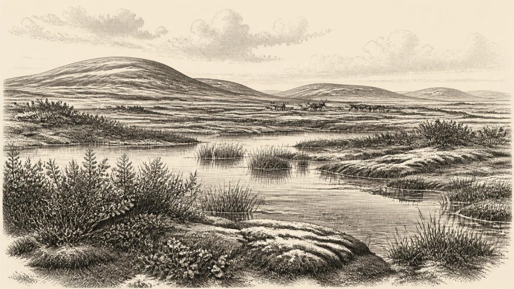
Derryvree’s plant and animal remains describe open, cold-country terrain under periglacial conditions: ground shaped by intense frost but not necessarily covered by glacier ice. Mosses, sedges, dwarf willow, mountain avens, clubmosses and aquatic plants including bogbean point to a patchwork of shallow water, wet ground and sparse tundra-like vegetation. Pollen, macrofossils and insect remains are especially valuable because they record habitats close to the former pool rather than merely the broadest regional climate. The landscape was neither Ireland’s later temperate woodland nor an unbroken desert of snow. In favourable seasons, wet hollows and stream margins could sustain vegetation; elsewhere, freezing, thawing, wind exposure and thin soils imposed severe limits.
This was a changing environment, not a stable ecological backdrop. The two tills enclosing the freshwater sequence show that local ice advances bracketed its formation. They also explain why such evidence is rare. Glaciers eroded older ground surfaces, redeposited sediment and disturbed or destroyed sites that might once have contained clearer evidence of animals or people. Ireland’s fragmentary record is therefore partly a history of loss: an ice sheet could preserve a small protected lens of silt while removing the surrounding landscape in which living creatures had travelled.
A Fauna of Open Country
In the limestone country near Doneraile in north County Cork, Castlepook Cave, also known as Mammoth Cave, has produced Ireland’s most important concentration of Late Pleistocene animal remains. Excavations and collecting in the late nineteenth and early twentieth centuries recovered bones of woolly mammoth, reindeer, giant deer, brown bear, wolf, Arctic fox, lemmings and spotted hyaena, among other animals. The survival of this fauna shows that parts of Ireland were connected ecologically to the wider north-west European Ice Age world. The familiar modern island fauna is an exceptionally poor guide to this earlier reality.
Yet the cave is not a single moment frozen in time. Its deposits were accumulated and disturbed over long periods; some bones were brought in by carnivores, some may have been moved within the cave, and many were excavated before modern stratigraphic methods were available. Re-dating published in 2020 showed that several Castlepook and neighbouring-cave specimens were markedly older than previous measurements had suggested. It indicated that parts of the southern Irish fauna belong in MIS 3 and that giant deer and spotted hyaena may have disappeared locally before the later Last Glacial Maximum. Thus Castlepook is powerful evidence for a broad cold-stage fauna, but cannot prove that mammoth, hyaena, reindeer and giant deer stood together near the cave in 30,880 BCE.
The animal evidence nevertheless suggests a landscape with enough seasonal food and cover to support both grazers and predators. Reindeer could exploit lichens, herbs and sedges in open terrain; giant deer and mammoth imply varied forage on productive patches; wolves and hyaenas represent scavenging and predation within that food web. Caves may have served as carnivore dens, traps for bones or shelters used intermittently by animals. They should not be romanticised as peaceful menageries. Nor should every fossil be placed in a single “mammoth-steppe” scene: the actual habitats of southern Cork and Fermanagh varied with topography, moisture, season and the shifting proximity of ice.
The Human Question
Ireland’s possible human presence at this horizon must be described with special care. A reindeer bone from Castlepook has been reported as bearing a cut mark made while the bone was fresh, and has been presented as evidence of human activity about 33,000 years ago. If that interpretation and date are sustained, it would demonstrate that a person or small group handled and perhaps butchered reindeer in Ireland during MIS 3. It would be an important finding, but it would still not establish a settled population, a camp, a hearth, a stone-tool industry, a burial ground or a continuous occupation.
For 30,880 BCE itself, no secure occupation surface can be assigned to the year, and the Castlepook bone should not be converted into an elaborate story of resident hunters. No associated tool assemblage identifies the technology used; no house plan identifies how people sheltered; and no human remains reveal ancestry, diet or social organisation. The cautious conclusion is narrower. Ireland may have been visited by Upper Palaeolithic hunter-gatherers during a broader MIS 3 interval when conditions and access allowed, but whether people were present at this particular point, how long they stayed, and whether they returned regularly remain unknown.
This restraint matters for society and economy. Hunting, scavenging, meat processing and the use of hides, sinew, antler or bone are reasonable possibilities for Ice Age foragers generally, but they are not documented activities at Derryvree in this year. There is no evidence of farming, herding, pottery, metalworking, market exchange or managed territory. Equally, there is no material basis for reconstructing Irish political affairs, diplomacy or organised conflict. Animals competed and predators hunted, but it would be misleading to translate that ecological pressure into human warfare without evidence.
Ice, Water and Access
At approximately 32,830 calendar years BP, global sea levels were lower than today, and the outlines of coasts, plains and shallow seas differed greatly from the modern map. But lower water did not automatically create a simple walkable route into Ireland. Relative sea level depended not only on global ice volume but on local crustal movement caused by ice loading, while channels and marine basins remained important barriers. Modern reconstructions of British–Irish Ice Sheet growth show that pre-Last Glacial Maximum ice extent and timing were dynamic and still imperfectly resolved. Recent work supports episodes of ice growth, retreat and advance during MIS 3 rather than one uncomplicated progression towards maximum glaciation.
For Ireland, this means that regional conditions matter more than a single map coloured white or green. Derryvree records an ice-free periglacial wetland at one stage; tills record later or earlier glaciation at the same locality; southern raised-beach and marine evidence indicates complex relations between sea level and ice loading. Around 30,880 BCE, the island’s habitable ground, coastlines, animal corridors and possible approaches may have altered over centuries and millennia. A person could only have reached the region through landscapes and seaways very different from those of modern Ireland, but the precise route cannot be recovered.
Belief, Culture and Silence
There is no securely dated Irish cave art, portable art, grave, shrine or ceremonial deposit from this horizon. Religion and language are therefore beyond recovery. The absence of evidence does not prove that any people present lacked stories, customs, kinship obligations or spiritual ideas; all human communities possess rich social worlds. It does mean that none can responsibly be assigned an Irish form, name or content. The most tangible culture here is scientific culture: the careful reading of bone surfaces, fossil pollen, insect fragments, sediment layers and dating uncertainties.
The principal development relevant to 30,880 BCE was environmental volatility. Ireland contained, at least during parts of this wider period, places where cold-adapted plants grew, freshwater accumulated and large mammals moved through open ground. It also lay within the sphere of a developing British–Irish Ice Sheet whose advances could rapidly transform or erase those places. Whether humans briefly shared this landscape remains a significant but limited question. Derryvree and Castlepook do not give Ireland an Ice Age chronicle; they give it something more fragile and revealing: a record of tundra water, animal movement, advancing ice and the narrow conditions under which life could persist.
Primary Sources
- A Middle Midlandian Freshwater Series at Derryvree, Maguiresbridge, County Fermanagh, Northern Ireland
- A reconsideration of the radiocarbon dating of the Marine Isotope Stage 3 fauna from southern Ireland
- Late Pleistocene chronostratigraphy and ice sheet limits, southern Ireland
- The timing and magnitude of the British–Irish Ice Sheet between Marine Isotope Stages 5d and 2: implications for glacio-isostatic adjustment, high relative sea levels and ‘giant erratic’ emplacement
- Growth and retreat of the last British–Irish Ice Sheet, 31,000 to 15,000 years ago: the BRITICE-CHRONO reconstruction
- Growth and retreat of the last British–Irish Ice Sheet, 31,000 to 15,000 years ago: the BRITICE-CHRONO reconstruction
- Timing, pace and controls on ice sheet retreat: an introduction to the BRITICE-CHRONO transect reconstructions of the British-Irish Ice Sheet
- Maximum extent and dynamic behaviour of the last British–Irish Ice Sheet west of Ireland
- Pattern and timing of retreat of the last British-Irish Ice Sheet
- Dynamic cycles, ice streams and their impact on the extent, chronology and deglaciation of the British–Irish ice sheet
- The problem of a late quaternary landbridge between Britain and Ireland
- The Island of Ireland: Drowning the Myth of an Irish Land-bridge?
- Deglaciation, Earth crustal behaviour and sea-level changes in the determination of insularity: A perspective from Ireland
- The IntCal20 Northern Hemisphere radiocarbon age calibration curve (0–55 cal kBP)
- IntCal20 Northern Hemisphere Radiocarbon Age Calibration Curve (0–55 cal kBP)
- IntCal: History
- Figure 6: The subdivision of the Quaternary Period in Ireland
- Quaternary
- Heritage Artefacts of County Cork
- 2022:564 – Castlepook Cave, Castlepook South, Cork
- Explore: The Wonder Cabinet
- New insights on the fauna of Ireland's Younger Dryas and Early Holocene from Alice & Gwendoline Cave
- The Mesolithic in Ireland: when was it?
- The Irish Quaternary Fauna Project