

Castlepook’s Reindeer Enigma30858 BCE
The notional date 30,858 BCE represents a broad late-Pleistocene interval around 33,000 calendar years ago, not a recoverable annual event. Ireland’s unstable MIS 3 climate produced regionally varied ice, open tundra, wetlands and freshwater basins. At Derryvree, County Fermanagh, organic deposits between glacial tills preserve plants and insects indicating cold, treeless wetland conditions. Castlepook Cave, County Cork, yielded diverse Ice Age fauna accumulated over millennia, including mammoth, reindeer and hyaena. A marked reindeer femur may indicate human butchery around 33,000 years ago, but isolated evidence cannot establish settlement, routes, or continuous occupation. Subsequent glaciation destroyed much evidence, leaving environmental glimpses.
Dateline
The label 30,858 BCE cannot be treated as a recoverable Irish year. No one on the island recorded time in a calendar of this kind, and no archaeological technique can identify a particular season or event so far back with annual precision. It is a modern point on a deep-time scale, equivalent arithmetically to about 32,807 years before AD 1950. The responsible historical frame is therefore a broad calibrated late-Pleistocene interval around 33,000 calendar years ago, within Marine Isotope Stage 3 (MIS 3), rather than a conventional annal.
For Ireland, this was a world of climatic instability before the Last Glacial Maximum. The island’s surviving evidence is scant, discontinuous and difficult to date. Later ice repeatedly eroded bedrock, redistributed sediment and destroyed or buried older ground surfaces. Yet deposits beneath the drumlins of County Fermanagh and animal bones from a cave near Doneraile, County Cork, preserve rare glimpses of a country that was neither simply a white wilderness nor a settled human landscape. They show episodes of exposed ground, freshwater, tundra vegetation and large mammals, set against growing glacial pressure.
A Date Within Ranges
Radiocarbon ages, calendar ages and BCE dates are not interchangeable. A radiocarbon measurement estimates the remaining carbon-14 in organic material; because atmospheric carbon-14 has varied, that result must be calibrated against internationally constructed curves. At more than 30,000 years ago, a laboratory determination commonly translates into a wide calendar range, not a single date. Stratigraphy adds another kind of evidence: it establishes that one deposit lay before or after another, but rarely supplies a precise calendar year.
The best-known northern record relevant to this horizon is at Derryvree, near Maguiresbridge in County Fermanagh. Road cutting through a drumlin exposed freshwater silts, sands and organic deposits sandwiched between two tills: unsorted debris left by glacier ice. This sequence demonstrates an earlier glacial advance, a subsequent non-glacial interval in which water and organic sediment accumulated, and a later ice advance that sealed the basin. The organic layer produced the conventional radiocarbon determination BIRM-166, about 30,500 ± 1,170 radiocarbon years BP. It is a valuable marker for the later part of MIS 3, but it is not a proof that the Derryvree wetland existed in 30,858 BCE exactly.
Modern reconstructions of the British–Irish Ice Sheet likewise work at millennial, not annual, resolution. They show substantial ice growth across Ireland and Britain from roughly 31,000 to 26,000 years ago, with different sectors advancing and retreating at different times. Consequently, it would be misleading to colour all Ireland either ice-covered or ice-free at this nominal date. The more defensible picture is regional variation: ice, cold open terrain, lakes and wet hollows changed over long periods, while the evidence that happens to survive is concentrated in a few exceptional places.
Derryvree’s Cold Wetland
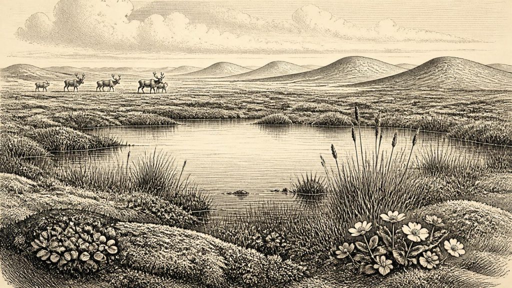
Derryvree is important because its plant and insect remains provide direct environmental evidence rather than later legend or inference from landforms alone. Fossils include bogbean (Menyanthes trifoliata) and mountain avens (Dryas octopetala), alongside mosses, sedges and other cold-stage taxa. Bogbean indicates standing or slow-moving freshwater at the basin; mountain avens is strongly associated with open, cold, often calcareous ground. Together with insect evidence, they support an interpretation of treeless, periglacial tundra with wet margins and pools, rather than forest or farmland.
This was not a lifeless landscape. During short growing seasons, shallow water could sustain aquatic plants and marsh vegetation; sheltered ground could carry herbs, grasses, dwarf shrubs and mosses. In winter, frozen soils, snow cover and severe winds would have shaped the terrain. Permafrost or seasonal ground freezing may have affected drainage and soil stability, though local deposits should not be converted into a uniform climate map for the whole island. Wind-borne pollen can travel far, and each basin records conditions in and around its own catchment.
There is no basis for imagining farms, permanent villages, cleared fields or managed livestock. Nor can the Derryvree sequence reveal language, kinship, political authority, diplomacy, warfare, ritual or formal learning. Those are not merely gaps in a written record: there are no securely associated structures, hearths, tools, human remains or occupation surfaces from the site. Its achievement is different and more fundamental: it preserves a living freshwater environment from between episodes of glaciation.
Castlepook and the Animal World
At Castlepook Cave, also called Mammoth Cave, in north Cork, the evidence is striking but must be handled with equal care. Excavations between 1904 and 1918 recovered a very large collection of bones from cave deposits. More than 2,000 surviving specimens and later direct dates show that the cave accumulated animal remains over a long interval, broadly from about 45,700 to 19,950 years BP. It was not a single frozen moment. Water movement, earlier excavation methods and animal activity disturbed parts of the deposits, meaning that all the species found there did not necessarily live together.
The recorded fauna includes woolly mammoth, reindeer, giant deer, brown bear, wolf, Arctic fox, mountain hare, lemmings and spotted hyaena. It demonstrates that parts of Ireland could support a varied Ice Age fauna during the broader period. Reindeer and lemmings evoke open, cold habitats; mammoth and hyaena suggest links to wider north-west European mammoth-steppe ecosystems. Hyaenas also complicate the story: as den-users and scavengers, they could have carried bones into the cave or modified carcasses themselves. Cave assemblages are therefore records of many processes, not straightforward census lists.
For an article centred on around 33,000 calendar years ago, the most consequential object is a reindeer femur from Castlepook. A direct radiocarbon result has been publicised as roughly 33,000 years old, and a deep linear modification has been interpreted as stone-tool damage made while fresh bone was processed. If that reading is sustained, it would place human activity in Ireland vastly earlier than the well-attested Mesolithic settlement of the early Holocene. It could indicate that people reached the island or its then altered coastal margins, acquired a reindeer carcass and cut it with a stone implement.
But the conclusion must remain narrow. The femur is an isolated item from a complex, historically excavated cave collection. It does not demonstrate a resident population, a campsite, a hunting party’s route, a named cultural group or a continuous Palaeolithic occupation. No securely contemporary hearth, stone-tool assemblage or dwelling has yet been demonstrated at Castlepook. The cautious formulation is that it is important possible evidence for human butchery, under active archaeological investigation, rather than a licence to invent Ireland’s first community.
Movement Without Proven Networks
Lower sea levels altered the outlines of the lands and shelves around Ireland, but proximity must not be confused with a documented land route. The later sea-level record indicates that Ireland’s steep surrounding shelf limited coastal expansion in many areas, and scholarship has rejected a simple Holocene land-bridge explanation for post-glacial colonisation. Conditions around 33,000 years ago were earlier and glacially different, but the available evidence does not establish how any people represented by the Castlepook bone travelled, if indeed the mark is anthropogenic. A crossing by land, ice, coast or water cannot responsibly be specified from one bone.
Accordingly, there is no evidence for trade, exchange systems, alliances or diplomatic contact in Ireland at this point. Equally, there is no reason to presume complete isolation from the wider European world: the animal record itself shows that Ireland formed part of a changing north-west European ecological zone. What can be said is that movement by large mammals was possible during suitable intervals, and that the same broader environmental opportunities may have made short human visits possible. The scale, direction and frequency of such movement remain unknown.
Landscape Before Settlement
The deepest historical development appropriate to 30,858 BCE is not the rise of a people or polity, but the precarious persistence of habitable niches during an increasingly cold phase. Derryvree’s freshwater deposits show that a wetland ecosystem flourished locally between ice advances. Castlepook’s fauna records animals using Irish landscapes and caves across many millennia. The possible reindeer cut mark raises, rather than resolves, the question of whether Upper Palaeolithic people briefly entered that world.
Later ice growth transformed the setting again, scouring and burying evidence that might have clarified the human story. That loss is central to the history. Ireland around this notional year is known through sediments, seeds, insects and bones precisely because those remnants survived extraordinary geological change. Their testimony supports a vivid but disciplined image: cold open ground, pools edged with sedges and bogbean, herds and predators moving through an unstable landscape, and perhaps an exceptionally early human encounter whose full circumstances remain beyond recovery.
Primary Sources
- A Middle Midlandian Freshwater Series at Derryvree, Maguiresbridge, County Fermanagh, Northern Ireland
- The Irish Quaternary Fauna Project
- Castlepook Cave: County Geological Site Report
- 2022:564 – Castlepook Cave, Castlepook South, Cork
- Archaeology Research Excavation Grant 2022: Final Report
- Archaeological Heritage of County Cork
- Reindeer Bone Found in Cork Cave Shows Human Activity in Ireland 33,000 Years Ago
- Ireland’s Palaeolithic Archaeology – Fleeting Footprints in a Frozen Land
- Menyanthes trifoliata L.
- Dryas octopetala L.
- References and Recommended Reading
- Irish Quaternary Association
- Outreach and Education Resources
- Growth and Retreat of the Last British–Irish Ice Sheet, 31,000 to 15,000 Years Ago: the BRITICE-CHRONO Reconstruction
- BRITICE-CHRONO Maps and GIS Data of the Last British-Irish Ice Sheet 31 to 15 ka
- The IntCal20 Northern Hemisphere Radiocarbon Age Calibration Curve (0–55 cal kBP)
- IntCal Publications
- The Island of Ireland: Drowning the Myth of an Irish Land-Bridge?
- The Late Quaternary History of East-Central Ireland
- Quaternary Geology Services
- The Mesolithic in Ireland: When Was It?
- Archaeology and the M3