Derryvree Before the Advance30902 BCE
30,902 BCE is a modern label within a broad calibrated radiocarbon range, not a historical year. Derryvree, County Fermanagh, preserves freshwater silts between glacial tills, indicating an ice-free interval of treeless tundra, wetlands, insects and cold-adapted vegetation before renewed ice advance. Ireland was environmentally varied but approaching extensive Last Glacial Maximum glaciation, which erased much earlier evidence. Castlepook Cave, County Cork, records mammoth, reindeer, giant deer, predators and other cold-stage fauna, accumulated over long periods. A cut-marked reindeer femur may indicate brief human butchery, but lacks supporting artefacts or occupation evidence. No society, settlement, politics or culture can be reconstructed.
Dateline
30,902 BCE is a modern calendar label imposed on a stretch of the Late Pleistocene for which Ireland has no annals, rulers, settlements, named peoples or dateable events. It must not be treated as a year in the historical sense. The closest responsible evidence comes from radiocarbon determinations, fossils and layered sediments, each representing intervals rather than a single season or day. In particular, the date falls within a calibrated range associated with a buried freshwater deposit at Derryvree, near Maguiresbridge in County Fermanagh. It is therefore possible to describe an Irish Ice Age landscape relevant to this point in time; it is not possible to recount what happened in Ireland in that numbered year.
A Date Within a Range
The archaeological setting is Marine Isotope Stage 3, a long and climatically unstable portion of the last Ice Age. Radiocarbon years are conventionally counted backwards from AD 1950, and they are not identical to calendar years because the proportion of carbon-14 in the atmosphere has varied through time. Modern calibration curves turn a radiocarbon measurement into one or more probability ranges, not an exact historical date. This distinction is especially important at an age of more than 30,000 years.
At Derryvree, roadworks in 1969 cut through a drumlin and exposed organic freshwater silts and fine sands lying between two thick tills: unsorted material deposited by glacial ice. The organic bed produced radiocarbon determination Birm-166, 30,500 radiocarbon years before present, with a substantial uncertainty. Later discussion has placed it broadly at about 36,900–31,700 calibrated years before present, approximately 34,950–29,750 BCE. Thus 30,902 BCE lies inside that broad calibrated span, but it cannot be assigned to a particular layer, living creature or human action. The sequence instead establishes an order of events: glacial deposition, an ice-free freshwater interval at this locality, and renewed glacial deposition.
The Derryvree Wetland
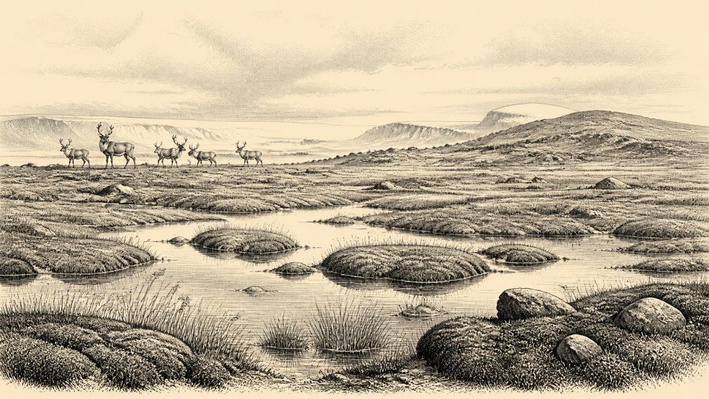
Derryvree is one of the most revealing Irish records for this period because it preserves life as well as ice. Plant remains and insects from the freshwater sediments indicate open tundra vegetation and a periglacial regime: ground and water affected by intense cold, repeated freezing and thawing, and long winters. The deposit has been interpreted as a muskeg-like wetland with pools, plant-rich water and surrounding mosses. Such a place should not be imagined as a pleasant modern bog. It was a cold, exposed, seasonally changing environment, with shallow water and wet ground surviving amid a generally treeless landscape.
The evidence supports local environmental reconstruction, not a complete map of Ireland. Yet it is important precisely because it shows that the island was not simply entombed beneath continuous ice throughout the period. At least in north-central Ireland, there was an interval in which freshwater organisms, wetland plants and insects could inhabit an ice-free terrain. Summer thaw, flowing or standing water, and short growing seasons made small ecological refuges possible. The upper till shows how precarious that opening was: ice later returned across the site and sealed the record beneath glacial sediment.
Open tundra does not mean lifelessness. Low vegetation would have included herbs, sedges, mosses and scattered dwarf shrubs suited to cold ground and short summers. There is no basis for depicting forest, farming or permanent village life. Wood would have been scarce locally, while exposure to wind and frost would have been severe. The rhythm of the year was likely governed by snow cover, meltwater, wet ground, the availability of graze and the movements of animals rather than by any calendar recognised by people.
An Island Approaching Greater Glaciation
The Derryvree sequence also matters for the history of the Irish Ice Sheet. It demonstrates ice-free conditions in Fermanagh before the major build-up of the last British–Irish Ice Sheet. Syntheses of dating evidence suggest that much of Ireland’s later ice cover expanded from relatively limited conditions after about 34,000 years ago, ultimately reaching a far more extensive state during the Last Glacial Maximum, around 26,000–20,000 years ago. At 30,902 BCE, therefore, Ireland was not yet the uniformly ice-covered island often imagined in popular accounts of the Ice Age; nor was it secure from advancing ice.
This was regional change on a vast scale. Glacier ice, frozen ground, meltwater and shifting coastlines remodelled terrain, while later ice erosion destroyed or buried many older surfaces and archaeological traces. That destructive history is a major reason why the evidence for very early human activity in Ireland is so sparse. Drumlins, tills, striations and sediment-filled basins are not merely geological scenery: they are the damaged archive through which this period must be reconstructed.
Castlepook’s Animal Archive
The strongest faunal evidence relevant to this age comes from Castlepook Cave, also called Mammoth Cave, near Doneraile in north County Cork. Excavated in the early twentieth century, it yielded a remarkable assemblage including woolly mammoth, reindeer, giant deer, brown bear, wolf, Arctic fox, lemmings and spotted hyena. The National Museum of Ireland describes Castlepook as the country’s most important site for mammal remains of the last cold stage. Radiocarbon work indicates that hyenas and other mammals reached Ireland from Britain during an interval broadly around 45,000–30,000 years ago.
That list should not be turned into a single frozen scene. Cave deposits accumulated over long periods, and bones may have entered through carnivore transport, natural death, water movement and excavation practices that did not meet modern recording standards. A mammoth bone and a lemming remain may be broadly comparable in age without proving that the animals met at the cave entrance. Nonetheless, the assemblage securely demonstrates that Ireland intermittently supported a cold-adapted, open-country fauna very different from the later wooded island.
Spotted hyenas are particularly revealing. Their presence implies not an imagined African climate but the existence of the Eurasian spotted hyena, a powerful carnivore able to use caves as dens and bone accumulators. Reindeer, mammoth and giant deer point to grazing landscapes; wolves and foxes to predators and scavengers moving through the same food webs. Caves could preserve the remains of this world, but they were not necessarily places where people lived. A bone assemblage is an ecological record first, and only sometimes an archaeological one.
The Reindeer Femur Question
Castlepook has acquired special importance because a reindeer femur bears a deep linear mark interpreted by palaeozoologist Ruth Carden as damage made by a sharp stone tool while the bone was fresh. County Cork heritage material presents the object as Palaeolithic and about 31,000 BC. If the mark is confirmed as human butchery, it would be evidence that a person processed a reindeer in Ireland far earlier than the better-established terminal-Pleistocene human evidence from Alice and Gwendoline Cave in County Clare.
That conclusion remains appropriately cautious. The date of a bone establishes when the animal died within a range; it does not itself date the incision, identify its maker, demonstrate a hunt, or show that butchery happened inside Castlepook Cave. No associated stone tools, hearth, dwelling, human remains or repeated occupation surface has yet been identified for this early claim. Carnivores may have taken discarded bone into the cave after people handled a carcass elsewhere. The femur is consequently best treated as possible evidence of a brief human encounter with Ireland, not proof of a settled Palaeolithic population.
Society Beyond the Evidence
There is no evidence for political affairs, diplomacy, organised warfare, religious practice, trade routes, language, artistic traditions or systems of learning in Ireland at this date. Nor can social rank, family structure, seasonal camps or beliefs be recovered from Derryvree’s silts or Castlepook’s bones. It would be misleading to supply them by analogy with later Irish communities or with better-known Upper Palaeolithic societies elsewhere in Europe.
If people did visit, the practical demands would have been stark: obtaining food from unpredictable animal resources, finding shelter and fuel, making and maintaining stone tools, and travelling through a landscape in which weather and ice margins could change quickly. These are reasonable ecological inferences, not direct observations of Irish daily life. A visitor may have been part of a highly mobile group operating across north-west Europe; equally, the present evidence cannot establish the route, number, duration or frequency of visits.
No Historical Ireland Yet
The most meaningful story for 30,902 BCE is therefore neither one of kingdoms nor of an empty, featureless wilderness. Ireland was an environmentally varied, cold-stage landscape caught between episodes of glaciation. Derryvree records freshwater life and treeless tundra in Fermanagh; Castlepook preserves the bones of animals that crossed or recolonised parts of the island during favourable intervals; and one marked reindeer femur raises, without finally resolving, the possibility of human activity. The evidence is fragmentary, but it is powerful enough to show an Ireland with water, vegetation, grazers, predators and perhaps transient people—an island on the threshold of a much greater advance of ice.
Primary Sources
- A Middle Midlandian Freshwater Series at Derryvree, Maguiresbridge, County Fermanagh, Northern Ireland
- Trimlines, Blockfields and the Vertical Extent of the Last Ice Sheet in Southern Ireland
- Deglacial Rates and Controls for the Western Margin of the British-Irish Ice Sheet
- Radiocarbon Constraints on the Age of the Maximum Advance of the British–Irish Ice Sheet in the Celtic Sea
- Radiocarbon Constraints on Readvances of the British–Irish Ice Sheet in the Northern Irish Sea Basin During the Last Deglaciation
- BRITICE Glacial Map, Version 2: A Map and GIS Database of Glacial Landforms of the Last British–Irish Ice Sheet
- The Irish Quaternary Fauna Project
- Heritage Artefacts of County Cork
- Spotted Hyena Skull
- First Evidence of a Late Upper Palaeolithic Human Presence in Ireland
- New Insights on the Fauna of Ireland’s Younger Dryas and Early Holocene from Alice & Gwendoline Cave
- The Colonization of Ireland: A Human Ecology Perspective
- The Mesolithic in Ireland: When Was It?
- Geology of Ireland
- Ireland Through Geological Time
- Quaternary Geomorphology
- The IntCal20 Northern Hemisphere Radiocarbon Age Calibration Curve (0–55 cal kBP)
- The BRITICE Glacial Mapping Project
- Glaciers and Ice Sheets
- Quaternary Geoheritage Activities: Themes
