

Elephant Hall’s Reindeer World30877 BCE
Around 30,877 BCE, Ireland experienced an unstable Late Pleistocene cold stage rather than a datable historical year. Before the Last Glacial Maximum, ice margins fluctuated, producing regionally varied conditions. Derryvree, County Fermanagh, preserves freshwater sediments beneath later till, indicating treeless, waterlogged tundra with grasses, sedges, mosses and Arctic-alpine plants. Castlepook Cave, County Cork, contains a disturbed but important faunal archive of mammoth, giant deer, reindeer, predators and smaller cold-adapted animals. A possibly cut-marked reindeer bone raises, but cannot prove, Upper Palaeolithic human activity. Glaciation, erosion and rising seas limit evidence, allowing environmental reconstruction but no account of communities and society.
Dateline
30,877 BCE is a modern label, not a date that can be matched to an Irish event. No written record, calendar, settlement sequence or securely dated human occupation allows history to be told year by year at this depth of time. In archaeological terms, the number corresponds approximately to 32,826 calibrated years before present (cal BP, where “present” is AD 1950). The relevant evidence is dated in broad ranges, often with substantial uncertainty. The responsible question is therefore not what happened in Ireland during one particular year, but what the island’s changing environments and rare deposits can tell us about the period around it.
A Cold-Stage Landscape
Ireland lay within Marine Isotope Stage 3, a long, climatically unstable part of the Late Pleistocene. It was not yet the familiar wooded and maritime island of later prehistory. Nor should it be pictured simply as an unbroken white ice cap. The Last Glacial Maximum, when the British–Irish Ice Sheet covered Ireland and extended across much of its continental shelf, came later, broadly around 27,000–23,000 cal BP. Before that maximum, ice sheets repeatedly grew, shifted and retreated; their margins and thickness varied greatly by region.
The evidence for this earlier phase is difficult to reconcile into one island-wide map. Marine records from the western seaboard indicate substantial ice loading and changing relative sea levels during the wider interval from about 40,000 to 19,000 cal BP. Meanwhile, deposits preserved beneath later glacier sediments show that some Irish localities were ice-free at particular times. This is not a contradiction so much as a warning against false certainty: an ice sheet is dynamic, and the Irish evidence is fragmentary. Conditions in north-central Fermanagh, lowland Cork and the Atlantic shelf need not have been identical.
Derryvree’s Buried Wetland
The closest environmental window onto the broad period is at Derryvree near Maguiresbridge, County Fermanagh. Road works exposed freshwater organic silts and fine sands lying between two tills, the unsorted deposits left by glacier ice. Their order records a sequence of glaciation, an interval in which this place supported freshwater life, and a later return of ice. The organic bed produced a conventional radiocarbon age of 30,500 years BP, with a wide error margin. Published calibration places it broadly at about 36,900–31,700 cal BP, equivalent roughly to 34,950–29,750 BCE.
That calibrated interval includes 30,877 BCE, but it does not identify a day, season or individual layer corresponding to that year. The deposit is evidence for a long environmental episode. Radiocarbon measurements are not calendar dates until calibrated against independently dated records; even then, ranges at this age remain wide. The Derryvree material is particularly valuable because it survives under a later drumlin landscape that otherwise conceals much of the earlier ground surface.
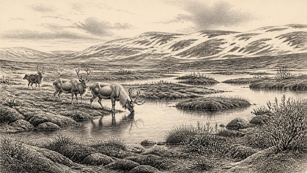
Its fossil assemblage describes a cold, open and waterlogged world. Grasses, sedges, juniper and herbs point to largely treeless vegetation. Mosses, plant remains and insects indicate muskeg: saturated ground with organic-rich pools and wet margins rather than woodland or a settled lakeshore. Reported taxa include dwarf willow, mountain-avens, bogbean, water-milfoil and Arctic-alpine clubmoss. Together they suggest shallow freshwater amid low vegetation, exposed ground and severe winters. The inference is of periglacial conditions, shaped by freezing and thawing near an ice margin, not proof that the locality was permanently glacier-covered.
Nearby deposits at Greenagho, near Belcoo, similarly demonstrate that parts of Fermanagh contained organic freshwater sediments before later ice advanced across them. Such sites offer the strongest evidence for regional landscape and climate around the nominated date. They do not, however, furnish houses, hearths, tools, graves or named communities. They illuminate habitats, not a human society.
Castlepook and Its Fauna
For animal life in pre-maximum-glaciation Ireland, Castlepook Cave near Doneraile in north Cork is indispensable. Also called Mammoth Cave, it is a limestone cave system whose accumulated bones make it Ireland’s richest known archive of Late Pleistocene vertebrates. Excavation began in the early twentieth century, and many deposits were disturbed by earlier digging and by water movement. Consequently, Castlepook is not a single intact hunting camp or a neatly layered record of one moment. It is a time-averaged cave archive requiring specimen-by-specimen dating and taphonomic caution.
Nevertheless, its fauna establishes that Ireland supported an impressive large-mammal community before the Last Glacial Maximum. Bones from the cave include woolly mammoth, giant deer, reindeer, brown bear, wolf and spotted hyaena, along with Arctic fox, mountain hare, collared lemming and Norwegian lemming. Several direct radiocarbon determinations fall in the wider Middle Midlandian cold-stage interval, though many lie earlier than 30,877 BCE once expressed in calendar years. They should therefore be treated as ecological context for this part of the Ice Age, not evidence that every listed species stood in Cork in the specified year.
The cave’s “Elephant Hall” preserves especially evocative traces: mammoth and reindeer remains recovered from deposits associated with the cave’s complex history. Yet animal bones alone cannot establish how the animals died or arrived. Carnivores, natural deaths, water transport, cave use and excavation practices may all have contributed. Spotted hyaena is particularly important because its presence helps explain why bones accumulated and were modified in caves. Castlepook’s evidence reveals a predator-rich landscape and mobile herbivores, but not a stable local herd, a seasonal migration route or a human hunting territory.
The Human Question
A reindeer femur from Castlepook has been interpreted as bearing a deep mark made by a sharp stone tool while the bone was fresh. If that interpretation is confirmed, it may indicate that a person butchered a reindeer in Ireland during the Upper Palaeolithic, far earlier than the formerly accepted record of post-glacial settlement. The claim is important precisely because the Irish evidence is so sparse. It must also be framed carefully. The bone is not from a securely sealed occupation floor accompanied by a hearth, stone-tool assemblage, dwelling, human remains or a cluster of similarly processed carcasses.
There is therefore no secure basis for describing a population, a camp, a journey, or even a repeated human presence in Ireland at 30,877 BCE. A possible cut-marked bone is evidence of a possible act, not of settlement. Modern re-examination, improved collagen preparation and radiocarbon methods have already shown that some older Irish faunal dates require revision. Further excavation of undisturbed deposits at Castlepook may clarify the cave’s chronology and the origin of its bones. Until then, the most careful conclusion is that human activity before the Last Glacial Maximum is possible and potentially significant, but remains unproven at the scale required to write social history.
What Cannot Be Recovered
Nothing in the surviving record identifies political authority, diplomacy, warfare, law, named groups, formal religion or learning in Ireland at this time. There is no evidence for agriculture, permanent villages, domestic animals, metallurgy, markets or organised long-distance trade. It would be misleading to fill those silences with assumptions drawn from much later Mesolithic or Neolithic Ireland. Even if people occasionally reached the island, their food, movement, shelter and social relations cannot responsibly be reconstructed from one disputed modified bone.
Nor is absence of evidence necessarily evidence of absence. Later glaciation eroded, buried and redistributed earlier surfaces; rising seas then altered the surrounding lowlands and drowned potential archaeological landscapes. Organic deposits survive only in exceptional settings such as basins sealed beneath till, while caves preserve selective, often disturbed faunal assemblages. The survival bias is immense. Archaeology can demonstrate that parts of Ireland were inhabited by cold-adapted plants and animals, and that ice margins were advancing and retreating; it cannot turn the landscape into a complete census.
An Island in Transition
The chief historical development around 30,877 BCE was environmental rather than political. Ireland was passing through a severe and unstable phase before the full expansion of the last ice sheet. In Fermanagh, freshwater pools and mossy tundra existed during at least part of the broad Derryvree interval. In Cork, the Castlepook archive records a wider Ice Age fauna whose members lived in changing, open habitats and faced formidable carnivores. Across the island and its shelf, accumulating ice was altering drainage, coastlines, ground conditions and the chances that later evidence would survive.
This is consequently a history of limits as well as discoveries. Modern calendar-year precision is unavailable; calibrated ranges and stratigraphic relationships are more meaningful than an apparently exact BCE number. The evidence supports a cold, largely treeless, regionally varied Ireland, with wetlands in some ice-free areas and a notable Late Pleistocene mammal fauna. It permits a cautious question about human presence, but no confident narrative of Irish communities. The most durable witness to the period is not a monument or a ruler, but the sediment, pollen, moss, bone and cave earth that endured beneath the ice.
Primary Sources
- Castlepook Cave, County Geological Site Report
- The Irish Quaternary Fauna Project
- Occurrence of Mammalia Relicts at Site Castlepook Cave
- Heritage Artefacts of County Cork
- Ireland’s Palaeolithic Archaeology – Fleeting Footprints in a Frozen Land
- Figure 6: The Subdivision of the Quaternary Period in Ireland
- Irish Pleistocene Biostratigraphy
- A Middle Midlandian Freshwater Series at Derryvree, Maguiresbridge, County Fermanagh, Northern Ireland
- Introduction to the Late Quaternary and Holocene of Northern Ireland
- The IntCal20 Northern Hemisphere Radiocarbon Age Calibration Curve (0–55 cal kBP)
- Radiocarbon Constraints on the History of the Western Irish Ice Sheet Prior to the Last Glacial Maximum
- Trimlines, Blockfields and the Vertical Extent of the Last Ice Sheet in Southern Ireland
- Growth and Retreat of the Last British–Irish Ice Sheet, 31,000 to 15,000 Years Ago: the BRITICE-CHRONO Reconstruction
- Maximum Extent and Dynamic Behaviour of the Last British–Irish Ice Sheet West of Ireland
- The Deglaciation of the Western Sector of the Irish Ice Sheet from the Inner Continental Shelf to its Terrestrial Margin
- Timing and Pace of Ice-Sheet Withdrawal Across the Marine–Terrestrial Transition West of Ireland During the Last Glaciation
- Early Deglaciation of the British-Irish Ice Sheet on the Atlantic Shelf Northwest of Ireland Driven by Glacioisostatic Depression and High Relative Sea Level
- Ireland: Submerged Prehistoric Sites and Landscapes
- The Timing and Magnitude of the British–Irish Ice Sheet Between Marine Isotope Stages 5d and 2: Implications for Glacio-Isostatic Adjustment, High Relative Sea Levels and ‘Giant Erratic’ Emplacement
- New Insights on the Fauna of Ireland’s Younger Dryas and Early Holocene from Alice & Gwendoline Cave
- Radiocarbon Constraints on the Age of the Maximum Advance of the British-Irish Ice Sheet in the Celtic Sea
- Freshwater Organic Deposits and Stratified Sediments Between Early and Late Midlandian (Devensian) Till Sheets, at Aghnadarragh, County Antrim, Northern Ireland