

The Fermanagh Silt Interval30876 BCE
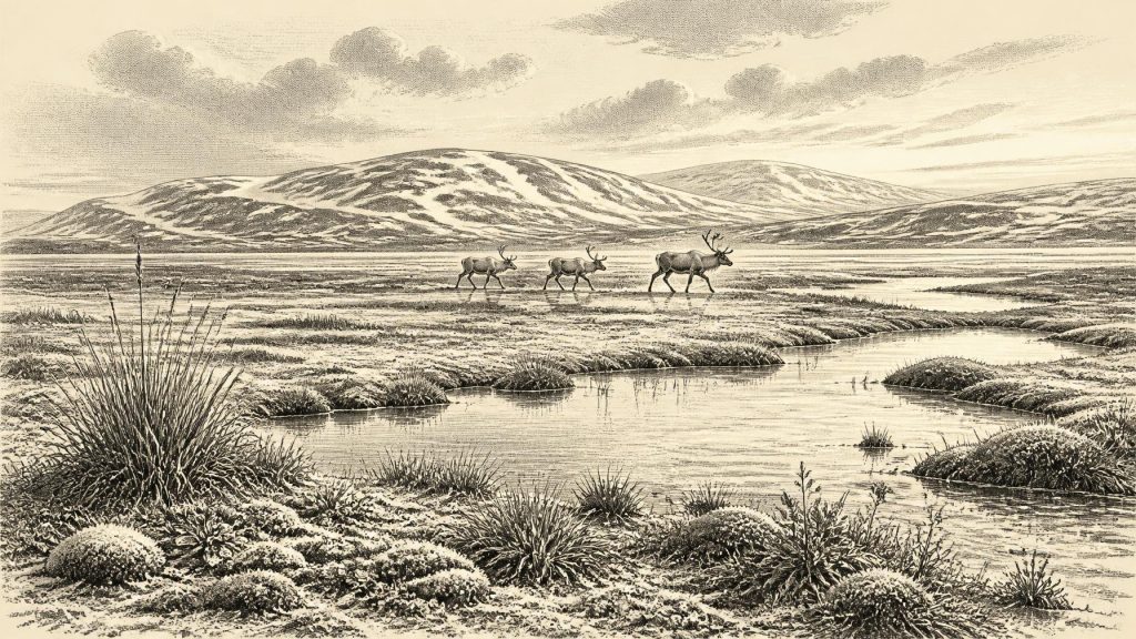
Around 30,876 BCE, Ireland’s record is environmental rather than historical. At Derryvree, County Fermanagh, freshwater silts between glacial tills indicate a locally ice-free interval, broadly dated to 34,950–29,750 BCE, with cold, treeless, wet tundra-like habitats. The evidence cannot identify conditions in a single year or across the whole island. Before the Last Glacial Maximum, fluctuating ice, meltwater and low sea levels shaped varied landscapes. Castlepook Cave in County Cork preserves remains of cold-adapted mammals; a possibly cut-marked reindeer bone may indicate brief human activity, but not settlement. Later glaciation obscured much evidence and substantially reshaped Ireland’s landforms over subsequent millennia.
Dateline
The label 30,876 BCE is a modern point on a calendar, not a year that can be recovered from Ireland’s archaeological record. No written chronology, settlement layer or scientific measurement can identify an event on the island with that precision nearly 33,000 years ago. In radiocarbon convention this date falls roughly 32,825 years before AD 1950, within the Late Pleistocene and Marine Isotope Stage 3. The responsible history of Ireland at this depth is therefore a history of dated ranges, sediment layers and changing habitats rather than named people or year-specific happenings.
A Date Inside a Broad Range
The closest important Irish environmental record is at Derryvree, near Maguiresbridge in County Fermanagh. Road-cutting through a drumlin in 1969 exposed an exceptional sequence: an older glacial till, freshwater silts and fine sands with organic material, and a later till above them. Till is sediment laid down directly by glacier ice. The sequence demonstrates that ice occupied the site, that an ice-free interval then allowed freshwater and organic deposits to accumulate, and that ice later returned.
Organic material from the Derryvree freshwater deposits produced a radiocarbon age of about 30,500 radiocarbon years before present, with a large uncertainty. Radiocarbon years are not equivalent to calendar years, because the amount of carbon-14 in the atmosphere has varied through time. Modern calibration curves convert such readings into calendar-age probabilities, but they do not turn them into exact dates. Published calibration places the Derryvree evidence broadly at about 36,900–31,700 calibrated years BP, approximately 34,950–29,750 BCE. The notional year 30,876 BCE falls within that wide span, but the deposit cannot be assigned to it precisely.
This is an important distinction. Derryvree provides a local window on an interval, not a weather report for every part of Ireland and not an annual diary. Its value lies in demonstrating that biologically active, locally ice-free ground existed in Fermanagh during a cold and unstable phase of the last Ice Age, before the fullest development of the last British–Irish Ice Sheet.
Water, Frost and Open Ground
The fossil evidence at Derryvree points to a treeless landscape with freshwater habitats. Pollen, plant macrofossils and insects indicate mosses, sedges, grasses and herbs, alongside plants adapted to cool, exposed conditions. Juniper occurred, but there is no basis for imagining woodland. The older term “muskeg”, used in discussions of the site, conveys the likely mixture of wet, organic ground, shallow water and sedge-rich margins; it should not be mistaken for a modern bog preserved unchanged since the Ice Age.
The landscape was not simply a white wilderness. Seasonal meltwater, pools and wet hollows could support aquatic plants and insects, while nearby mineral ground carried sparse vegetation. Frozen or repeatedly freezing soils would have shaped drainage and restricted plant growth. The contrast between wet basins and exposed ground mattered: each offered different food, shelter and movement routes for animals. Yet the record does not establish the precise extent of lakes, permafrost or ice at any single moment. It supports an interpretation of cold, open, locally wet tundra-like terrain, not a complete map of Ireland.
Across the island, conditions were likely varied. Uplands, western coasts, limestone caves and lowland basins responded differently to snow accumulation, meltwater and advancing ice. Later glaciation eroded, buried and rearranged much older ground, leaving a strongly uneven archive. This is why the best evidence comes from rare protected deposits, such as the Derryvree sediments between tills, rather than from a continuous national sequence.
Before the Ice Sheet’s Maximum
Thirty millennia ago Ireland was within the wider climatic system that affected Britain, the Atlantic shelf and north-west Europe. Sea level was much lower than today because enormous quantities of water were stored in continental ice sheets. But low sea level does not itself prove a dry, walkable route to Ireland at this particular time. The palaeogeography of the Irish Sea changed repeatedly, and the case for a Late Quaternary land bridge between Ireland and Britain has long been debated. For this period, it is safer to say that Ireland was ecologically connected to neighbouring regions at intervals than to claim a known migration corridor.
The later Last Glacial Maximum was still ahead. Reconstructions of the British–Irish Ice Sheet show that its growth, maximum extent and retreat differed between sectors and were not a single island-wide event. The maximum ice volume is generally placed much later, around 23,000 years ago, although particular margins advanced and withdrew at different times. Derryvree therefore belongs to a pre-maximum world of climatic oscillation and changing ice limits. It should not be presented as either wholly ice-covered Ireland or as a temperate, settled country.
Castlepook’s Mixed Fauna
Southern Ireland offers a different kind of evidence. Castlepook Cave, near Doneraile in north County Cork, has yielded one of Ireland’s most significant pre-Last Glacial Maximum collections of animal remains. Reindeer, woolly mammoth, giant deer, brown bear, wolf, arctic fox, hare, lemmings and spotted hyaena are among the animals represented in material from the cave system and its excavations. Their presence shows that Ireland was, at various times in the broader period, part of a north-west European world in which cold-adapted and open-country mammals could reach and survive on the island.
That list must be handled carefully. A cave bone collection is not a photograph of a single living herd. Carnivores may have dragged prey into the cave; animals could have died there naturally; water could have moved bones; deposits may have accumulated across long intervals; and early excavation practices did not always preserve the fine stratigraphic context now expected. Revised radiocarbon work has also shown the need to reassess some older determinations from southern Irish caves. Castlepook is powerful evidence for faunal presence, but it cannot demonstrate that all these animals lived together in 30,876 BCE.
A Possible Human Trace
A reindeer femur from Castlepook has attracted particular attention because a deep mark on the bone has been interpreted as potentially made by a stone tool during butchery. The bone has been publicly associated with an age of roughly 33,000 years ago. If the incision is confirmed as a fresh-bone cut mark made by people and securely related to the animal’s death, it would be evidence for human handling of a carcass in Ice Age Ireland far earlier than the formerly accepted record.
But it remains a limited and contested proposition, not proof of a population. No securely associated hearth, stone-tool assemblage, dwelling, burial, occupation surface or repeated hunting camp of comparable age has been identified at Castlepook. Nor is there evidence for continuous habitation across the island. The safest conclusion is that the marked bone may record a brief Upper Palaeolithic visit or episode of carcass processing during the wider period; it cannot support a narrative of an established Irish community in this particular year.
What Cannot Be Written
There is no evidence from Ireland around this horizon for political authorities, territories, diplomacy, warfare between named groups, farming, trade networks, formal religious institutions, monuments or writing. Nor can archaeology identify languages, kin groups or individual beliefs. It would be misleading to supply these absences with analogies from better-documented Upper Palaeolithic societies elsewhere in Europe. People may have possessed rich social and symbolic lives, but Ireland’s surviving evidence does not allow those lives to be described responsibly.
The economy, if people were present at all, can only be inferred at the most general level: mobile hunter-gatherers elsewhere in Ice Age Europe relied on flexible knowledge of animals, seasonality, stone and shelter. In Ireland, the marked reindeer bone offers at most a possible indication of animal processing. It does not reveal hunting methods, food-sharing rules, clothing, camp organisation, exchange or ritual. The animals and sediments tell us much more securely about habitats than about society.
The Shape of Deep Irish History
The principal development relevant to 30,876 BCE was environmental instability. Freshwater accumulated at Derryvree during an interval between glacial advances; open, cold-country vegetation supported a small but productive ecological mosaic; mammals moved through a wider changing landscape; and ice would later bury or destroy much of the evidence. The result is a history with no kings, battles or villages, but one that is still distinctly Irish: a Fermanagh wetland sealed under a drumlin, and a Cork cave preserving fragments of vanished animal worlds.
Modern Ireland’s familiar coasts, soils and drainage had not yet taken their present form. The later ice sheet would scour bedrock, transport sediment and help create many of the landforms that remain visible today. Around this date, however, the clearest responsible image is not of a nation in the usual historical sense, but of a shifting Ice Age landscape—partly habitable in places, climatically severe, ecologically connected beyond the sea, and known through a handful of precious, incomplete archives.
Primary Sources
- A Middle Midlandian Freshwater Series at Derryvree, Maguiresbridge, County Fermanagh, Northern Ireland
- Irish Pleistocene Biostratigraphy
- The Irish Quaternary Fauna Project
- A Reconsideration of the Radiocarbon Dating of the Marine Isotope Stage 3 Fauna from Southern Ireland
- The Exploration of Castlepook Cave, Co. Cork
- On the Cave of Castlepook, Near Doneraile, Co. Cork
- Growth and Retreat of the Last British–Irish Ice Sheet, 31,000 to 15,000 Years Ago: The BRITICE-CHRONO Reconstruction
- BRITICE-CHRONO Maps and GIS Data of the Last British-Irish Ice Sheet 31 to 15 ka
- Timing and Pace of Ice-sheet Withdrawal Across the Marine–Terrestrial Transition West of Ireland During the Last Glaciation
- Trimlines, Blockfields and the Vertical Extent of the Last Ice Sheet in Southern Ireland
- New Data for the Last Glacial Maximum in Great Britain and Ireland
- Extent and Timing of the Last Glacial Maximum in Britain and Ireland: A Review
- Quaternary Deposits and Glacial Stratigraphy in Ireland
- The Problem of a Late Quaternary Landbridge Between Britain and Ireland
- The IntCal20 Northern Hemisphere Radiocarbon Age Calibration Curve (0–55 cal kBP)
- Quaternary Geomorphology 1:50,000 Ireland (ROI) ITM
- Quaternary
- Geology of Ireland
- Figure 6.— The Subdivision of the Quaternary Period in Ireland
- Outreach and Education Resources
- Ice Age Ireland: Cool Fossils!
- The Mesolithic in Ireland: When Was It?