

Maguirebridge’s Lost Pond30878 BCE
30,878 BCE cannot be identified as a specific Irish year, but falls within Marine Isotope Stage 3. At Derryvree near Maguiresbridge, Fermanagh, freshwater silts, sands and organic remains between tills record an ice-free interval, broadly dated to 36,900–31,700 calibrated years before present. Pollen, mosses and fauna indicate treeless, tundra-like wetlands amid fluctuating glacial conditions. Castlepook Cave in Cork preserves bones of mammoth, reindeer, giant deer, bear and hyaena, though accumulated over millennia rather than contemporaneously. A possibly cut-marked reindeer bone suggests unconfirmed human contact, not settlement. Evidence reveals changing cold ecology, while political, cultural and social history remains largely unrecoverable.
Dateline
The label 30,878 BCE is a modern calendrical convenience, not a date that can be recovered as a particular year in Ireland’s deep past. No contemporary calendar, settlement sequence or event record can identify what happened in one named year so far back. In terms used by Quaternary science, it falls roughly 32,827 years before AD 1950, within Marine Isotope Stage 3, an unstable part of the last Ice Age. The responsible subject is therefore an interval rather than an annual chronicle: an Ireland of shifting ice margins, cold wetlands and mobile animal populations, known through sediments, fossils and cautious dating.
A Date Within a Broad Range
The closest Irish environmental evidence comes from Derryvree, near Maguiresbridge in County Fermanagh. Roadworks in 1969 cut through a drumlin and exposed a remarkable sequence: organic freshwater silts and fine sands lying between two thick sheets of till, the unsorted debris left by glacier ice. The order of the deposits is secure. Ice had occupied the locality; then a period without local glacier cover permitted water, plants and sediment to accumulate; later ice advanced again and sealed the wetland beneath a second till.
Organic material from this freshwater series produced the radiocarbon determination BIRM-166, approximately 30,500 radiocarbon years before present, with a substantial error range. Radiocarbon years are not identical to calendar years, because atmospheric carbon-14 has varied through time. Calibrated treatments place the Derryvree evidence broadly around 36,900–31,700 calibrated years before present, or about 34,950–29,750 BCE. The requested year lies within that span, but cannot be attached to a particular plant, animal, season or human action in the deposit. This is an important distinction: the evidence illuminates a phase of Irish prehistory, not a day in its history.
Water Beneath the Drumlins
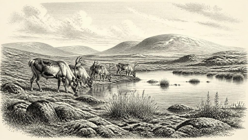
Derryvree is valuable because much of Ireland’s older Pleistocene landscape was later scoured, buried or reworked by ice. Here, however, silts, sands, pollen, mosses, plant remains and small animal evidence survived long enough to show that part of south Fermanagh was not an unbroken ice sheet. It contained freshwater—probably a shallow pool, marshy hollow or slow-moving watercourse—surrounded by open ground. The original investigators described the flora and fauna as having a full-glacial character and interpreted the setting as tundra under a periglacial climate.
The vegetation was low, sparse and adapted to short growing seasons. Herb pollen, moss macrofossils and cold-environment plant indicators point away from forest and towards sedges, herbs, damp ground and patches of exposed mineral soil. A few grains of tree pollen should not be turned into evidence for local woodland: they may have travelled far, been redeposited or survived poorly. What the assemblage securely establishes is treeless or nearly treeless country around the water. In warmer months, wet ground could sustain mosses and freshwater plants; in winter, frost, snow cover and frozen soil would have strongly governed the landscape.
This was not a timeless “Ice Age” scene. Marine Isotope Stage 3 was marked by abrupt climatic fluctuations across the North Atlantic region. Derryvree records one local interval in which liquid water and organic sediment accumulated between glacial episodes. It does not prove that all districts of Ireland were simultaneously open, nor that conditions remained constant for centuries. The later growth of the British–Irish Ice Sheet would radically transform the island, but its major maximum lay ahead. Ice advance was regionally uneven, and the island’s terrain, sea basins and uplands produced a complicated geography of ice, exposed ground and changing drainage.
An Open-Animal Landscape
The wider Irish record shows that large mammals repeatedly reached the island during this long cold stage. Castlepook Cave, near Doneraile in north County Cork, is the most important faunal archive for the period before the Last Glacial Maximum. More than 2,000 bones have been recovered there. They include woolly mammoth, reindeer, giant deer, brown bear and spotted hyaena; later Ice Age deposits also contain wolf, Arctic fox, Norwegian lemming and collared lemming. These are powerful evidence that Ireland participated, at intervals, in the wider north-west European world of cold-adapted animals.
They are not, however, a census of animals alive together in 30,878 BCE. Castlepook is a cave repository accumulated over many millennia through carnivore activity, natural deaths, water movement, collapse and antiquarian excavation. Its bones come from different episodes, and some deposits were disturbed. Recent reassessment has also shown that older radiocarbon determinations from Irish caves require caution because improved pretreatment methods can produce markedly different results. Mammoth or hyaena remains therefore demonstrate the long-term ecological possibilities of Pleistocene Ireland; they cannot by themselves reconstruct one contemporary Cork valley or guarantee that each species was present at Derryvree.
Even so, the combined evidence permits a restrained picture. Open vegetation could support grazing and browsing mammals, while caves and rock fissures offered denning places and traps for bone accumulations. Reindeer suggest cold, exposed terrain and seasonal movement; lemmings and Arctic fox point to severe conditions; hyaenas show that formidable carnivores formed part of the food web. Giant deer, despite their later popular name “Irish elk”, were not uniquely Irish and should not be imagined as symbols of a future nation. Their remains belong to a Eurasian Pleistocene species whose fortunes in Ireland rose and fell with changing climate and habitat.
The Human Question
Human history at this date is especially uncertain. A reindeer femur from Castlepook has been publicly reported as about 33,000 years old and as bearing a deep mark interpreted by palaeozoologist Ruth Carden as having been made on fresh bone with a sharp stone implement. If that interpretation is confirmed through full contextual and microscopic study, it would be extraordinarily early evidence that an Upper Palaeolithic person handled a reindeer in Ireland. It might represent butchery during a brief visit rather than residence.
That possibility must not be inflated into a settled population. The bone does not come with a securely associated hearth, lithic assemblage, dwelling floor, burial, camp surface or repeatedly occupied hunting station of equivalent age. Nor does a date on the animal automatically date the marking event. Castlepook’s complicated excavation history and mixed cave deposits make independent verification essential. The evidence permits the proposition of possible human contact with an animal carcass; it does not demonstrate a community, a migration route, the use of a particular technology or continuous occupation.
No Kingdoms, No Trade Routes
Accordingly, there are no recoverable political affairs, conflicts, diplomatic relations, rulers or institutions for Ireland in this interval. There is no evidence for farming, herding, fields, pottery, metalworking, formal exchange networks or permanent villages. Religion, language, learning and artistic traditions cannot responsibly be assigned to an Irish population that has not been securely identified in the archaeological record. Upper Palaeolithic communities elsewhere in Europe possessed sophisticated knowledge, social connections and cultural practices, but similarities cannot simply be projected across the sea into Ireland without Irish finds to support them.
What can be inferred is more modest and more revealing. If people did enter Ireland during such a cold phase, survival would have required detailed practical knowledge: reading animal movement, finding sheltered ground, obtaining fuel and food, and moving safely through an exposed landscape whose rivers, shorelines and ice margins differed greatly from those of modern Ireland. Yet this remains an inference from environmental constraints, not a discovered Irish lifeway. The strongest evidence concerns climate and ecology, not society.
A Fragile Archive
For 30,878 BCE, Derryvree’s lost freshwater hollow is the clearest guide. It shows that, within the wider Ice Age, a Fermanagh locality supported cold, open wetland conditions between two episodes of glaciation. Castlepook adds the broader fact of a varied Pleistocene fauna and a tantalising, still limited possibility of human activity. Together they replace both extremes: Ireland was neither a familiar inhabited countryside nor simply a featureless frozen void. It was a changing northern landscape whose most durable history was written in silt, bone, moss and ice.
Primary Sources
- A Middle Midlandian Freshwater Series at Derryvree, Maguiresbridge, County Fermanagh, Northern Ireland
- Palaeoecology: Irish Association for Quaternary Studies Field Guide 16
- The Quaternary of Ireland: Irish Association for Quaternary Studies Field Guide 17
- A Reconsideration of the Radiocarbon Dating of the Marine Isotope Stage 3 Fauna from Southern Ireland
- The Irish Quaternary Fauna Project
- Cork County Geological Site Report: Castlepook Cave
- Growth and Retreat of the Last British–Irish Ice Sheet, 31,000 to 15,000 Years Ago: The BRITICE-CHRONO Reconstruction
- Maximum Extent and Dynamic Behaviour of the Last British–Irish Ice Sheet West of Ireland
- Trimlines, Blockfields and the Vertical Extent of the Last Ice Sheet in Southern Ireland
- The Colonization of Ireland: A Human Ecology Perspective
- The Problem of a Late Quaternary Landbridge Between Britain and Ireland
- Relative Sea-Level Change Around the Irish Coast
- Freshwater Organic Deposits and Stratified Sediments Between Early and Late Midlandian (Devensian) Till Sheets, at Aghnadarragh, County Antrim, Northern Ireland
- Middle Midlandian Interstadial Deposits at Greenagho, Near Belcoo, County Fermanagh, Northern Ireland
- The Exploration of Castlepook Cave, Co. Cork. With 3 Plates.
- New Insights on the Fauna of Ireland’s Younger Dryas and Early Holocene from Alice & Gwendoline Cave
- The Archaeological Heritage of County Cork: An Overview
- Scientific Dating of Pleistocene Sites: Scientific Dating Methods
- Occurrence of Mammalia Relicts at Site Castlepook Cave
- Investigating Seasonal Mobility in Irish Giant Deer Megaloceros giganteus Through Strontium Isotope Analysis