Menyanthes Trifoliata Seed30855 BCE
At the notional date of 30,855 BCE, Ireland’s Late Pleistocene record is environmental rather than historical. Derryvree, County Fermanagh, preserves evidence of a cold, open, largely treeless wetland, where bogbean, aquatic plants, sedges and mosses survived despite severe seasonal conditions. Southern caves show that mammoths, giant deer, reindeer, carnivores and other animals reached Ireland during changing periods of ecological connectivity. A marked reindeer bone from Castlepook may record Upper Palaeolithic butchery, but cannot establish permanent human settlement. Subsequent ice-sheet expansion destroyed or disturbed much evidence, leaving a cautious reconstruction of a harsh, variable landscape rather than a chronicle of events.
Dateline
“30,855 BCE” is a modern point on a timeline, not a year that can be recovered from Ireland’s Ice-Age record. No calendar, named community or historical event survives from this depth of time. In archaeological convention it lies roughly 32,804 years before AD 1950, within the Late Pleistocene and Marine Isotope Stage 3 (MIS 3), a climatically unstable interval before the fullest expansion of the last British–Irish Ice Sheet. Evidence can be dated only within scientific ranges, and it comes chiefly from fossils, sediments and cave deposits rather than from settlements. The responsible history of Ireland at this point is therefore an environmental and archaeological reconstruction, with firm distinctions between what the material demonstrates and what it may suggest.
A Date Without a Chronicle
The nearest especially informative Irish environmental record is Derryvree, near Maguiresbridge in County Fermanagh. Road works in 1969 cut through a drumlin and exposed freshwater silts and fine sands lying between glacial deposits. The organic layer produced a conventional radiocarbon determination of 30,500 +1,170/−1,030 radiocarbon years before present. Radiocarbon years are not calendar years: atmospheric carbon has varied through time, so results require calibration against internationally maintained curves. Later summaries place the Derryvree deposit broadly in the later part of MIS 3, approximately c. 37,000–33,000 calibrated years BP depending on calibration method and confidence range.
That makes Derryvree highly relevant to 30,855 BCE, but not a snapshot of that particular year. Its sediments accumulated over time; its fossils describe a local wetland and its margins; and the sizeable uncertainty around the date prohibits a claim that its plants were growing in one precisely numbered year. Nevertheless, it preserves a rare Irish window into an interval that later glacial action largely obscured or destroyed. The layer also establishes an important point: before the Last Glacial Maximum, parts of Ireland were not continuously sealed beneath ice.
Fresh Water Beneath Later Ice
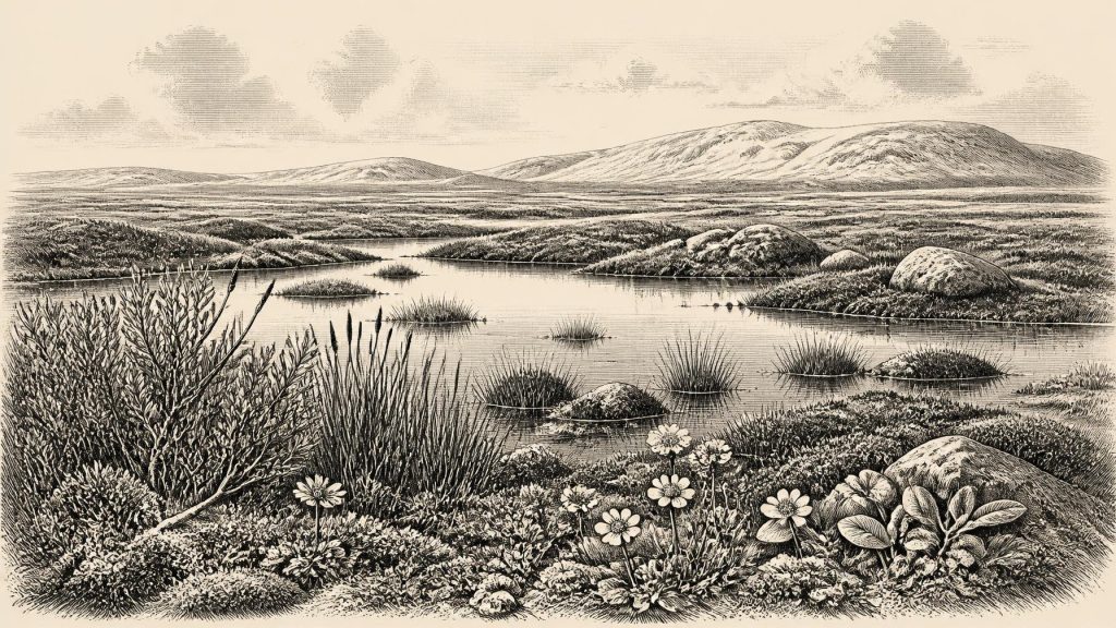
Derryvree’s pollen, plant macrofossils, mosses and insects indicate a cold, open and largely treeless landscape. The reconstructed setting has often been described as tundra or muskeg: wet, organic-rich ground with shallow pools, sedge-dominated edges and patches of low vegetation, subject to severe seasonal freezing. It was not the familiar green, wooded Ireland of later millennia, nor was it simply a blank snowfield. Fresh water existed locally, and around it grew communities adapted to exposure, a short growing season and cold soils.
Among the most evocative finds is a seed of bogbean, Menyanthes trifoliata, a wetland plant with a distinctive three-part leaf. Water-milfoil attests aquatic conditions, while mountain-avens, dwarf willow, lesser clubmoss, sedges and numerous mosses support the broader interpretation of open, periglacial country. Pollen preservation was poor, so the record must not be pressed into an exact map of plant cover. Yet the combined evidence is strong enough to reject dense forest. In dry patches, herb-rich ground and sparse low shrubs were more likely; in hollows, standing or slow-moving water supported a specialised freshwater flora.
This was a regional landscape, not a universal description of the whole island. Fermanagh’s drumlin terrain, drainage and geology differed from the limestone caves of north Cork, western uplands and Irish Sea basin. Still, comparable inter-till deposits in northern Ireland show that glacier advance, retreat and ice-free intervals created sharply varying local conditions. Ireland’s climate was connected to wider North Atlantic oscillations, but individual Irish deposits cannot always be matched precisely to a single Greenland warm or cold phase.
Animals in a Changing Corridor
Cave deposits in southern Ireland provide the complementary evidence of animal life. Castlepook Cave near Doneraile, County Cork, has yielded remains attributed to woolly mammoth, giant deer, reindeer, brown bear, wolf, foxes, hare, lemmings and spotted hyaena. These bones are not all from one moment. The cave was used and reworked over long periods, and carnivores could drag carcass parts into chambers. A species represented in the collection therefore proves that it reached Ireland at some point within its dated range; it does not prove that mammoths, hyaenas, reindeer and people all stood together outside the cave in 30,855 BCE.
Even so, the fauna transforms the scale on which Ireland’s Ice-Age past can be imagined. The island then supported, intermittently, mammals absent from its later Holocene fauna. Reindeer and lemmings accord with open, cold environments; mammoth and giant deer imply wider grazing landscapes; hyaenas and wolves reveal a predator community capable of exploiting large herbivores and carrion. Improved radiocarbon work on Castlepook, Shandon and Foley caves has revised several older determinations substantially upwards in age. It suggests that some southern Irish mammal populations, notably giant deer and spotted hyaena, may have disappeared locally before the Last Glacial Maximum, around 40,000 calibrated years BP.
These animals also demonstrate that Ireland was not ecologically isolated in the simple modern sense. Lower sea levels and changing ice margins altered the geography of north-west Europe, while animals evidently found routes into Ireland during suitable phases. The precise routes, shorelines and timing remain debated. It is safer to speak of episodic ecological connectivity than of an assured, permanent land bridge or a single migration highway.
The Castlepook Human Question
One Castlepook object gives this period exceptional archaeological importance: a reindeer femur carrying a deep linear mark interpreted by zooarchaeologist Ruth Carden as damage made by a sharp stone tool during carcass processing. County Cork heritage material presents the bone as c. 31,000 BC, and it has often been reported in popular accounts as evidence for human activity about 33,000 years ago. That formulation needs care. The age concerns the animal bone, the mark requires separate taphonomic judgement, and a radiocarbon age must not be treated as an exact calendar conversion.
If the incision is confirmed as an anthropogenic cut or chop made while the bone was fresh, it would be powerful evidence that a person handled a reindeer carcass in Ireland during the Upper Palaeolithic. It could represent the removal of meat, hide, marrow or sinew, perhaps by a small mobile party accustomed to exploiting open-country game. It does not prove that people killed the animal in the cave, lived beside it, or stayed on the island for a season. The discarded limb may have entered the cave after processing elsewhere, perhaps carried or scavenged by carnivores.
The limits are equally important. The femur derives from an old cave collection rather than a newly excavated, sealed occupation floor. No securely associated stone-tool assemblage, hearth, shelter, burial, human remains or concentration of butchered refuse of comparable age has yet been recovered. Recent survey and test work at Castlepook has sought intact deposits precisely because the existing archive raises major questions that it cannot answer alone. Thus the bone is best described as significant proposed evidence for a brief human presence, not evidence for a settled Irish population.
Society Beyond Recovery
There is no basis for describing political affairs, leaders, territories, diplomacy, organised warfare, religion, language, art, learning, trade or permanent settlement in Ireland at this date. None can be inferred from a wetland flora or a cave faunal assemblage. Nor is there evidence for farming, domesticated animals, pottery, monuments, villages or exchange networks. If people did reach Ireland, the cautious comparison is with mobile Upper Palaeolithic hunter-gatherers elsewhere in north-west Europe, whose social worlds were organised around small groups, seasonal movement and detailed knowledge of animals and terrain. That is a contextual analogy, not a recovered description of Irish society.
Everyday life is similarly beyond direct observation. The possible reindeer cut mark may indicate practical carcass processing, but it does not reveal diet as a whole, clothing, kinship, belief or the duration of a visit. There is no evidence for conflict between people, and no grounds for imagining either peaceful co-operation or violent competition. The most tangible pressures on any visitors would have been environmental: cold, wind, uncertain routes, predators, seasonal scarcity and an unstable relationship between land, sea and ice.
Approaching the Great Expansion
The Derryvree wetland and Castlepook fauna belong to a world soon transformed by worsening glacial conditions. The detailed chronology of ice growth before the Last Glacial Maximum remains under revision, but large-scale reconstructions show that the British–Irish Ice Sheet expanded markedly between about 31,000 and 22,000 years BP, with different sectors advancing at different times. By roughly 26,000–24,000 calibrated years BP, ice reached the continental shelf edge in several western and southern sectors. Later ice scoured, buried and rearranged landscapes, helping to explain why traces of any earlier human activity are so scarce.
For Ireland around the notional date of 30,855 BCE, the most secure story is therefore not one of kingdoms or events. It is of a cold, open country where freshwater pools and low vegetation survived in some places; where large mammals and carnivores moved through changing habitats; and where one marked reindeer bone raises the possibility of a fleeting human encounter. Maguirebridge’s bogbean seed remains the humbler but firmer witness: life persisted in a harsh Irish landscape, long before the records from which conventional history can be written.
Primary Sources
- A Middle Midlandian Freshwater Series at Derryvree, Maguiresbridge, County Fermanagh, Northern Ireland
- Palaeoecology
- Figure 6.— The Subdivision of the Quaternary Period in Ireland
- A Reconsideration of the Radiocarbon Dating of the Marine Isotope Stage 3 Fauna from Southern Ireland
- The Irish Quaternary Fauna Project
- The Irish Quaternary Fauna Project
- Heritage Artefacts of County Cork
- Archaeology Research Excavation Grant 2022: Final Report
- Ireland’s Palaeolithic Archaeology – Fleeting Footprints in a Frozen Land
- New Insights on the Fauna of Ireland's Younger Dryas and Early Holocene from Alice & Gwendoline Cave
- Growth and Retreat of the Last British–Irish Ice Sheet, 31,000 to 15,000 Years Ago: the BRITICE-CHRONO Reconstruction
- Growth and Retreat of the Last British–Irish Ice Sheet, 31,000 to 15,000 Years Ago: the BRITICE-CHRONO Reconstruction
- The Timing and Magnitude of the British–Irish Ice Sheet Between Marine Isotope Stages 5d and 2
- Exploring Controls of the Early and Stepped Deglaciation on the Western Margin of the British Irish Ice Sheet
- Stratigraphic and Palaeo-Geomorphological Evidence for the Glacial-Deglacial History of the Last British-Irish Ice Sheet in the North-Western Irish Sea
- Trimlines, Blockfields and the Vertical Extent of the Last Ice Sheet in Southern Ireland
- The Deglaciation of the Western Sector of the Irish Ice Sheet from the Inner Continental Shelf to its Terrestrial Margin
- The Island of Ireland: Drowning the Myth of an Irish Land-Bridge?
- The IntCal20 Northern Hemisphere Radiocarbon Age Calibration Curve (0–55 cal kBP)
- IntCal Publications
- IntCal: Radiocarbon Calibration Curves
- Menyanthes trifoliata
- Selaginella selaginoides
