

The Derryvree Freshwater Pause30854 BCE
30,854 BCE is a modern label for a shifting late MIS 3 glacial environment, not a datable Irish event. Sediments at Derryvree, Fermanagh, preserved between tills, record a temporary ice-free freshwater tundra of mosses, sedges, grasses and hardy shrubs, but date broadly to the mid-to-high 30,000s calibrated years before present. Castlepook Cave, Cork, contains mixed Late Pleistocene remains including mammoth, reindeer, horse, predators and lemmings, indicating cold open habitats. A marked reindeer bone may evidence butchery, not settlement. Glacial change, low sea levels and uncertain routes shaped a fragmented landscape; there is no evidence supporting communities, politics, farming or culture.
Dateline
30,854 BCE is not a year to which Ireland’s deep past can be dated in the ordinary historical sense. It is a modern calendar label, roughly 32,800 years before AD 1950, applied to a time long before writing, named communities or even securely dated human settlement on the island. Archaeology cannot identify an event, season or individual year this far back. The responsible frame is therefore a broad one: the later part of the Last Glacial period, within Marine Isotope Stage 3 (MIS 3), when climate, sea level and the extent of ice were all changing on scales of centuries and millennia.
The evidence is sparse, local and difficult. Much of Ireland’s older ground surface was later eroded, buried or rearranged by glaciers. The best material relevant to this era consists not of houses, graves or tools, but of sediments trapped beneath glacial deposits and animal bones recovered from caves. These records can illuminate landscapes and ecological possibilities. They cannot supply an annual chronicle, prove a settled population, or support claims about Irish political affairs, diplomacy, organised religion or a distinctive human culture in 30,854 BCE.
A Date Within a Long Cold Stage
MIS 3 extended broadly from about 57,000 to 29,000 years ago. It was not uniformly frozen. Greenland ice-core records show repeated abrupt shifts between colder stadials and relatively milder interstadials, while the British–Irish Ice Sheet changed in extent and form. At around 32,800 calibrated years before present, the island lay before the fullest later expansion of the last ice sheet, but that does not mean that Ireland was simply ice-free. Conditions varied greatly by region, altitude and time. Some places may have been affected by glacier ice; elsewhere, exposed ground, lakes, streams and wetlands could persist for intervals.
Modern radiocarbon calibration is essential to this subject. A radiocarbon measurement records the remaining carbon-14 in once-living material, not a calendar age. Atmospheric carbon-14 concentrations have fluctuated, and the conversion of an old radiocarbon result into calendar years produces probability ranges rather than a single secure date. The internationally maintained IntCal20 curve reaches back to 55,000 calibrated years before present, but uncertainty remains substantial at this depth of time. Accordingly, 30,854 BCE should be treated as a convenient point within a long environmental phase, not as the date of a particular Irish occurrence.
The Derryvree Record
The most revealing Irish environmental archive for the broad Middle Midlandian interval was uncovered during road works in 1969 at Derryvree townland, near Maguiresbridge in County Fermanagh. Excavators found freshwater silts and fine sands sandwiched between two thick layers of till: unsorted debris deposited directly by glacier ice. The stratigraphy tells a clear, if limited, story. Ice had occupied the locality; subsequently, a body of fresh water and its surrounding wet ground developed; then later ice or ice-derived sediment covered and sealed that evidence.
Organic deposits from Derryvree yielded a radiocarbon determination of 30,500 radiocarbon years before present, with a large error range. That is not equivalent to 30,854 BCE. When calibrated, it places the deposit broadly in an earlier part of the later MIS 3 world, approximately the mid- to high-30,000s calibrated years before present depending on the statistical treatment used. Derryvree is therefore highly relevant as an environmental analogue, but it must not be represented as a wetland observed in the exact numbered year of this article.
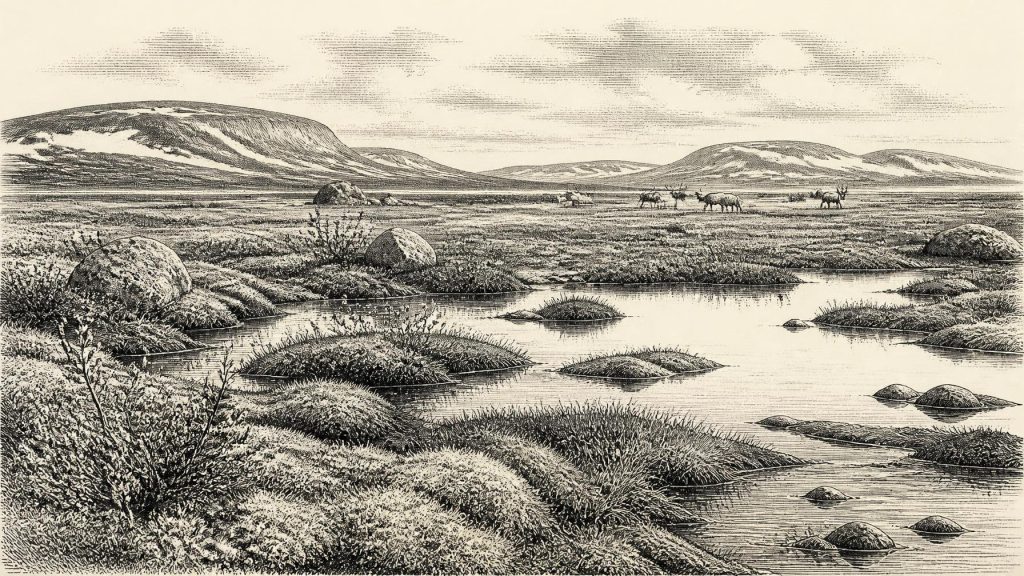
Its plant and animal remains indicate a treeless, cold-climate muskeg or wet tundra environment. Mosses, sedges, grasses and hardy herbs, together with plants such as dwarf willow, juniper and mountain-avens, point to an open landscape rather than woodland. Aquatic and wetland species show that shallow water remained present locally despite severe seasonal cold. Insect evidence reinforces that conclusion: the organisms recovered are consistent with northern, exposed conditions. This was not a featureless white wilderness. It was a low-growing, seasonally productive terrain of saturated hollows, pools, sedge-rich margins and frost-affected ground.
Ice, Water and Open Ground
The Derryvree sequence matters because it complicates any simple picture of a permanently ice-covered Ireland. The deposits demonstrate that, at least during one interval before the Last Glacial Maximum, Fermanagh contained an ice-free freshwater setting. Yet its position between tills is an equally strong warning: this was a temporary survival in a landscape repeatedly altered by ice. The drumlin landscape familiar in the district today is itself a legacy of glacial action, but the buried organic beds preserve a rare fragment of the terrain that existed between advances.
For 30,854 BCE itself, the safest interpretation is a regional mosaic rather than an island-wide reconstruction. Ice-sheet research shows that the British–Irish Ice Sheet was growing and reorganising during the interval from 31,000 years ago towards its later maximum. In Ireland, local ice histories cannot always be resolved to the same precision as the wider reconstruction. Sea level was substantially lower than today because much water was stored in continental ice sheets. Ireland’s coastlines and surrounding seas were therefore unlike the modern map, but the exact character of routes between Ireland, Britain and continental Europe at a particular moment remains uncertain. Animal dispersal demonstrates ecological connections at some points; it does not demonstrate an easy, continuously open land route at this date.
Castlepook’s Animal Archive
County Cork provides the other major source of evidence. Castlepook Cave, also known as Mammoth Cave or Doneraile Cave, lies in the Awbeg Valley beneath the Ballyhoura Hills. It has yielded Ireland’s richest known assemblage of Late Pleistocene vertebrate remains. Among the animals represented are woolly mammoth, reindeer, giant deer, brown bear, spotted hyaena, wolf, Arctic fox, wild horse and lemmings. Collectively, they show that parts of Ireland were reached by a varied cold-stage fauna during the long period before and around the Last Glacial Maximum.
But a cave bone collection is not a census from one afternoon, season or century. Many of Castlepook’s remains were excavated in the late nineteenth and early twentieth centuries, before modern methods of recording stratigraphy and sediment context were routine. Water movement and repeated disturbance within the cave have further mixed the evidence. Radiocarbon dates obtained from selected bones show that the fauna accumulated across a long span. A mammoth bone and a spotted-hyaena bone have produced dates in the region of 34,000 radiocarbon years before present, but neither result makes every animal from the cave contemporary with the other, Derryvree, or the nominal year 30,854 BCE.
The fauna nevertheless permits cautious inferences about everyday animal life beyond the cave. Reindeer and horse suggest open country with grazing opportunities; lemmings and Arctic fox indicate severe northern conditions; mammoth implies the wider mammoth-steppe ecological world, though its precise Irish habitat and chronology remain hard to specify. Hyaenas may have used the cave as a den or scavenging place and could themselves have introduced bones. Predation, scavenging, natural deaths, water transport and early collecting practices all shaped the surviving archive. The cave is powerful evidence for an Ice Age ecosystem, not a neatly preserved scene.
The Human Question
A reindeer femur from Castlepook has transformed discussion of the Irish Palaeolithic. Re-examined by zooarchaeologist Ruth Carden, it bears a deep linear modification interpreted as a cut or chopping mark made while the bone was fresh. The bone has been publicised as approximately 33,000 years old, and the mark has been presented as evidence that people butchered a reindeer in Ireland far earlier than the previously accepted post-glacial settlement record.
This possibility is important, but the limits of the claim matter. A modified bone, even if the mark is accepted as stone-tool damage, is evidence for a human encounter with a carcass, not proof of a resident community. No securely associated lithic assemblage, hearth, dwelling floor, burial, human bone, art or repeated occupation horizon has yet been identified at Castlepook for this period. Nor can the bone be tied securely to 30,854 BCE. The most that can responsibly be said is that it may indicate a brief Upper Palaeolithic visit or butchery episode somewhere within the broader late MIS 3 interval.
What Cannot Be Recovered
There is no evidence for Irish polities, chiefs, warfare, alliances, formal diplomacy, farming, trade networks or permanent villages at this time. If people did reach the island, they would have been highly mobile hunter-gatherers operating in a difficult and changing north-west European world. That is an inference from the wider archaeological context, not a demonstrated description of a particular Irish group. Nothing in the Irish record permits the reconstruction of their language, beliefs, social organisation, clothing or ritual practice. No cave art or portable art from Ireland can securely be assigned to this horizon.
Economically, the only direct evidence is ecological rather than human: wetland plants, grazing animals, carnivores and caves capable of sheltering or trapping remains. There is no basis for identifying exchange or seaborne commerce. Culturally, the period is best understood through the scientific practices that make it visible: stratigraphic recording, pollen and macrofossil analysis, insect study, zooarchaeology, radiocarbon dating and ice-sheet reconstruction. Each method supplies a different portion of the picture, and each has limits.
A Landscape, Not a Chronicle
Ireland around this notional year was a changing cold-stage landscape on Europe’s north-western edge. Its strongest evidence comes from a buried Fermanagh wetland and a Cork cave whose bones preserve an incomplete record of animals, climate and perhaps a rare human act. Derryvree shows that freshwater life and tundra vegetation could exist between glacial episodes. Castlepook shows that large mammals and predators reached the island during parts of the wider period. Together they make Ireland’s deep prehistory richer than an empty map, while also demonstrating why certainty must remain restrained.
The central historical fact is uncertainty honestly handled. Modern calendar-year precision is unavailable; the evidence does not sustain a year-specific event. What survives instead is a glimpse of cold water, low vegetation, roaming animals and advancing or retreating ice—an Irish landscape repeatedly made, buried and partly recovered by science tens of thousands of years later.
Primary Sources
- A Middle Midlandian Freshwater Series at Derryvree, Maguiresbridge, County Fermanagh, Northern Ireland
- Figure 6.— The Subdivision of the Quaternary Period in Ireland
- Irish Pleistocene Biostratigraphy
- The Irish Quaternary Fauna Project
- Quaternary Vertebrates
- Castlepook Cave, County Geological Site Audit
- Areas of Scientific Interest in County Cork: Castlepook Caves
- Archaeological Heritage of County Cork
- Heritage Artefacts of County Cork
- Castlepook Cave, Co. Cork, 2022 Excavation Report
- Growth and Retreat of the Last British–Irish Ice Sheet, 31,000 to 15,000 Years Ago: the BRITICE-CHRONO Reconstruction
- BRITICE-CHRONO: Introduction
- New Data for the Last Glacial Maximum in Great Britain and Ireland
- The IntCal20 Northern Hemisphere Radiocarbon Age Calibration Curve (0–55 cal kBP)
- IntCal20 Issue
- A 60,000 Year Greenland Stratigraphic Ice Core Chronology
- Dansgaard–Oeschger Events in Climate Models: Review and Baseline Marine Isotope Stage 3 Protocol
- Marine Isotope Stage 3 Sea Level Fluctuations: Data Synthesis and New Outlook
- New Insights on the Fauna of Ireland’s Younger Dryas and Early Holocene
- Preliminary Assessment of the Archive of Faunal Remains from Excavated Irish Cave Sites
- Stoats (Mustela erminea) Provide Evidence of Natural Overland Colonization of Ireland
- Mammoth Cave / Castlepook Cave