

Alternate Water Milfoil30824 BCE
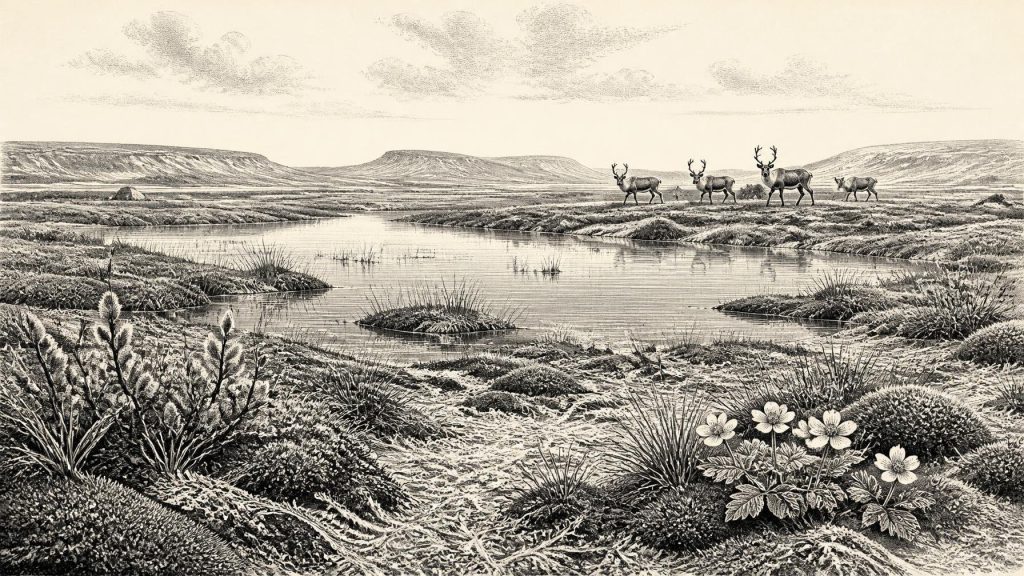
Around 30,824 BCE, Ireland’s history is reconstructed from environmental evidence rather than recorded events. Derryvree, County Fermanagh, preserves freshwater sediments between glacial tills, indicating an ice-free interval of treeless, periglacial tundra with wetlands supporting mosses, sedges, bogbean and alternate water-milfoil. Radiocarbon dating places this evidence broadly within later MIS 3, not a precise calendar year. Shifting ice margins created unstable regional conditions before the Last Glacial Maximum. Castlepook Cave, County Cork, records cold-adapted fauna including mammoth, reindeer and hyaena. A possibly butchered reindeer bone suggests transient human presence, but no settled community is proven. Ireland was ecologically dynamic, intermittently habitable.
Dateline
The numbered year 30,824 BCE cannot be treated as a date at which a recorded Irish event occurred. No written chronology, named person, settlement or political community can be placed in a particular modern calendar year so deep in prehistory. In fact, the appropriate evidence is measured in radiocarbon determinations, calibrated ranges, sediment layers and changing animal communities. This point in time belongs broadly to the later part of Marine Isotope Stage 3 (MIS 3), within the Midlandian cold stage of the Irish Pleistocene: a long, climatically unstable span before the Last Glacial Maximum reached its greatest extent.
The closest useful Irish evidence is not an event but a buried landscape at Derryvree, near Maguiresbridge in County Fermanagh. There, a road cutting made in 1969 exposed freshwater silts and fine sands enclosed between two separate layers of glacial till. That sequence is unusually valuable. It demonstrates that ice had occupied the locality, that an ice-free freshwater environment subsequently developed long enough to accumulate mud, plants and small animal remains, and that later ice or ice-derived sediment sealed the deposit. It is a rare surviving fragment of an Irish landscape that later glaciation did not wholly erase.
Dating a Deep Past
Derryvree’s organic sediment, recorded as BIRM-166, produced a conventional radiocarbon age of 30,500 ± 1,100 years before present. “Before present” in this system means before AD 1950, not before 30,824 BCE. Radiocarbon years must also be calibrated because atmospheric carbon levels have changed through time. Recent chronological modelling has placed the Derryvree evidence at about 33.5 ± 1.2 thousand calibrated years before present, while wider calibration treatments give a broad range rather than a single point. The year 30,824 BCE is therefore best understood as falling within the general chronological neighbourhood of this record, not as the date of one identifiable season, pool, animal death or human visit.
This distinction matters. A sediment bed can show that particular conditions existed at some point during a range of centuries or millennia; it cannot furnish an annual diary. Nor should a find in Fermanagh be used as a map of the entire island. Ireland was a large, environmentally varied peninsula at the north-western edge of Europe, its coastlines, sea levels, ice margins and habitable corridors changing over long periods. The evidence supports a changing regional mosaic, not a uniform Ireland.
A Treeless Wetland
The Derryvree deposit provides the clearest picture of everyday environmental conditions relevant to this period. Its pollen, seeds, mosses and spores indicate open, treeless tundra and wet ground under a periglacial climate. The term periglacial does not mean that the site was necessarily beneath ice; it describes a severe cold-region environment shaped by frost, seasonally frozen ground and proximity to glacial conditions. Dry land may have supported only sparse herbaceous cover, while low hollows held shallow water, sedges, mossy ground and fine sediment.
Macrofossils recorded from the deposit include plants now associated with cold or alpine conditions, among them mountain avens (Dryas octopetala), dwarf willow (Salix herbacea), lesser clubmoss (Selaginella selaginoides) and bogbean (Menyanthes trifoliata). Aquatic evidence, including alternate water-milfoil, confirms that freshwater was locally available. These remains are direct evidence for organisms preserved in this particular basin. Their wider significance is interpretative but reasonable: parts of south Fermanagh contained a cold, open landscape with wet refuges rather than closed woodland.
Such a setting would have looked unlike modern Ireland. There is no basis for imagining familiar hedged fields, oak woods, farms or villages. The horizon would more likely have been broad and exposed, with low vegetation, frost-disturbed ground and water collecting in sheltered depressions. Seasonal contrasts were probably important. Short growing seasons could briefly make wetland margins productive, while prolonged cold restricted plant growth and made movement across the landscape difficult.
Ice, Water and Moving Margins
At this date Ireland was approaching, rather than already sitting securely within, the fullest expansion of the last British–Irish Ice Sheet. The timing and limits of ice were not identical in every sector, and modern reconstructions emphasise that advance and retreat were asynchronous. Large-scale synthesis begins its mapped reconstructions at 31,000 years before present and shows an ice sheet growing through a complex geography of Irish, Scottish and marine sectors. The maximum ice volume came substantially later, around 23,000 years before present.
Derryvree captures the importance of that unevenness. Its lower till records an earlier glacial occupation. The freshwater silts show that the locality was then free of ice long enough for a wetland to form. Its upper cover demonstrates renewed cold-stage activity. The site therefore challenges any simplistic claim that Ireland was continuously, completely ice-covered throughout the whole late Pleistocene. Equally, it does not establish a stable, island-wide refuge. Its lesson is instability: ice margins shifted, watercourses changed, exposed ground appeared and vanished, and later glacier action buried much of the evidence.
These processes were themselves formative historical forces. They altered routes for animals, fragmented habitats and repeatedly reworked soils and landforms. The drumlins and glacial deposits that dominate many Irish landscapes today are much younger-looking expressions of these ancient processes. Yet they also conceal earlier episodes, such as Derryvree, beneath their tills.
Animals of the Cold Landscape
For the broader MIS 3 world, Castlepook Cave near Doneraile in north County Cork supplies an essential, though not exactly contemporary, faunal archive. Reassessment of bones from the cave using improved radiocarbon methods showed that several earlier dates had been substantially too young. The results place an important suite of animals in southern Ireland during MIS 3, well before the later Last Glacial Maximum. Castlepook is thus evidence that Ireland was connected to wider north-west European animal movements during favourable phases, even though it cannot provide a single snapshot for 30,824 BCE.
The cave’s assemblage includes woolly mammoth, reindeer, giant deer, brown bear, wolf, Arctic fox, hare, lemmings and spotted hyaena. It should not be imagined that all these animals stood together in one scene, or that every specimen belongs to precisely the same century. Caves accumulate material over time through deaths, carnivore activity, water movement and later disturbance. Nonetheless, the range of species indicates cold, largely open habitats capable of sustaining substantial herbivores and their predators. Reindeer and mammoth suggest grassland-tundra or mammoth-steppe conditions; hyaenas and wolves point to scavenging and predation within a mobile food web.
For animals, mobility was the defining economic fact. Herds could follow seasonal forage across exposed plains and valleys, while predators tracked them. Freshwater basins such as Derryvree may have offered water, plant growth and sheltered ground, but their value changed with weather and ice. There is no evidence for agriculture, domesticated stock, permanent field systems or trade in the later historic sense. The economy visible in the record is ecological: plants converting a brief growing season into food; grazers moving through available range; carnivores and scavengers exploiting carcasses.
The Human Question
Human history at this depth remains exceptionally uncertain. A reindeer femur from Castlepook has been reported as carrying a deep mark consistent with butchery by a stone tool and has been presented as possible evidence of people in Ireland about 33,000 years ago. The claim is important because it raises the prospect of Upper Palaeolithic visitors far earlier than Ireland’s long-accepted post-glacial settlement record. But one marked bone is not an excavated camp, hearth, tool assemblage, burial or settled community. It cannot show that people were present in 30,824 BCE, how many there were, or whether they stayed beyond a brief visit.
The responsible conclusion is therefore deliberately limited. Small, highly mobile hunting groups may have reached parts of Ireland during suitable intervals, perhaps following animal routes across the then different geography of the Irish Sea region. That is an interpretation, not a securely documented Irish society. No political authority, diplomacy, war, territorial boundary, language, ritual practice or system of learning can be responsibly reconstructed for this year. There are no known Irish monuments, artworks or artefacts that allow us to describe a local culture in the rich human terms available for later prehistory.
If people did enter this landscape, their practical knowledge would have been crucial: reading weather, finding freshwater, locating fuel, anticipating animal movement and travelling through terrain that could change dramatically with season. Those are plausible implications of survival in a cold north-west European environment, but they remain analogies rather than evidence recovered from an Irish occupation surface. The silence of the archaeological record may reflect small populations, short visits, later destruction by ice, or all three.
A History of Evidence
What can be said with confidence is that Ireland around this broad period was not timeless emptiness. It was a dynamic cold-stage landscape in which ice, water, vegetation and animals repeatedly remade the possibilities for life. Derryvree’s moss-rich mud preserves an interval when a Fermanagh hollow supported freshwater and tundra vegetation between episodes of glacial deposition. Castlepook shows that major cold-adapted mammals occupied or entered Ireland during the wider MIS 3 interval. Together they reveal environmental change on a scale beyond any one calendar year.
For 30,824 BCE, then, Ireland’s most defensible history is geological and ecological. The evidence is powerful precisely because it is modest: silts beneath a drumlin, seeds and mosses in ancient mud, bones in a Cork cave, and dates with margins of error. They do not yield kings, battles or villages. They reveal instead the conditions from which any human story, if one occurred here at all, would have had to begin.
Primary Sources
- A Middle Midlandian Freshwater Series at Derryvree, Maguiresbridge, County Fermanagh, Northern Ireland
- Palaeoecology: The Middle Midlandian Palaeoenvironment of South Fermanagh
- Figure 6: The Subdivision of the Quaternary Period in Ireland
- A Reconsideration of the Radiocarbon Dating of the Marine Isotope Stage 3 Fauna from Southern Ireland
- The Irish Quaternary Fauna Project
- Castlepook Cave, County Cork: County Geological Site Report
- 2022:564 – Castlepook Cave, Castlepook South, Cork
- Archaeology Research Excavation Grant 2022: Final Report
- New Insights on the Fauna of Ireland’s Younger Dryas and Early Holocene from Alice & Gwendoline Cave
- Growth and Retreat of the Last British–Irish Ice Sheet, 31,000 to 15,000 Years Ago: the BRITICE-CHRONO Reconstruction
- Exploring Controls of the Early and Stepped Deglaciation on the Western Margin of the British Irish Ice Sheet
- Late Pleistocene Chronostratigraphy and Ice Sheet Limits, Southern Ireland
- Radiocarbon Constraints on the Age of the Maximum Advance of the British–Irish Ice Sheet in the Celtic Sea
- Last Glacial Maximum Cirque Glaciation in Ireland and Implications for Reconstructions of the Irish Ice Sheet
- Trimlines, Blockfields and the Vertical Extent of the Last Ice Sheet in Southern Ireland
- Menyanthes trifoliata
- Salix herbacea
- Dryas octopetala
- Selaginella selaginoides
- Myriophyllum alterniflorum
- Deposits of the Last Glaciation
- Cork County Geological Heritage Audit Report