Derryvree’s BIRM-166 Record30783 BCE
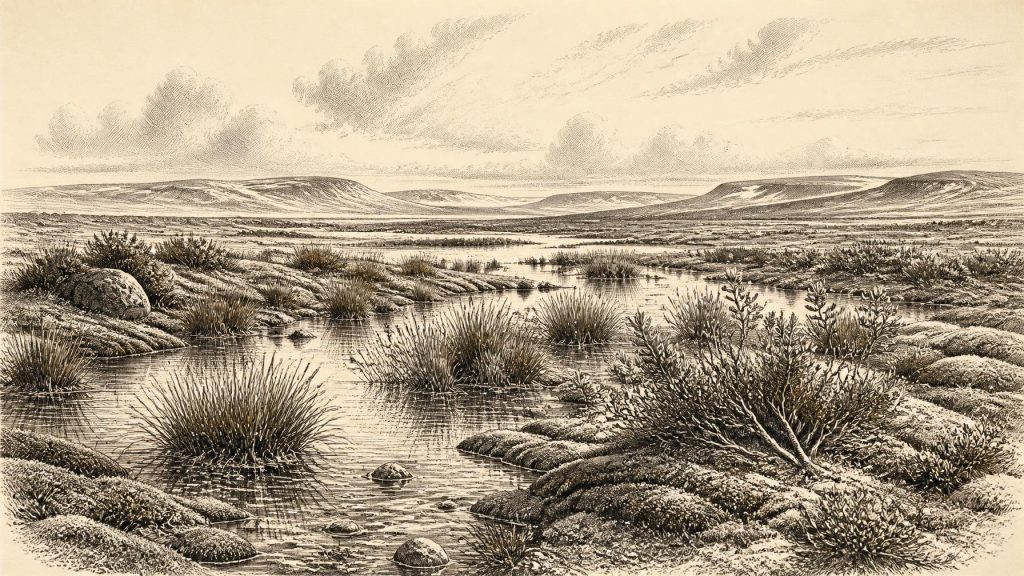
At c. 30,783 BCE, Ireland was a fluctuating Late Pleistocene landscape, not a historically documented society. Derryvree’s freshwater sediments, bracketed by glacial tills and dated broadly across this period, reveal an ice-free Fermanagh wetland with tundra vegetation, mosses, pools and cold-adapted insects. Castlepook Cave preserves MIS 3 fauna, including mammoth, reindeer, giant deer, predators and scavengers, showing that Ireland was not biologically empty. A marked reindeer bone may indicate brief human activity, but remains unconfirmed and cannot demonstrate settlement. Shifting ice, altered sea levels and later erosion complicate reconstruction, leaving evidence of environmental change rather than people, polities or events.
Dateline
Modern calendar-year precision is not available for Ireland at this depth of time. “30,783 BCE” is a useful chronological label, not a date at which archaeology can identify an event, a leader or a season. In the archaeological convention of years before present, counted from AD 1950, it lies about 32,733 years ago: within the Late Pleistocene and Marine Isotope Stage 3 (MIS 3), a long, climatically unstable phase of the last Ice Age. The responsible history of Ireland here is therefore a reconstruction from sediments, fossil plants, animal bones, landforms and scientific dates with broad uncertainty ranges.
Dating a Deep Past
The closest major Irish environmental record is not dated to one numbered year but to a wide interval that includes it. At Derryvree, near Maguiresbridge in County Fermanagh, roadworks in 1969 exposed freshwater silts and fine sands containing organic material between two distinct sheets of glacial till. The organic deposit produced the radiocarbon measurement BIRM-166: 30,500 +1,170/−1,030 radiocarbon years before present. Under later calibration, this has commonly been expressed as approximately 36,900–31,700 calibrated years BP, or very broadly c. 34,950–29,750 BCE.
That range matters. Radiocarbon years are not calendar years, because the atmospheric concentration of carbon-14 has altered through time. Calibration makes the relationship more realistic but does not remove uncertainty, particularly beyond thirty millennia. Nor was the Derryvree deposit formed in an instant: it represents accumulating sediments, vegetation and animal remains over an extended period. It can responsibly illuminate conditions around 30,783 BCE, but cannot tell us what occurred in that particular year. The same caution applies to every human or animal find discussed below.
A Wetland Between Glaciers
Derryvree is exceptionally important because its physical sequence records environmental change. A lower till shows that glacier ice had previously crossed the site. Above it lay the freshwater series. An upper till then sealed the deposit, showing that ice later returned. This was not Ireland’s familiar green and wooded landscape. The direct evidence instead indicates an open, treeless, periglacial environment: a cold wetland or muskeg-like mosaic of shallow pools, saturated ground, mosses and low vegetation, with exposed mineral surfaces nearby.
Pollen, plant macrofossils and insects allow this picture to be drawn in unusual detail. Grasses and sedges were significant components of the vegetation, alongside juniper and herbs. Mosses were especially abundant. The recorded flora includes bogbean, alternate water-milfoil, mountain-avens, dwarf willow and lesser clubmoss. Together, these plants point to wet ground and freshwater, yet also to low temperatures, sparse cover and tundra-like conditions. Insects support the interpretation of cold, organic-rich pools bordered by mossy ground rather than closed woodland. This is firm local evidence from Fermanagh, not proof that every valley and coast across Ireland was identical.
The Derryvree record consequently challenges any simple image of an island locked beneath unbroken ice throughout the last glaciation. At least during the interval represented by the freshwater beds, this locality was ice-free enough to support plants, insects and standing water. Yet it was a harsh world, shaped by frost action, short growing seasons and a climate capable of changing markedly over centuries or millennia. The later passage of ice buried and preserved the evidence, while also destroying or obscuring much else that may once have existed.
Ice, Water and Uncertain Coasts
The wider history of the British–Irish Ice Sheet remains an active area of research. The fullest and best-dated expansion of the last ice sheet belongs later, broadly after 31,000 years ago and especially during the Last Glacial Maximum, conventionally around 26,000–20,000 years ago. Research nevertheless suggests that ice masses had grown, retreated and reorganised during earlier MIS 3. Some scholars argue for substantial ice-sheet development before the conventional maximum; others stress how incomplete and overprinted the surviving evidence is. The later glacier was powerful enough to reshape landforms and remove older deposits, making certainty difficult.
For around 30,783 BCE, Ireland should therefore be understood as part of a fluctuating north-west European cold-stage system, rather than assigned a single all-island ice map. Lower global sea levels altered the surrounding shelves and coastlines, but relative sea level around Ireland was also affected by the weight of nearby ice depressing the land. It would be unsafe to claim a particular walkable route between Ireland, Britain and continental Europe for this one notional year. What can be said is that the geography of sea, land, ice and coastal lowlands differed greatly from that of the modern island, and could change as ice advanced or receded.
Castlepook’s Animal World
Southern Ireland provides a contrasting archive. Castlepook Cave, also known as Mammoth Cave, near Doneraile in north County Cork, has yielded one of Ireland’s most important collections of Pleistocene animal remains. Its fauna includes woolly mammoth, reindeer, giant deer, brown bear, Arctic fox, hare, wolf, lemmings and spotted hyaena. Revised radiocarbon work has shown that several of these animals were present in southern Ireland during MIS 3, before the Last Glacial Maximum. The cave evidence does not represent a single living community observed at one moment: caves can accumulate bones through predation, scavenging, denning, natural death, water movement and later disturbance. Nevertheless, the assemblage securely shows that a diverse cold-stage fauna reached the island over this broad period.
Reindeer and lemmings are particularly evocative indicators of open, cold country; mammoth, giant deer and hyaena demonstrate that Ireland was not biologically empty. Carnivores and scavengers would have competed for carcasses, while herbivores moved through changing patches of grassland, herb-rich ground and wetland. Such animals could exploit seasonal opportunities, but their presence should not be converted into an exact reconstruction of weather, vegetation or migration routes in 30,783 BCE. Nor should the cave be imagined as an untouched time capsule. Much of its historic collection was excavated before modern recording standards, which limits what can be inferred about the original position and association of individual bones.
The Question of People
Castlepook also raises the most intriguing, and most limited, question about people in Ireland at this time. A reindeer femur from the cave has been publicised as about 33,000 years old and as carrying a deep mark interpreted as having been made by a sharp stone implement during carcass processing. If further work confirms both the anthropogenic origin of the modification and its relationship to the dated animal bone, it would be remarkable evidence for a human encounter with a reindeer in Ireland before the Last Glacial Maximum.
That conditional language is essential. A radiocarbon determination dates the death of an animal within a statistical range; it does not by itself date a mark on its bone, identify its maker or demonstrate how long anyone remained nearby. No securely associated hearth, stone-tool assemblage, dwelling floor, burial, camp, art or repeatedly occupied food-processing area of this age has yet been published from Castlepook. The marked femur cannot establish a permanent population, a named cultural group, a migration route or descent from later inhabitants. At most, it is a potentially important sign of brief Upper Palaeolithic activity within a landscape otherwise known principally through environmental and faunal evidence.
The distinction is sharpened by comparison with the much later, better-studied butchered brown-bear patella from Alice and Gwendoline Cave in County Clare. Direct dates place that evidence around 12,810–12,590 calibrated years BP. It remains the principal published evidence for a terminal-Pleistocene human presence on the island. The gap between it and the possible Castlepook signal is immense. Ireland around 30,783 BCE must not be furnished with villages, regular hunting territories or an established society merely because people elsewhere in Europe had sophisticated stone technologies and varied Upper Palaeolithic traditions.
No Polities, No Proven Trade
There is no evidence for political affairs, diplomacy, warfare, formal religion, writing, trade networks or settlement organisation in Ireland at this horizon. There were no recorded rulers or institutions, and no basis for naming an Irish people, language or belief system. If people did visit, their daily life may have involved mobile hunting, gathering and the use of portable tools, as among other Upper Palaeolithic groups in Europe; but that is comparative possibility, not an Irish fact. Likewise, the movement of mammal populations demonstrates ecological connectivity at some stage, not commerce or human exchange.
The most meaningful “regional change” was environmental. Freshwater ground at Derryvree existed between episodes of glaciation; cave fauna in Cork records a cold-adapted animal world; and the developing ice sheet was altering landscapes, drainage and coastlines. These processes set the conditions under which any human movement would have occurred. Their legacy also explains why the record is so fragmentary: ice erosion, rising seas, sediment movement and antiquarian excavation have each removed, redistributed or obscured traces of the deep past.
An Evidence-Led Ireland
Ireland around this point was not a historical country in the later sense, but a changing Pleistocene landscape. The Derryvree freshwater beds provide the clearest window: an ice-free Fermanagh wetland with tundra vegetation during a broad calibrated interval that encompasses 30,783 BCE. Castlepook demonstrates that large mammals and formidable carnivores inhabited southern Ireland in the wider MIS 3 world, while a single marked reindeer bone offers a provocative but unconfirmed possibility of early human action. The proper annual entry is therefore not a fabricated event, but a measured conclusion: this was an age of cold wetlands, mobile fauna, shifting ice and evidence whose value lies as much in its limits as in its revelations.
Primary Sources
- A Middle Midlandian Freshwater Series at Derryvree, Maguiresbridge, County Fermanagh, Northern Ireland
- Figure 1: Deposits Observed in the Road Cutting at Derryree and Maguiresbridge
- Figure 6: The Subdivision of the Quaternary Period in Ireland
- Irish Pleistocene Biostratigraphy
- The Irish Quaternary Fauna Project
- A Reconsideration of the Radiocarbon Dating of the Marine Isotope Stage 3 Fauna from Southern Ireland
- First Evidence of a Late Upper Palaeolithic Human Presence in Ireland
- New Insights on the Fauna of Ireland’s Younger Dryas and Early Holocene from Alice & Gwendoline Cave
- The Timing and Magnitude of the British–Irish Ice Sheet Between Marine Isotope Stages 5d and 2
- Growth and Retreat of the Last British–Irish Ice Sheet, 31,000 to 15,000 Years Ago: The BRITICE-CHRONO Reconstruction
- Pattern and Timing of Retreat of the Last British-Irish Ice Sheet
- Radiocarbon Constraints on the Age of the Maximum Advance of the British-Irish Ice Sheet in the Celtic Sea
- Early Deglaciation of the British-Irish Ice Sheet on the Atlantic Shelf Northwest of Ireland Driven by Glacioisostatic Depression and High Relative Sea Level
- Timing and Pace of Ice-Sheet Withdrawal Across the Marine–Terrestrial Transition West of Ireland During the Last Glaciation
- Trimlines, Blockfields and the Vertical Extent of the Last Ice Sheet in Southern Ireland
- The IntCal20 Northern Hemisphere Radiocarbon Age Calibration Curve (0–55 cal kBP)
- BRITICE-CHRONO Maps and GIS Data of the Last British-Irish Ice Sheet 31 to 15 ka
- Advances in Irish Quaternary Studies
- Heritage Artefacts of County Cork
- Ireland’s Palaeolithic Archaeology – Fleeting Footprints in a Frozen Land
