Fermanagh’s Permafrost Pond30784 BCE
Around 30,784 BCE, Ireland was a cold, unstable Late Glacial landscape rather than a settled society. Derryvree, County Fermanagh, preserves freshwater sediments between glacial tills, showing treeless tundra vegetation, wet hollows and seasonal pools during MIS 3. Castlepook Cave, County Cork, contains remains of mammoth, reindeer, giant deer, predators and other cold-stage animals, although its mixed deposits cannot represent one moment. Climatic improvements periodically allowed liquid water and animal movement, while changing ice and sea levels reshaped routes and habitats. No secure evidence demonstrates human settlement or activity at this date; Ireland’s record chiefly documents environmental change and intermittent fauna.
Dateline
30,784 BCE is not a year for which Irish history can identify an event, a ruler, a battle or even a season. It is a modern calendar label placed on a very deep prehistoric horizon. Around 32,733 years before AD 1950, Ireland lay within the later part of the Last Glacial Period, conventionally Marine Isotope Stage 3 (MIS 3). Dates at this depth are obtained from radiocarbon determinations, stratigraphic relationships and climatic correlations, not from a calendar kept by people living here. They carry substantial margins of error. The responsible question is therefore not “what happened in Ireland in this year?” but what surviving evidence can illuminate Ireland during the broad interval in which it falls.
The best answer comes from environmental deposits and animal remains rather than from settlements. The most relevant Irish evidence is a freshwater sequence at Derryvree, near Maguiresbridge in County Fermanagh, and the much larger but more complicated bone assemblage from Castlepook Cave near Doneraile in north Cork. Together they show that parts of Ireland could support life in cold, open conditions before the Last Glacial Maximum. They do not, however, supply a continuous local history, nor do they demonstrate a permanent human population.
Dating a Cold Landscape
Derryvree was exposed in a road cutting through a drumlin in 1969. The section revealed silts and fine sands laid down between two thick sheets of glacial till. Within that sheltered interval were freshwater sediments containing pollen, plant remains and small animal evidence. One conventional radiocarbon determination, BIRM-166, gave an age of 30,500 radiocarbon years before present, with a large uncertainty. Radiocarbon years are not calendar years: atmospheric carbon-14 has varied through time, and old results must be calibrated against an internationally maintained curve.
Using modern calibration, the Derryvree determination corresponds only to a broad, uneven probability range of roughly 36,900–31,700 calibrated years before present, or about 34,950–29,750 BCE. The label 30,784 BCE lies near the younger end of that wide span, but cannot be assigned to a particular bed, plant, animal or episode at the site. Calibration is not a machine that turns a sample into an anniversary. It is a way of expressing, more honestly, how much time the evidence can encompass.
The Derryvree deposit belongs to the Irish Midlandian, the regional name for the last glacial cycle. MIS 3 was not a single unchanging freeze. Greenland ice-core and European cave records show abrupt oscillations between colder stadials and relatively milder interstadials, often on millennial or shorter scales. Irish evidence is too sparse to attach Derryvree securely to one named Greenland event. Yet cave-calcite growth at Crag Cave in County Kerry independently indicates that liquid water and at least occasional climatic amelioration occurred in south-west Ireland during episodes of MIS 3. The island’s climate was severe and unstable, rather than uniformly locked beneath ice for the entire period.
A Freshwater Refuge at Derryvree
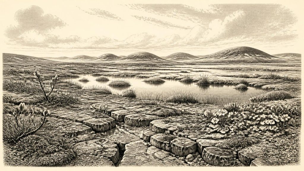
The direct evidence from Derryvree is ecological. The plants include dwarf willow, mountain avens, lesser clubmoss, sedges, mosses and the aquatic species bogbean and alternate water-milfoil. These are not traces of woodland or farming. They point instead to open, treeless ground, with wet hollows and shallow fresh water sustained during the thawing season. Such a setting could have contained bare mineral soil, frost-shattered ground, sparse herb-rich vegetation and wetter margins where plants found protection from wind and desiccation.
This was not modern Fermanagh in miniature. There is no basis for imagining fields, hedges, lakeside villages or dense forest. Winter ground freezing, seasonal snow cover and periglacial processes were probably important. During warmer months, meltwater and local drainage could feed pools and marshy patches. The contrast between exposed tundra and productive wet ground matters: it explains why a small sedimentary basin can preserve a richer plant assemblage than the surrounding landscape might suggest.
The Derryvree sequence also records regional change. It sits between tills, demonstrating that a freshwater environment existed between episodes of glacial deposition. The later advance of ice buried and protected the sediments, while also destroying or concealing much of the wider land surface on which animals or people might once have left traces. That preservation history is central to Ireland’s Palaeolithic problem. Absence of camps is not proof that no person ever entered the island, but neither can lost landscapes be treated as positive evidence for settlement.
Castlepook’s Animal Archive
Castlepook Cave, in the limestone country north of Doneraile, is the principal Irish archive for large mammals before the Last Glacial Maximum. Excavations led by Richard Ussher in the early twentieth century recovered an enormous collection, although only a fraction survives in museum collections and the original recording does not meet modern excavation standards. The cave yielded remains attributed to woolly mammoth, giant deer, reindeer, brown bear, wolf, Arctic fox, spotted hyaena and lemmings. Geological Survey Ireland describes it as Ireland’s richest vertebrate site for the period leading towards the glacial maximum.
These animals make an important point about the wider Irish landscape. At different times during MIS 3, Ireland was capable of supporting a varied cold-stage fauna, including grazers and browsers, predators and scavengers. Reindeer and lemmings suit open northern environments; mammoth and giant deer evoke extensive herbaceous terrain; hyaenas and wolves indicate a food web with large carcasses and competing carnivores. But the cave assemblage must not be read as a single, simultaneous scene. Individual specimens have dates spanning many thousands of years, while carnivore activity, water movement, sediment disturbance and antiquarian collecting mixed material from different phases.
Recent redating has sharpened that warning. Improved chemical pretreatment of bone collagen showed that some earlier Castlepook radiocarbon results were thousands of years too young. The consequence is valuable but sobering: the fauna confirms a long and complex MIS 3 history, while making simple claims about a particular animal living in a particular century less secure. Around 30,784 BCE, Castlepook is best used as evidence that this kind of fauna had reached Ireland during the broader period, not as a census of creatures standing together outside the cave.
Ice, Coasts and Movement
Ireland had not yet reached the Last Glacial Maximum, when ice later expanded across much of the island and its surrounding shelf. Reconstructions of the British–Irish Ice Sheet show that growth and maximum extent were spatially uneven, with major advances occurring between about 31,000 and 22,000 years ago and maximum ice volume around 23,000 years ago. At this earlier horizon, conditions could vary greatly between districts and through time. Derryvree’s intertill freshwater deposits and the animal evidence from Cork demonstrate that at least some ground was available between major glacial episodes.
Sea level was lower than today because much water was held in global ice sheets, exposing land now submerged around north-west Europe. Even so, the exact routes between Ireland, Britain and continental Europe remain debated. Some reconstructions allow broad lowland connections at glacial low sea levels; others stress marine channels, ice margins and changing relative sea levels. It is safest to say that animal movement into Ireland was possible during favourable phases, but that the precise geography of every route is unresolved. A faunal connection is not, by itself, proof of a permanent dry land bridge, nor of regular human travel.
People: A Question, Not a Settlement
There is no securely excavated dwelling, hearth, stone-tool assemblage, burial, human bone or settlement surface in Ireland that can be dated to around 30,784 BCE. The best-established direct evidence for Palaeolithic people in Ireland remains much later: a cut-marked brown-bear kneecap from Alice and Gwendoline Cave in County Clare, dated to approximately 12,810–12,590 calibrated years before present. It shows that people visited Ireland near the end of the Ice Age, not that they occupied it at the date considered here.
Castlepook has nevertheless reopened the older question. A reindeer bone from the historic collection has been reported as bearing a mark consistent with cutting by a sharp stone tool, and research teams have identified further bones for examination. If microscopic study, dating and contextual analysis ultimately confirm human modification, it would be striking evidence for a brief Upper Palaeolithic encounter with Ireland. At present, though, one marked bone from a disturbed old collection cannot establish who made the mark, whether they hunted or scavenged the animal, how long they stayed, or whether they returned.
This limitation governs every human theme. There are no identifiable polities, leaders, territories, diplomatic relations or wars. There is no evidence for trade, formal exchange networks, language, art, religion, burial practice or teaching institutions in Ireland at this time. It would be anachronistic to project Celtic, Gaelic or later Irish identities backwards into a Late Pleistocene landscape. Nor should the lack of Irish evidence be mistaken for a claim that any visitors lacked culture or knowledge: Upper Palaeolithic communities elsewhere in Europe possessed sophisticated skills and social worlds. The point is narrower. Ireland has not yet yielded material evidence capable of describing those worlds here.
What Can Be Said Responsibly
For this point around 30,784 BCE, Ireland is best understood as a changing cold-stage environment. Derryvree offers a rare close view of tundra vegetation and freshwater life beneath later glacial deposits. Castlepook shows that large mammals and formidable carnivores entered the island during the wider MIS 3 interval. Crag Cave contributes evidence that climatic improvement periodically allowed water to circulate through karst systems. These are substantial discoveries, but they describe environmental opportunity more clearly than human history.
The most important historical fact is therefore one of scale and uncertainty. Ireland was not yet the familiar island of farms, forests, roads and named communities. It was a landscape repeatedly altered by climate, ice, changing coastlines and animal movement. Its surviving record is sparse because later ice, erosion and sea-level change removed or buried so much. What remains—a freshwater silt, a bogbean seed, a fragmentary bone, a cave passage—does not furnish an anniversary. It preserves a difficult, compelling glimpse of life at the north-western edge of Ice Age Europe.
Primary Sources
- A Middle Midlandian Freshwater Series at Derryvree, Maguiresbridge, County Fermanagh, Northern Ireland
- A reconsideration of the radiocarbon dating of the Marine Isotope Stage 3 fauna from southern Ireland
- The Irish Quaternary Fauna Project
- Castlepook Cave Deposits: Cork County Geological Site Report
- The Exploration of Castlepook Cave, County Cork
- Archaeology Research Excavation Grant 2022
- Archaeology Research Excavation Grant Report
- 2022:564 – Castlepook Cave, Castlepook South, Cork
- Archaeological Heritage of County Cork
- Heritage Artefacts of County Cork
- Growth and Retreat of the Last British-Irish Ice Sheet, 31,000 to 15,000 Years Ago: the BRITICE-CHRONO Reconstruction
- The Timing and Magnitude of the British-Irish Ice Sheet Between Marine Isotope Stages 5d and 2: Implications for Glacio-Isostatic Adjustment, High Relative Sea Levels and ‘Giant Erratic’ Emplacement
- Trimlines, Blockfields and the Vertical Extent of the Last Ice Sheet in Southern Ireland
- Last Glacial Maximum Cirque Glaciation in Ireland and Implications for Reconstructions of the Irish Ice Sheet
- Episodic Speleothem Deposition Tracks the Terrestrial Impact of Millennial-Scale Last Glacial Climate Variability in SW Ireland
- The IntCal20 Northern Hemisphere Radiocarbon Age Calibration Curve (0–55 cal kBP)
- The Problem of a Late Quaternary Landbridge Between Britain and Ireland
- Ireland: Submerged Prehistoric Sites and Landscapes
- First Evidence of a Late Upper Palaeolithic Human Presence in Ireland
- New Insights on the Fauna of Ireland’s Younger Dryas and Early Holocene from Alice & Gwendoline Cave
- Outreach and Education Resources
- Palaeolithic People at Edenvale
